Our "Down Your Street" project
Old photographs of local streets always fascinate and it is noted that this section of the web-site is one of the most frequently visited, but these old streets really come alive when we know who lived in them and the day to day goings on, the gossip and so on. Please email and send in your memories of these streets, or maybe your parents or grandparents recollections. My mail box is bulging with correspondence on the subject which I will bring to you in due course. PL
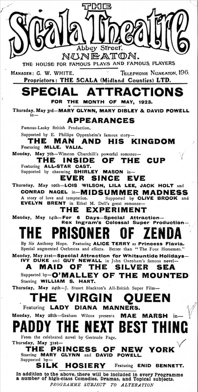
AN EXAMPLE OF OUR DOWN YOUR STREET PROGRAMME IN ACTION:
|
|
This book is available through all good booksellers or available online.
|
This book is available from all good booksellers and online.
|

Our new book published in February 2016. Referencing many of the old public houses in Nuneaton.

The location of many old public houses noted in the book.
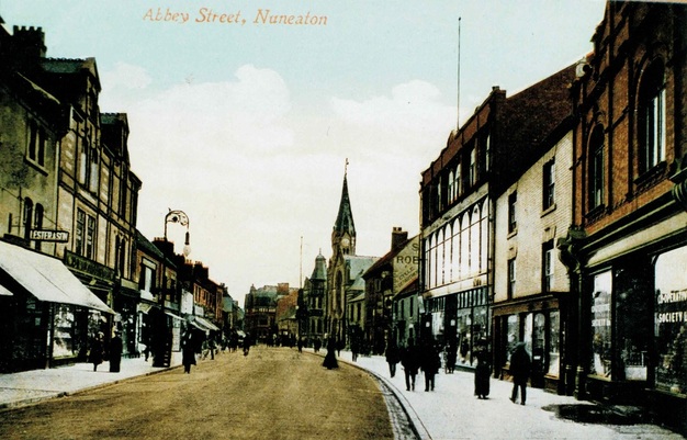
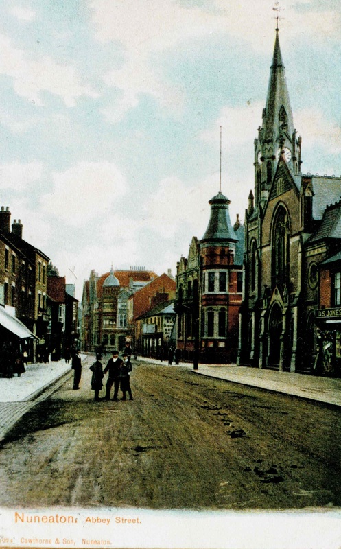
Nuneaton's Changing Townscape Through Time in Old Images
The street layout of Nuneaton 200 years ago was much simpler than it is today.. In the early 19th century the town consisted of one long street - Abbey Street and seven short streets - Church Street and Bond Street. Bridge Street, Coventry Street, Wheat Street and Back Street, and at the town end of Wash Lane, a few buildings which would later be Gas Street, then Queens Street . A link road Abbey Gate and looping around the back of the town were two narrow lanes, Back Lane which became Vicarage Street, and Derby Lane/Brick Kiln Lane/Peacock Lane which became Regent Street and King Edward Road. The core of the town was the Market Place which was the business hub of the district. Up until the 1870's the population was around 8000 and two thirds lived in Abbey Street. Most of those were crammed into tenements and cottages laid out in yards known locally as "Courts". (In Atherstone and Bedworth they were known as "Yards"). Living conditions were filthy, unhealthy, cramped and ill lit. There was a general shortage of fresh water, and the sanitary conditions were disgusting. At the beginning of the 19th century two thirds of the population were wholly or in part dependent on the silk trade. Nuneaton was one of the major centres for this trade (Bedworth, Derby, Macclesfield and parts of Coventry were centres of the silk industry but the focus of silk products were the distributors in Bethnal Green for the London fashion trade.) There were a number of lanes or roads which radiated away from the town. Derby Lane (now Weddington Road), Hinckley Road which ended up in Hinckley, Attleborough Road, Wash Lane (now Queens Road), Swan lane (now Croft Road), Coton Lane or Road, and Barr Green or Tuttle Hill.
This section illustrates these roadways through time.
Composite Postcard Views from the Alan Cook and Tom Burgoyne Collections
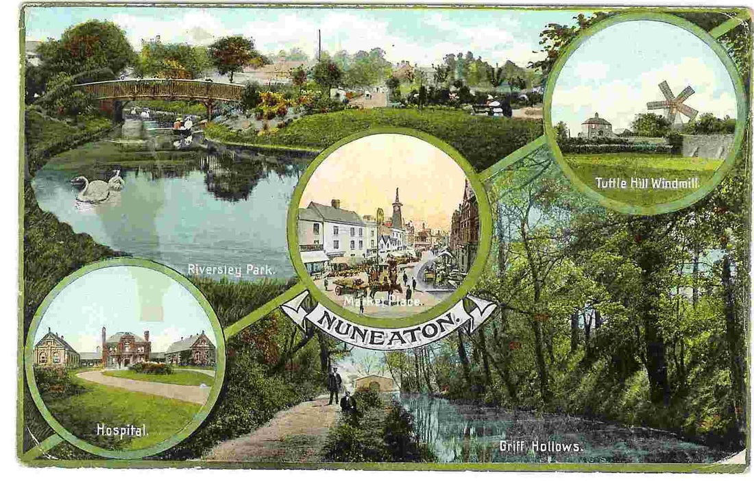
(Alan Cook collection)
(Tom Burgoyne Collection)
(Tom Burgoyne, Courtesy of Ian Burgoyne)
Another Nuneaton Postcard. (Harridan Online Collection)
(Glenn Noon Collection)

(Glenn Noon Collection)
(Glenn Noon Collection)

(Glenn Noon Collection)
(Glenn Noon Collection)
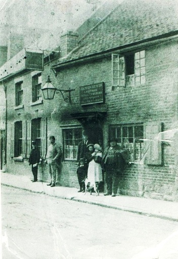
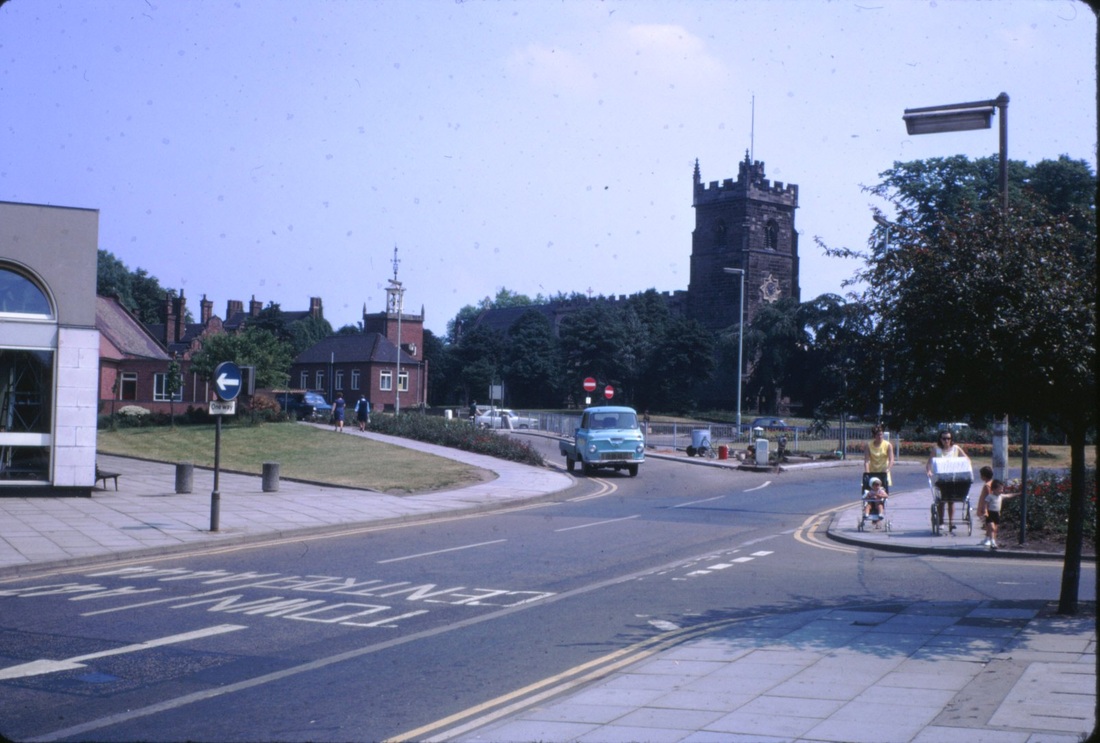
An introduction to the streetscape of Nuneaton.
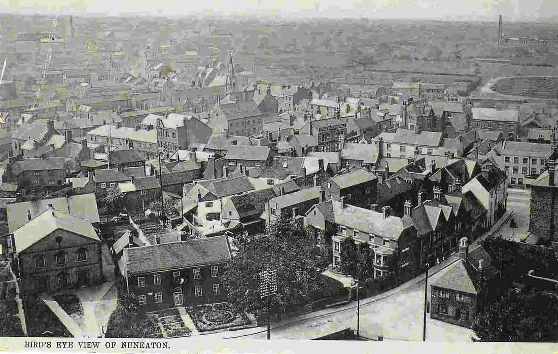
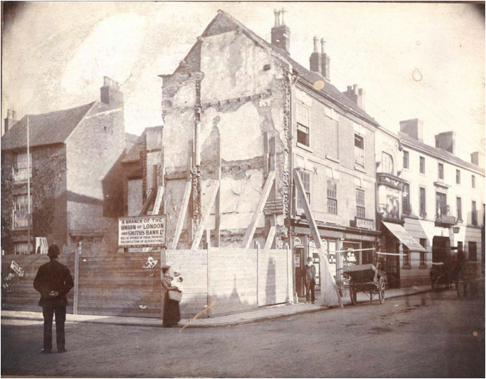
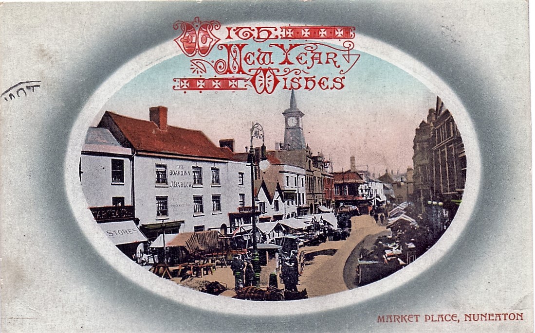
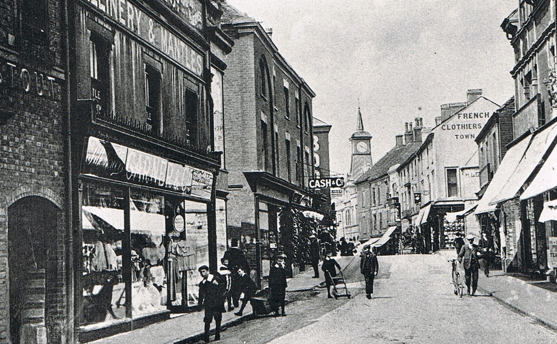
An aerial view of Nuneaton taken from the electricity works chimney, 1900. Coventry Street in the foreground. This aerial view shows how close in the green fields were to the old town. On the middle extreme right of this picture is the Newdigate Arms sports ground, where local sports were played. There was even a floodlit football match played there as early as the 1870's. Although the floodlights were portable and electrocuted the operators. As you can see we get a glimpse of the Market Place, right and side and notice how narrow Coventry Street is. The building with the three gables is the Nags Head pub which had just been rebuilt when this photo was taken. In front of it was Bridge House who the owner John Warden Clay had inherited it from his uncle the Rev. Hugh Hughes who was the curate in charge of Nuneaton church for upwards of 50 years. (Famous for his inaudible sermons). John Warden Clay was a leading light in the Nuneaton Institute that became the library, and his grandson - Sir Frederick Gibberd - the famous modernist architect - designed the Nuneaton Library building which is in Church Street today. It was called Bridge House because in the clump of trees in front of the house ran the Wash Brook (and still does in culvert) but at that time it discharged into the river just off the picture at the very bottom (the bridge parapet can just be seen along the bottom rim of the picture). To the left is the old independent chapel which dated back to the early 18th century which became the Congregational Church when it merged with the Zion Chapel in Bond Gate in the late 19th century. Next to it the Manse. Leading off the Market Place to the middle left is Queens Road today but was then Queen Street and had earlier been Gas Street, and before that Wash Lane. Left of middle of the photo you can catch a glimpse of the rooftops of Abbey Street as it heads out of town. This was where the vast majority of the population were living at that time. A noticeable characteristic is the cluster of buildings backing on to the main streets. Mostly courts and yards, with fascinating jitties and snickleways connecting them one to another and to the main street. One of the delights of these old towns was that you could travel around the district from yard to yard without touching the main streets, around corners in a rabbit warren of alleys whereupon new vistas would open up. Although presumably you needed a strong constitution to do so in vew of the seedy quarters one might stumble across, and the string of abuse received from our great unwashed ancestors. Bottom right is Mill Lane which led down to the Flour Mill. The small premises on the corner was knocked down in 1925 to build the row of shops which is there today. In the late 19th century Slipper Baths were established in Mill Lane (much talked about at the time to render the solution to a big problem of general uncleanliness amongst residents of the town) to help cater for the sanitary requirements of the local population who generally needed a bath. How often they took to the slipper baths I am not sure. Once a week perhaps but generally a good wash could be had by stripping to the waist and using the water butt in the yard. Nearly every yard had a water butt where soft rain water ran off the roofs into the gutters then was collected in barrels through iron down pipes. Very often a peg was attached to the end of the down pipe to focus the flow. With all the soot from coal fires the water in the butt was not very clean, but lathered up with carbolic soap it rendered the body slightly cleaner than it had been. Of course people rarely washed the nether regions as privacy was called for and in teeming courts and yards with ill fitting doors that was a rare commodity. The block of buildings leading to the Market Place incorporating the Nags Head in Coventry Street was demolished in the 1920's to make room for the motor car. The entrances to the Market Place at the time of this photo were very narrow, and were gradually opened up starting with the Queens Street entrance in 1909 which involved demolishing the Crystal Palace pub. At one time there were 127 pubs or beer houses in Nuneaton. There were 14 recorded in the Market Place and 38 in Abbey Street alone! (Alan Cook Collection)
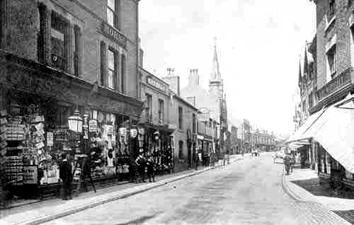
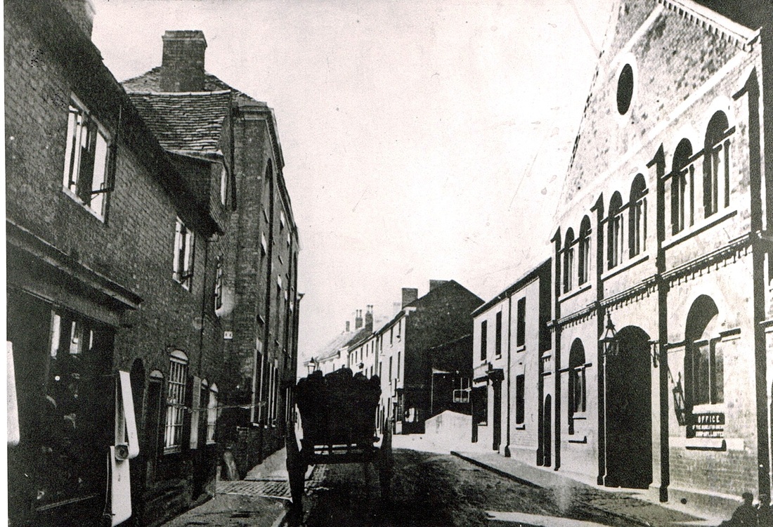
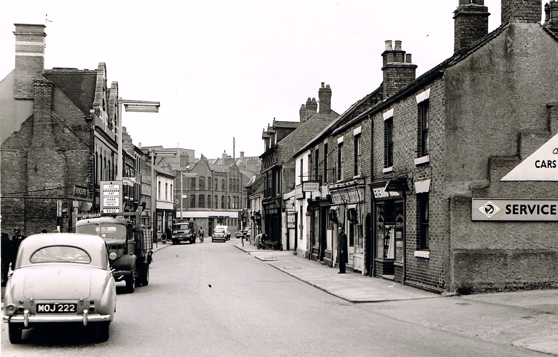
Approaching the town - Coventry Street leading to the Market Place.
Welcome to this tour and to put the town into context thought it might be interesting to approach the hub of the town - The Market Place - via Coventry Street and introduce you to the father of the library movement in Nuneaton to whom this section of the web site is dedicated - John Warden Clay. Mr. Clay was the leading light behind the establishment of a library in the town and it is only fitting as the free of charge dissemination of local knowledge goes on line, and we create a library in cyber space that we remember Mr. Clay and his good work back in the 1850's and 60's. PL
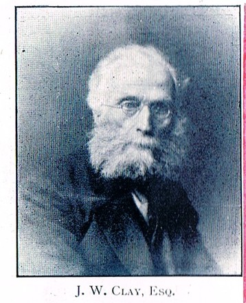
John Warden Clay (1821-1904) was one of 17 children. His uncle the perpetual curate at Nuneaton parish church the Rev. Hugh Hughes (1755-1830) and his family the Clays and the Wardens were relatives of George Eliot's mother. Indeed it is said that J.W.Clay was at school with Miss Evans between 1828 and 1832 at the Elms in Vicarage Street. Mr. Clay's grandson was Sir Frederick Gibberd - the great modernist architect - who designed Liverpool Cathedral and Harlow New Town. He also designed part of Nuneaton when it was newly rebuilt in the early 1960's. The Nuneaton Library was designed by Sir Frederick Gibberd which is poignant as J.W.Clay was founder of the Nuneaton Library - or Nuneaton Institute as it was then, when it was a locked glass fronted book case in Vicarage Street School. The library is under threat but I believe it is a fine building which reflects some of Gibberd's influences of the great French designer Le Corbusier - and should be listed as a good example of Gibberd's small design work. It would be a great pity if it was demolished now that we know the very important link it has with the history of Nuneaton. The photo was taken c. 1902 just two years before Mr. Clay passed away.
(Clare Speight)
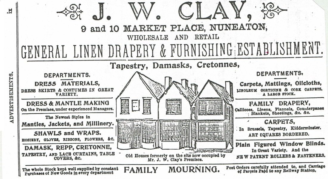
J.W.Clay occupied property which once was the site of these old fashioned multi pane window shops. Once occupied by John Astley and his father also John Astley. They were probably pulled down in the 1840's. John Astley Junior was the "Nuneaton Diarist".
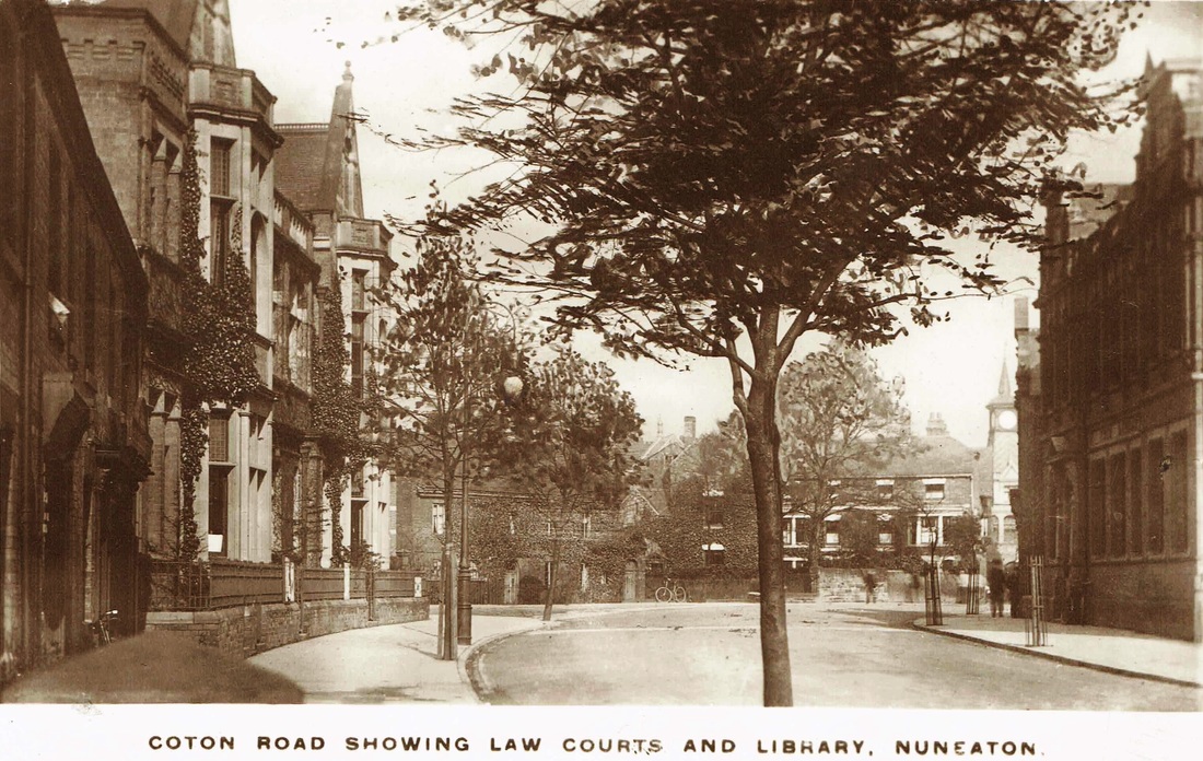
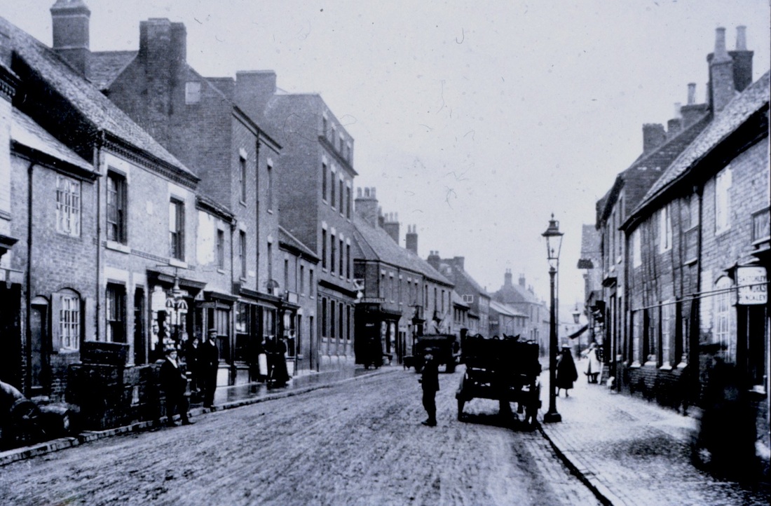
Coton Road leading into Coventry Street in the 1890's. This entire location was altered by roadworks in the 1920's. The house behind the telegraph pole was demolished, the gable ends projecting into Coventry Street which was the Nags Head pub show how narrow this entrance to the Market Place beyond was. The Nags Head was transferred to a new site in Queens Road in 1929. The cottage in the foreground right of centre of the picture was demolished in 1925. Notice at this point the Wash Brook which flows down from Camp Hill (and still does today) enters the River Anker and behind the wall on the right is a promontory of land associated with the flour mill. The two bridge abutments can clearly be seen and the Wash Brook lies in open cut at the side of the large tree on the left. Its a bright winter's day by looking at the tree. It is very hard to imagine that this lovely old fashioned old town is the one we know today because every aspect of this view has gone. All due to the advent of the motor car. As the streets got busier the narrow entrances to the Market Place were opened up. Nuneaton Town Hall stands on the land in the foreground. John Warden Clay owned bridge house and his business premises were in the Market Place in the distance. To go into his shop all he had to do was thread the passages at the back of the Nags Head pub and emerge into the back of his premises.
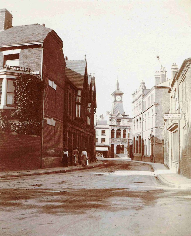
Coton Road, looking towards Bridge House and the town centre. A delightful approach to a quintessential English town. (courtesy of Jean Lapworth)

Bridge House which features in the two photos above was a lovely mansion in a quaint location. Home of John Warden Clay (1821-1904). The house was owned at one time by Mr. Clay's uncle the Rev. Hugh Hughes (1755-1830) the perpetual curate for 52 years at Nuneaton parish church. It was pulled down for road widening in the late 1920's which seems such a shame. It was a beautiful house in an immaculate setting. Note the tidy lawn and garden and the old bench where Mr. and Mrs Clay would sit out on a warm day away from the bustle of the town centre just a few yards away.
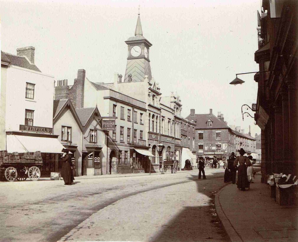
In this view of Coventry Street before WW1 you can see how narrow it used to be before it was opened out in the 1920's by demolishing all the buildings on the left. The end of Bridge House can be seen which has, for some reason bricked up windows. (Maybe to deter local vandals hurling bricks through them because Nuneaton back then was as uncouth then as it is now. Beyond the distinctive gable ends of the Nags Head pub. This was the second Nags Head on this site, the original pulled down in the 1890's and replaced by this building which was only to last about 30 years before it too was demolished for road widening purposes. Its replacement was built in Queens Road. On the right is Barclays Bank as we know it today. The nearest buildings in view on the right nearer the camera have all gone now. The Market Place is seen in the middle distance with Nuneaton's iconic clock tower. (Horace Bull, courtesy Ruby Atkins)
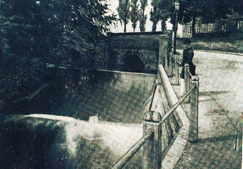
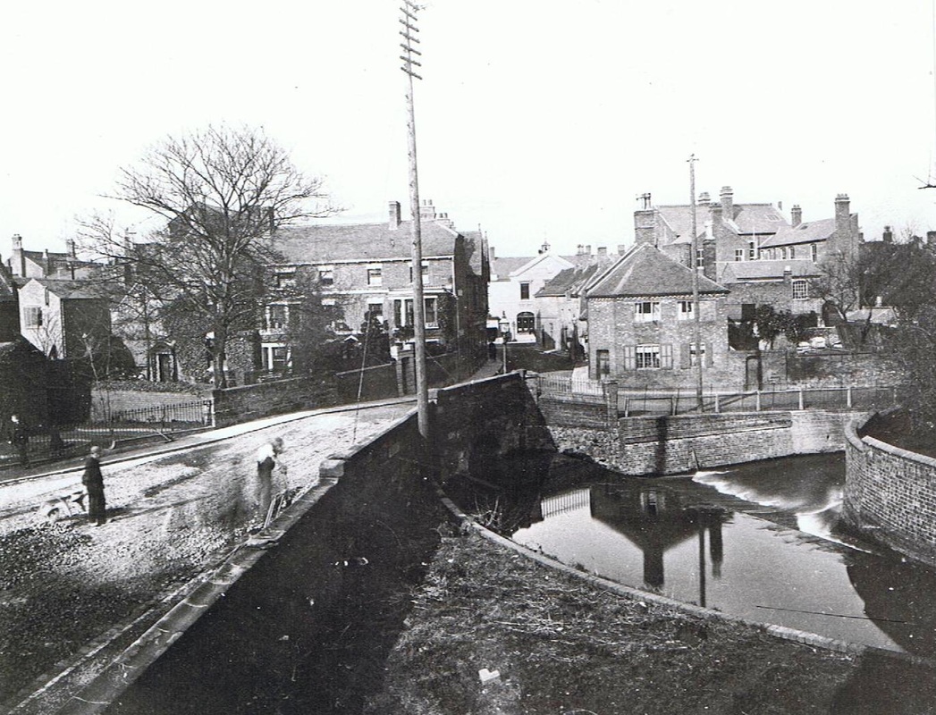
The bridge which marked the boundary between Chilvers Coton and Nuneaton parish which was within a few yards of Bridge House above. The weir has now been completely lost and the River Anker / Wash Brook confluence changed out of recognition.
The original Nags Head pub, replaced in the 1890's. It was an old fashioned place.
A better view of the Nags Head in the 1890's before a new pub was built on the site.
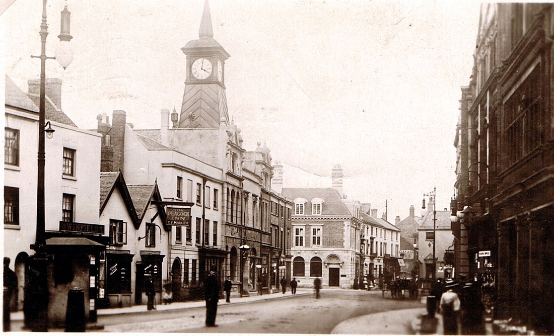
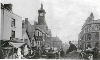
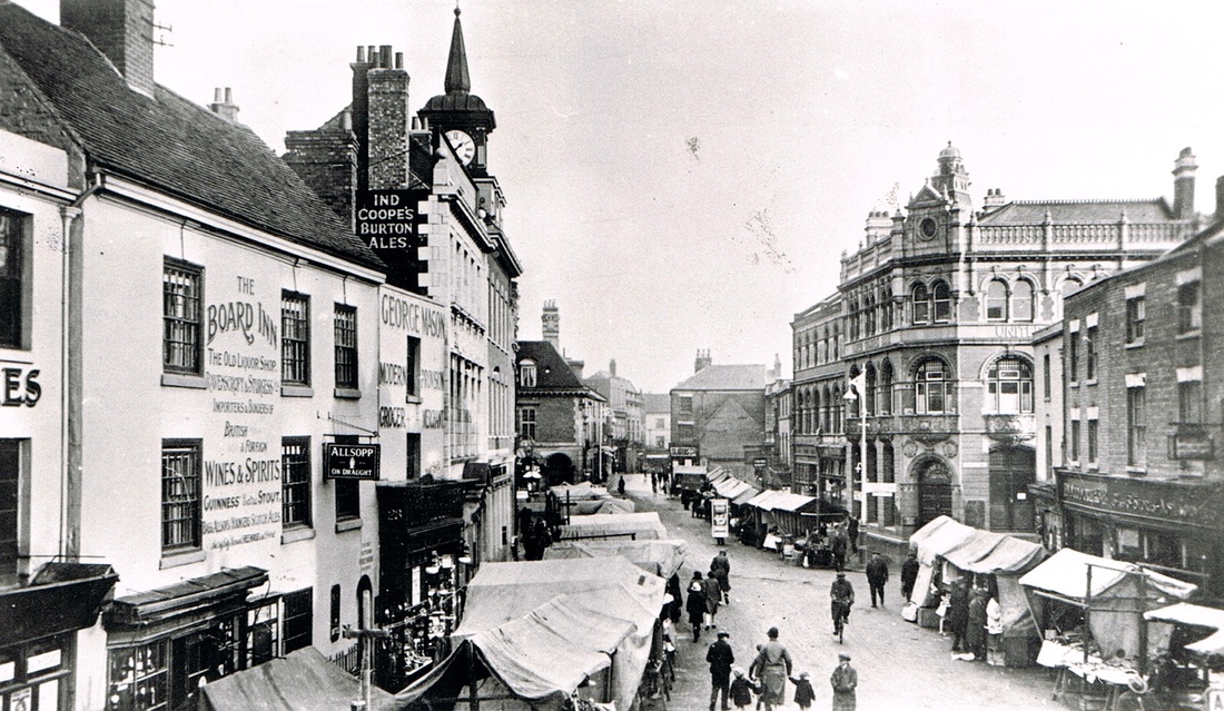
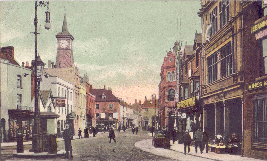
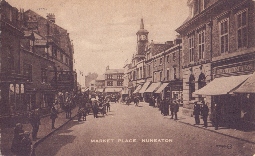
The Market Place - the heart of the town and its principal business district.

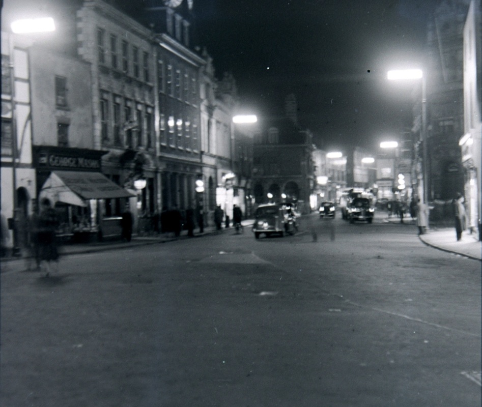
Nuneaton Market Place in the 1940's. looking towards Bridge Street.
The Market Place in 2010 (Peter Lee)
Market Place from the Air
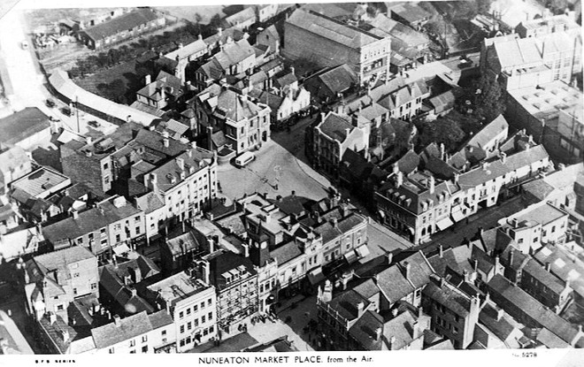
There are many features of this aerial view long since disappeared. The agricultural sheds in the top left replaced by new modern shops in the early 60's with the site for Nuneaton bus station extreme top left. Parsons & Sherwins the tall building in Newdegate Street top centre. Next to it the garage which stood on the site of the wooden Theatre Royal which existed 1895-1900. The square in the centre is Newdegate Square with the bulk of the Newdegate Arms Hotel on the left of the square. The Bull Hotel middle left in the centre where Bridge Street leads off.
An aerial view of Nuneaton Market Place, Newdigate square and Bridge Street about 1949.
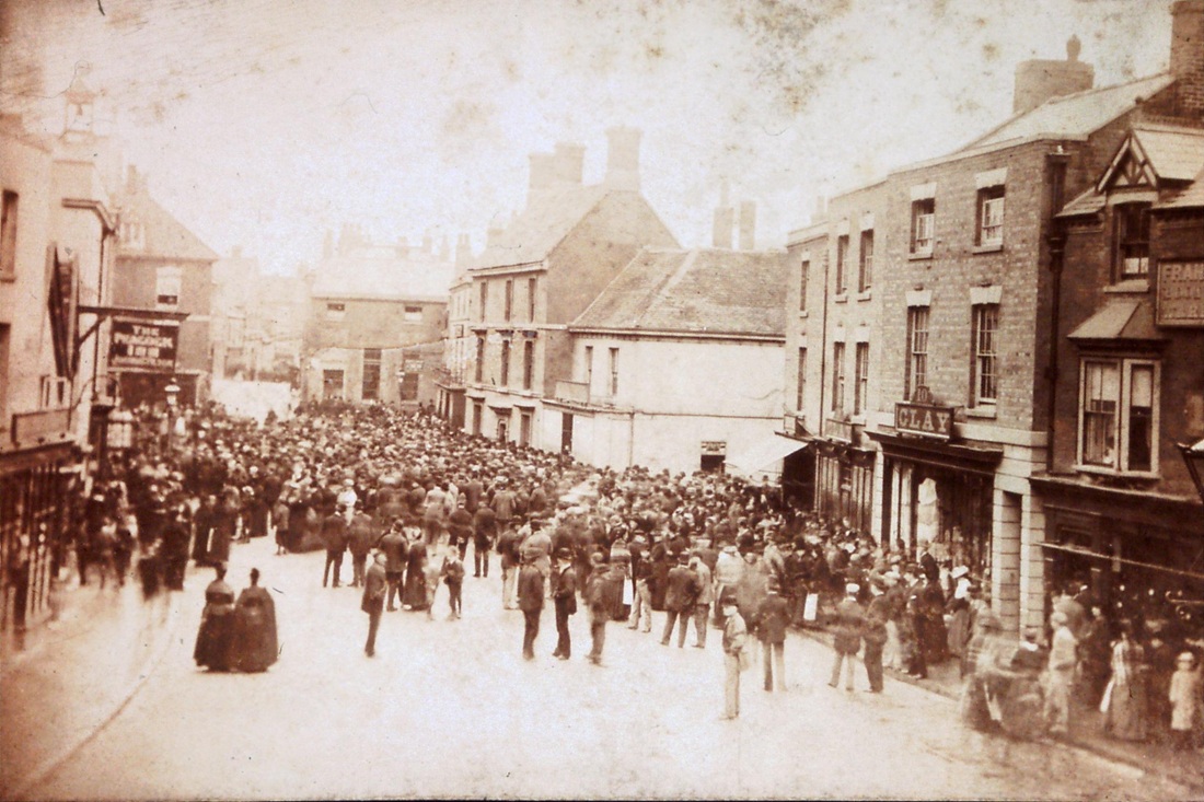
Nuneaton Market Place 1894. The very large crowd gathered to hear the result of the general election from the telegraph machine in the town post office. The building facing the Market Place in the centre of the photo. The white stucco'd building centre right is the site of the current Barclays Bank. The predecessor bank is the three storey building beyond which was then the Midland Bank. It looks as though the vast majority of the adult population have turned out all cramming up to the Post Office to here the results. I think this might have been the first election local miner's champion Billy Johnson was standing for the Liberal Party. He was a local lad, born in Chilvers Coton and living in Collycroft then Bedworth, he had championed the cause of the working man. Hence the interest in this election. He did not get in this time round but would do so later. The low white building on the corner harks back to an earlier election the Great Reform Election of 1832 when there were riots in the Market Place with rumours of election rigging. The low white building was the shop of "Tory Bob" Arnold who the rioters thought involved in the affair, which had deprived them of their favoured candidate - Dempster Heming - the people's champion. "Tory Bob" had to make his escape after the local militia were called in to restore order, and as the people ran away the troops galloped amongst them and one man died in the melee. The story of this election was told by George Eliot in "Felix Holt the Radical". For many years old Nuneatonians computed their years from the date of "Dempster's Election" and its famous riots. Forgotten now of course, but a big thing to our forefathers. If your ancestor had a baby born in Nuneaton in the year 1832 called "Dempster" now you know why! The locals seem to forgive "Tory Bob" as he went into the pub trade later, and at one time was a messenger for Craddock & Bull's bank, riding to London with the cash (and bringing it back as well). On these expeditions he always rode armed with a revolver!
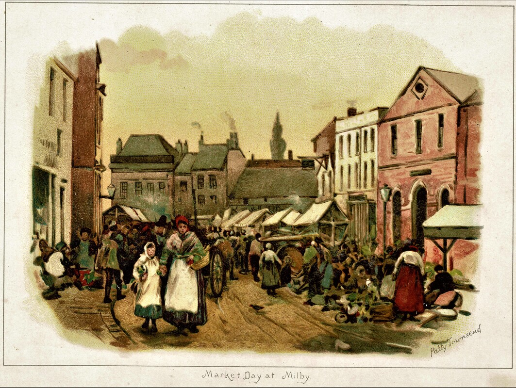
A water colour painting by Patty Townsend. (Reg. Bull Collection / Ruby Atkins)
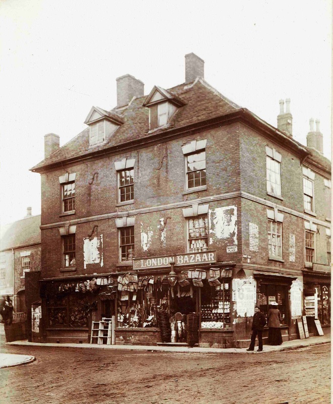
The London Bazaar stood in the Market Place (Nr. 30)on the corner of Newdigate Street opposite Iliffe's the chemist. It sold domestic hardware, including a good line in linen bags. The building recessed on the left was Henry Lester's house (now Debenhams store). The shop on the right with the notice boards outside in William Cawthorne, printers and stationers emporium. This decrepit building was demolished in 1909. (R.A. Bleasdale, courtesy Ruby Atkins)
The London Bazaar was demolished in 1909, and a new bank replaced it. Here you can see the demolished plot buildings adjacent heavily shored up with Mr. William Cawthorne standing in his doorway fearful no doubt his old premises might fall down.
The Market Place c. 1909/10. You can see in the centre of the picture the brand new and very elegant building which replaced the rather decrepit old premises of the London Bazaar.

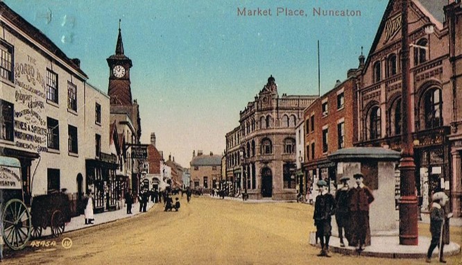
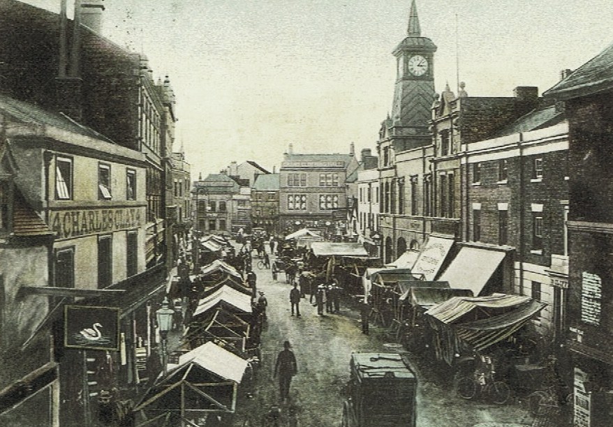
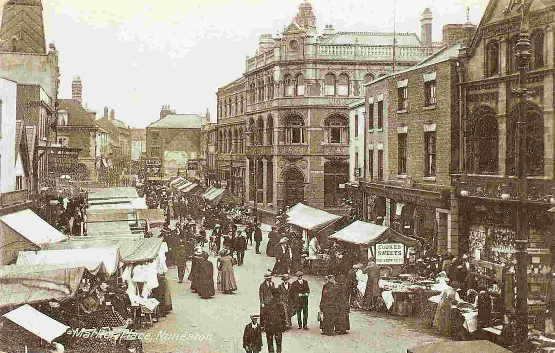
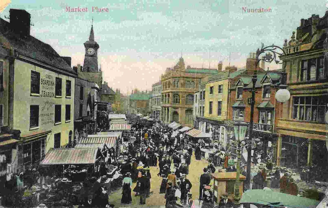
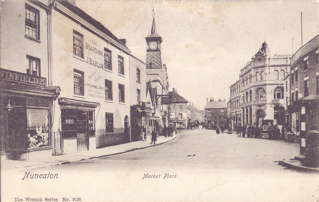
Nuneaton Market Place c. 1900. A busy market day. A photograph taken from a first floor window of the Crystal Palace Inn. This is a fine picture and showed how "old Nuneaton" used to look in the 19th century. Where the iconic Nuneaton town clock stands today is the original town hall with its bell tower. It also had a clock on the front which was a bit of a disgrace towards the end as it never kept time, and finally fell silent. Townspeople were ashamed of it. The bell above it harks back to the days of the old Market Cross which stood just in front of the Town Hall but had to be taken down in 1810 before it fell down. It too had a bell and this was known as the "Pancake Bell" as it was always rung on Pancake Day. It was also rung too if there were any announcements to be made by the town crier. If the Pancake Bell was ringing residents would gather around to hear his sonerous voice read the news. The French defeated, Nelson's victory, The King is dead, long live the King that sort of thing. In the early 19th century few people could read and write so they relied on the town crier to find out what was going on in the wider world. There were no local newspapers either, other than the Coventry papers which were not widely distributed. So people were generally ignorant of the everyday happenings in the towns around. The market was important from that point of view as well. People could gather in the pubs on market day and listen to the market traders, the local business people could do deals, swap intelligence, and everybody discussed each others business. One local trader John Astley kept a diary and by some miracle this survived. One day in the late 1870's it was taken into the Nuneaton Observer office and handed on to Alfred Scrivener, the editor, and he serialised it in the paper. His serialisation and the notes that went with it will be published in full soon on this web site. John Astley was a grocer and sold things like pork pickled in wooden barrells and other necessary goods. People who went into his shop told him stories which he wrote down for posterity. It gives an impression that our Nuneaton ancestors were a rough and ready lot and he tells you all their gossip. The old town hall was taken down and council business was transacted in the "new" municipal office in Queens Road which it shared with the local fire brigade and Nuneaton's only ladies toilet. This building was altered in later years (1933 onwards) as the library. Perhaps old timers can remember it before the modern library was built. You can see five pubs in this view but at one time there were eleven in and around the Market Place together at one time, but at an earlier date 14 in all.
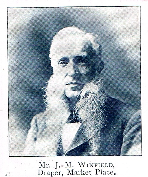
A busy market day before World War One. The shop on the left was owned by Mr. J.M. Winfield to the right.
|
|
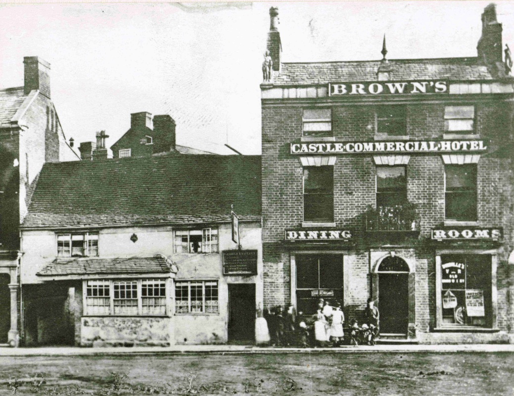
The White Hart Inn (left) and Ebenezer Brown's Castle Commercial Hotel. At one time there stood to the left of the White Hart another ancient pub - The Ram, or "Old Ram" which dated back to the times of Good Queen Bess, but was demolished in the 1870's. The White Hart itself was not much younger, and it too was pulled down not long after this picture was taken in the 1880's. The White Hart was said to be associated with the more "Radical" members of the local population. (Reg. Bull's Collection, courtesy Ruby Atkins)
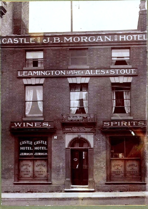
The Castle Hotel was one of the principle pubs in the Market Place. It was also a hotel and it had an annexe in Queens Road, called Morgan's Hotel. James Birt Morgan was a native of the Forest of Dean, a miner who was latterly under-manager at Charity Colliery in Bedworth before he went into the pub trade in 1893. In July 1898 he took over the Peacock Inn in the Market Place, but his wife Emily died in 1899, she was only 34. He then took over the Castle Hotel in the Market Place and turned it into a thriving business. Unlike the Bull Hotel and the Newdigate which were top class hotels in their day, the Castle filled the sector of the market just below them. Providing basic accommodation at a reasonable price for travelling salesmen, workmen, engineers and that type of guest. Nevertheless with good ale on tap and ten other pubs close by the night life of Nuneaton must have been bustling back then for Mr. Morgan's guests. Mr. Morgan was treasurer to the Nuneaton and District Licensed Victuallers association in 1915. He had a brother - Mr. E. Morgan of the Castle Brewery, Tamworth. Mr. Morgan died in tragic circumstances in March 1920. He was 59. (Nita Pearson - from a cousin in South Africa)
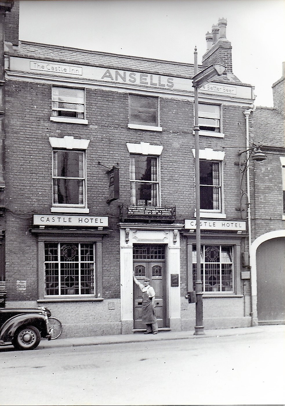
The Castle Hotel as it was in the 1950's. (Reg. Bull / Courtesy Ruby Atkins)
The Market Place on Market Day in the 1920's.
The Market Place c. 1910-14. Note the town water pump on the right. This supply of water was to water horses and for drinking purposes. In order for the public to drink it was provided with a cast iron ladle - called - The Fever Cup!
The Market Place between 1905 and 1909. (Ruby Atkins Collection)
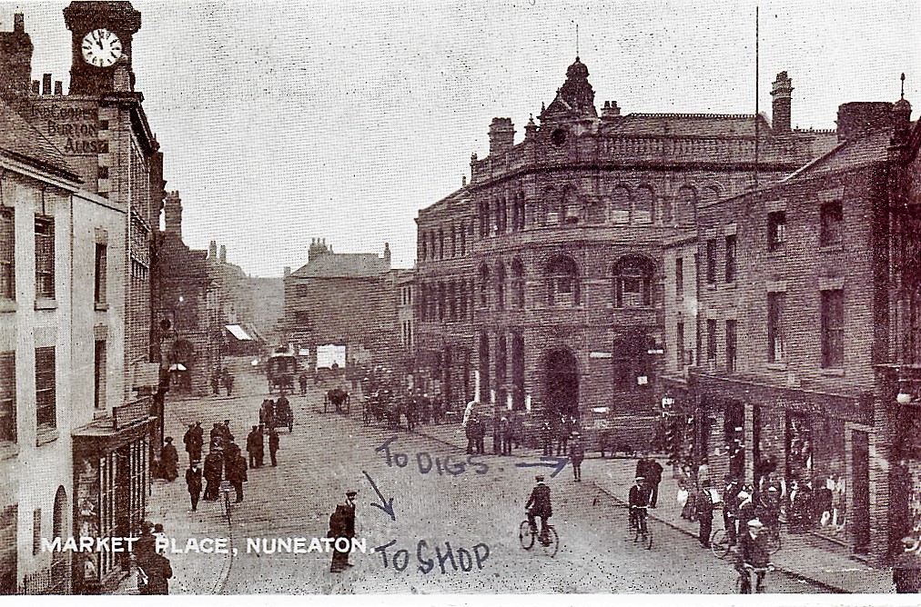
Market Day sometime before 1909. Nuneaton's most distinctive clock seen here was commissioned on Wednesday 15th May 1901 at 5 minutes past 5 in the afternoon by Alderman E.F.Melly. The clock cost £350.
Market Place after 1912 (Alan Cook Collection)
Market Place before 1909. (Alan Cook Collection)
The Market Place after 1912. (Glenn Noon Collection)
The Market Place, Coventry Street to the left and Queens Road ahead. After 1909. (Glenn Noon Collection)
A Christmas Card from old Nuneaton Market Place. The image was taken 1908/09 and hand coloured. (Glenn Noon Collection)
Another tinted postcard of the Market Place. Before 1909. (Glenn Noon Collection)

(Glenn Noon Collection)
Before 1909. (Glenn Noon Collection)

(Glenn Noon Collection)
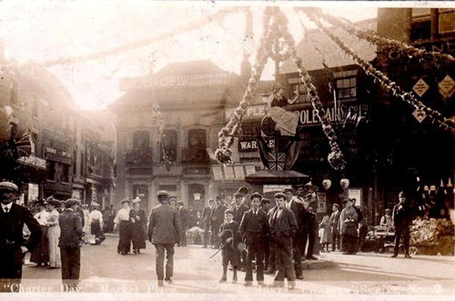
A Charter Day 1907 photo of the Market Place with local residents enjoying the festivities.

(Glenn Noon Collection)
(Glenn Noon Collection)
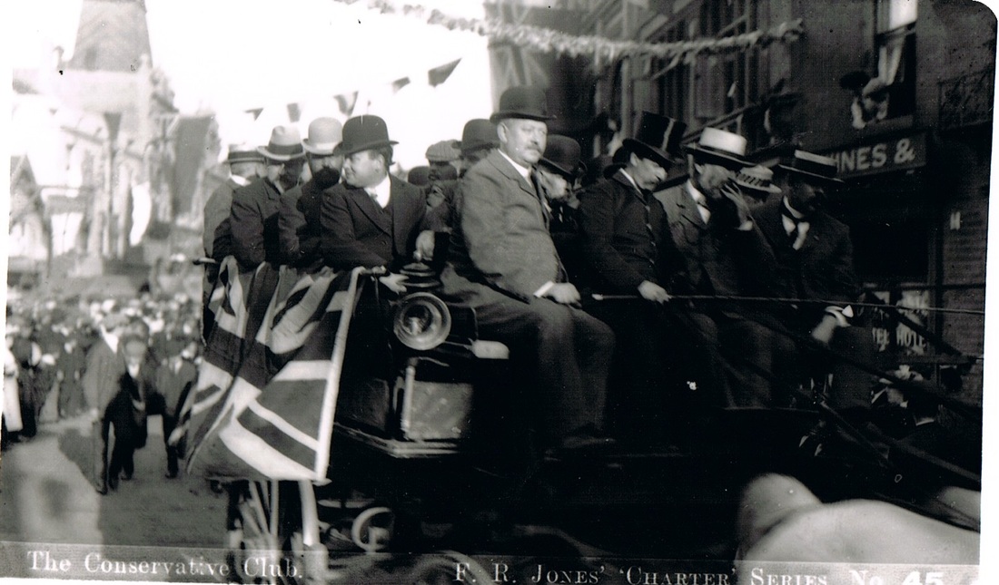
Distinguished members of the Conservative Club have hired transport for a parade through the town on Charter Day 1907 and are passing through the Market Place.

Mr. Joseph Fielding Johnson, first mayor of the newly formed Borough of Nuneaton passes through the Market Place in some style. 1907.
A local tradesman passes through the Market Place in Charter year 1907. (NLHG Archive)
The Market Place in the 1920's. (Glenn Noon Collection)

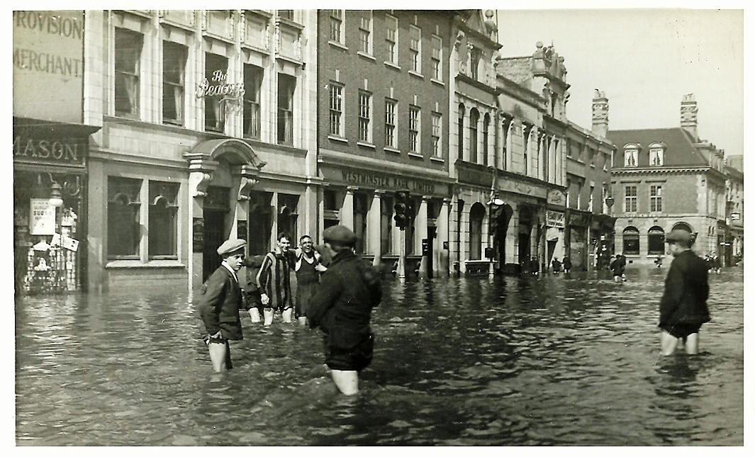
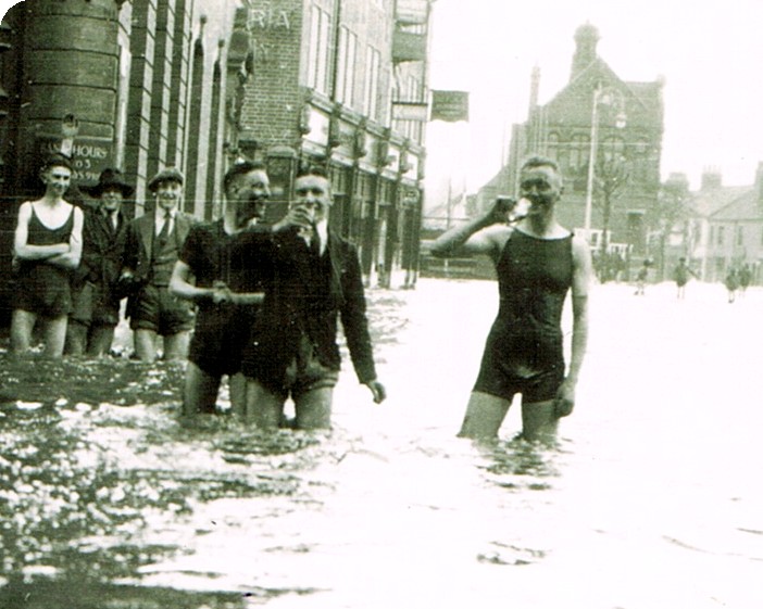
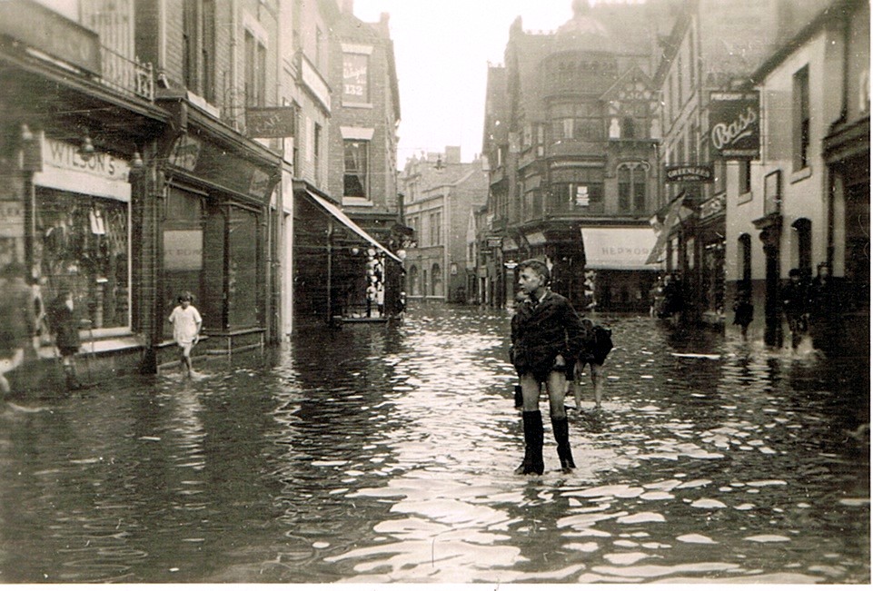
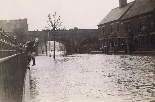
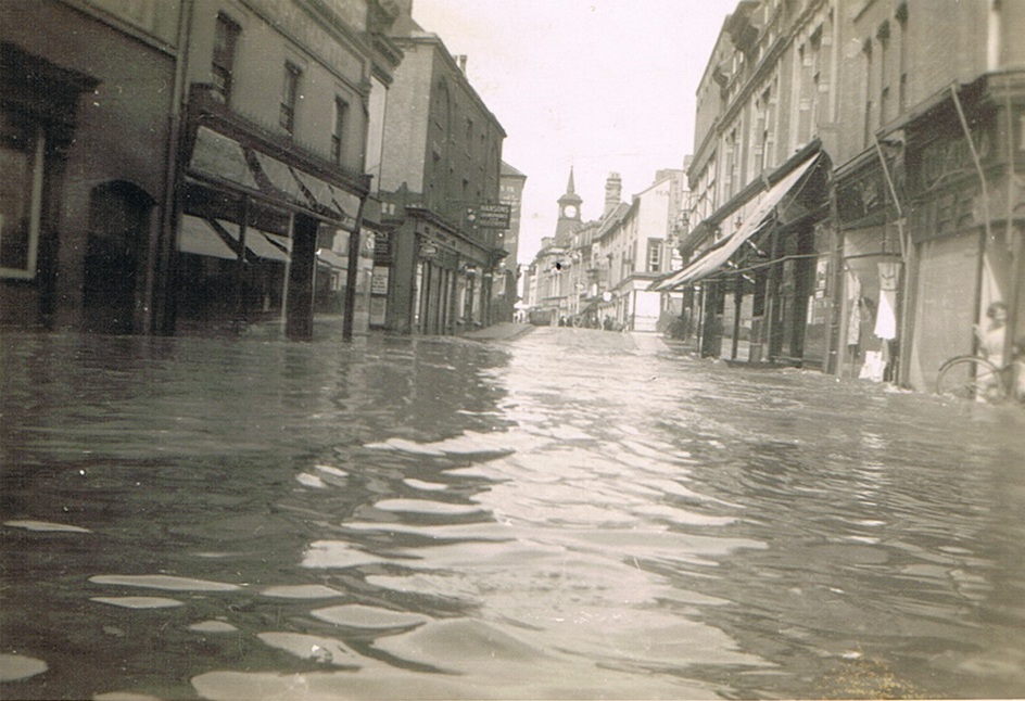
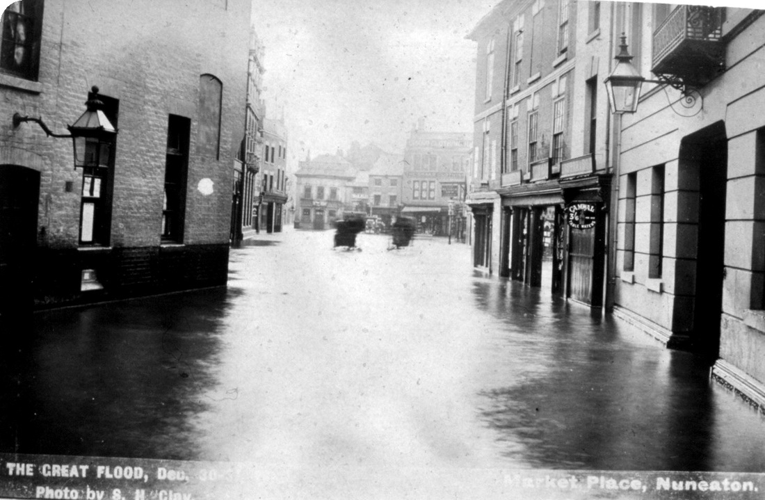
Nuneaton Market Place during the great flood of 1932. It looks like much of the stock in Burtons and the Star Supply Stores has been spoiled. (Pat Haselwood)
Another view of the great flood 1932. Note that the little twin gabled
ancient pub the Peacock has been replaced by a much more substantial three stories building. (Pat Haselwood)
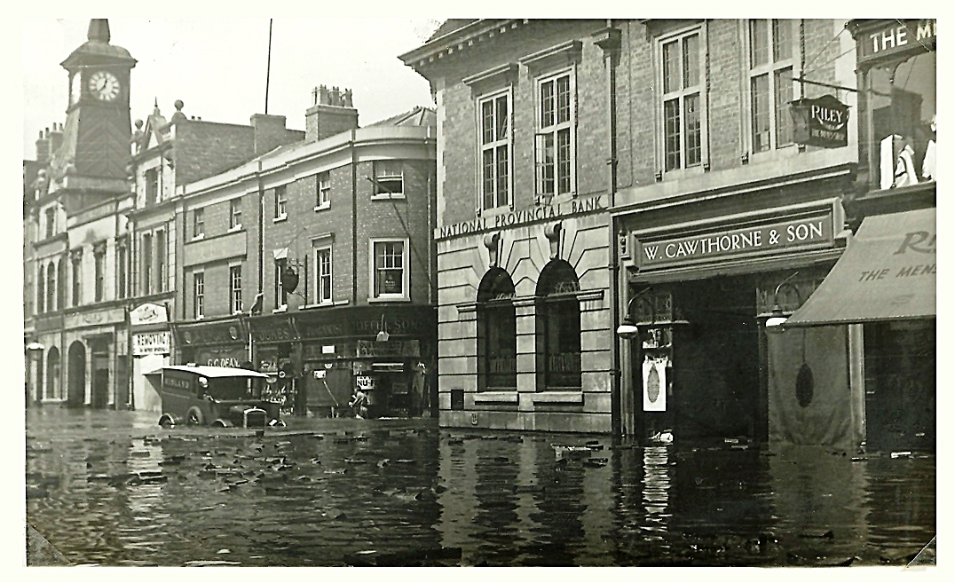
Another view of the flood which has caught a Midland Red van up to the tops of its wheels. 1932. (Pat Haselwood)
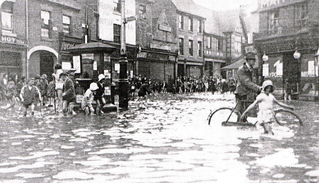
By the afternoon many of the town's kids headed into the Market Place for a paddle. (NLHG Archive)
This was not to be recommended considering the effluent absorbed into the flood water. We are looking from the Market Place, Barclays Bank on the corner, into Coton Road. The building in the centre is the old Carnegie library which will be pulled down next year when the Council House in its early stages of construction to its left is completed. (NLHG Archive)
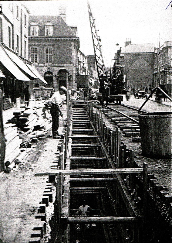
In 1936 a new pipe was laid in the Market Place and this was laid very deep. The work involved building a temporary rail line in the Market Place for lowering the heavy pipes and equipment down. The work involved a tragic fatality and the press cutting accompanying this gives the details of the tragedy. Note the former wooden blocks exposed which had been lifted four years earlier in the flooding and those that remained had been tarmacked over. (NLHG Collection)
|

|
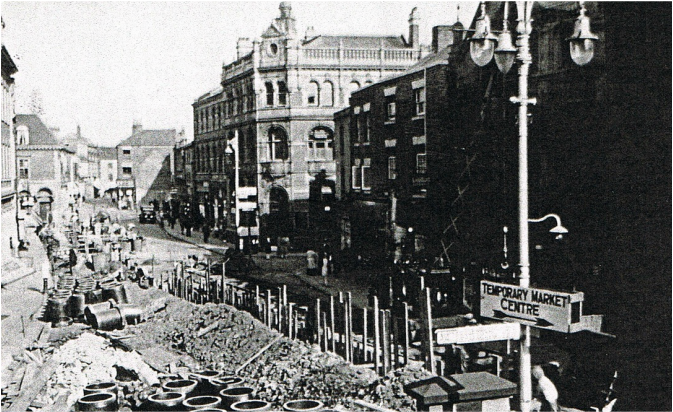
The new pipeline works involved considerable disruption and for a time the ancient street market was moved up Queens Road. (NLHG Collection)
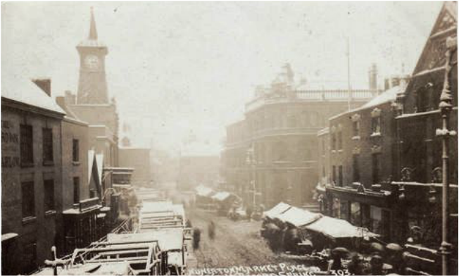
A bleak, snowy and very cold market day in Nuneaton. The record cold spring of 1908 on Saturday afternoon April 25th when at 5.30pm the Market clock froze and 8 - 10 inches of snow fell. (Jean Lapworth Collection, A F.R. Jones card, probably the photography was by Bradbury of Stockingford).

(Reg. Bull, Ruby Atkins Collection)
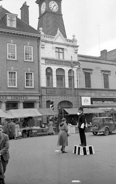
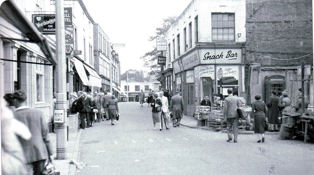
It is impossible to imagine today that a PC standing on a wooden box directing traffic was all that was necessary to regulate the motor vehicles entering and leaving the Market Place. Such was the lack of traffic in the 1950's. This photo was one of the well known ones taken by Reg. Bull.
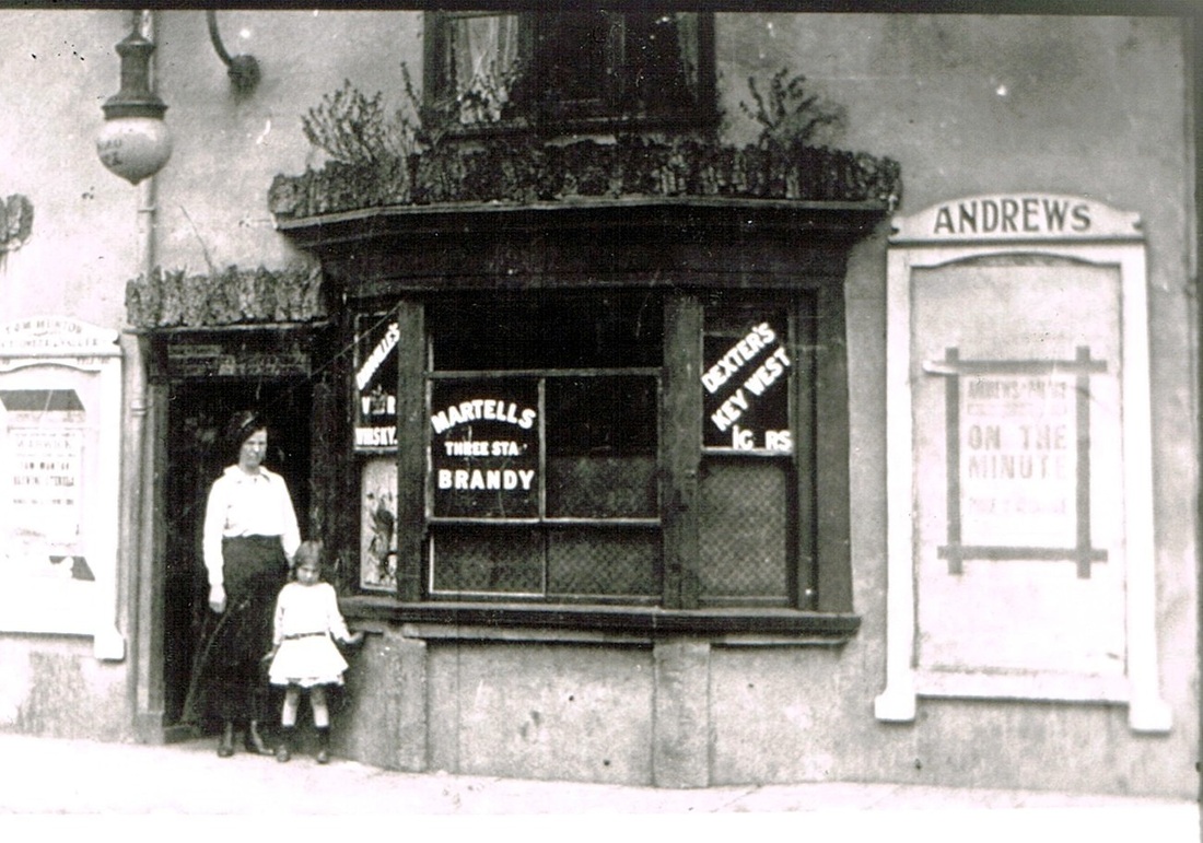
The landlady of the Peacock in the early years of the 19th century. Note the advert for Andrew's Picture Palace which stood in Victoria Street. The Palace Cinema was its lineal descendent on the corner of Victoria Street and Queens Road. So this must date the photo to around the First World war period. (Fred Phillips)

The Peacock Inn which is mentioned above. It relates the scale of the buildings in the Market Place at the beginning of the 19th century. A fine old pub.
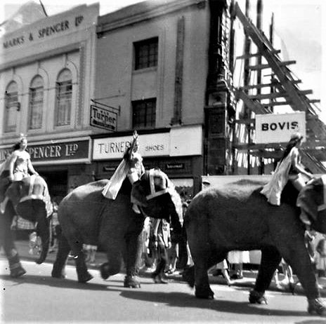
The circus is in town and as part of the advanced publicity elephants parade through the Market Place. (Reg. Bull / Courtesy of Ruby Atkins)
A corner of the Market Place looking into Abbey Gate. Mid 1960's. (Reg. Bull / Courtesy of Ruby Atkins)
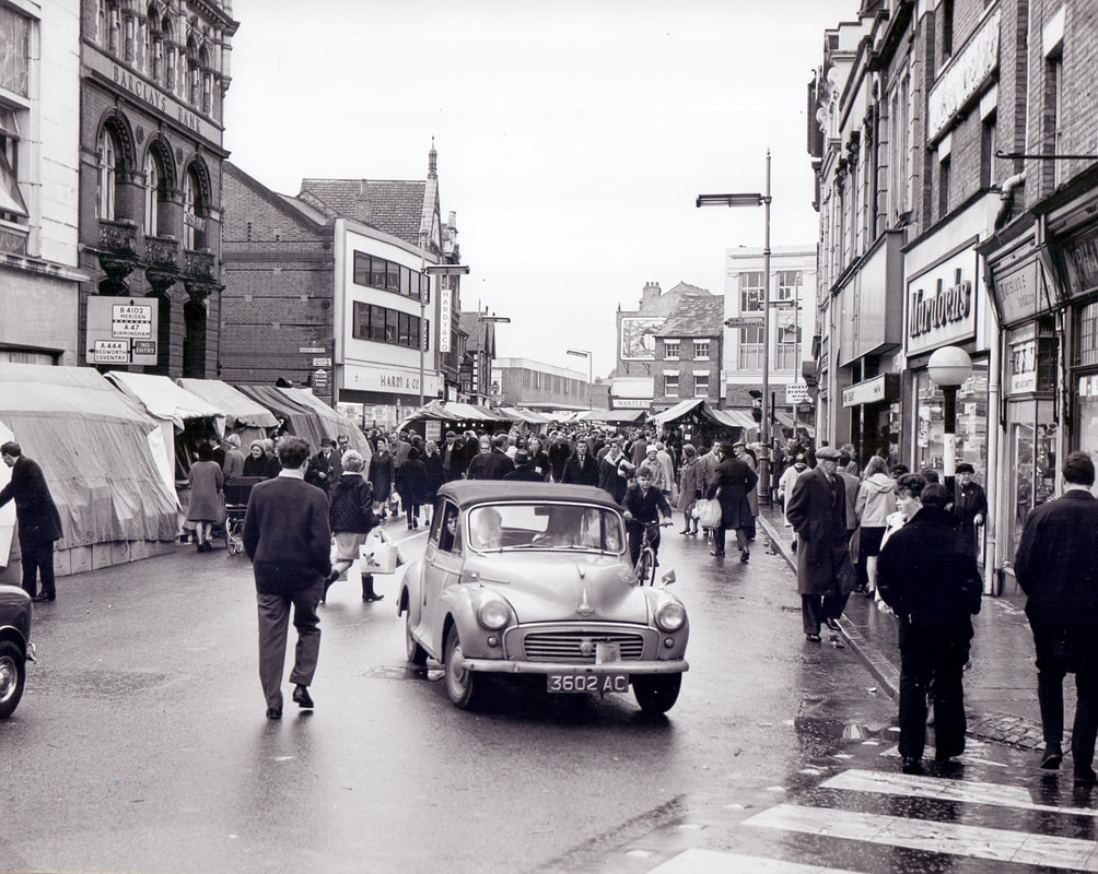
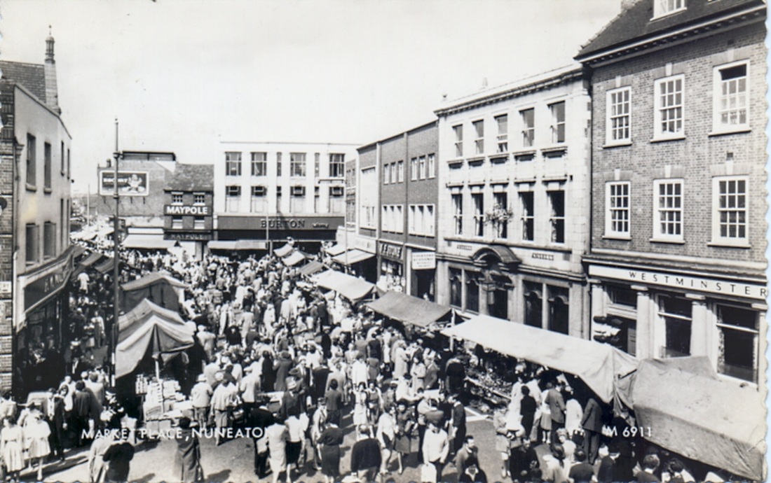
A busy Saturday market when cars could drive through the town in the 60's. (Reg. Bull / Courtesy of Ruby Atkins)
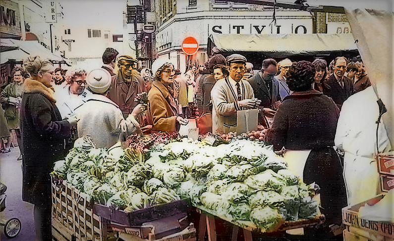
A colourised busy Market Day. Dagwood is ready to pay for some vegetables. (Reg. Bull / Courtesy of Ruby Atkins)
(Glenn Noon Collection)
Pedestrianisation gets underway. 7th August 1984. (B.Wood)

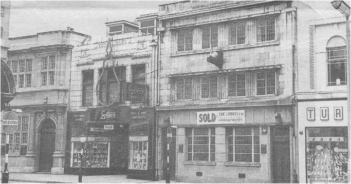
Remember the Tatler? Latterly a grocery shop but originally a cinema. (Peter Lee)
There still is some fine terracotta work in the Market Place. This photo taken in the 1950's with the original Boots store. You can just see the Tatler to the right. Woolworths to the left and far left on the corner of Coventry Street. A feature of the town was fine detailing in the form of pediments to buildings, little pinnacles, turrets, projections above roof level, but these fell out of favour in the 60's when one of these fell into the street in a shower of shards of terracotta fortunately missing passing members of the public but to property owners it was a wake up call. I guess in Victorian times they hadn't factored in wind and snow loads on roofs. Over the years as gales blew these pediments were loosened. Their cement attaching them to the building deteriorating until they became loose and ready to drop on a pedestrian at any moment. The building owners gradually took them down as a precaution against this happening and the Nuneaton roof scene became bland and uninteresting.
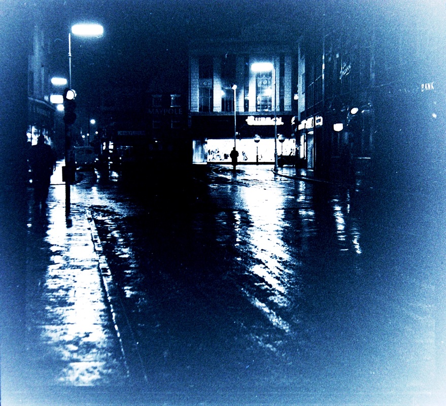
The Market Place at night in the 50's. (W.H.Hope, courtesy Colin Yorke)
The Market Place at night in the 1950's. (W,H,Hope, courtesy Colin Yorke)

The Maypole and W.R.Fletcher's shop in the Market Place in the 1950's.
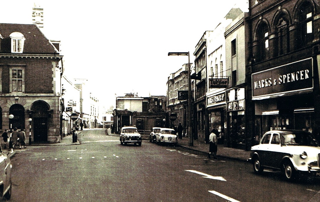
Demolition has just started in Bridge Street so this would date the photo to c. 1959.

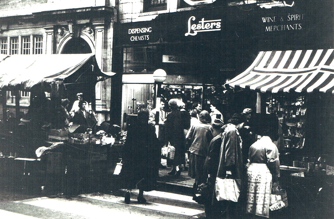
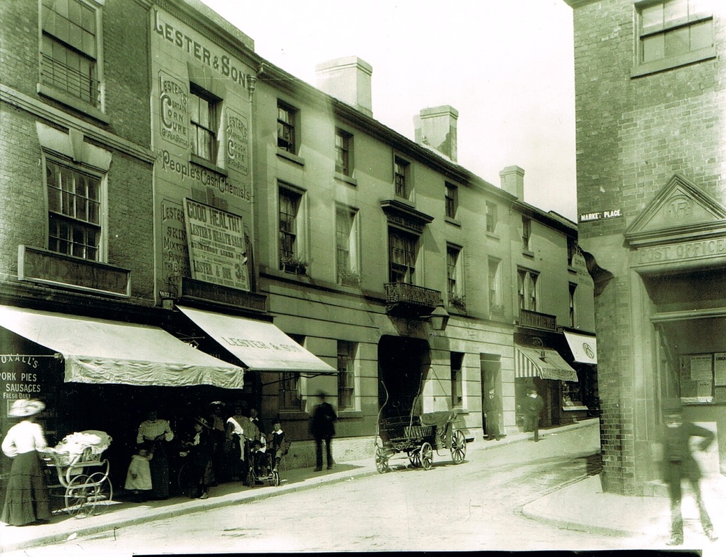
Lester's the Chemist's shop in the Market Place, Nuneaton. (Geoff Edmands)
The old fashioned White Swan pub was entirely rebuilt in late 1940. The "New" pub closed on the 30th December 1962.
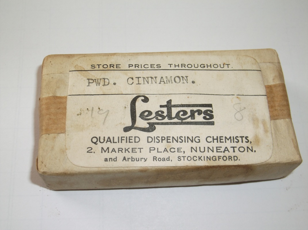
Is this the last unopened package from Lester's the Chemist? (Gavin Metcalfe)
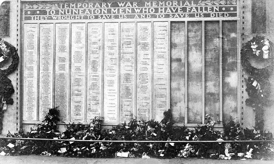
Shortly after the war the men from Nuneaton who fell were remembered on this temporary wall memorial which was next to the Post Office in the Market Place. The memorial was removed when a new one was erected in Riversley Park.
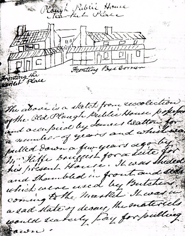
The old Plough Inn in the Market Place was demolished in the 1840's. A sketch from the Nuneaton Diary kept by John Astley. John Astley had a grocers shop in the MArket Place and kept a diary of everyday events in the town between 1810-1845. It is full of gossip.
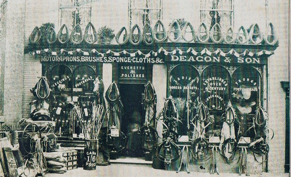
Deacon & Son, Saddlers in the Market Place. This business closed about 1926. It must have been a big job putting this lot out every day and taking it in at night. You can imagine the stong smell of leather and horse linament permeating the shop. George Deacon (1850-1926) was born in Bedford and his wife Elizabeth (1852-1925) was born at Ashley in Northamptonshire. Deacon's took over the business by 1872 from a B. Mayhew, although the saddlery business in these premises was originally started by George Gray in the 1790's, and Mr. Gray's son Thomas (1805-1857) ran it behore Mr. Mayhew owned the business.
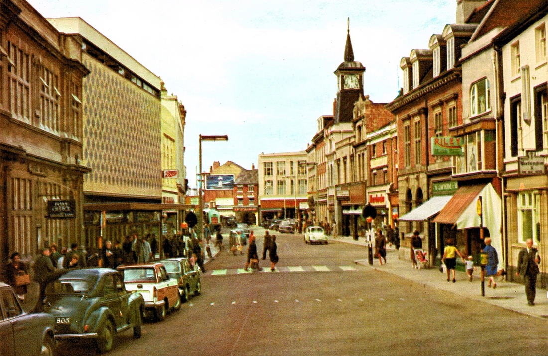
Nuneaton Market Place in the 1960's. I am very grateful to Kay and Bob Farndon as that is probably their red and white Triumph Herald on the left which they bought in 1966. There is believed to be only one of this type in Nuneaton at the time as far as they know.
Nuneaton Market Place from Bridge Street. 1981.
(Robert Browning)
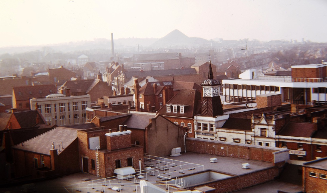
Alan Cook took this photo from a vantage point looking towards the Market Place with Abbey Street in the centre of the picture going off towards the tall chimney on the skyline. The year is 1976. The conical tip of Mount Jud stands out of the haze.
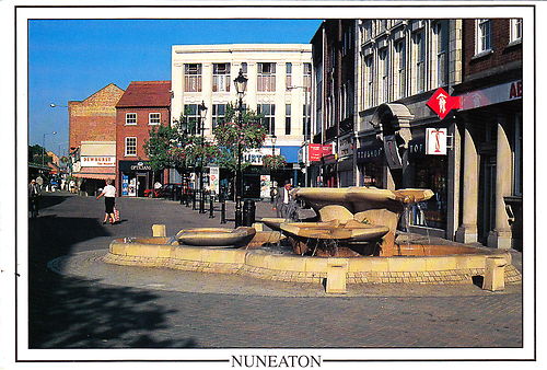
A recent postcard view of the giant bidet in the Nuneaton Market Place. A water feature which is said to be in the same position as the old Market Cross which was demolished in 1810.
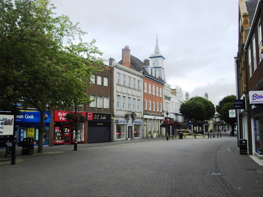
The Modern Market Place 2010
Let me know if you think it is an improvement on the old one.
Principle Town Streets -
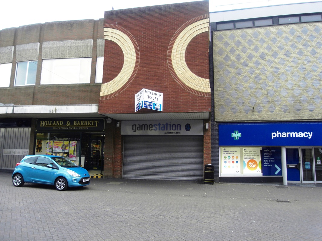
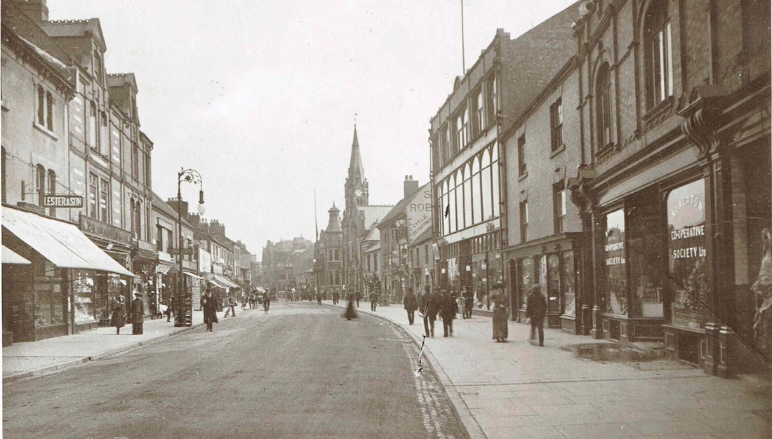
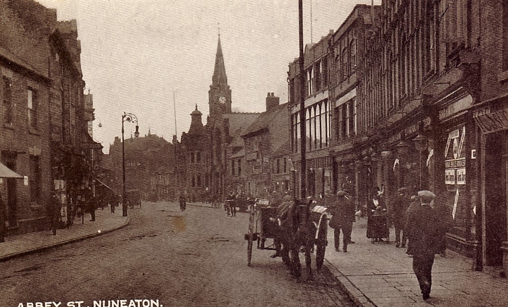
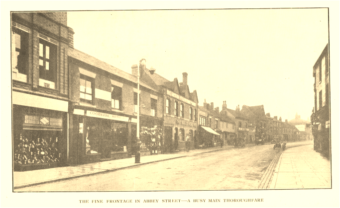
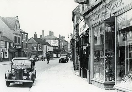
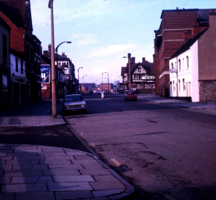
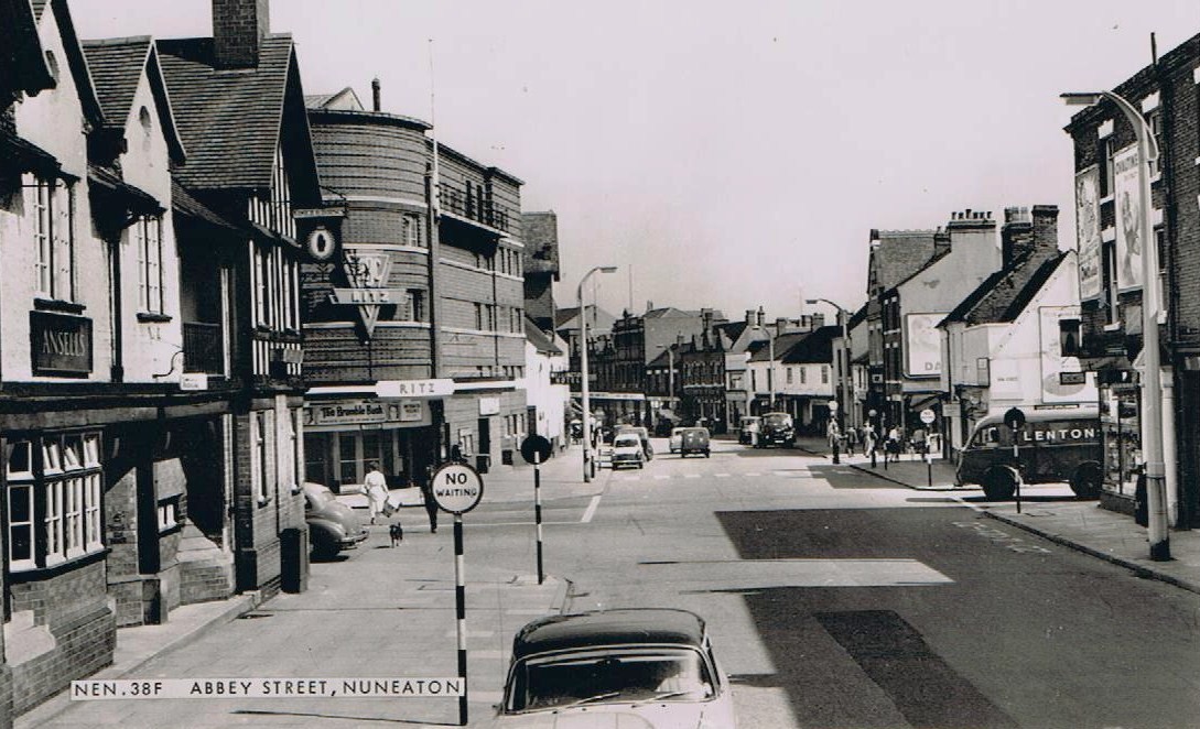
Abbey Street (Nuneaton's most populous street until 1900)
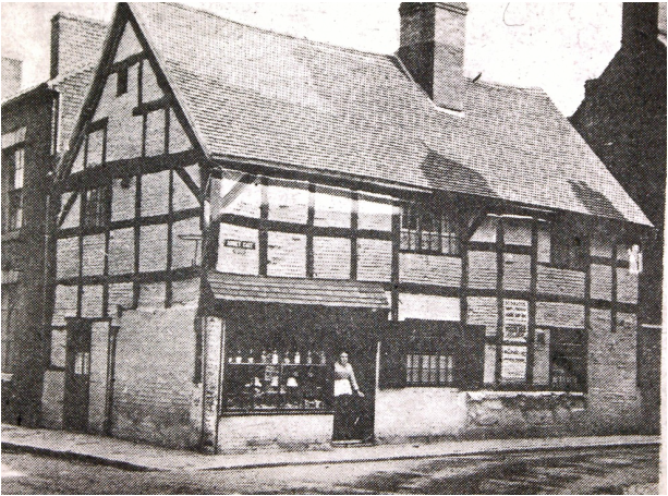
The old timber framed pub which stood on the corner of Abbey Gate which was replaced by the Gate Hotel below.
The Gate Hotel on the corner of Abbey Gate and Newdigate Street was built at the private expense of Reginald Stanley, the local brickworks proprietor in 1895 and one cannot help but think that this building was a three dimensional catalogue of Stanley Brothers finest terracotta wares, so much rich variety of clayware was incorporated into the building. Perhaps Mr. Stanley had it in mind that when visiting architects, contractors, or other customers came to Nuneaton to discuss their requirements an overnight stay at his hotel would put them in the mood to place orders having seen his goods used in situ . Mr. Stanley engaged the well known local builder Thomas Smith of Chilvers Coton. Mr. Smith built many of the finest buildings in the town. The Gate (which took its name from Abbey Gate where it was (and still is) located) ceased to be a hotel in 1908 and was offered for sale by J.A.Cartwright, the local estate agent. It did not reach its reserve price of £4000 although it cost £8000 to build. Its sale coincided with Reg. Stanley preparing to relinquish his duties on the board of the brick company and possibly took place to liquidate his local assets prior to retirement.

Remember Fredericks the shop on the right of the lamp post where young men bought their drainpipe trousers, velvet collared jackets, string ties for their nights out up the Co-Op Hall. (Peter Lee)
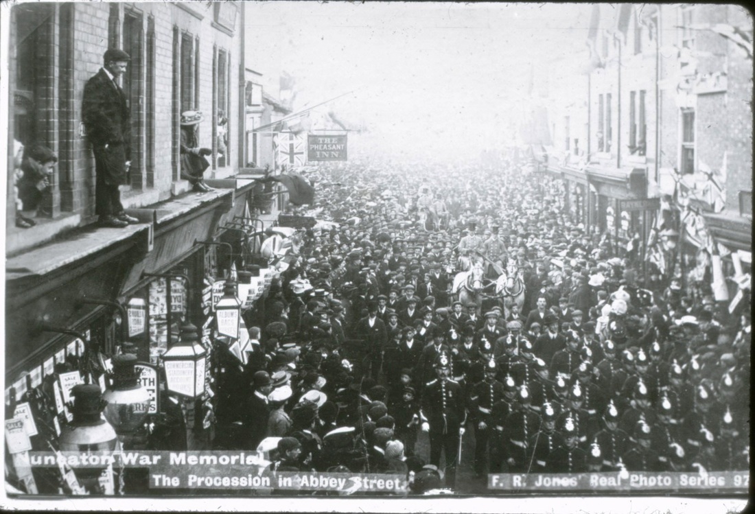
General Buller's Parade through Abbey Street to mark the end of the Boer War. 1905. The pub sign of the Pheasant Inn is visible in the centre of the picture. Those young people were ill advised to obtain such vantage points. What were their parents thinking of?
A road level view of Abbey Street with F.R. Jones shop on the left (the purveyor of hundreds of picture postcards) and just beyond the light coloured façade of the Pheasant Inn.
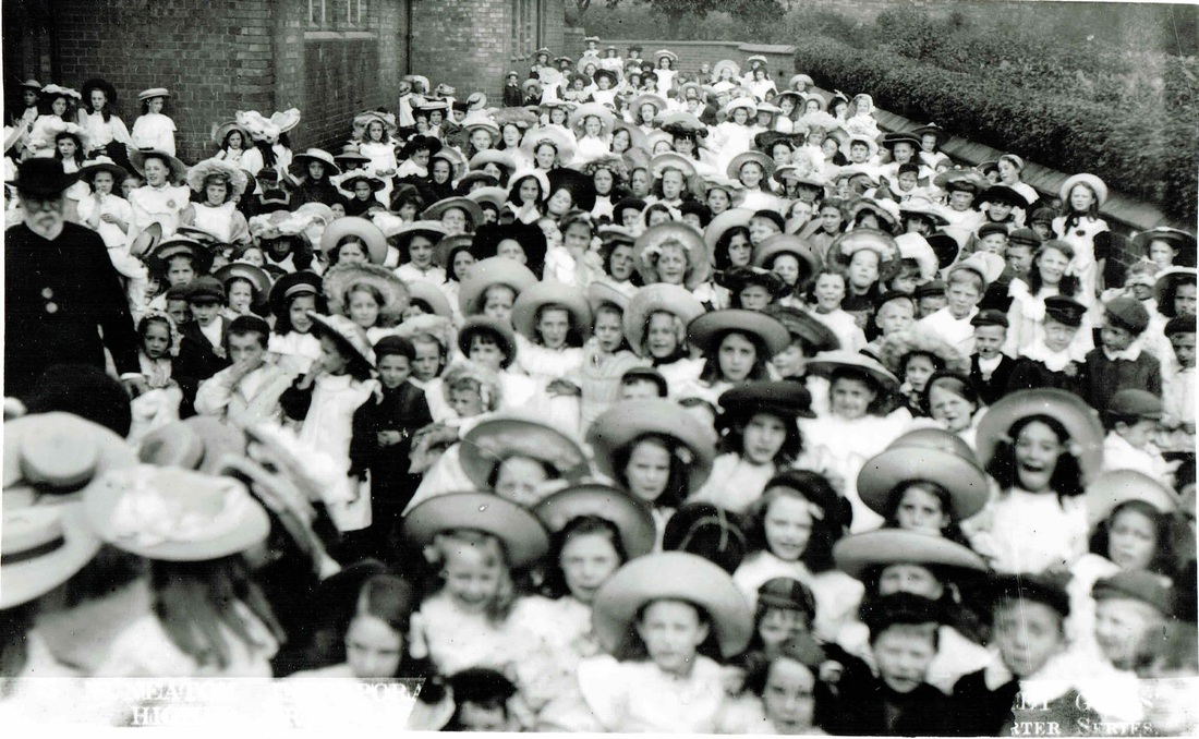
One of F.R. Jones well known "Charter" series, hundreds of postcards recording the incorporation of Nuneaton as a Borough in 1907. It is thought that many of these photos were taken by the photographer Bradbury of Stockingford, and for a short time were issued as Jones, Bradbury series then, after F.R.Jones ceased trading in 1908 Bradbury continued selling postcards until the 1920's. It is estimated from this one source alone there are hundreds of images of our old home district.
|

F.R.Jones was a well known stationer and sold hundreds of different picture postcards of the district from the shop whose window cill the photo above stands over the shop with its wide range of stationery items visible. He also sold this handy railway guide to the local train services.
(Reg. Bull Collection)
|
Abbey Street during the Great Flood of 1932. The old Pheasant Inn on the right.

William Wilson was the first owner of the Nuneaton Observer who operated from the same premises.

The initials of William Wilson are cast into this ornamental archway over the entry to Mr. Wilson's premises in Abbey Street.
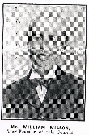
William Wilson - Founder of the Nuneaton Observer.
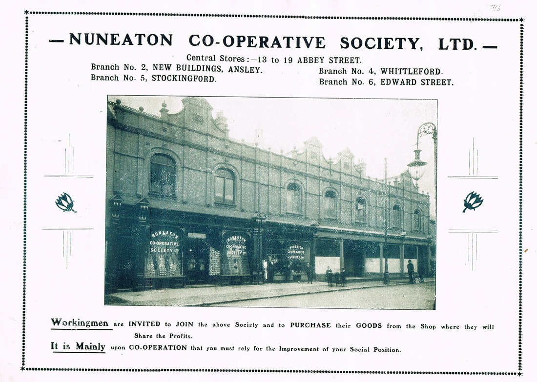
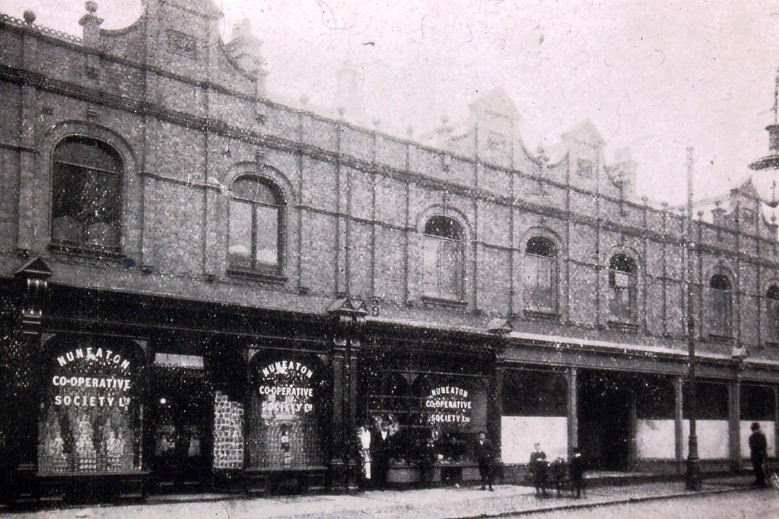
An enlargement of the photo above. The Nuneaton Co-Op store in Abbey Street.
Abbey Street with the Co-Op on the right. 1940's.
(Reg. Bull Collection)
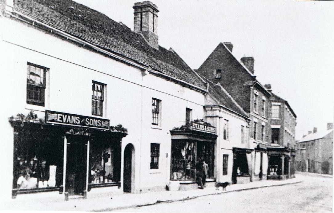
Evans & Sons were relatives of Mary Ann Evans (George Eliot). Samuel Evans was a gardener on the Arbury estate where Robert Evans was estate agent (or manager). When J.H.Clay died (who was related to George Eliot on her mother's side) Samuel Evans took over the gardening supplies, seedsmen and agricultural requisites business. The small shop next door was Thomas Peake's later to become Yoxalls,. We are looking towards Back Street (now Newdigate Street).
Yoxall’s shop and café in Abbey Street (Reg. Bull)
When we think of pork pies today we think of Melton Mowbray, the Leicestershire town that has become synonymous with this traditional English pastry. Hardly remembered nowadays is that at the turn of the 20th century Nuneaton was almost as well known as the home of the pork pie as the town in Leicestershire not to mention its own recipe for pork sausages, made with secret ingredients in a time honoured tradition. Walter Yoxall won several gold medals for his products, which were despatched in hermetically sealed containers throughout the country and to the colonies.
The business that was to become Yoxall's is recorded as having started in 1773. The first proprietor is not known but in 1792 there are five bakers listed in a trade directory for Nuneaton for that year: John Drake, William Hornby (?), William Jelley, William Tingle and John Woodcock. Later a family name of Peake at 130 Abbey Street ran a bakery for a large part of the 19th century. William Peake (1800-1834) was listed there in 1828 and after his death was succeeded by his son, also William, and his widowed wife Sarah and later by another son Thomas Peake. During this time they formulated the Nuneaton pork pie and sausage.
In the Nuneaton Observer business directory for 1880, Thomas Peake (Jnr.) advertised the following:
"PEAKE, Thomas, Confectioner, 130 Abbey-St. Refreshments, choice wines, chops and steaks, tea and coffee at any hour, porkpies, sausages. Madeira, Seed, Sultana and other cakes. Reading biscuits, pigeon, veal and ham pies. Public dinners, cold collations, and tea parties, served in the best style at moderate charges."
An advertisement in the 'Cawthorne's Family Almanac' for 1889 reads:
Porkpies, sausages, teacakes, dinner rolls and biscuits. Rich bride cakes, made to order at the shortest notice. Luncheon and school cakes; and all kinds of fancy Biscuits. Calves feet jellies, Blanc Manges, Creams etc.
TRY TRENT VALLEY SELF RAISING FLOUR. For making light and wholesome puddings, cakes and pastry, without barm, baking powder or eggs.
Pigeon, veal and ham pies, pork pies, sausages daily.
N.B. wholesale agents for Huntley & Palmers celebrated biscuits and madeira cakes.
British and Foreign wines. Your patronage and support respectfully solicited.
A year later the business was purchased by Walter J. Yoxall.
The original recipe for Mr. Peake’s pies was passed on to his successor when he took over in June 1890. Walter Yoxall (1867-1935) was born in the Black Country town of Wednesbury. His father, also Walter (1842-1900?), was a baker and in 1881 the family lived at 50-51 Portway Road, Wednesbury. Walter senior was the son of a needle maker from Studley in Warwickshire, Zebedee Yoxall (1813-1849).
Before moving to Nuneaton, Walter Yoxall junior had spent six years in the United States learning his trade as a master baker and confectioner. He brought modern ideas to Mr. Peakes old established business. Bread making became an important part of Mr. Yoxalls business. He also added two up to date coke ovens not long after he took over in 1890. Then around 1900 the old shop was entirely rebuilt.
Abbey Street in the 1880’s. Yoxall’s original shop is in the small slightly projecting frontage to the right of the second Evans bay window.
In 1925 Mr. Yoxall recalled, how, a few days after he took over Tom Peake's business he had a conversation with an old lady which he felt pretty well summed up the narrow mindedness and small town attitudes that prevailed in the 1890's. He was severely cross examined by the old dame as knowing this newcomer who had taken over old Tom Peake's business, she was sizing him up. She said she was very careful with whom she traded. The conversation went something like this: "Do you belong to such and such religion". "No" replied Mr. Yoxall. "Do you belong to such and such political party" she enquired, to which Mr. Yoxall again replied "No". "Well" she said "You can close your shop!!" Of course Mr. Yoxall did not close his shop and prospered in the town as Nuneaton was entering into a new era of prosperity. The old lady had grown up in a town of impoverished ribbon weavers, and she still retained those narrow old fashioned ideas that prevailed in the weaving fraternity.
Mr Yoxall also trained premium apprentices in the art form he had mastered. He later sent highly trained bakers and confectioners off to establish and run new firms all over the country. He became Chairman of the local Master Baker's Association. Awards for his products came thick and fast. In 1901 his Madeira Pound Cake won first prize at an international bakery exhibition in London. He followed this up with a gold medal for his pork pies at the London Exhibition in 1903 and first honours for his Christmas Plum Pudding at another exhibition in 1904. Medals of all kinds followed for a wide range of his products.
Mr. Yoxall was one of the first business premises in Nuneaton to be lit be electricity. He also supplied his neighbours with electric current too. He connected his electrical supply into adjacent business properties in Abbey Street.
Behind the shop was a restaurant known as the 'Cosy Café'. He also offered his services as an outside caterer providing food to businesses and private parties throughout the district. In 1909 his shop and restaurant employed 20 people as well as part time catering staff. Mr Yoxall pioneered a profit sharing scheme so that his employees also took a keen interest in the best interests of the business.
By the 1920's there were three Yoxall shops in Nuneaton, at 130 Abbey Street, 20b Queens Road, and in Coventry Street. The last two were established about 1905. They also owned the 'Cosy Café' in Attleborough Road. They later had a shop in Newdigate Street. The late Beryl Kerby had an aunt who worked in the Newdigate Street shop and remembers, how on Saturday night, if there were any sausages left, that they could not keep until Monday so were given away to staff. Beryl remembers splendid 'fry-ups' on Sunday morning with Yoxall's prize sausages.
Walter Yoxall had this beautiful house built in Hinckley Road, set within lavish gardens. The site is now occupied by North Warwickshire & Hinckley College (courtesy - Jean Lapworth)
Walter Yoxall and his wife owned a large home in extensive grounds known as 'Cecil House' in Hinckley Road. Walter died in December 1935 and his wife in November 1939. After their death the house was demolished to make way for the Technical College which was built in the grounds.
In 1943 Harry Cleaver, a well-known local businessman who was the managing director of Nuneaton Timber Company, purchased Yoxalls Ltd. The original coke ovens were replaced by gas in 1967, and shortly afterwards the café was increased in capacity from 50 seats to 150. The shop was also modernised in November 1967.
The café was a very popular rendezvous. I recall spending many Saturday afternoons there in the 60's with friends for coffee or a glass of 'pop' as we planned our night out at the Co-op Hall.
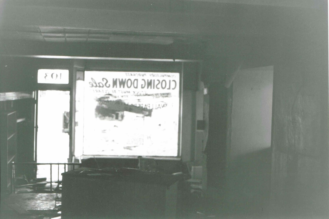
Later Harry Cleaver's son, Leonard took over the ownership of Yoxalls and in 1974, due to ill health and his severing his connection with Nuneaton he sold the premises to the Nation-wide Building Society. 34 jobs were lost. Yoxalls closed on Saturday 2nd August 1974. 201 years after it started as a baker's shop in Abbey Street.

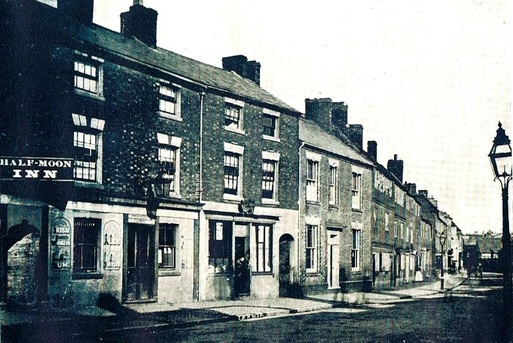
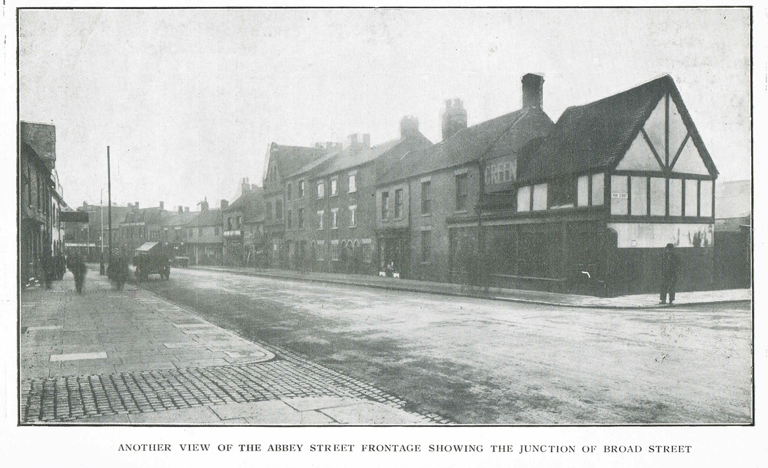
Abbey Street was Nuneaton's most populous street in 1885. Buildings on the right still have their silk weaving windows. They will be replaced in the 1890's. The building that was once the Half Moon Inn is still there today and looks likely to remain so for the foreseeable future. This photo is looking towards the town centre (Tom Burgoyne Collection)

More or less the same spot today taken 2011. The Half Moon Inn has become a shop. The old top shops long gone. (Peter Lee)
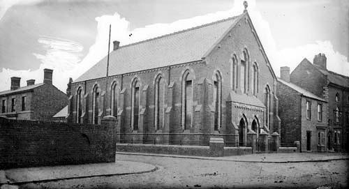
This small part of Abbey Street was an enclave of Methodism, with two chapels in close proximity. The original Methodists met in a cottage in Abbey Street but in the 19th century (after 1851) a dedicated chapel was built in Stratford Street (a newly constructed roadway at that time). Then they moved into new premises. This is the Wesleyan chapel on the corner of Stratford Street and Abbey Street in the foreground. The wall on the left surrounds a piece of open space which is known as Till's yard. (Roland Till was the publican (and blacksmith) at the Pheasant pub). The building to the left of the chapel is the original police station. Prior to that the town constable Abel Vernon worked from home! When a villain needed locking up there was a lock up in Abbey Street where he could incarcerate his felons before they were hauled before the court at the Newdigate Hotel in Nuneaton for minor offences or sent off to Warwick or Coventry for trial if more serious. Not the best arrangements especially as the lock up got a tad over crowded. This Wesleyan church was demolished to make way for a new one. Apparently this building you see here was structurally unsound. The building far right was called the Weavers Arms and is still extant as a town pub today.
Another pre WW1 view of Abbey Street. (Peter Bayly Collection)
A classic view of old Abbey Street before WW1. The Gate Hotel in the distance on the right. A low row of buildings incorporated "The Pheasant" public house which closed in the 1930's. Nearer on the right the Nuneaton Liberal Club (still there today) and the Wesleyan Church. (W.Cawthorne series)
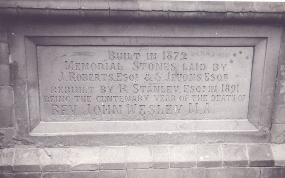
The foundation stone of Abbey Street, Wesleyan Methodist Church which was in the course of demolition to make way for shops. (Copyright photo - Geoff Edmands Catalogue Nr. 2450 1/50:F11 (H.P.3)
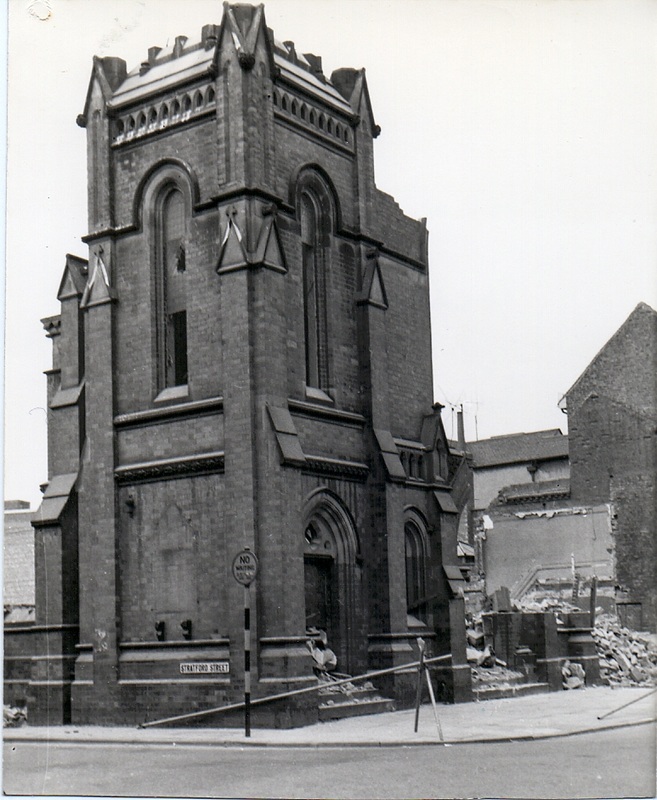
Demolition of the Weslyan Church is well underway on 22nd September 1963. (Geoff Edmands Nr. 2448)
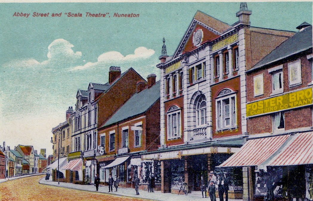
A heavily tinted and re-touched image of Abbey Street. The Scala cinema dominates this view. So it dates the picture after 1914. (Glenn Noon Collection)
An early view of the Scala (NLHG Archives)

The Scala picture house when it was being painted by Messrs. Thomas's of Mount Street Passage, Nuneaton. Second from the left is Harry Goodall of Clarence Street. He went on to be the chief projectionist to the Picture House in the Market Place. Fourth from the left has been identified as Harry Hartland, foreman of Thomas's the painters and decorators. The man on the balcony is the cinema manager. (Jean Lapworth collection)
Rush hour in old Abbey Street in the 1970's. Stratford Street to the left.
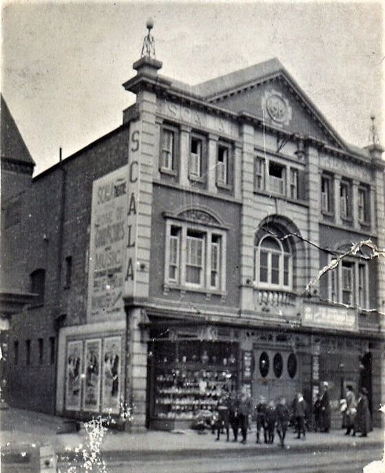
The decorative frontage of the Scala theatre with the lighted finials intact. (Reg. Bull / Courtesy of Ruby Atkins)
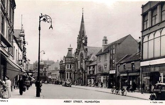
A beautiful idyllic view of old Abbey Street on a warm sunny day in the 1950's. Just as we remember it. Wilkinson & Son's bill head on the extreme left whose bill head is below.
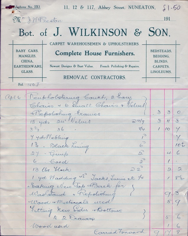
Wilkinson & Son's bill head with samples of prices of the day.
Abbey Street in the 1950's. Wesleyan Church on the right. Liberal club beyond. Spires domes and turrets were a feature of old Nuneaton. The distinctive edifice that was the Wesleyan church was demolished during September 1963.
Abbey Street in the 1970's. The lofty roofs seem less inspiring with the loss of the Wesleyan church.

116 Abbey Street, Chemist & Post Office.
A heavily tinted coloured image of Abbey Street before WW1. (Glenn Noon Collection)
Abbey Street in the early 1900's. Lesters chemists on the left replaced Mr. Slinn in the photo above.
(Glenn Noon Collection)

A photo of Abbey Street shops Left to Right Nrs. 114, 115, 116, 117 c. 1980. (Peter Lee)
The Bulls Head pub is dominant in the block of buildings on the left. It was an ancient pub and was at one time owned by the Nuneaton Gas Works whose premises it backed on to. Alongside it was a jitty called Bulls Head Passage which came out in Broad Street. There was a gentleman's urinal half way down the passage for those pub goers caught short on their way back to Queens Road. The Gas Co. sold the pub in 1893 to Messrs. Bass, the Burton brewers. The pub was extent in 1806 when it was kept by the Robottom family who were publicans in Nuneaton for upwards of a hundred years. The building you see here was a late 19th century rebuild of the premises. The premises are still there but are now a fine Indian restaurant. Photo taken c. 1926. (Reg. Bull Archive)
Looking towards the section of Abbey Street which included Ranby's Chemist in the 1950's. (Reg. Bull)
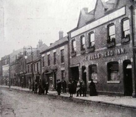
The Bull's Head before WW1.
At the back of Abbey Street these old out buildings were tucked away and remarkably these remain to this present day, but the old brickwork has been covered over. On the left you can just make out their former large top light weaving windows, a remnant of the old silk trade. The photo was taken from Burgage Walk in the late 1970's. (Peter Lee).
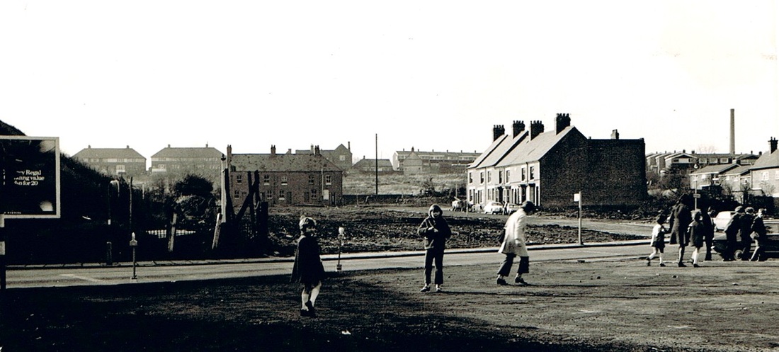
THis depressing picture shows Abbey Street and the houses in Broad Street in a transitory period back in the 1980's when the gas works site had been levelled in preparation for building the new Co-Op car park and the new inner ring road. For a few years the cleared area looked like this. Ranby's chemist shop in Abbey Street has a large advertising sign on it on the right. For some time the area was used for ad hoc parking. (Peter Lee)
The Rendezvous Café was a popular venue for an older generation of Nuneatonians. Here it is in the 50's . This whole block of buildings disappeared in the 60's including Peter Lenton's shop and offices. (Reg. Bull / Courtesy of Ruby Atkins)
Looking up Abbey Street towards Abbey Green in the 1970's. Ritz on the right, the remnants of old Abbey Street on the left. The white fronted pub on the right is the Wellington and the gable end of the Coach & Horses can be seen. Much of the old Abbey Street beyond has been demolished. Ranby's Chemist still stands on the corner of High Street.
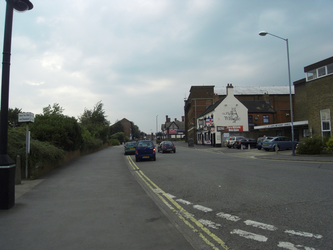
Abbey Street 2012. Ritz Cinema and former Wellington pub on the right.
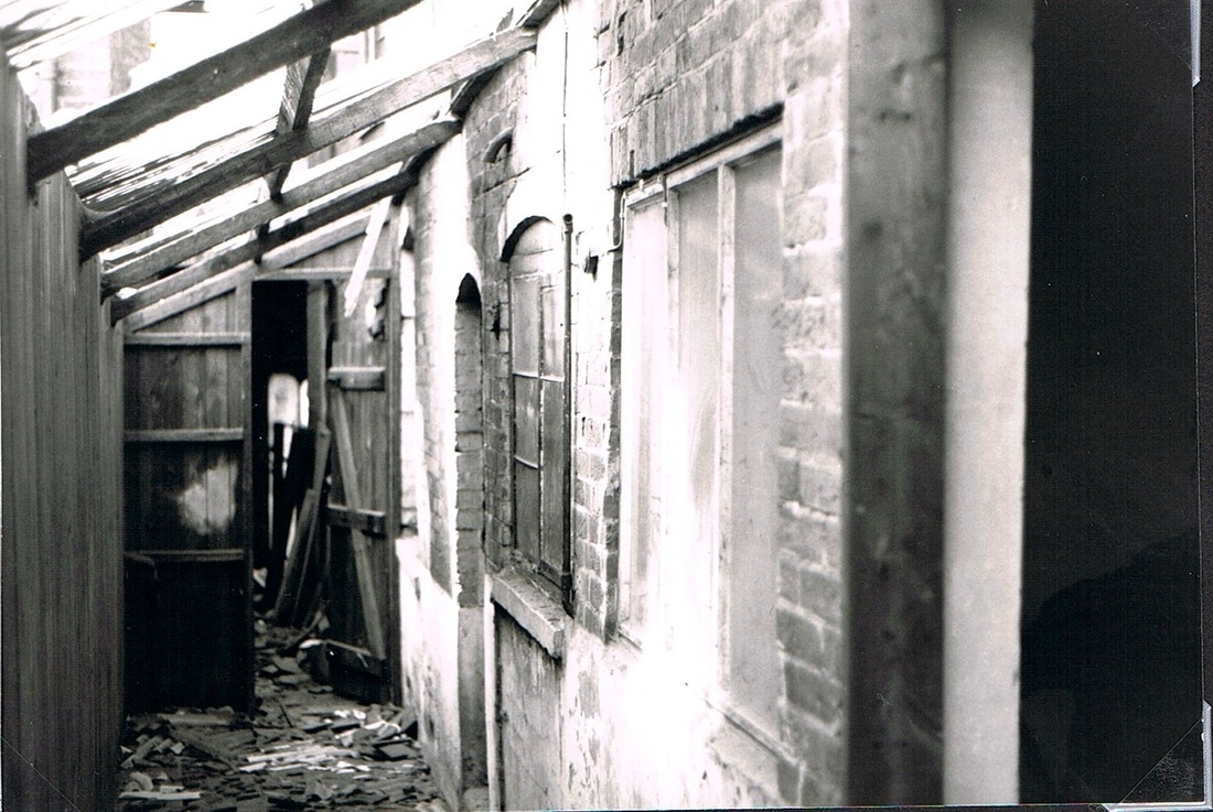
Inside Powell's shop looking outwards. The premises is just about to be demolished. W. Powell & Sons were decorating and paint suppliers for many years but their shop was pulled down for the construction of an access road to Abbey Street when the inner ring road was constructed. (Peter Lee)
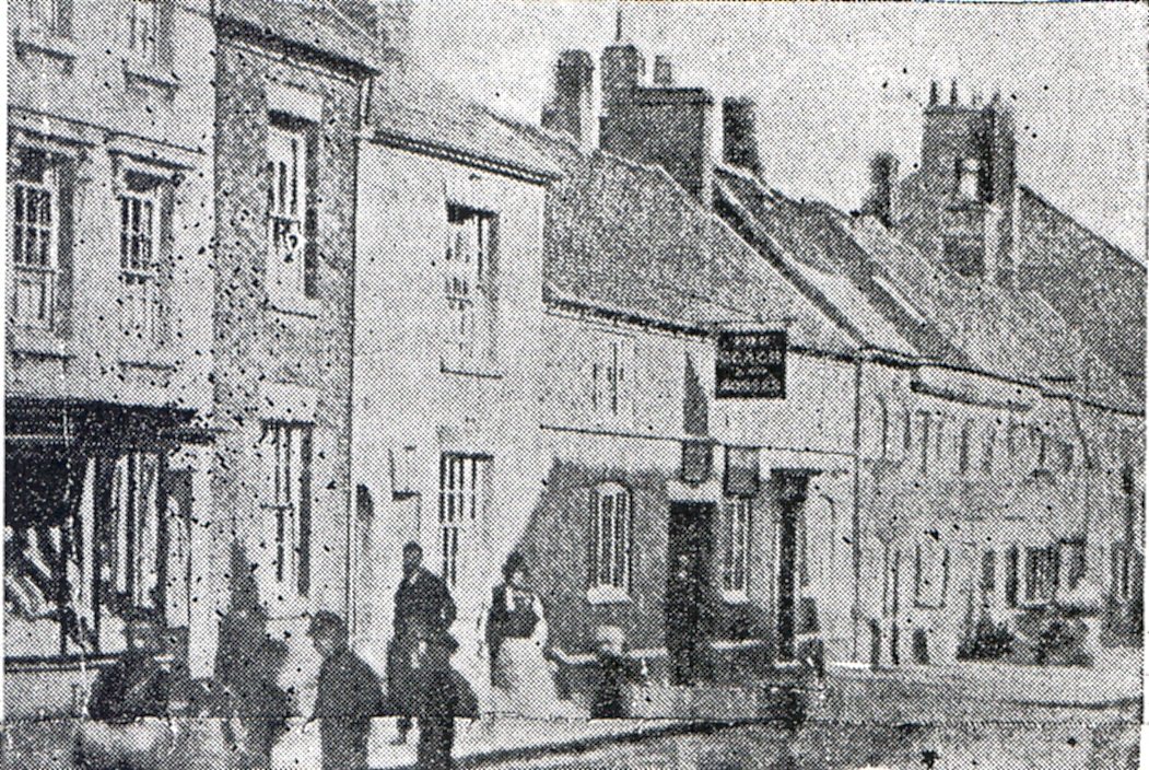
The Coach & Horses pub before it was rebuilt in the "modern" mock Tudor style that existed latterly. This photo was taken before 1900 and was found in the Nuneaton Observer 1958. (Moreton J. Ensor Collection)
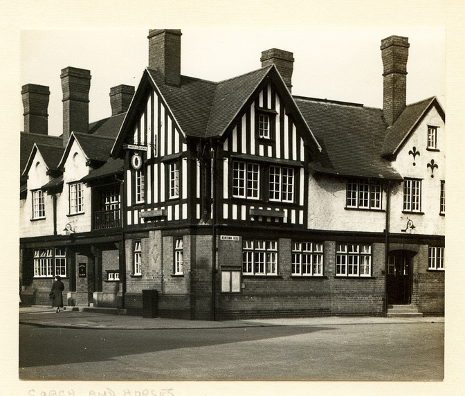
The Coach & Horses Pub in Abbey Street. (Now the Kingsholme) (Colin Yorke)
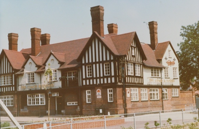
The Coach & Horses in the 1980's? (Courtesy Colin Yorke)
Ranby's the chemist just before demolition. It had been a nice Georgian house and the doorway bears testimony to its former heritage but the road here was widened to build the inner ring road and the old house and shop was pulled down without consideration from anyone. (Peter Lee)
A classic view of old Abbey Street before this section was decimated by the inner ring road. Taken in the 1950's. There are some highly evocative memories in this photo particularly for a kid who attended the Saturday matinee at the Ritz. Dreadful B movies, Westerns, Things from outer space and various poorly acted and dodgy scenery films wetted our appetite for a trip to Pickens batch bar opposite where we queued for pork and sausage batches. The batches dipped in gravy. After this was dribbled down our shirts us kids had a great Saturday morning out. The highlight of our whole week. In the foreground on the left is the Coach & Horses pub (now called the Kingsholme but soon to be demolished for a petrol station in 2013/4. Most of the buildings on the right have gone. Remember Ranby's on the opposite corner? And Lenton's the fruiterers whose shop was in one of the white buildings a little way down Abbey Street towards the town centre; who had a warehouse on the corner of Broad street/High street.
Abbey Street looking towards the town centre, December 1951. (Reg. Bull)
Abbey Street again in 1951. Palladino's yard on the right. The Palladino family came from Florence in Italy in the 19th century and in the best Italian tradition sold ice and ice cream. The family are still in Nuneaton to this day but no longer are in the ice cream business of course. The shop to the left of the house is Newcombe Bros. well known removal contractors whose pantecnicans could be hired for moving home. All these buildings were slums but they look very attractive to local historians today, but you try living in them! (Reg. Bull)
THe house occupied by Dr. Frederick Guy Beauchamp's House, 75 Abbey Street before demolition in the 1950's. Dr. Beauchamp (1902-1981 ) was a radiologist at Manor Hospital Nuneaton and married Miss June Duprez (1918-1984) on 26th September 1935 who went on to become one of the leading Hollywood actresses of the 1940's. She left Nuneaton in the late 1930's, leaving her husband in Nuneaton and sought fame in Hollywood. The couple were divorced in 1944. This historic house was pulled away like so many buildings in Abbey Street it had great character and would have added to the streetscape had it been saved. But that sort of thinking was non-existent in the town in those days. (Nuneaton Newspaper Archives)

Abbey Street and Upper Abbey Street at night looking towards Meadow Street (the lit building in the distance and Abbey Green in the far distance. All of these buildings have been demolished. (courtesy: Colin Yorke)

More or less the same view as above in 2011. (Peter Lee)
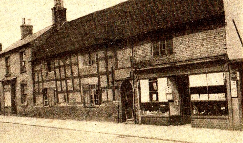
The remains of an old court cottage in Abbey Street in a row at the rear of Powell's shop premises. Immediately prior to demolition. This was the typical accommodation of the old silk weavers.
Upper Abbey Street and Abbey Green commences at Meadow Street and returns to Priory Street on the opposite side.
Abbey Street 1909, Upper Abbey Street commenced with Meadow Street in the middle distance on the left. Abbey Street's numbering system could be difficult to follow for casual historians, but effectively the numbering system started at Nr. 1 on the corner of Abbey Gate, then travelled 1,2,3 etc on the same side to the Meadow Street corner. Crossed the road and travelled back down the other side of the road until Nr. 136 was opposite Nr. 1. Upper Abbey street on the other hand started at Nr. 1 on the Meadow Street corner and it too followed the same principle so that the last house in Upper Abbey Street was opposite the Meadow Street corner. The tall building on the Meadow Street corner is Pool Lorimer & Tabberer's factory. It had been originally built as a warehouse for the silk trade where the silks produced locally were stored prior to despatch to London. It was built at the time of the great flush in the silk ribbon trade when an exotic range of Gauze ribbons were all the rage and the ribbon weavers of Nuneaton were flat out producing these high quality ribbons. The gauze period was followed by a terrible slump and by the 1830's the warehouse we see here was redundant. It then became a pub called the "Gauze Hall", one of many pubs in Abbey Street at that period. However, the pub trade did not last and it was turned into the local Baptist church until 1899, when the new Baptist church was erected in Manor Court Road. A building more suited to prayer. About 1901 The Gauze Hall was taken over by Pool Lorimer & Tabberer, a branch, of a Leicester company who traded there until 1928 when the Gauze Hall caught fire and was gutted. The remains were demolished and that corner of Meadow Street was derelict for many years thereafter as I recall. (Reg. Bull Collection)
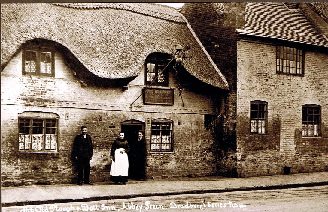
The Old Plough & Ball pub in Abbey Street was an ancient hostelry which may have dated back to the days of Good Queen Bess. It had very low ceilings and during 1905 work was being carried out to raise the ceilings. This caused the old pub to collapse injuring two work men. The original name of the pub was The Golden Ball, but the name was altered when the old Plough was pulled down in the Market Place in the 1840's and the licence combined.

Abbey Green c. 1965 (Reg Bull)
Arthur Street named for Arthur Jeffcoate, fruit sales and wholesale confectioner, who had retail premises in Market Place, Bond End and Queens Road, Nuneaton.
Arthur Street awaits demolition in the early 1970s prior to the Bedworth by-pass being built. The Jolly Colliers pub can be see in the centre of the picture on the crest of the rise which is College Street. Coton Arches on the left.
(Geoff Edmands)
Aston Road
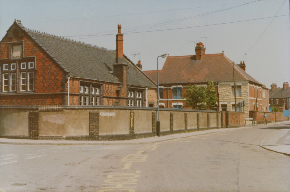
Aston Road, corner Abbey Green. c. 1980's. (courtesy Colin Yorke)
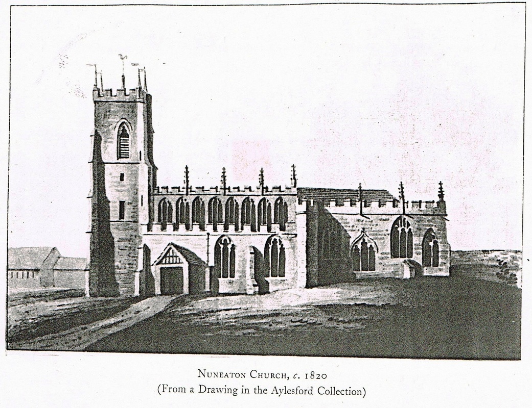
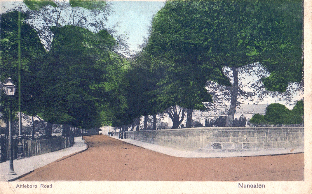
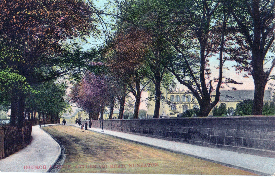
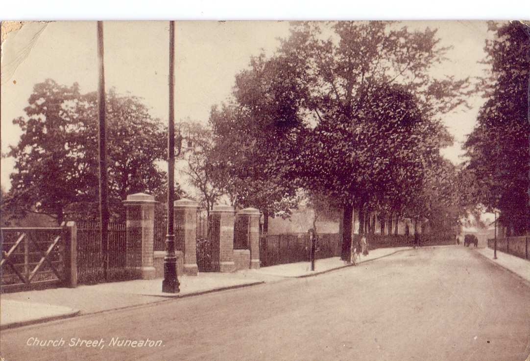
Attleborough Road (formerly Church End)
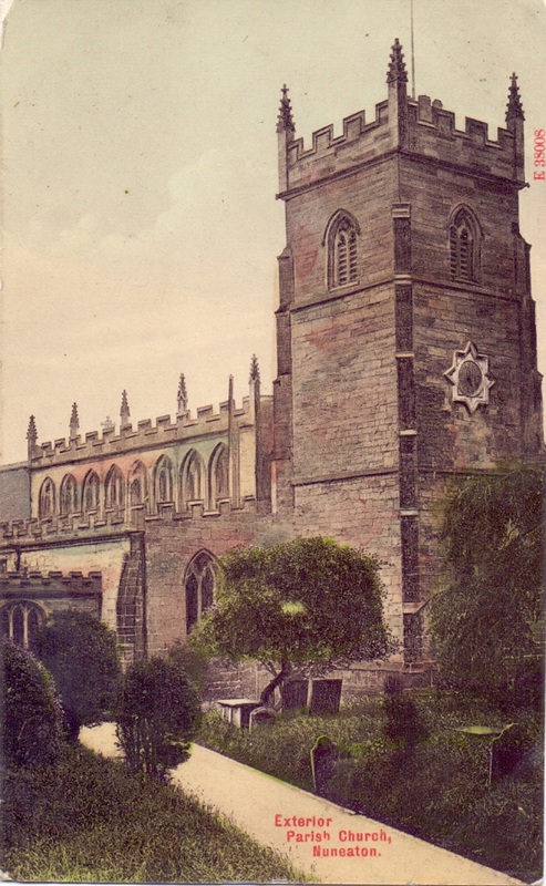
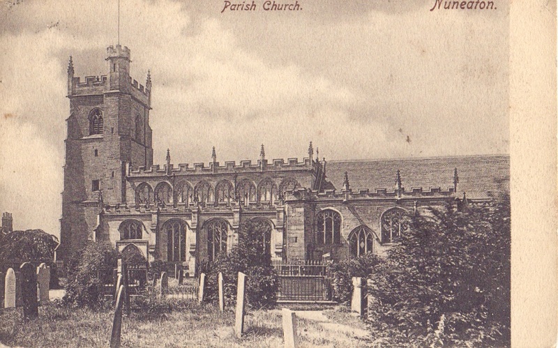
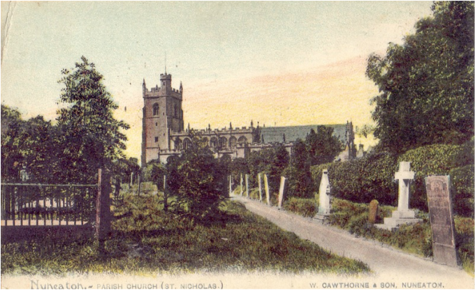
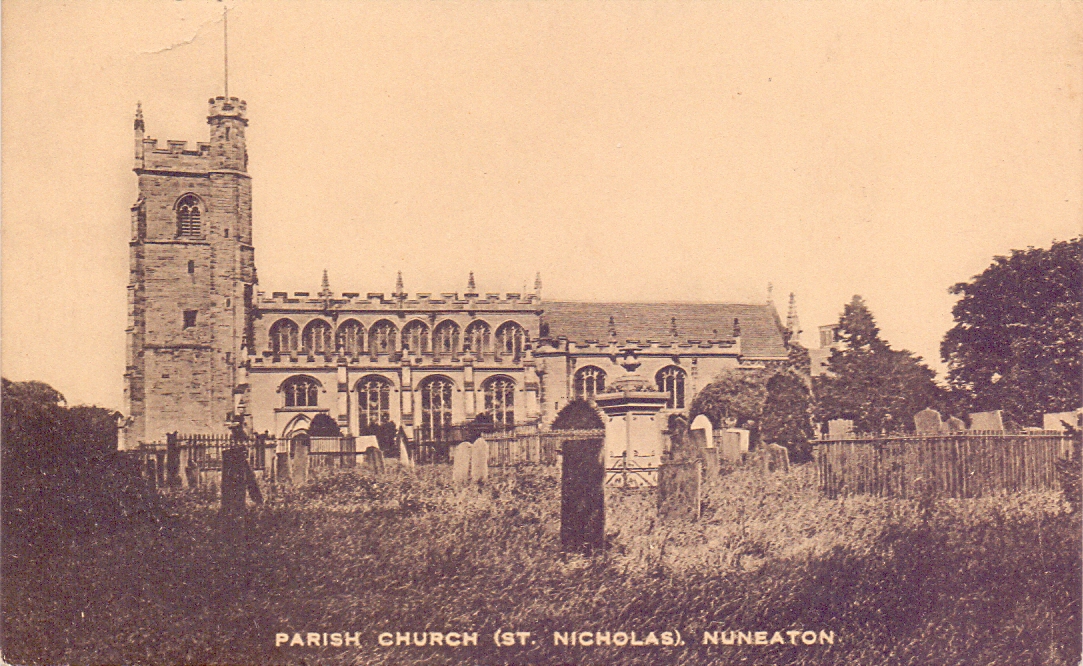
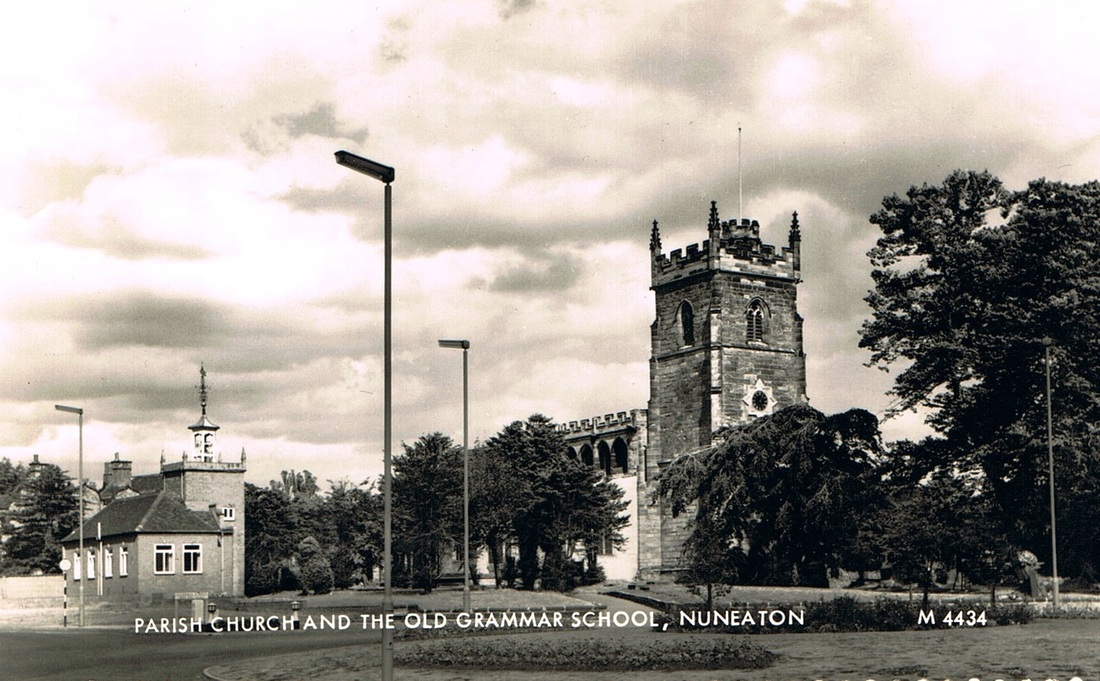
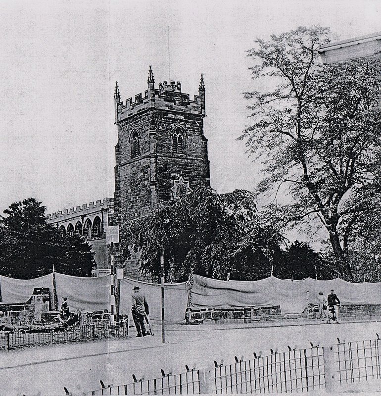
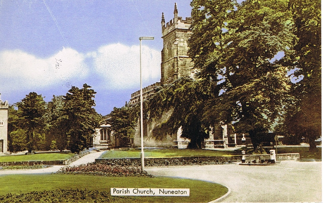
St. Nic(h)olas Parish Church
St Nicholas Parish Church for centuries was always spelt with an h. Sometime in the 1940's the h was dropped and it is now called St. Nicolas Parish Church. This web site will use the historic version.

(Glenn Noon Collection)
(Glenn Noon Collection)
(Glenn Noon Collection)
(Glenn Noon Collection)

(Glenn Noon Collection)
(Glenn Noon Collection)

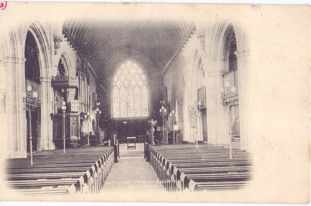
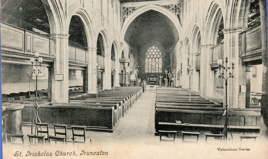
St. Nicholas Parish Church before the galleries and old pews were removed.
(Glenn Noon Collection)
(Glenn Noon Collection)
(Glenn Noon Collection)
When Vicarage Street was widened in the early 60's to build the new ring road part of the old churchyard had to be removed. Here the graves are shrouded as they are removed. Vicarage Street runs off to the left and follows the line of the sacking shrouds erected temporarily.
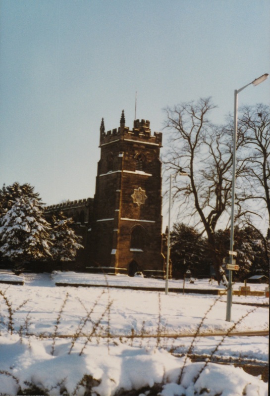
As a complete contrast Nuneaton Parish Church in the depths of winter. (Courtesy: Colin Yorke)
The road beyond this junction is Church Street. Attleborough Road is behind the photographer and commences at this junction.
(Glenn Noon Collection)
Another view a little bit further along Church Street towards Nuneaton town centre. The Attleborough stone wall on the right was reduced in height in 1956. The stone was taken away and dumped just over the river bridge in Attleborough at the back of Lister Street and Gadsby Street. This work was carried out when work took place to tidy up the graveyard after the war when many of the headstones were dislodged and blown down. The gravestones were mostly laid flat around the perimeter of the churchyard so that people could read them. This necessitated the reduced height of the wall. The old wall had many engraved initials from generations of Nuneatonians. The large Lime trees on the right had been planted at the expense of Benjamin Rayner the English Master of Nuneaton Grammar School in 1836. (Glenn Noon Collection)

(Glenn Noon Collection)
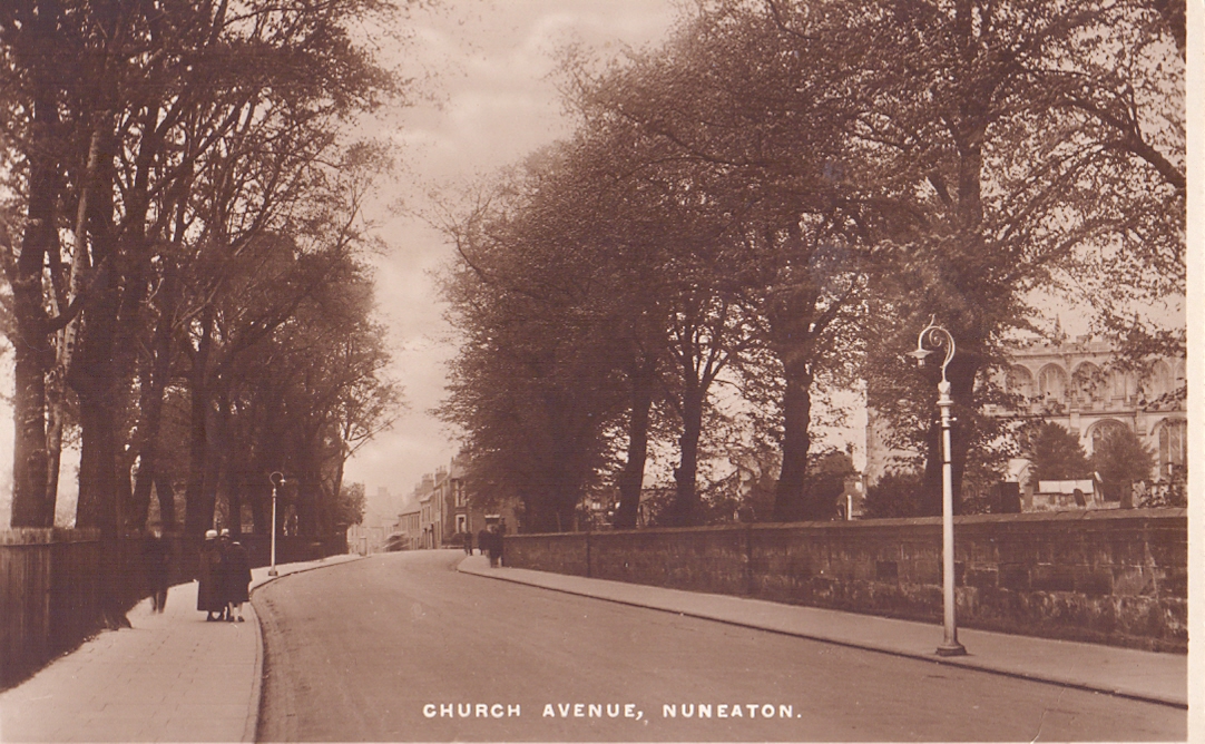
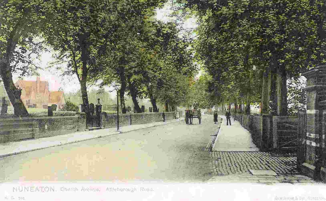
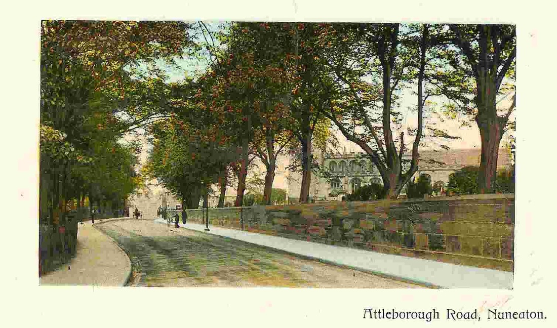
Attleborough Road looking towards Attleborough. St. Nicholas Parish Church on the left with the Grammar School beyond. The row of trees on the left were planted by Benjamin Rayner in the 1820's. (Alan Cook Collection)
(Glenn Noon Collection)
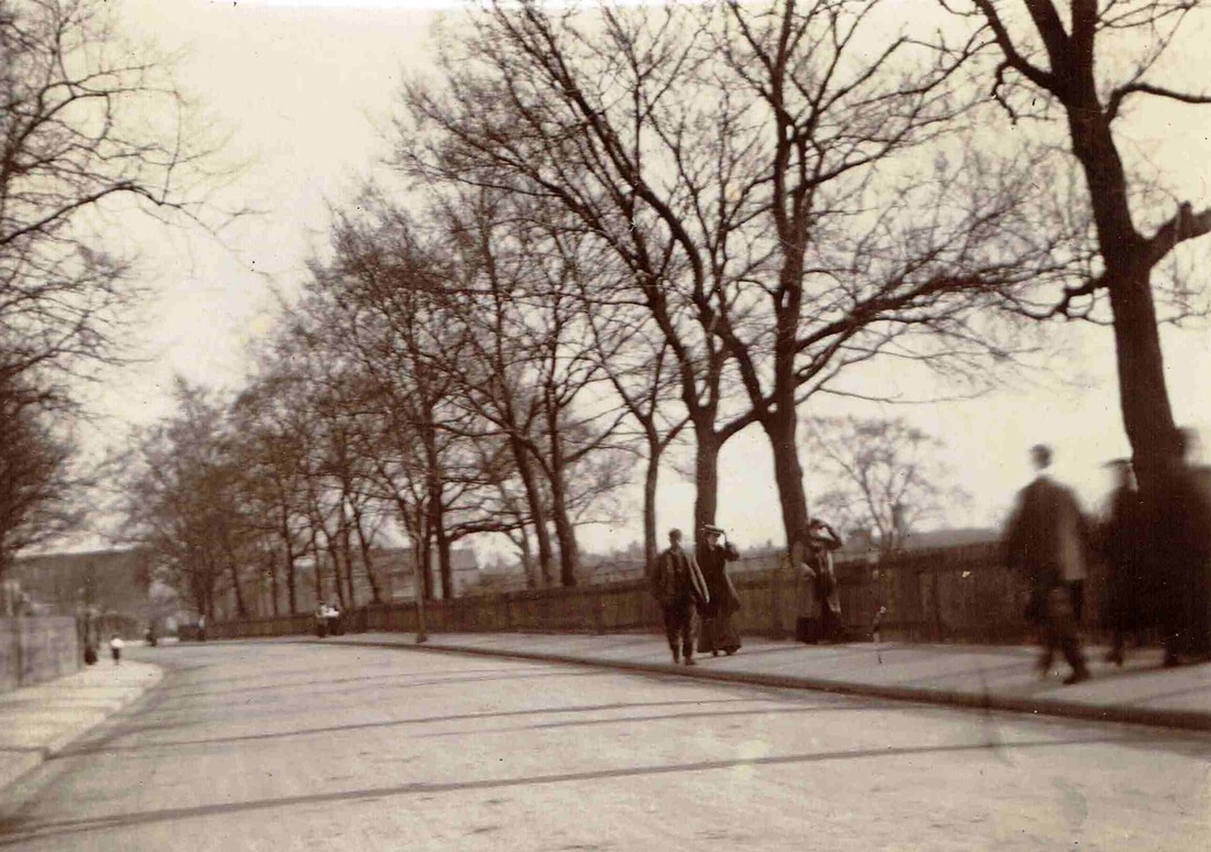
A moment in time captured in Attleborough Road before WW1. The wall on the left is the boundary wall of Nuneaton churchyard. The good folk of Nuneaton (and Attleborough) go about their 100 year old business. The bulk of Fielding Johnsons factory can be seen in the distance. The well known house - Drachenfels is in the middle of the picture. Its winter, there are no leaves on the trees.
(Horace Bull, Ruby Atkins Collection)
A view from the opposite direction to the one above about the same period looking towards Nuneaton town centre. Early 1900's. St. Nicholas parish church on the right. The stone wall is much higher than it is today for a combination of reasons. The road level has risen, and one or more row of stones were removed for some reason. These stones were dumped by the river bridge on the Attleborough side of the River Anker. Benjamin Rayner's trees are seen on the right. The stone wall which was constructed from grey Attleborough sandstone was carved with the names and love messages of generations of Nuneaton people. (Alan Cook Collection)

The place where Church Street ran into Attleborough Road is the road junction on the left which is where King Edward Road comes in. (Formerly Peacock Lane). (Glenn Noon Collection)

Drachenfels on Attleborough Road was built for James Wheway (1867-1946). Mr Wheway was a furniture and crockery dealer who had the foresight to erect a new furniture emporium on the corner of Lister Street and Attleborough Road when Attleborough was a new planned suburb on the outskirts of town. As the new houses which sprouted in Gadsby Street and the surrounding streets Mr. Wheway made his money by giving tic on furniture to these new homes owners. He was a member of the Baptist Church and a leading councillor. He was also a director of the North Warwickshire Traction Co. He had nine children by his first wife and three by his second. His brother was Mr. George H. Wheway who was a boot and shoe dealer at 92 Queens Road and in Norman Avenue. The inspiration for the turreted house called Drachenfels was from a cruise Mr. Wheway took on the Rhine in Germany and he was attracted by a house he saw near to the German city of Mainz which he sketched. On return to England he arranged for his architect to design a new house in the German style we see here. The house still stands today. (Alan Cook)
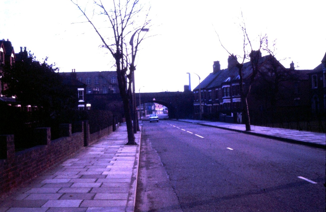
Attleborough Road in the 1970's. Coventry line railway bridge and fielding Johnson's factory in the distance. Drachenfels far right. (Peter Lee)
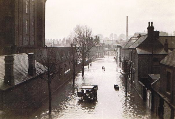
Attleborough Road looking towards Attleborough during the great flood of 1932. Note the spectators on the railway bridge. A lot of fun was being had by all because of this novel event. (Tom Burgoyne)
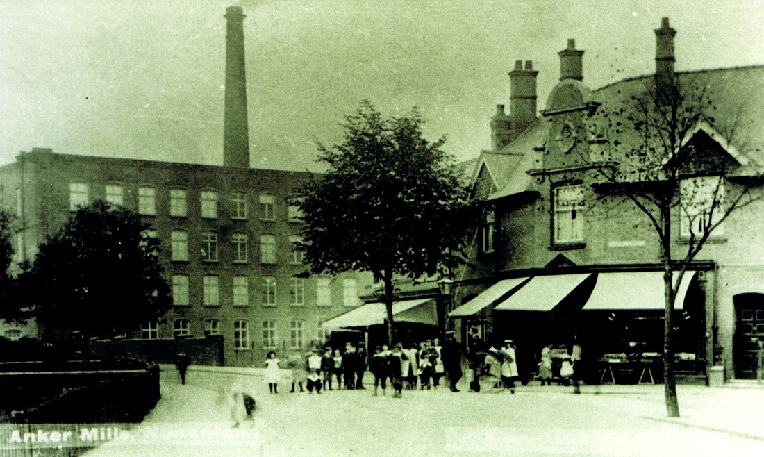
Attleborough Road, Nuneaton became Attleborough Road, in the parish of Attleborough. The border was the bridge in the distance where the River Anker form the demarcation line. Fielding Johnsons Anker Mills in the distance dominates the view. We are now in Attleborough so continue along Attleborough Road in the Attleborough section. This would be in the period 1900-1907.
Beaumont Road

Nuneaton Borough Football Club. Beaumont Road Entrance.
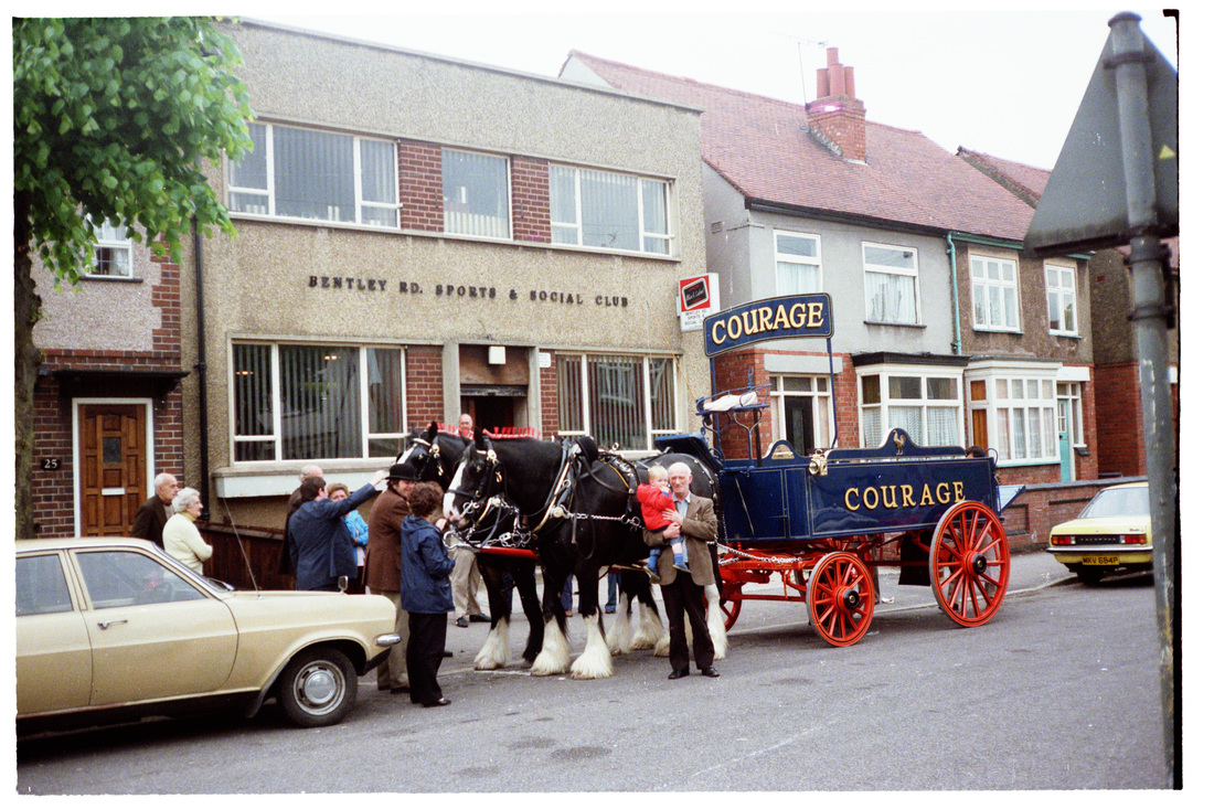
Bentley Road
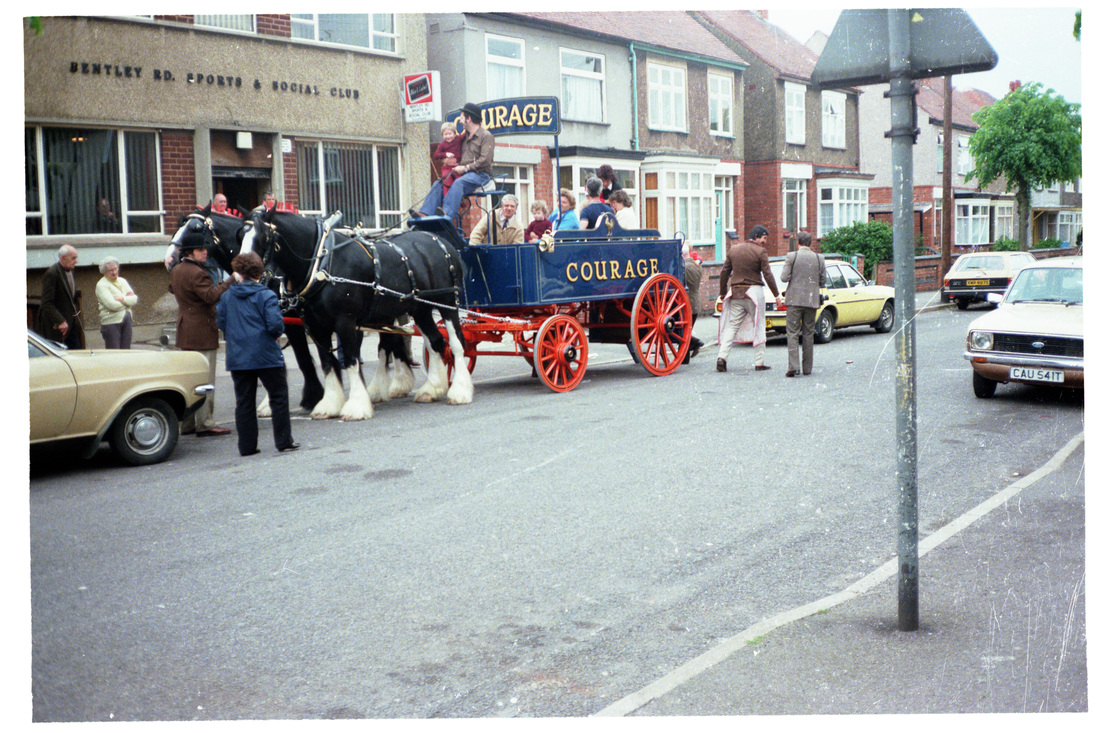
Bentley Road Sports & Social Club. (E.J.Wilshire, courtesy Colin Yorke)
(E.J.Wilshire, Courtesy Colin Yorke)
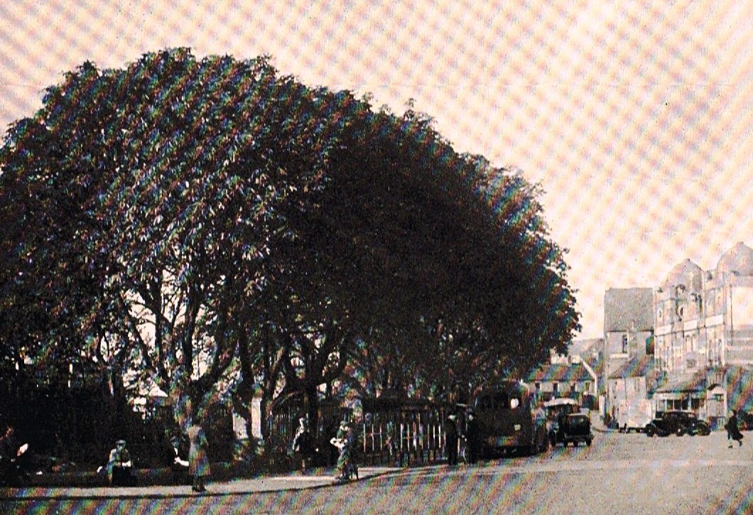
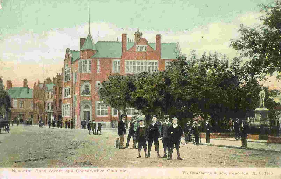
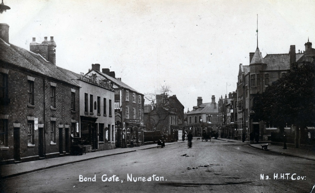
Bond Gate & Bond End
Bond Gate c. 1900. I am not sure what the event is, some kind of parade perhaps. Are those pugilists on their way to a fight parading through the streets?
(Ruby Atkins)
This is Bond Gate in 1932 looking towards the town. To the new comers the whole of this scene has changed. The shops on the right is where the 1970's block stands today. The Hippodrome is hidden from view on the left. The great stand of trees cut down about 10 years ago. All the buildings we see here are gone.
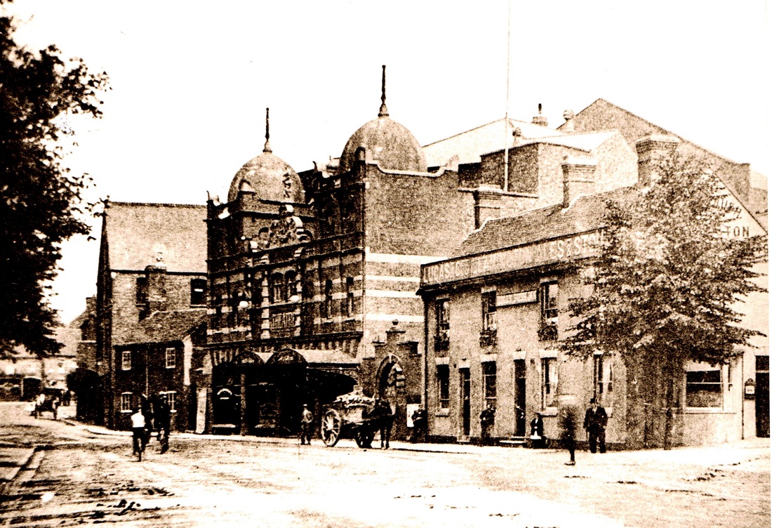
Bond Gate, c. 1920. The twin turrets of the Hippodrome Theatre in the distance. (Fred Phillips Collection)
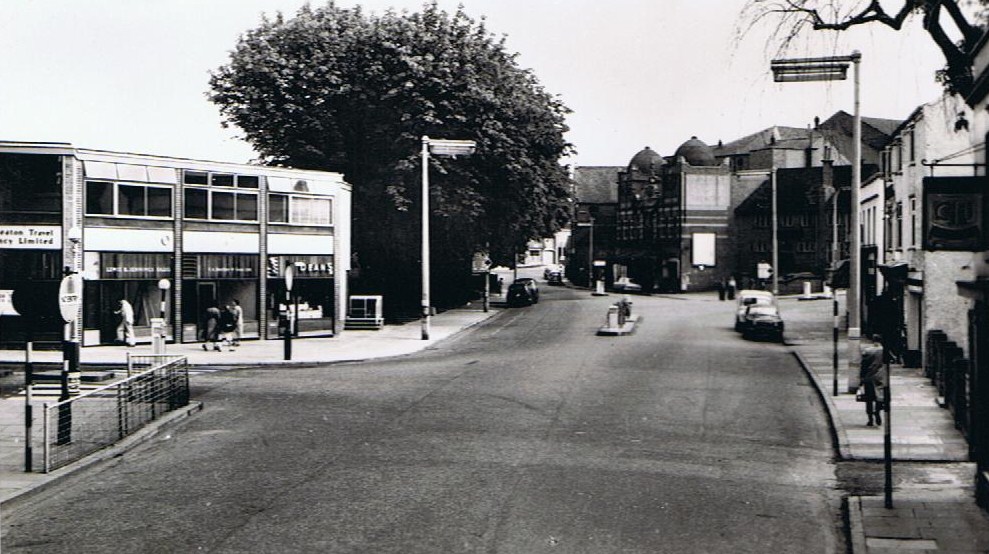
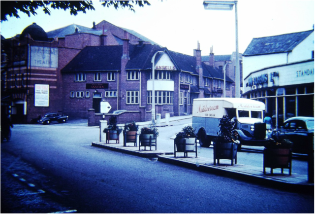
A 1950's view of Bond Gate with the Midland Red bus stand in the centre and a very fine stand of mature trees. These were cut down in the 1990's for street works but surely must have been one of the best features of Bond Gate. Hippodrome on the right.
Bond Gate very early 1960's. Looking towards Bond Street. Newdigate Street on the left.
Bond Gate, an old W. Cawthorne postcard c. 1910. (Alan Cook Collection)
Bond Gate in the 1950's. Hollybush pub in the centre, Leicester Road bridge to the right with Sam Robbins garage extreme right. The Hippodrome on the left. (Ron Powell - Alan Cook Collection)
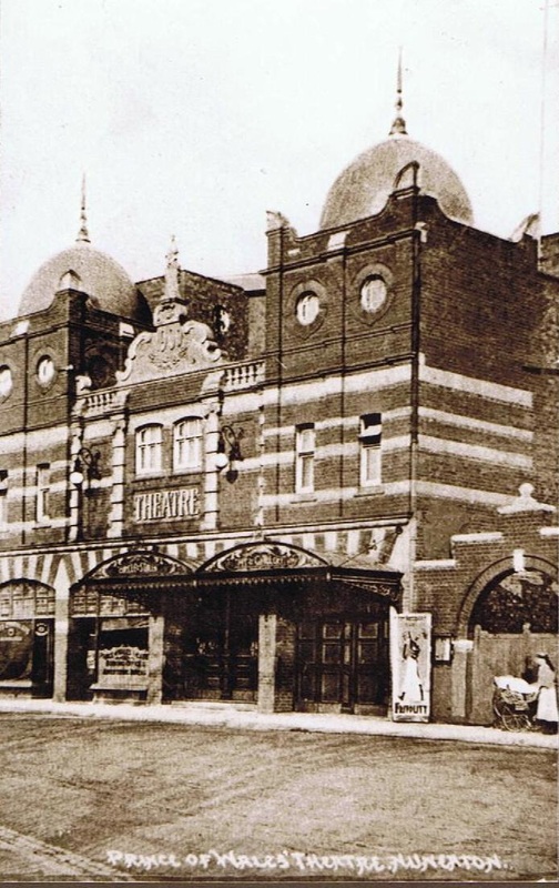
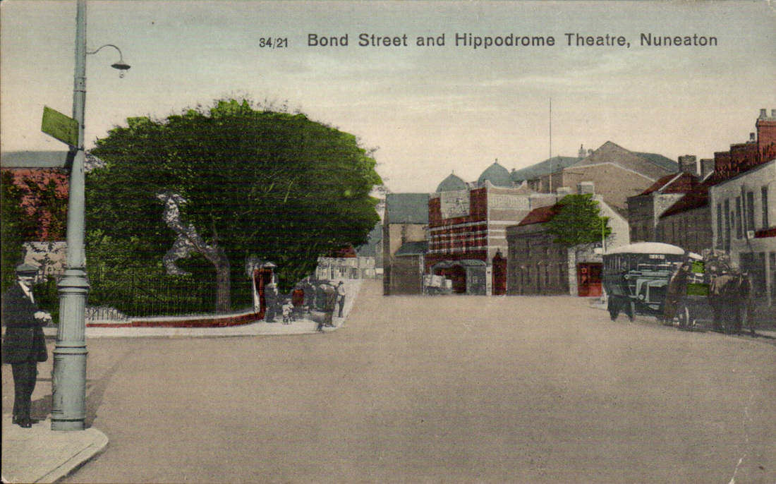
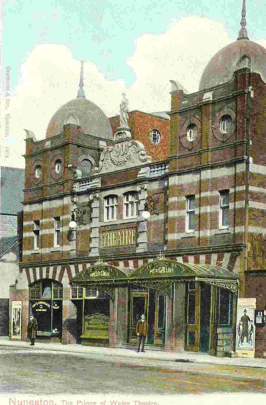
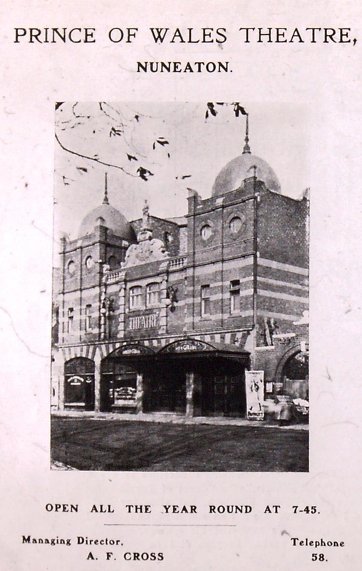
Bond Street with the Hippodrome (formerly the Prince of Wales) Theatre and the Hollybush on the right.
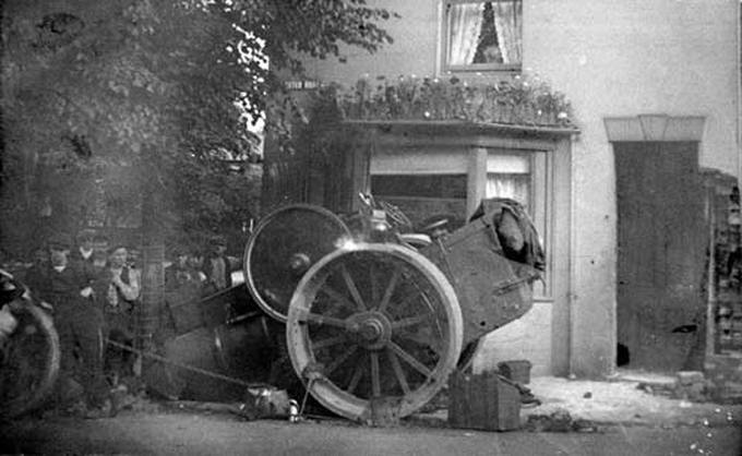
The bottom of the Leicester Road bridge next to the Hollybush pub could be a hazard in the days when brakes were not very good. This traction engine has run away and looks as though it has demolished part of the pub's wall before hitting a tree and losing its front wheels. Just to the left of the large fly wheel is "Cutter" Moreton who lived in Leicester Road and was regular at the Hollybush. He was a horse slaughter with knacker's yard in Glebe Lane off the Hinckley Road.
Remember the awful statue which depicted two naked people wrestling. Not sure what the relevant of that was in Nuneaton, but it can be seen here in Bond Gate where it stood for a few years. All the buildings from the Nuneaton Observer Offices across to the other tree were cleared away for modernisation of the town centre. H.P Carter whose shop is framed by the tree came from Ibstock to start his Nuneaton business. He sold guns and actually built a motorcycle at one stage "The Colonial" one or possibly two examples still exist. I think one is in the Coventry Motor Museum. (Keith Draper)
Bond Street
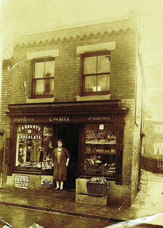
George White's shop at 39 Bond Street. Mr. White was a railwayman so his wife kept the shop. There is a jitty at the side of the shop which once led I am told to a row of cottages called Gladstone Terrace. All this has disappeared under Dunelm's car park.

The old Crown Inn in Bond Street c. 1880. The Railway Tavern on the right. (Tom Burgoyne Collection)
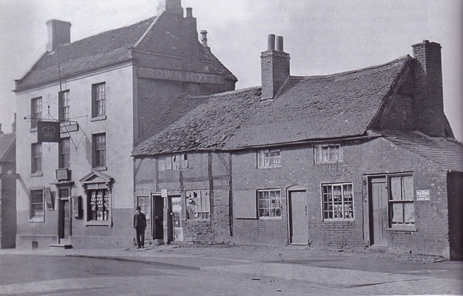
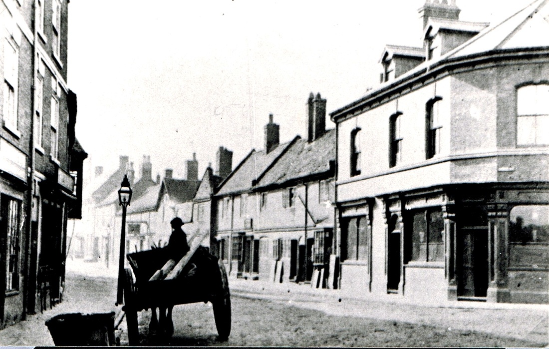
A poor photo of Bond Street looking in opposite direction to the photo above with the old Crown Inn dominant. To the left of the Crown Inn the gap between the buildings led to the Crown yard where there were court cottages and a skittle alley. The decrepit old cottages to the right give an indication of what the rest of the town was like when this photo was taken, probably in the 1890's.
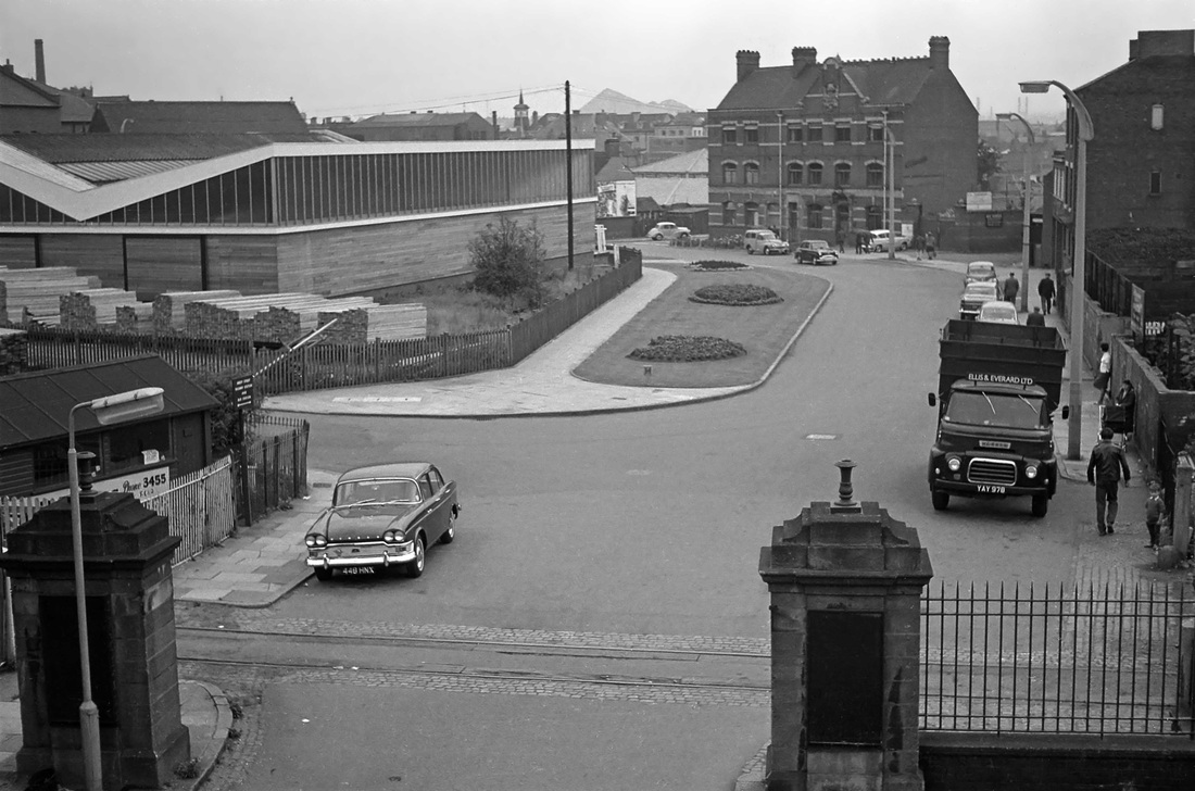
Bond Street looking towards Bond Gate from Nuneaton Station passenger bridge. Note the station gates in the foreground which once sported lamps (since gone). The siding crossing the entrance gate used to deliver logs by train to the Nuneaton Timber Co. yard on the left. The siding went out of use in the 50's when Nuneaton Timber Co. no longer processed raw timber and went over to pre-processed timber and joinery products. The new V roofed building on the left is the joinery department of Nuneaton Timber Co. Looks like Ellis & Everard's coal lorry on the right. Ellis & Everard a well known Leicester coal and builders merchant received their coal in Nuneaton's down goods yard on the right. They had builder's merchants premises in Bond Gate as well. The Crown public house in the background. In the distance Griff Colliery tip. (Cedric A. Clayson, courtesy John Clayson)
Bracebridge Street.

The VE day street party 1945 in Bracebridge Street. A lovely day.
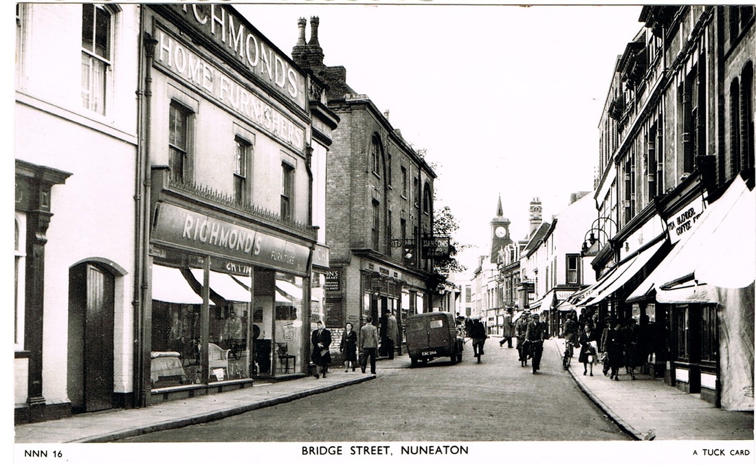
Bridge Street, (Nuneaton)
(Horace Bull, Ruby Atkins Collection)
The great flood of 1932 left an indelible record on townspeople who can remember that calamitous event. There are not many around today who can remember it of course. But local photographers took their cameras out to records the scene and this was the awful prospect of Bridge Street with river water from the Anker flooding out of Mill Walk on the left and into the shops and doorways throughout the street. The crest of the bridge can be seen in the middle distance so in view of the level of water seen here the Anker was swollen to the parapet of the bridge itself. One lady has taken refuge with her bike in the doorway on the right. (Ken Orgill Collection)
Bridge Street from the Market Place.
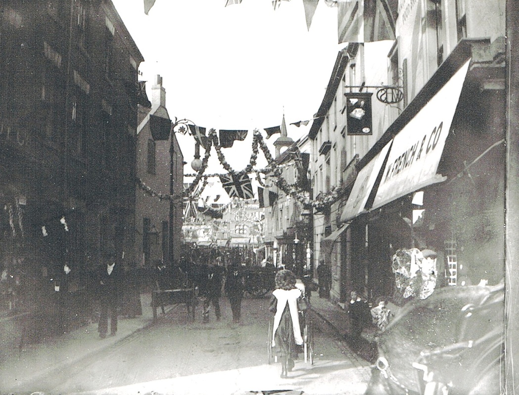
Bridge Street decorated for Charter Day, 1907.
Bridge Street looking towards the Market Place. (Reg. Bull)
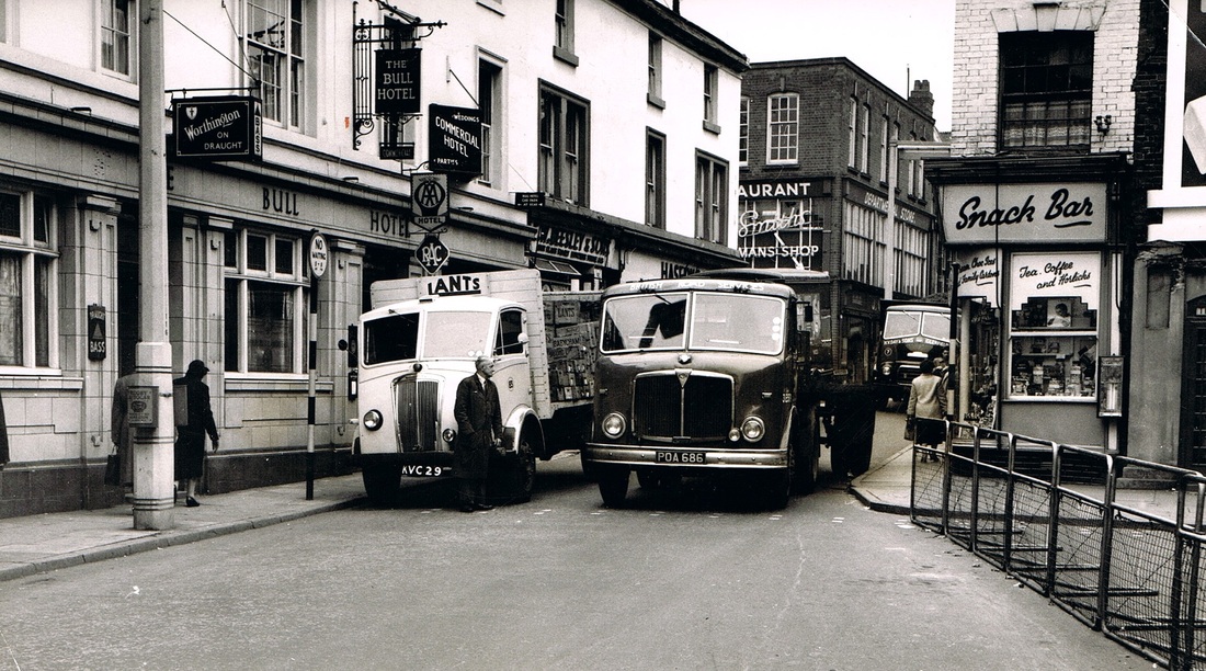
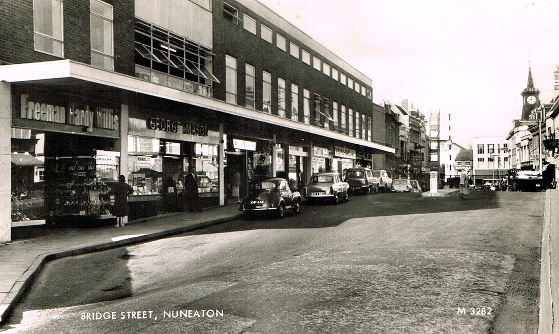
A nice selection of old lorries squeeze through the narrow defile of Bridge Street illustrate the problem that caused this street to be widened. Bridge Street had become a one way street in 1950. It later became a pedestrian street which would have saved pulling down those interesting old buildings on the right. (Reg. Bull)
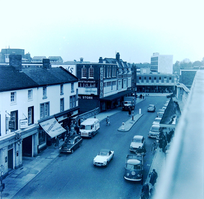
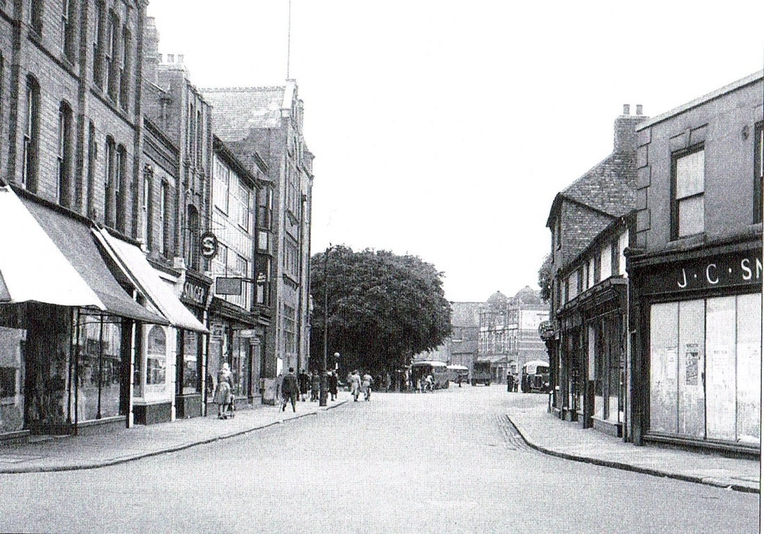
An interesting roof top view of Bridge Street in the 1960's by the style of the cars. J.C.Smiths is still J.C.Smiths. We are looking towards Church Street. (Colin Yorke)
Bridge Street in the early 1900's. The gap between the buildings on the left is Mill Lane, this provided vehicular access to the flour mill. Even as late as the 1940's the old Sentinel steam lorries had to negotiate this corner. Dropping red hot ashes from their ash pan in the road it must have been quite a sight seeing them trying to back into this narrow lane from Bridge Street. It would stop the traffic for a while that's for sure.
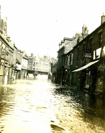
Looking out of Bridge Street towards the Market Place in the great flood of 1900. Post office on the left, The Bull Hotel gateway on the right.
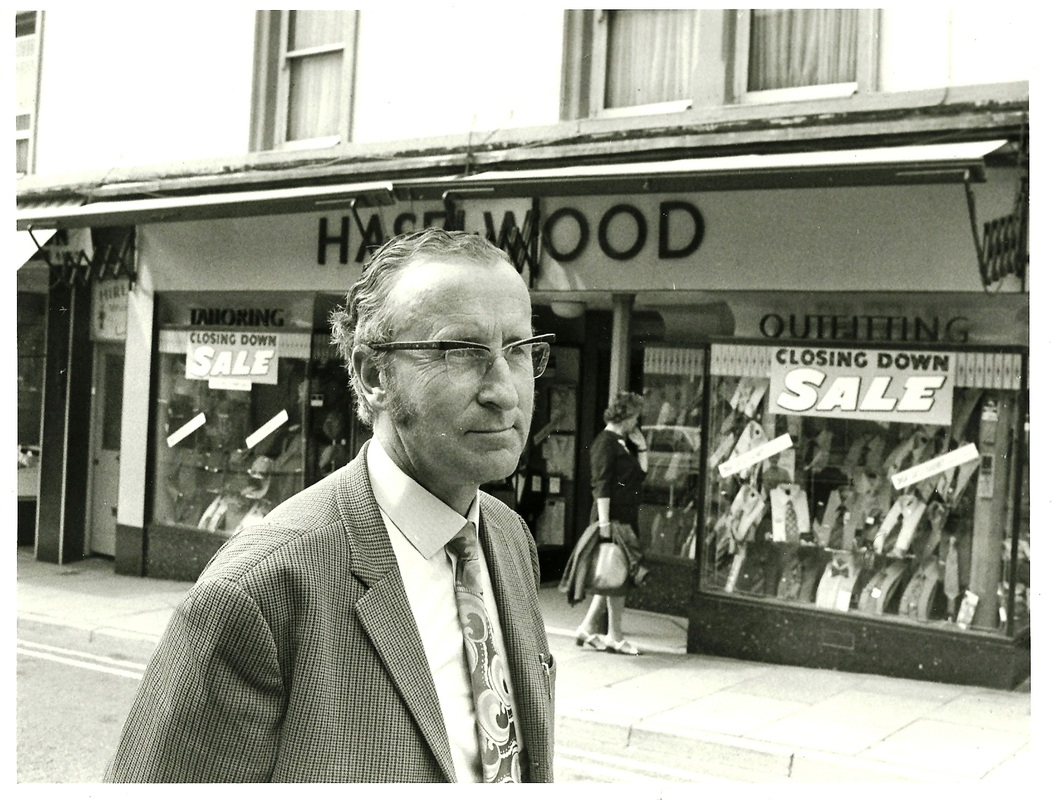
Ken Haselwood outside his shop in Bridge Street shortly before he retired. (Pat Haselwood)

Haselwood's familiar shop on Bridge Street, high class men's outfitters. (Pat Haselwood)
Bridge Street c. 1900. The open door of the old post office is on the right. Bull hotel in the centre of the photo. It is appropriate that the post office and the Bull Hotel are clustered together as the Bull Hotel itself was Nuneaton's original post office. Every day a bag of letters arrived on the stage coach which plied its way from Coventry to Hinckley and these were distributed from the Bull Hotel. But as the universal post increased due to the railway taking over the distribution network formerly carried out by stage coaches, proper facilities were needed for sorting increasing volumes of letters and the Post Office was built opposite the Bull in the Market Place. We can see in its open door way here. The post office was demolished in 1912 to make way for a brand new one, more suited to the 20th century, and this area of the Market Place was entirely cleared so that the building line was pushed back extending the size of the Market, and clearing the way for the new Post Office frontage.
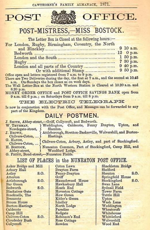
In the Good Old Days you knew the name of your postman. But do you know where:
The Bracknells, Cloudesley Bush, Kitler's Green, Paradise, Wheatcroft, are today?

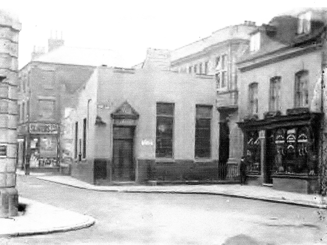
A very poor image of the old Post Office before demolition in 1912. Deacon's saddlers to the right.
The "new" post office rises behind the old one 1912.
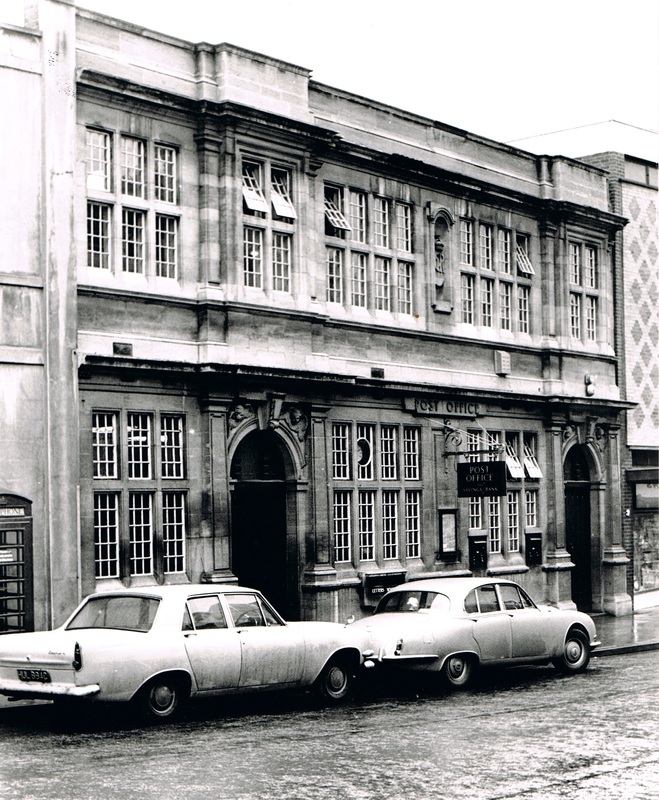
The "New" Post Office January 1968. (Reg.Bull)
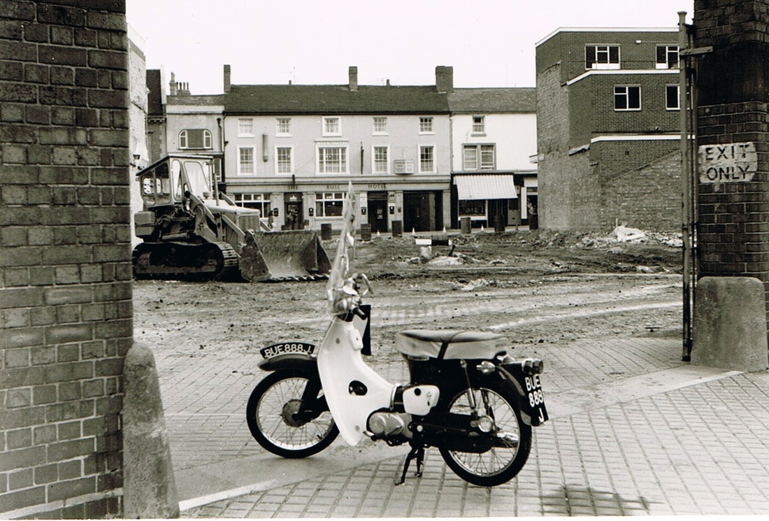
The gap left by the demolition of the old post office in the Market Place, Nuneaton. Photographed through the gates to the Flour Mill with the Bull Hotel dominant in the centre of the picture. Geoff Edmands moped is framed by the gate. (Geoff Edmands)
Bridge Street in the 1880's. The Nuneaton Brewery on the right.
The gateway to the Bull Hotel, Bridge Street c. 1900. It is here that the old line of stage coaches arrived before the days of the railways, and discharged the wealthy travellers who were accommodated overnight in the hotel. At one time an old blind beggar stood at this gateway and everytime the stage pulled up was in position to scrape away a lively tune on an old fiddle in order to beg for a few coppers from the kind hearted travellers. For many years the Bull was the hotel and town parcel distribution depot for the London & North Western Railway whose horse bus carried passengers from the Trent Valley station to the Hotel. In January 1871 the hotel had 13 bedrooms, and stabling for 30 horses. Its horse bus met 48 trains daily at Nuneaton station. The Bull had been rebuilt into this form in the middle of the 19th century. The photograph dates from the 1890's. (Clare Speight)
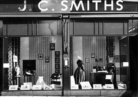
J.C.Smith's shop window in the 1950's. (Colin Yorke)
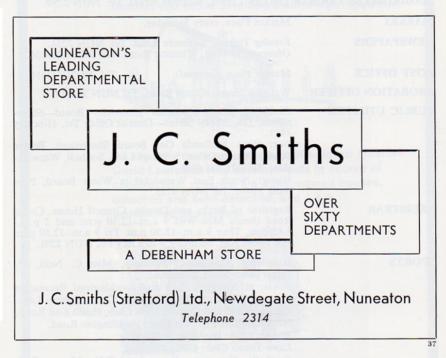
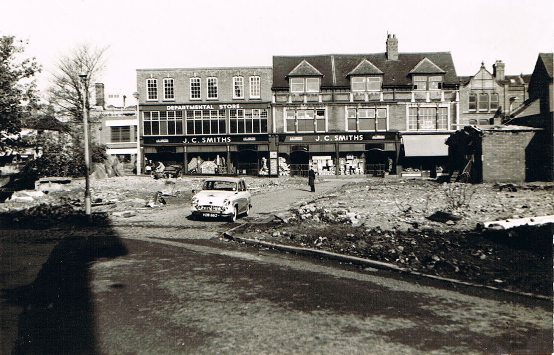
A better view of J.C.Smith's 1st November 1959. The ground in front has been cleared of the old shops ready for reconstruction. The car is standing in old Mill Lane which will be lost under the new rebuilding. The bulk of the old flour mill sends its shadow left over the proceedings. The only time in history that you could get a good view of Smith's shop like this. (Geoff Edmands)
Bridge Street in the 1970's (Geoff Edmands collection)
Broad Street

This photo was taken c. 1926.
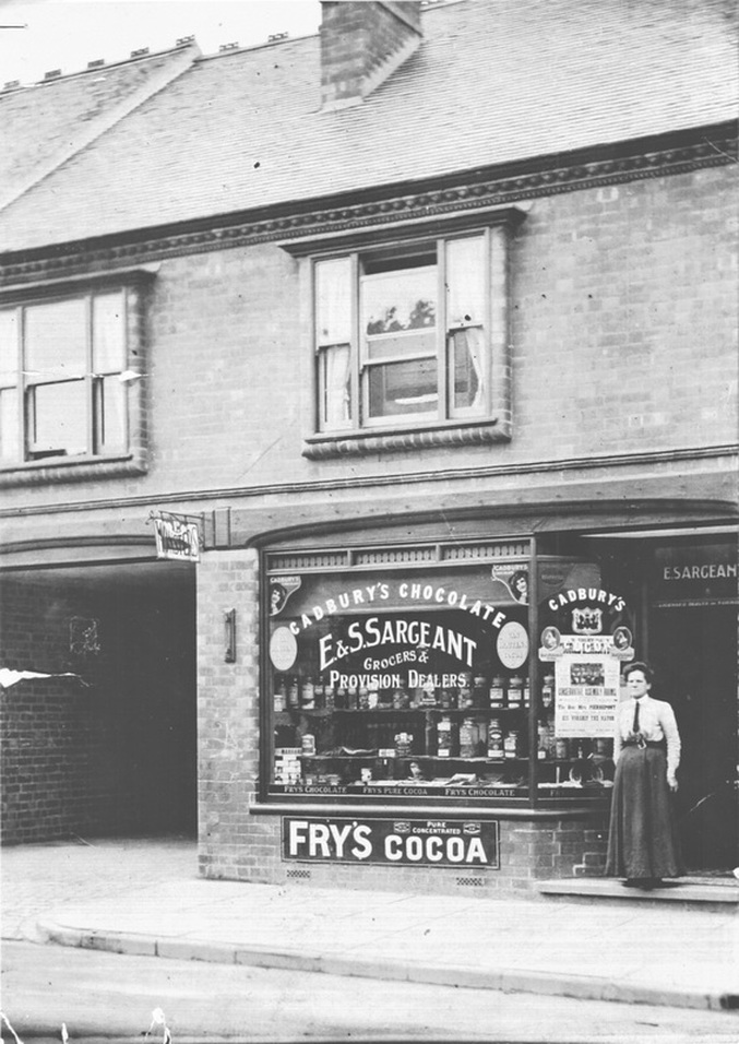
E&S Sargeant's grocer's shop in Broad Street probably May 1912.
Burgage Place & Burgage Walk
Looking towards Abbey Street. The old cottage on the right has been converted into an electricity sub station. On the left is the flank wall of the Scala Cinema. (Peter Lee)
Church Street
Muscutt & Clay's Shops
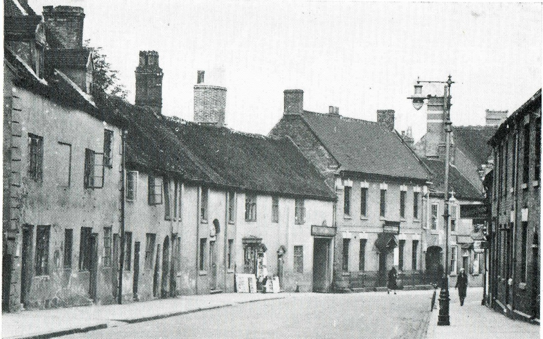
Church Street looking towards Bond Gate before World War One. An idyllic summer photo of an old town still untainted by the motor car. Muscutt and Clay's shops are on the right. The entrance to Bridge Street on the left. (Horace Bull, courtesy Ruby Atkins)
Church Street towards Bond Gate in the 1950's.
Church Street, 1880's. The then quite new "Marquis of Granby" public house on the right, later the "Granby's Head". A little further down the road immediately to the right of the gas lamp post is the sign for the Queens Head. Then still un-rebuilt an old cottage style pub. At one time there were five pubs in Church Street.
Church Street during the great flood of 1932.
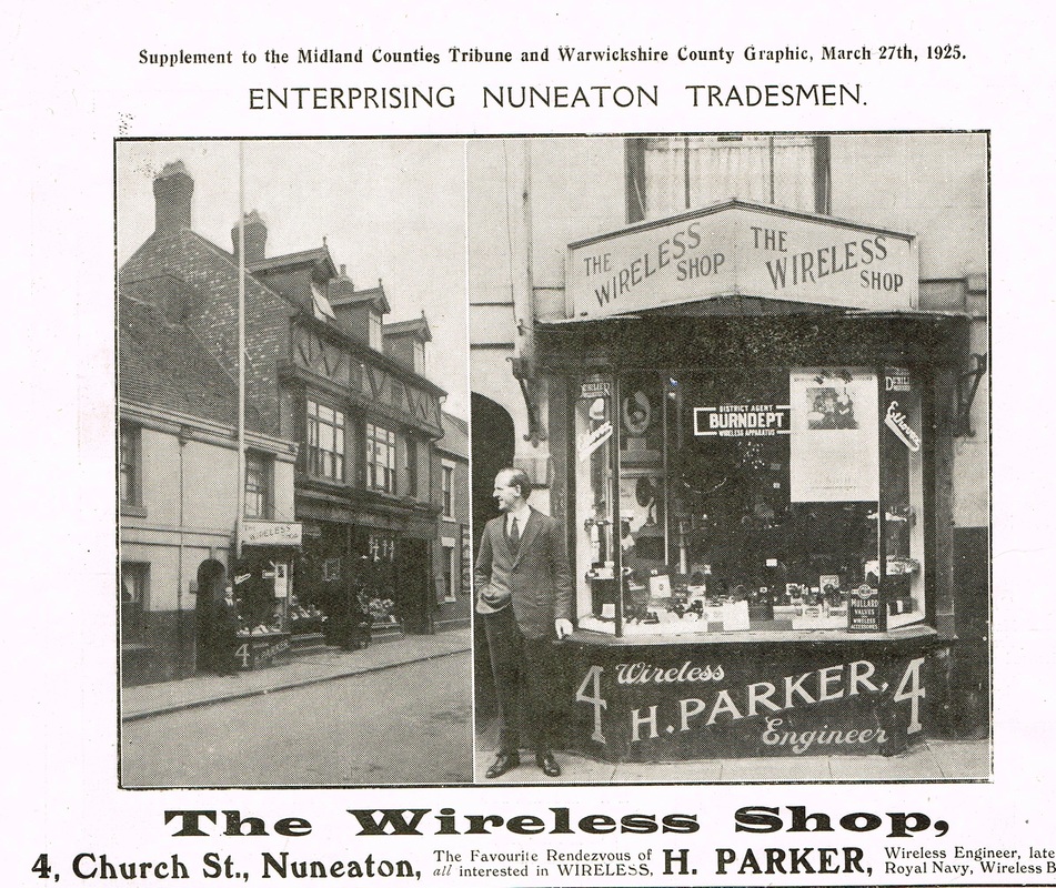
The Wireless shop next door to the King's Head Pub.

Church Street before the first World War. The large house on the left was "The Close" latterly owned by Alderman E.F.Melly bombed in May 1941 and destroyed as were most of the houses on the left. A charming old fashioned town street. Church Street was Nuneaton's original street before the Market Place was built.

Church Street early 1900's.
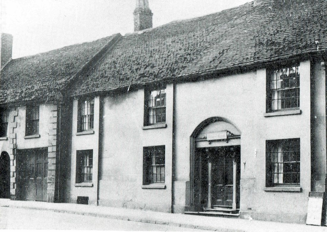
The house with the distinctive arched doorway was locally known as "Lawyer Dempster's House", but the lawyer involved was not Dempster Heming of Caldecote Hall but James Williams Buchanan (1792-1846). These old properties were badly damaged in an air raid in May 1941. Perhaps because of its George Eliot connection and in a more enlightened town this historic building would have been saved, but no-one in Nuneaton at the time was the slightest bit interested in its heritage. (not much has changed there - unless there is a job for a jobs-worth in it).
Another period view (1930's) of Church Street with Lawyer Dempster's doorway clearly visible on the left and a large entry which is now opened out to form Mill Walk. All the buildings you see here on the left were badly damaged by bombing. John Robinson's house with the canopy over the porch to the left of the lamp post with a lady walking in front of it, was also destroyed. The paper shop on the left was owned by a family called Flowers who moved to Hinckley after the bombing.
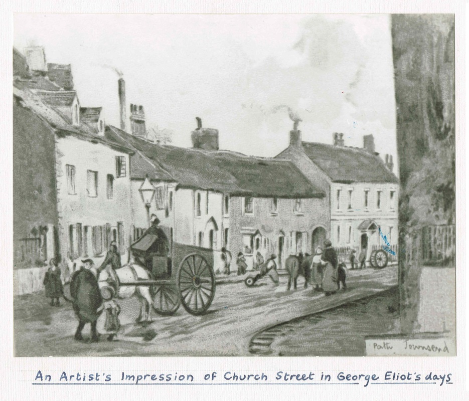
A Pattie Townsend water colour of the same scene.

Through the gateway is Mill Walk and the house on the right is John Robinson's house. This was bombed in 1941. What I cannot understand though is why the poster on the left appears to be in reverse because by carefully looking at the Pattie Townsend painting the picture is the right way round.
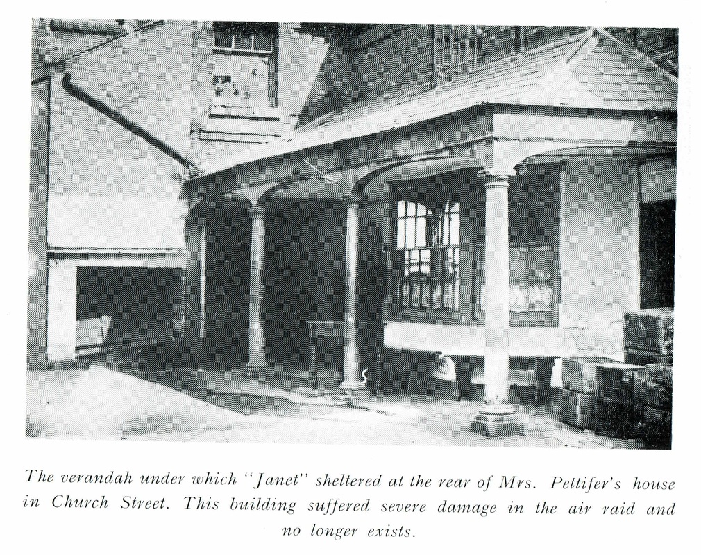
This was the rear of John Robinson's house in Church Street.
Church Street in the 1950's. The street still displays evidence of war damage. The empty space on the left where buildings which were badly damaged in May 1941 were demolished after the war.I have vague memories as a kid just about the time the old properties including the garage on the right was being demolished with a pal, retrieving some old oil drums from the garage with the intent of building a raft to sail up and down the Coventry Canal. The drums were rolled back to our house in Norman Avenue and lashed together with rope. A crude platform of wood roped to the top and the whole lot hauled up to the "cut" at the Cat Gallows Bridge. We launched the vessel and as we clambered aboard could hear a loud glugging noise as it lurched over. We scrambled off in confusion. For some reason we had overlooked the fact that there were no bungs in the ends of the oil drum. That bit of school boy pleasure was over. I often wonder if our raft still resides at the bottom of the canal and each time I think of old Church Street I remember those old oil drums.(courtesy; Keith Draper)

A parade through the town along Church Street in 1910 to honour the late King Edward. (Maurice Billington Collection)
The former Kings Head pub in Church Street was a very old hostelry. Throughout its existence it served beer direct from the barrel at the back of the bar. Dispensed into quart jugs. It was demolished in 1960 (Arthur Tooby)

The house known as "The Close" in Church Street plays host to an exercise of Nuneaton Fire Brigade. "The Close" was the home of Edward Ferdinand Melly, Managing Director of Griff Collieries Ltd. It was bombed by the Luftwaffe in the great air raid on Nuneaton in May 1941. Mr. Melly and his wife were killed that night.
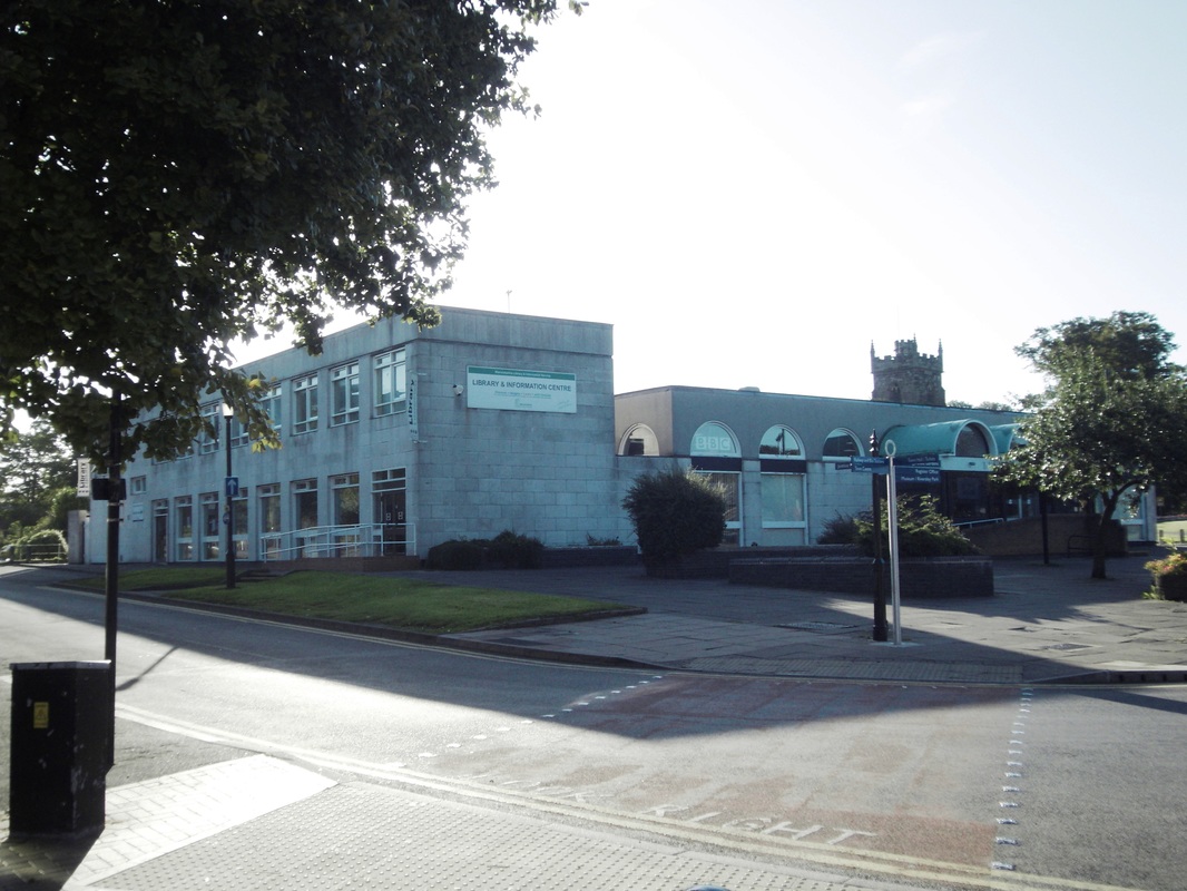
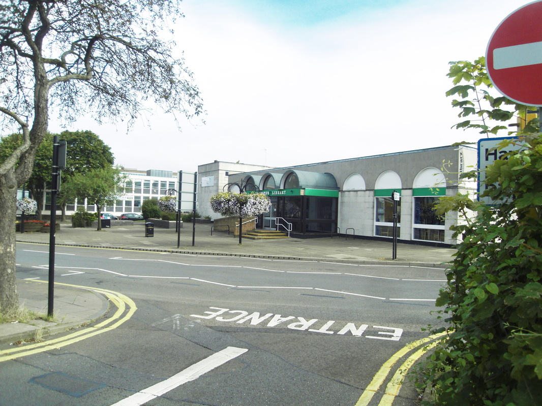
Nuneaton Library - through time.


(Maurice Billington)
This scene seems to have hardly changed at all since the photo was taken in the 1970's. (Maurice Billington)
Church Street in the 1970's. Powell House on the right. (Colin Yorke Collection)
Corporation Street
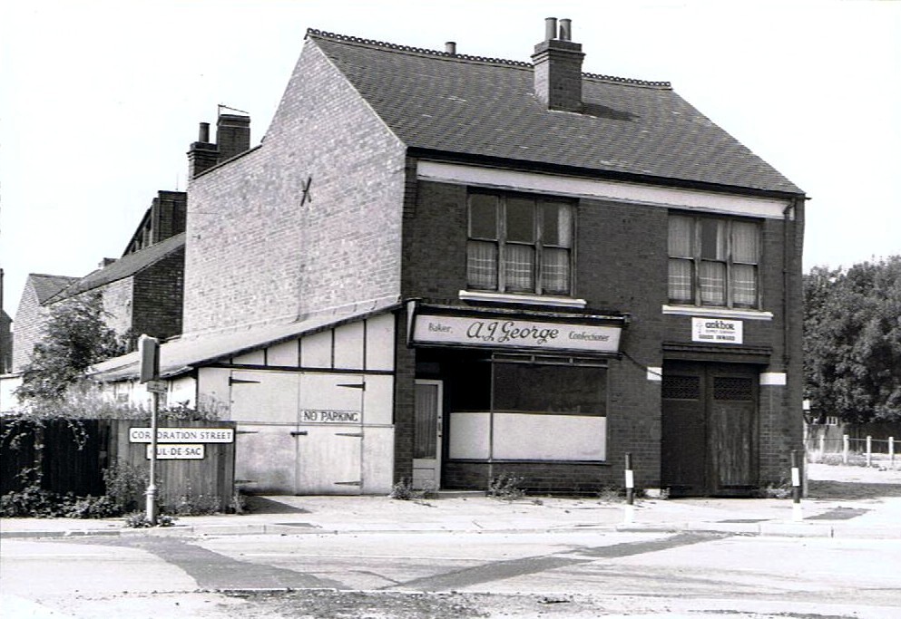
A.J. George was a baker who occupied premises on the corner of Corporation Street and Newtown Road. These old buildings were demolished to allow the construction of a traffic island. (Peter Lee)
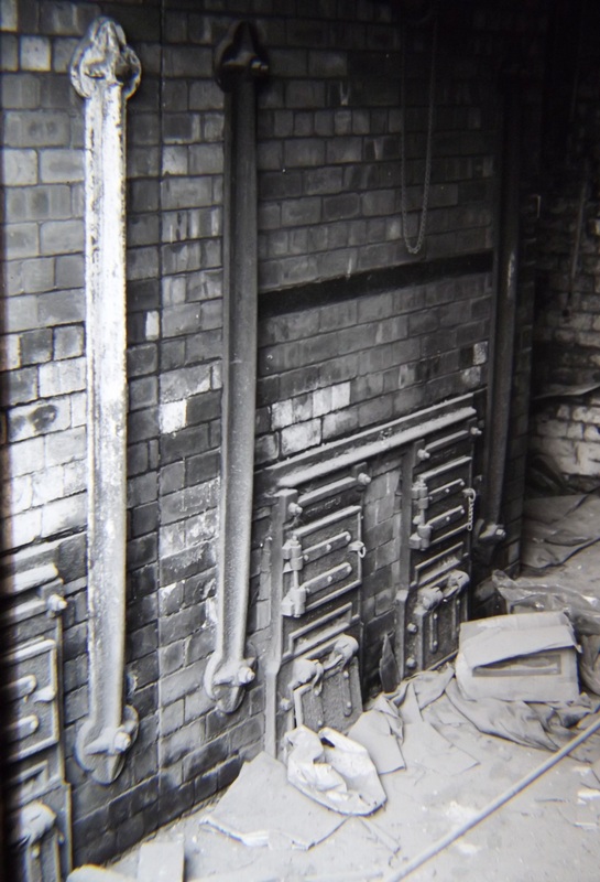
The old baker's oven in George's Baker's Shop before demolition. (Alan Cook)
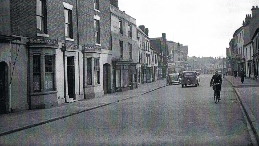
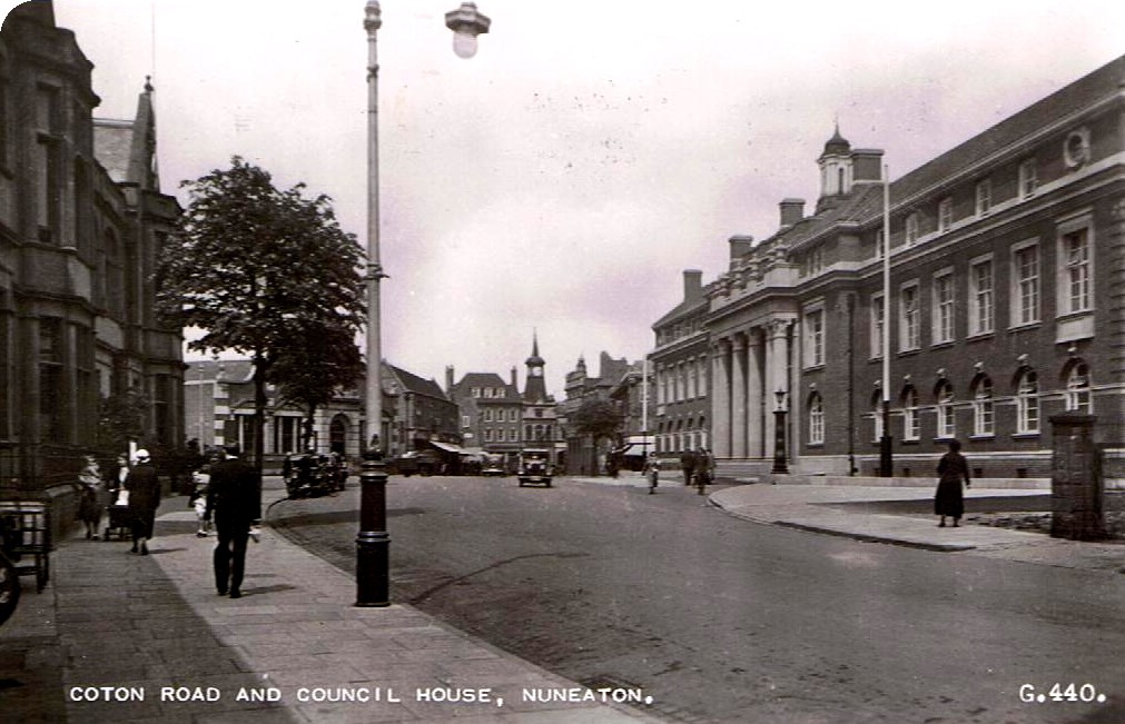
Coton Road
Coton Road from the Flour Mill. 1973. Princes Street leads off to the right. Nuneaton Hospital maternity block on the horizon. (Alan Cook)
Looking towards Coton Road and Courtaulds on the horizon. 1973. (Alan Cook)
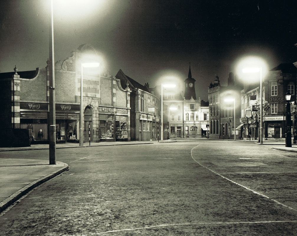
Coton Road, looking towards Coventry Street at night in the 50's. This townscape has changed considerably from the good old days. The "new" line of Coventry Street was altered in the 1920's to make room for the motor car.The Refuge Assurance building on the right was also built in the mid 20's. Prior to these alterations this entrance to Nuneaton had an old fashioned aspect. Where the photographer is standing untroubled by cars is technically in Chilvers Coton parish. Chilvers Coton was divided into four ends - Church End - Virgin's End - Heath End and Town End. This is Town End. You can see why? It abuts Nuneaton Town Centre. The border line of the is under the set of shops on the left - Doree - The Wool Shop and underneath these runs the old Wash Brook, by this time culverted which passes under Coton Road and forms the demarcation line between Coton Road and Coventry Street before discharging into the river Anker near the flour mill on the right. This was the ancient border.(courtesy Colin Yorke)
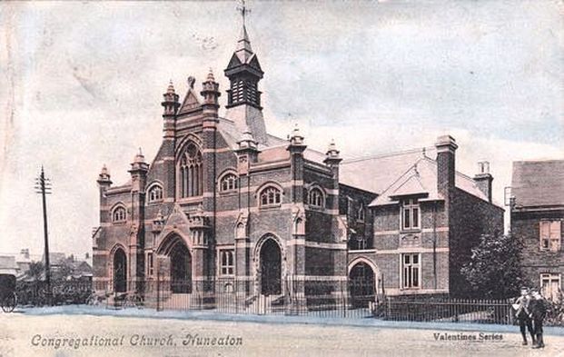
The Congregational Church, (now the United Reform Church in Coton Road) (Peter Lee Collection)

Nuneaton police station, court building and jail. Chapel Street on the right. Prior to the police station being built the court was held in the Newdigate Arms Hotel. (Peter Lee Collection)

Coton Road, former Carnegie library on the right. Replaced by the Council House in 1933. This phot was taken during the first decade of the 1900s.
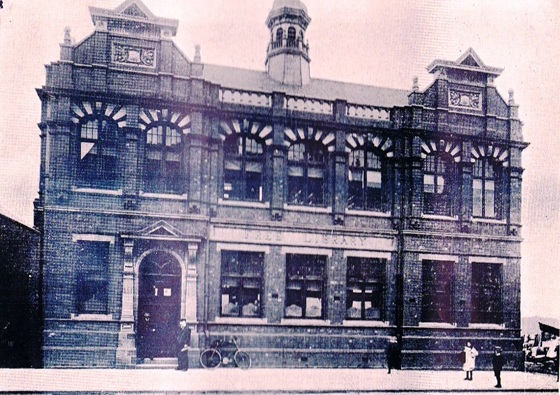
The former library in Coton Road. This was very much brought to the town by John Warden Clay the father of the library in Nuneaton. Funds were provided by Andrew Carnegie who used his great wealth to promote libraries throughout the country. The library was removed in 1933 to make way for the Council House above and the staff moved the library to the old council offices and fire station in Queens Road.
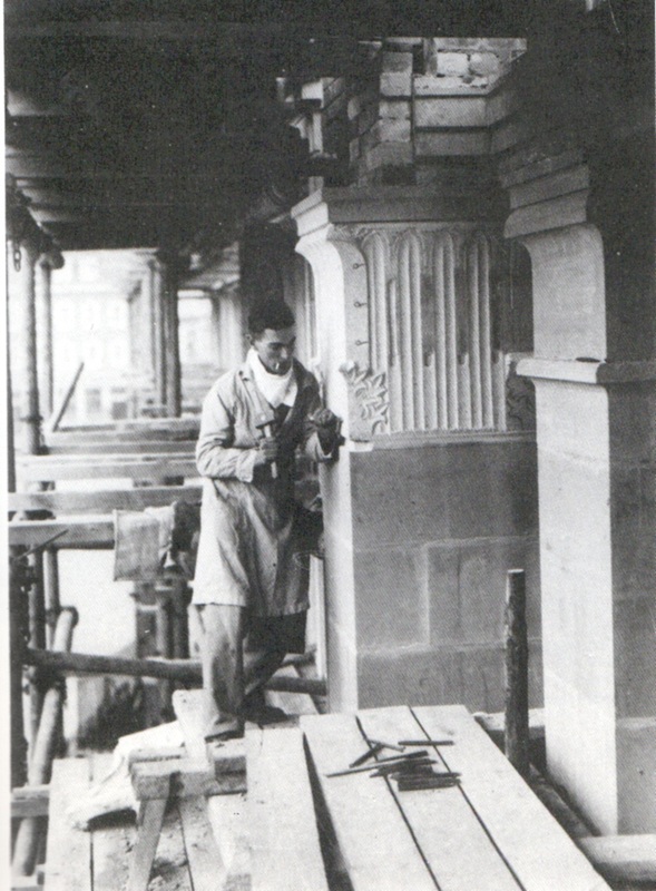
Construction of the council house required some fine stonework. Here a skilled mason works on a decorative column.
The new Nuneaton Council House in the 1930's.
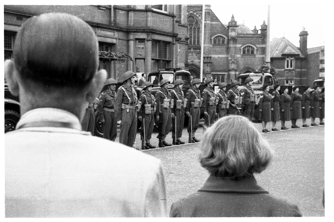
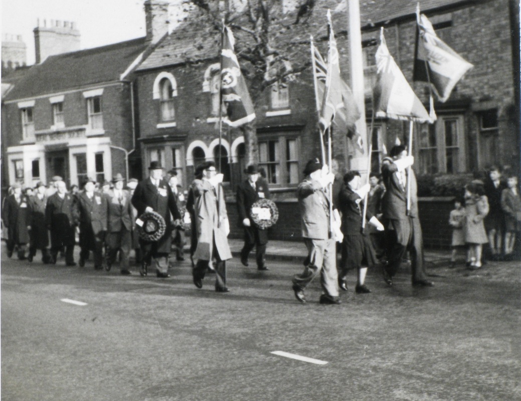
Troops in Coton Road outside the Council House, but what was the occasion? (Colin Yorke)
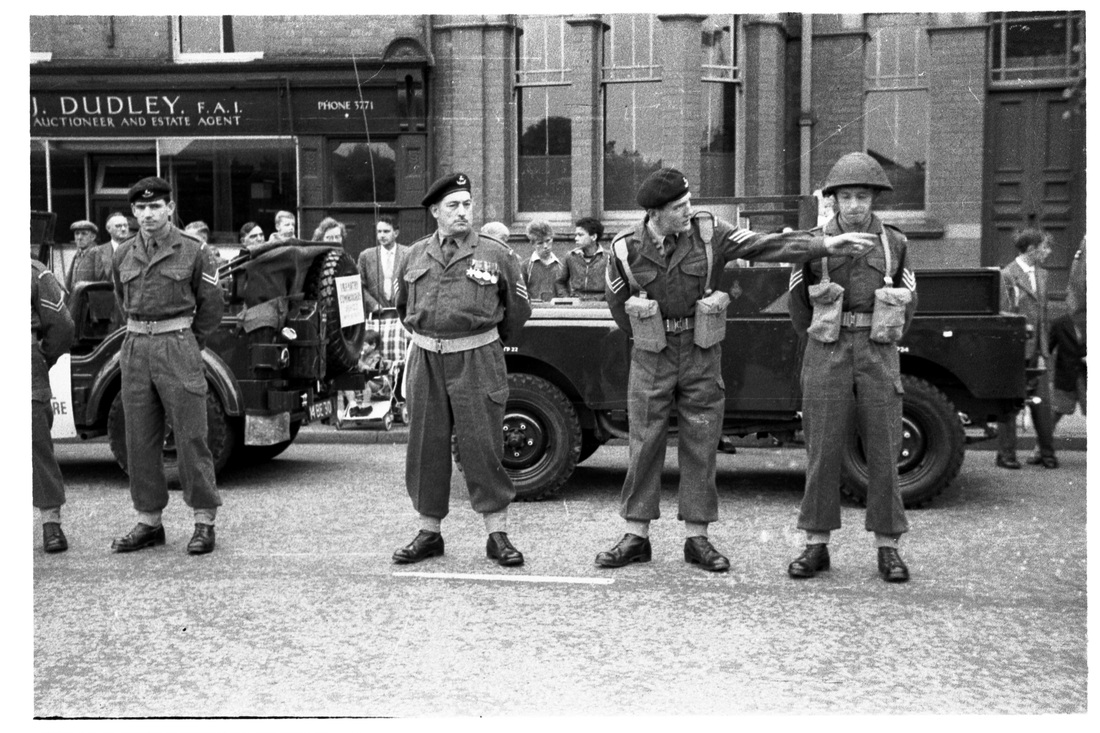
Could it be Rememberance Day? The Police station is in the background and Eric Dudley's estate agents. (Colin Yorke)
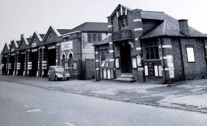
The Midland Red bus garage in Coton Road.
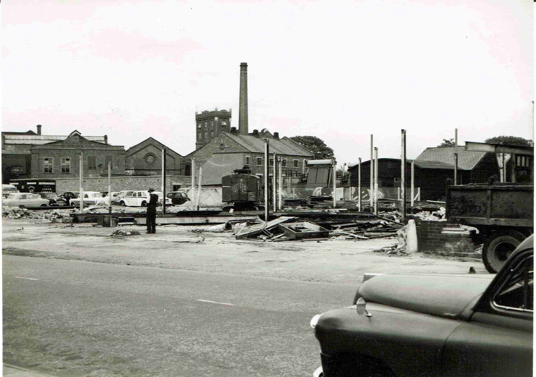
The final stages of the demolition of the Midland Red bus garage in Coton Road, Nuneaton. The flour mill dominates the skyline. At this point the Nuneaton inner ring road was built to cut through the bus garage site. The buildings in the immediate foreground at the rear of the bus garage was the former Nuneaton Corporation electricity works. Some of these buildings were not demolished until quite recently. (Geoff Edmands)
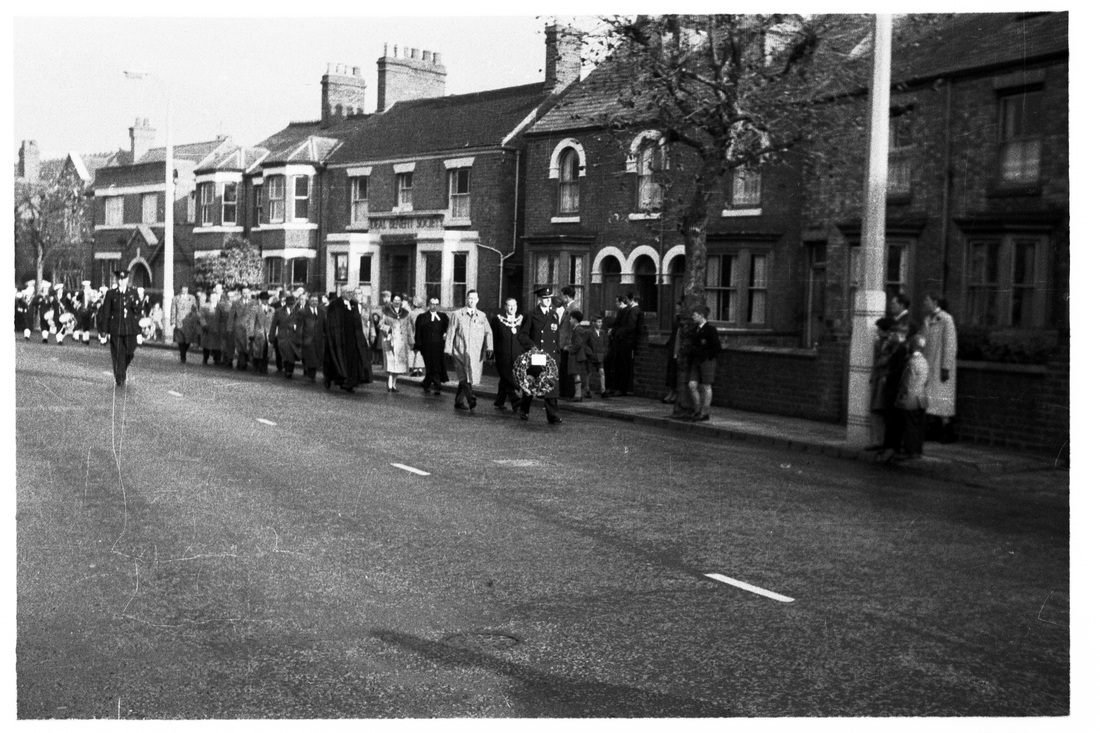
A Remembrance Day parade in Coton Road in the 1950's. All the buildings on the right were demolished when Coton Road was widened into a dual carriageway. (E.J.Wiltshire, courtesy Colin Yorke)
The old houses in the background in Coton Road were demolished when the dual carriageway was built. This looks to be Rememberance Day but the year is not known. Probably the 1950's. (E.J.Wiltshire, courtesy Colin Yorke)
The rear garden of Thomas Feest, stonemason, at 56 Coton Road, with possibly his wife c. 1924. The photo was taken by Miss Winkley, managaress of J.C.Smith's at the time. (David Gamston)
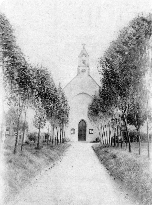
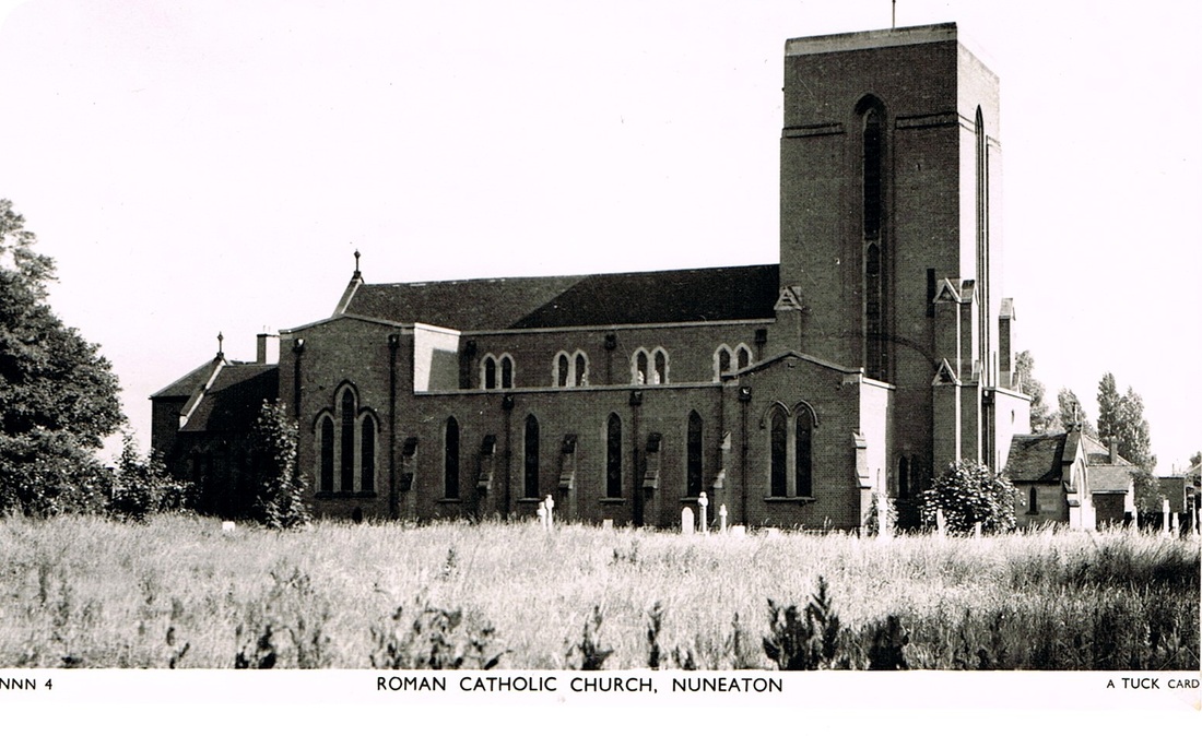
Nuneaton's first Catholic church.
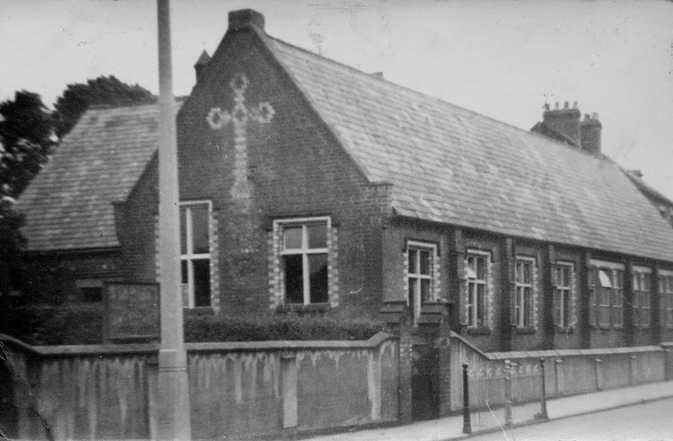
St. Joseph's School, Coton Road, which was demolished for road widening around 1970/1.
(Dr. Kevin Woodward)

Road widening has started along Coton Road. The single carriageway road can be seen but sufficient width has been cleared for the new dual carriageway. The old houses which once stood in the gap between the road and the fence in the foreground flattened and scraped clean. St. Joseph's School is still there in the distance in front of the Catholic church but this will soon disappear as well together with part of the graveyard. (Geoff Edmands)
Coventry Road
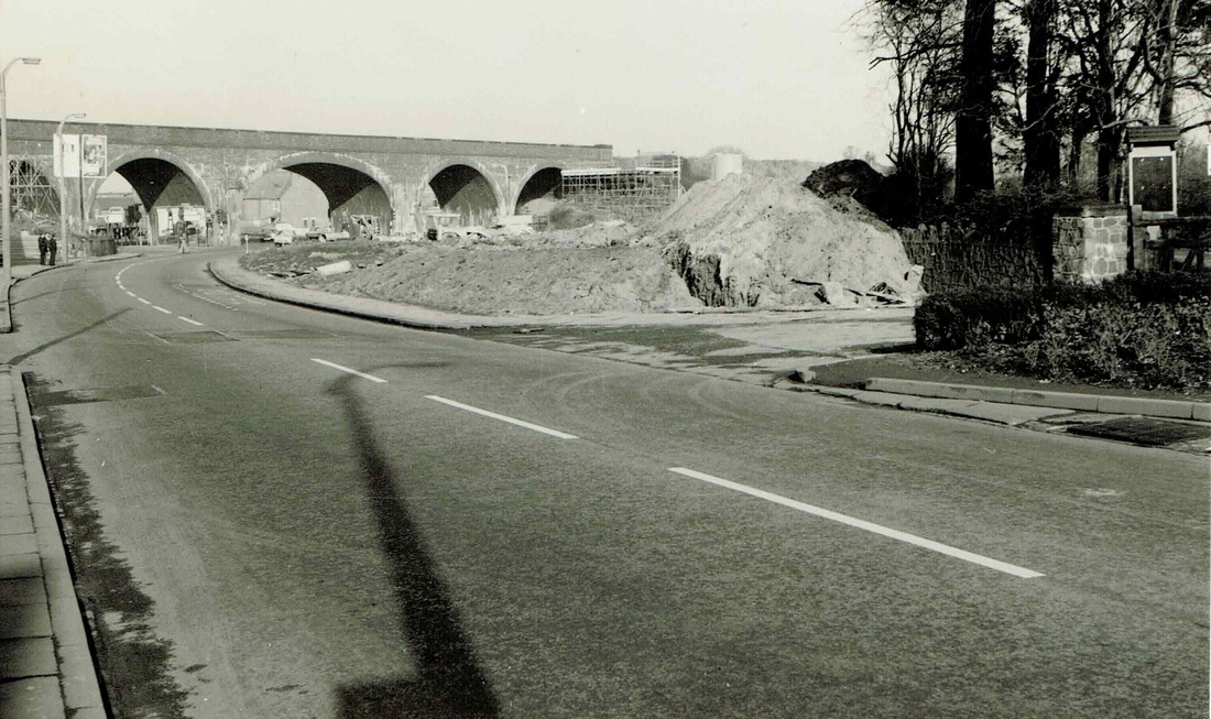
Coventry Road back towards Coton Arches. Demolition of the old properties which once stood in the centre of this view is complete. Coton Church is over on the right off the photo. (Geoff Edmands)
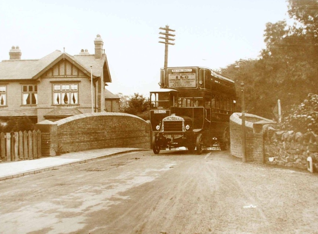
Coventry Road bridge looking towards Nuneaton with the old narrow canal bridge which was replaced c. 1925. The Wharf Inn was to the right where the roadway is widening.
Croft Road
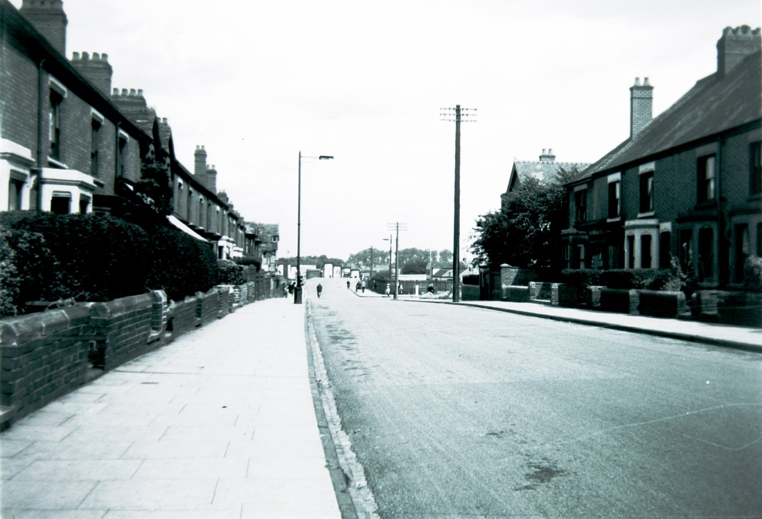
Croft Road towards the town. 1950's. The Coventry Canal bridge is in the distance. Greenmoor Road off to the right. Up until the 19th century this stretch of road was called Swan Lane. (Thanks to Rob. Everitt who pointed out on the 19th April 2014 that I mislabelled it as Midland Road). (courtesy Colin Yorke)
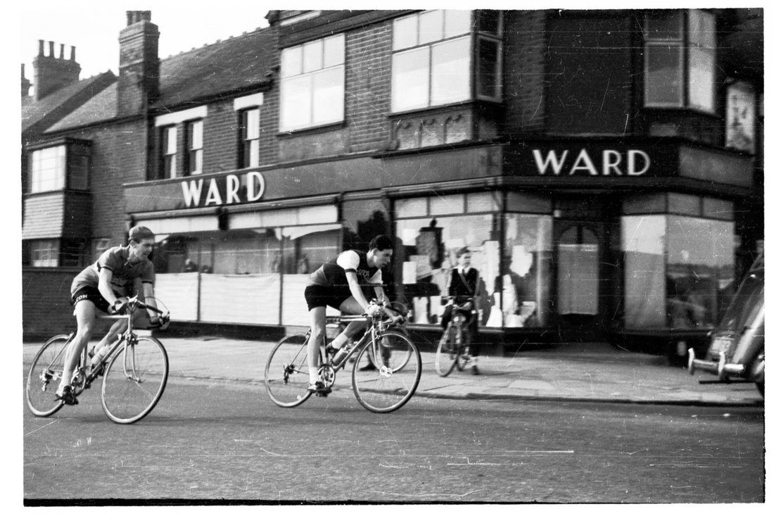
A bicycle race on the corner of Croft Road. Looks like they are turning into Tomkinson Road. Sometime in the 50's. (Colin Yorke)
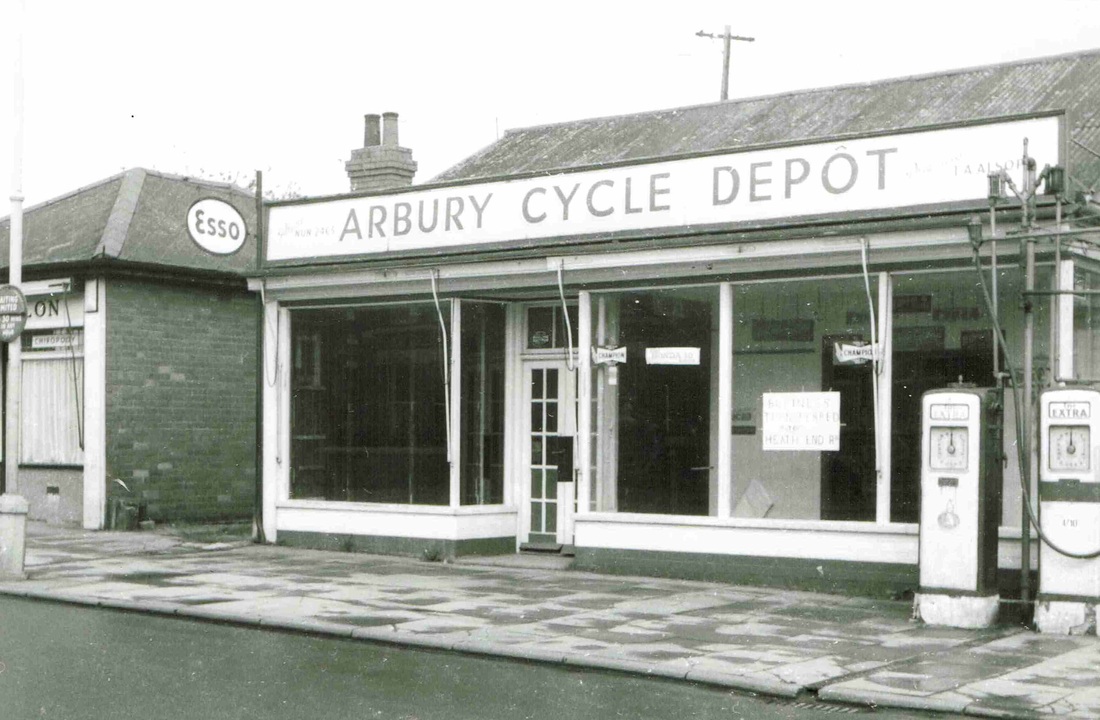
Arbury Cycle Depot, Croft Road, Stockingford after closure, awaiting demolition. Arbury Cycle Depot was started in 1925 and closed c. 1965. It was the main BSA agency for the town, and was the first dealer to sell Honda motorcycles (their first model was the C100). It was run for many years by David Allsopp whose father started the business. They did MOT's. Later on the business moved further up Croft Road and they opened a garage. (Ruby Atkins Collection - thanks to Jim Lee for the additional information)
Deacon Street named after George Deacon, saddler, in the Market Place, Nuneaton.
Dugdale Street
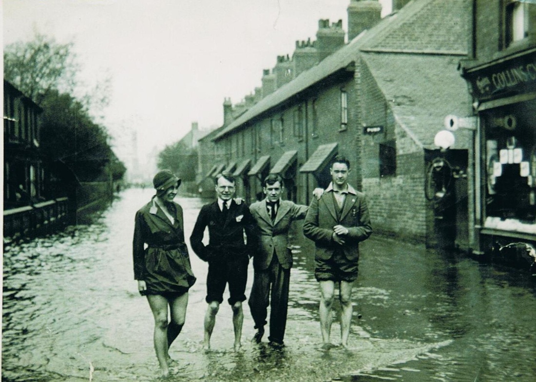
Dugdale Street during the great flood of 1932. The young lady shows a lovely pair of legs. Collins Cycle shop on the right.
The Dugdale Arms in Dugdale Street started life as a beer house. (Reg. Bull)
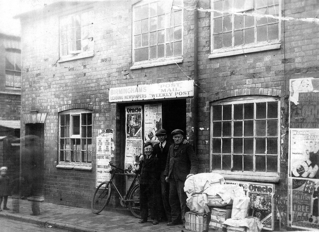
In Dugdale Street was a wholesale newspaper and magazine distributor. This small outfit would receive bulk supplies of newspapers and distribute them around the town to all the newsagents and small vendors. If I recall correctly the name of the proprietor was Taylor.
Factory Road
(courtesy of Mark Hood)
Frank Street named for Frank Jeffcoate.
George Eliot Street
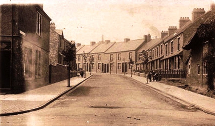
George Eliot Street before WW1. Note the old thatched cottage on the right.
Harefield Road
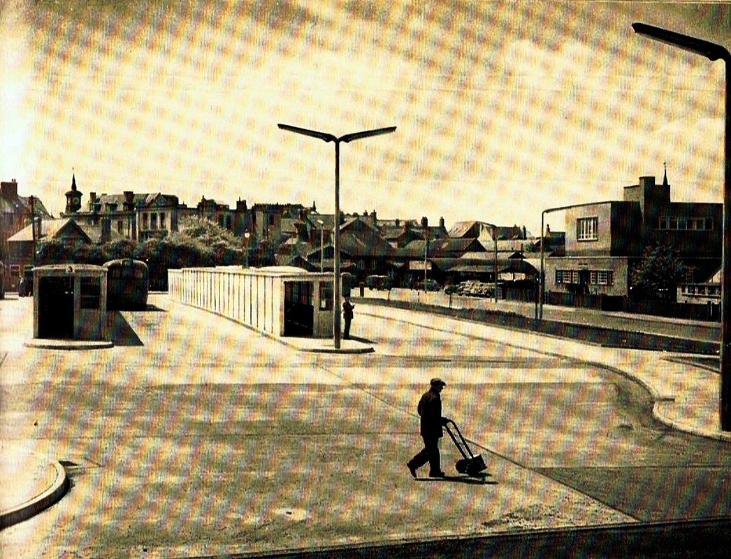
Nuneaton Bus Station as newly built in 1956. Up until then bus termini from several directions terminated in different parts of the town. From Coventry in Coton Road, from Hinckley & Leicester in Bondgate. From Stockingford in Broad Street. This is a publicity picture taken at the time the Bus Station was built on land formerly occupied by agricultural machinery dealers sheds to service the farmers coming into the town on Market and Cattle Market days. The cattle market is to the right of the prominent lamp post. Note that the bus station arcade of shops had not been built when this picture was taken. Nuneaton telephone exchange on the right. An old Midland Red SOS bus stands in the bus stand. The bus shelters were concrete structures which were entirely replaced in the 1980's when they started to fall apart because the re-bar inside had corroded badly and they broke up.
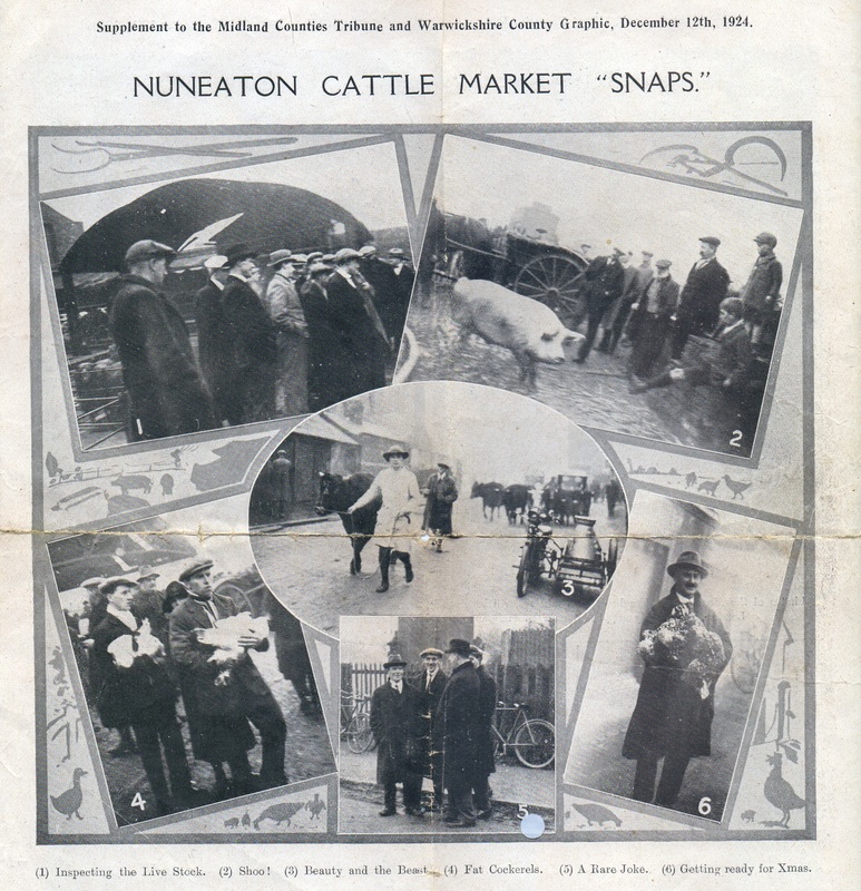
Harold Street named for Harold Jeffcoate..
Henry Street named for Henry Lester (Lester's the Chemist in the Market Place, Nuneaton).
High Street

High Street VE days celebration 1945. A visit from the mayor - Stan (C.J.S.) Dickens and his wife. Stan was mayor from 1944-46.
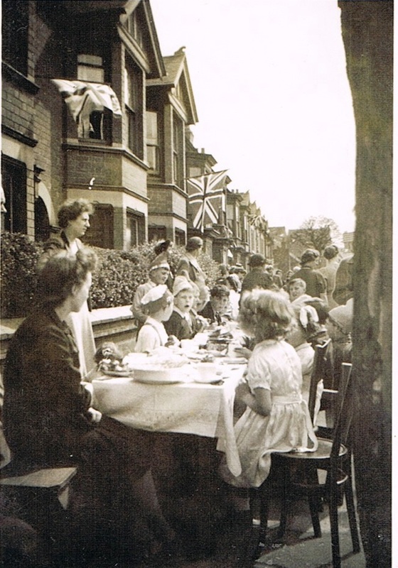
High Street families tuck into their VE day picnic. 1945.
(Ken Orgill Collection)

Another view of the High Street families posing for the camera with the kids displaying a range of silly hats and masks. Recognise anyone? (Ken Orgill)
Higham Lane
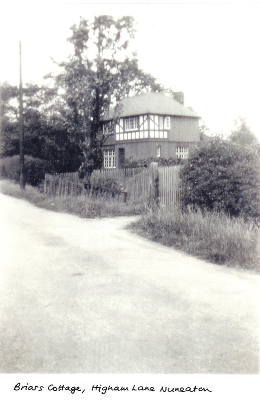
See the article on Joseph Worthington who lived here, in the Family History section. (Eileen Worthington)
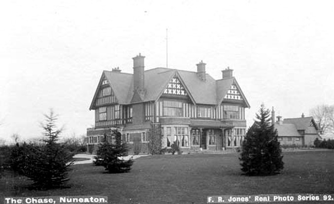
Hinckley Road

Despite the title on the card this is Hinckley Road, Nuneaton before WW1.
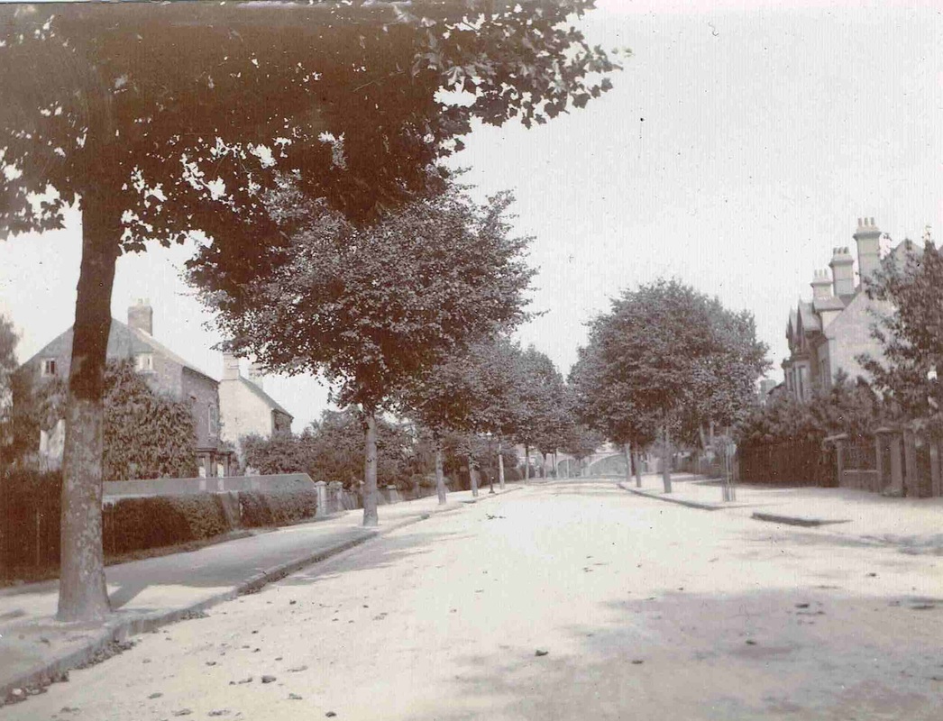
Old Hinckley Road before WW1 looking towards Hinckley. The railway bridge can just be discerned in the distance. (Horace Bull, courtesy of Ruby Atkins).
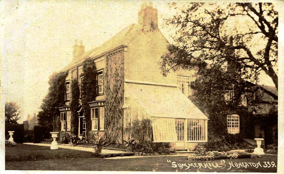
Summerhill House, Hinckley Road, Nuneaton. Home of Mr.Henry Slingsby, silk manufacturer.
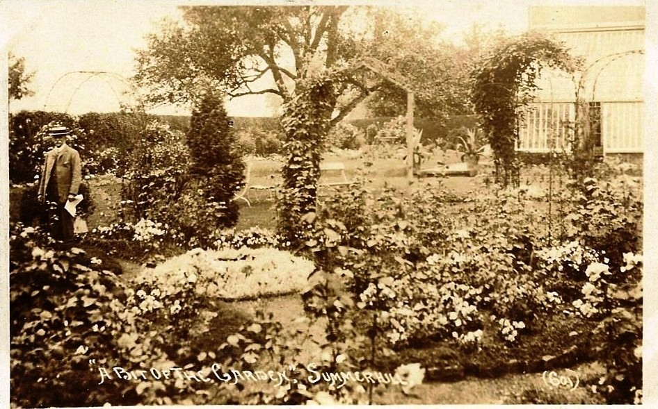
Mr.Henry Slingsby and his magnificent garden. Summerhill House. Pity this is not a colour photo.
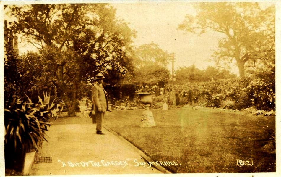
In the beautiful garden of Summerhill House which once stood in Hinckley Road. At one time most of the houses on the left hand side of Hinckley Road going out of Nuneaton were large mansions and this was one of them.
Horestone Grange
An enlarged section of this 18th century map showing Nuneaton church and "Horeston Grange" in the fields beyond the town.
The only known image of the original Horestone Grange. This was the original manor house of Nuneaton dating back to the 9th century. It was called Horestone because it was built of "grey stone" from the Attleborough stone quarries nearby. In the 15th century it was owned by the Mallory family one of several estates they had. In 1648 it was purchased by the Stratford family who were then the second wealthiest family in England with huge estates in the Cotswolds, and they were extending their properties into Warwickshire. The Stratfords purchased Bretts Hall, Ansley Hall and the Merevale Estate. Horestone continued in their possession until it burnt down in rather mysterious circumstances in the 18th century. (see Haunted Nuneaton). The Midland Railway completed the demolition when their new line connectiong from Abbey Street to Midland Junction cut through the remains of the derelict grange and the only things left were the moats. The grey stone was robbed out by the local population because cut stone was a valuable commodity in the 18th century used for building new houses and walls in the area. The moats in turn silted up, and after the railways were grouped in 1923 several truck loads of bone china emblazoned with the London & North Western Railway's crest were dumped in one of the moats as the new railway regime cleared out the old station dining rooms.
The Stratford's incidentally left Horestone by the late 1680's and it was converted into a woollen mill and tenanted at that time by a Charles Beale. One of these Stratfords, or possibly his tenants was deemed by the local population a bit "odd", and the former name of Wheat Street was "Oddaways Lane" from this perception of the resident of the dark and gloomy old grange across the fields beyond the town. It is perhaps not surprising that there are various old wives tales about Horestone Grange. Whether there is any tincture of truth in them at this distance in time is hard to tell. But in the 19th century when collective memories were a little fresher the tales that surrounded Horestone Grange were very odd indeed. Its all gone now as the former country estate with its ancient grange at the heart is now a housing estate on the outer fringes of Nuneaton. Most people are oblivious to the origins of the name.

The official London & North Western Railway track plan and section shows the configuration of the railway lines as they swept through the remains of Horestone Grange in 1864.
The complex moat system is well illustrated in this view and it can be seen that the main house was thoroughly destroyed by the time the railway was completed. It seems likely though that before the civil engineers started setting out the line there was not much left other than a few Attleborough stone walls. The two side moats were used to corrall livestock in the winter when they were brought in to the grange during the bad weather. A couple of stone barns remained at that date but they have gone now. As you can see the land was owned by the Stratford Dugdales when it was sold to the railway company. The track to the left heads towards Hinckley. The track going off to the left (upper) was the loop line which went over the top of the Trent Valley station and headed towards Birmingham via Abbey Street station. There are two sets of tracks straight ahead. One pair (the two topmost) headed along the course of the line as it is today. the lower pair was the loop line which formerly ran at the back of Nuneaton loco shed and headed towards Coventry. This set of tracks had a very brief life as a through route, as although a connection was put in at the Coventry end it was little if ever used and the connection taken out quite early. Probably in the 1880's as it does not appear on the early Ordnance Survey maps.

Horestone Grange from the air. Before Horestone Grange estate was built. The site of the manor house is off the picture to the left. The St. Nic(h)olas Park estate is on the right. The Midland Railway branch from Midland Junction to Abbey Junction sweeps around the top left hand corner. (Picked out with trees). North Warwickshire college is the modern building in the centre of the picture. Note that the triangular field formation in this "before" photo is replicated in the one below in reverse and this provides a datum for the old and new character of the area.
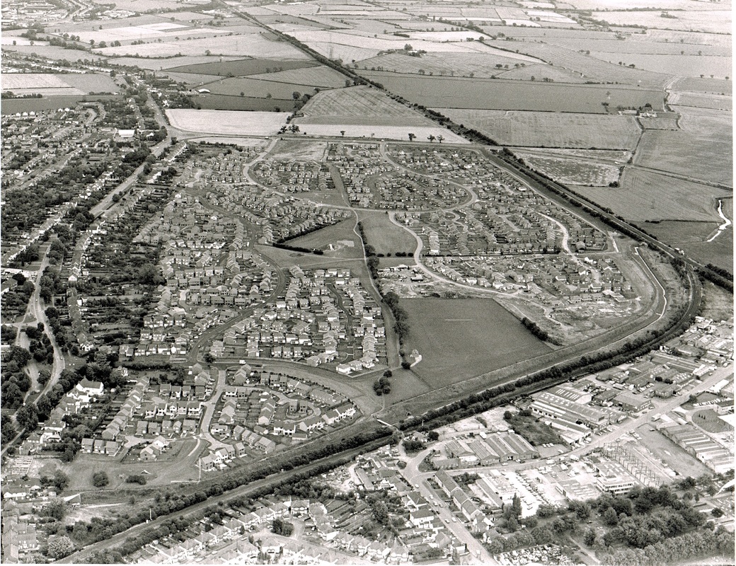
Horestone Grange from the air. The old Manor House known as "Horestone Grange" stood exactly where the railway line coming in from the left met the main Nuneaton to Leicester line that heads northwards at the junction on the extreme right of this picture. No sign of the Grange remains above ground, and you are hard pressed to identify the moats these days. Horestone Grange generated a lot of fear and dread amongst Nuneaton townspeople back in the 18th & 19th century, and gave rise to tales of hauntings. It was also said that the Midland Junction signal box which stood at the junction itself and on the top of the old grange was also haunted. Although in this case the ghost was said to be of a former signalman who was forever "on duty" at his post. Although when the loop line in the bottom of the picture was closed the Midland Junction box was removed from the junction and the old signalman is probably mooching around the area with his hands in his pockets for want of something to do.
King Edward Road (formerly Peacock Lane)

The Beamish family in their house in King Edward Road. Long since demolished (or possibly blown down by the Luftwaffe in WW2) (Margaret Beamish)
Leicester Road

Hinckley Road railway bridge leading into Leicester Road beyond. Before WW1. The steel over bridge has since been replaced. The bridge carried the Midland Railway loop line between Midland Junction and Abbey Junction to take MR trains direct from Leicester to their own station at Nuneaton Abbey Street station.
(Horace Bull, Ruby Atkins Collection)

The Junction of Hinckley Road and Leicester Road before 1908.
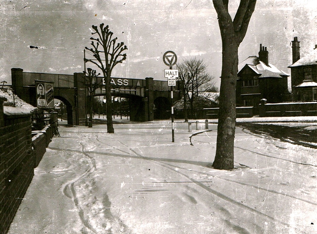
A wintry view from Old Hinckley Road to Leicester Road with the iconic railway bridge one day in the 1950's. (Courtesy Alan Cook, Ron Powell)
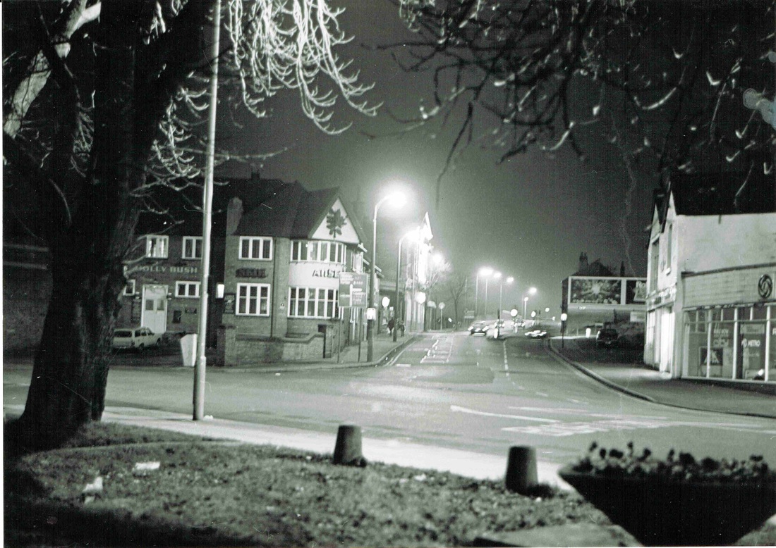
Looking up Leicester Road from Bond Gate towards the railway bridge. Hollybush pub on the left in the 60's. (Reg. Bull)
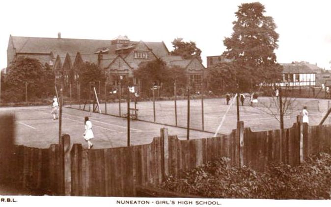

Vints Theatre on Leicester Road.
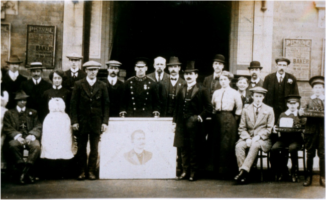
This may have been for the opening of the Empire or Vints theatre on Leicester Road in 1912.
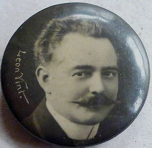
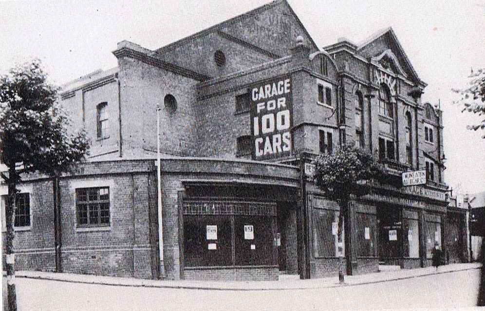
This well known building still stands on Leicester Road today on the corner of Back Street which is on the extreme left of the picture. It was opened in 1910 as the Empire Theatre with a capacity of 4000 but closed as a theatre in 1917 due to lack of custom during WW1.
Leicester Road bridge is rebuilt in connection with electrification on the Trent Valley main line which it crosses below. This view was taken on Sunday morning, 28th October 1962. The workmen are having the day off. The opportunity has been taken to widen the bridge as well to a dual carriageway. (Geoff Edmands ref: 2116 1/25:F.7)
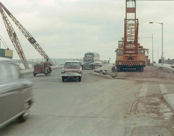
Leicester Road railway bridge was rebuilt as a dual carriageway and raised in connection with electrification work on the Trent Valley main line and the work can be seen nearing completion on Sunday, 28th October 1962. The crane that had been used for lifting in the concrete beams supporting the bridge deck can be seen as well as the once familiar crane on the left hand side once used by Nuneaton Timber Co. Ltd for lifting large trees when raw timber was processed at the timber yard they owned in Regent Street. There is a fine selection of period cars travelling over the left hand carriageway in both directions as the new stretch of road over the bridge had not been completed. (Geoff Edmands)
Manor Court Road

Nuneaton Baptist Church was established in 1831 and for the first nine years was housed in an ordinary house in the Abbey Green area. In 1840 it removed to the old Samaritan chapel on Midland Road. In 1875 it removed again to the former "Gauze Hall" public house formerly a ribbon warehouse in Abbey Street, on the corner of Meadow Street. The Baptist church we see here was opened in 1900.
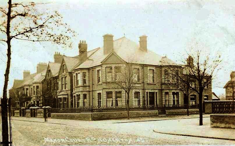
Manor Court Road c.1910. Development along this road started in 1878 when the former narrow track was widened to 30'0".
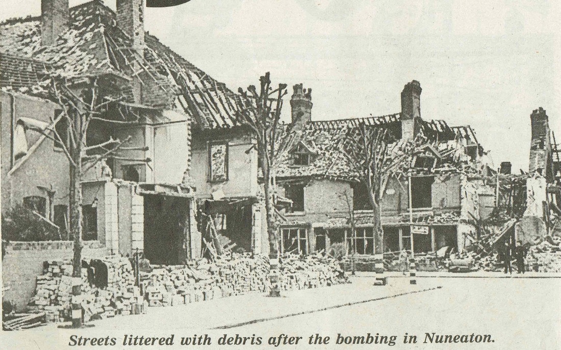
This is the result of bombing in the Manor Court Road area. Manor Court Road where the policemen are standing, although this photo was obviously taken some time afterwards as bricks are stacked and the debris cleared up. Note how the trees are painted with white bands to prevent people walking into them in the blackout.
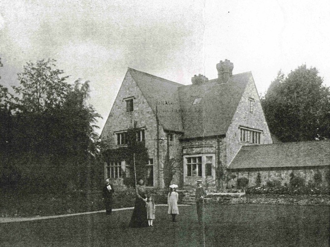
Manor Court Road Vicarage for the vicar of St. Mary's Abbey Church. 1904. (Reg. Rowley Collection)
Nuneaton & Bedworth Borough Council have produced an excellent publication on the history of the Abbey Conservation Area which incorporates the history of the fine buildings in Manor Court Road and surrounding streets:
| The Abbey Conservation Area |
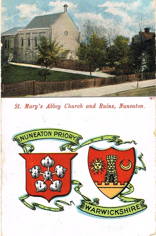
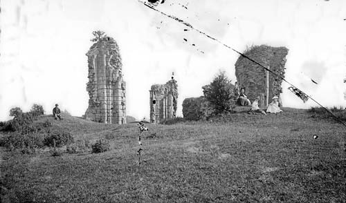
Nuneaton Abbey Ruins before St. Mary's Abbey Church was built utilising some of the old stonework. This photo probably dates from the 1860's. The old ruins look to be a popular picnic spot for Nuneaton folk.
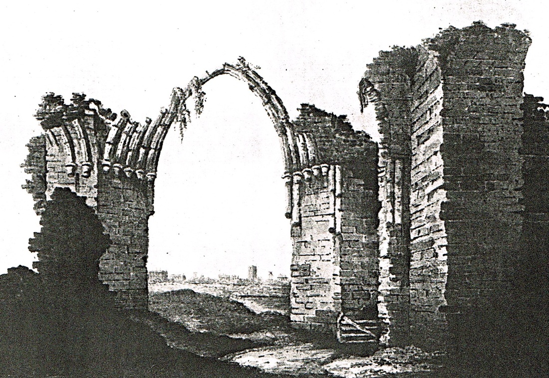
This print is dated from the 1820's and shows the Nuneaton Abbey Ruins at their most picturesque. The reason that the Abbey fell into such disrepair was that local people used the stonework as a convenient source of ready cut stone work, and made off with it to build new houses, garden walls, or repairs to their homes. As a result over 400 years much of the stone was recycled into the houses in Nuneaton town. When old properties were demolished architectural stonework from the Abbey was frequently found, in fact in the 19th century it is reported that two entire properties in Abbey Street were entirely built from stone quarried from the Abbey ruins.
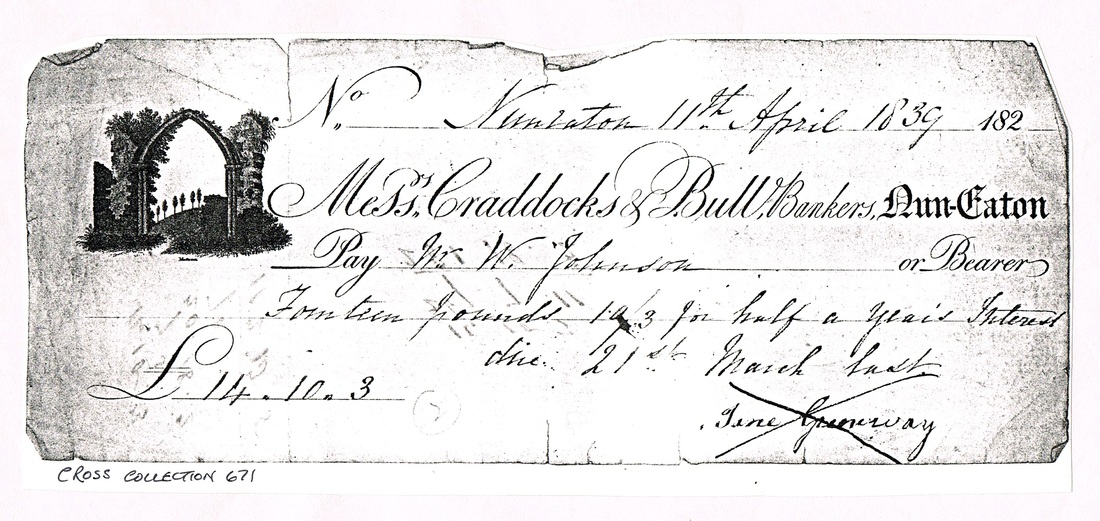
Nuneaton people were proud of their Abbey ruins. To such an extent that local bankers, Craddock & Bull used an image of the ruins on their cheques.
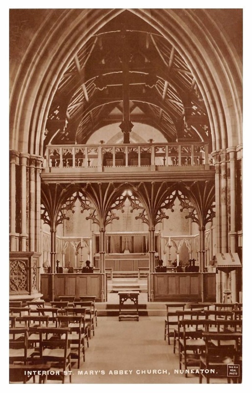

The garden of the Manor Court Residential Home (once the home of Reginald Stanley) is a timeless oasis taking us back to how Nuneaton was in the 12th century. The old Wash Brook meanders its course through the garden as it has done unchanged for centuries. (Peter Lee)
The garden at Manor Court. (Peter Lee)
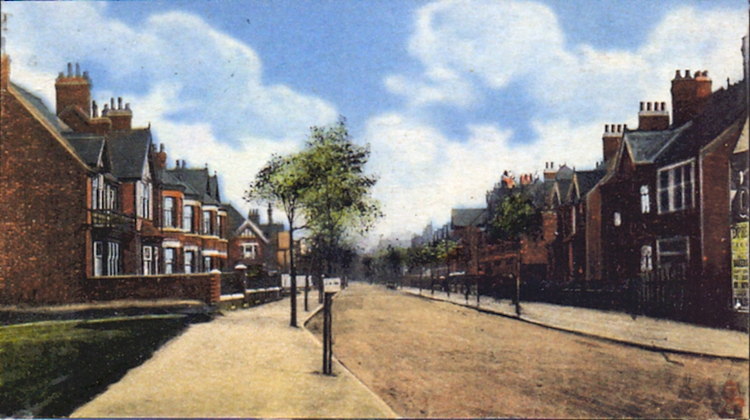
Manor Court Road from the Queens Road end. Before WW1. (Glenn Noon Collection)
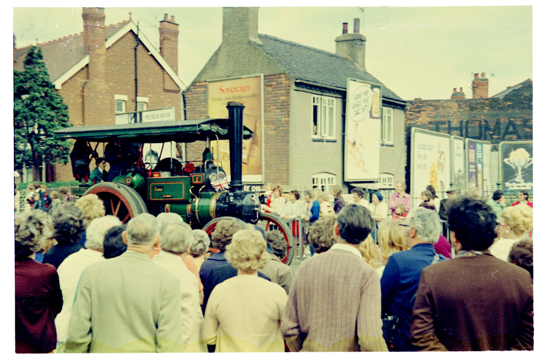
The corner of Manor Court Road and Queens Road looking towards Queens Road one Carnival Day in the 1970's with a fine traction engine in the parade.
The cottage in the background is interesting. It is still there in 2013. It must have derived a fair amount of income from advertising companies using its prime position to exhibit their posters. The cottage itself is a remarkable survivor since it follows the alignment of an old sough which used to drain the Haunchwood Colliery into the Wash Brook further down Queens Road. On Nuneaton Borough match days at Manor Park their front garden was full of push bikes. (E.J.Wiltshire, courtesy Colin Yorke)
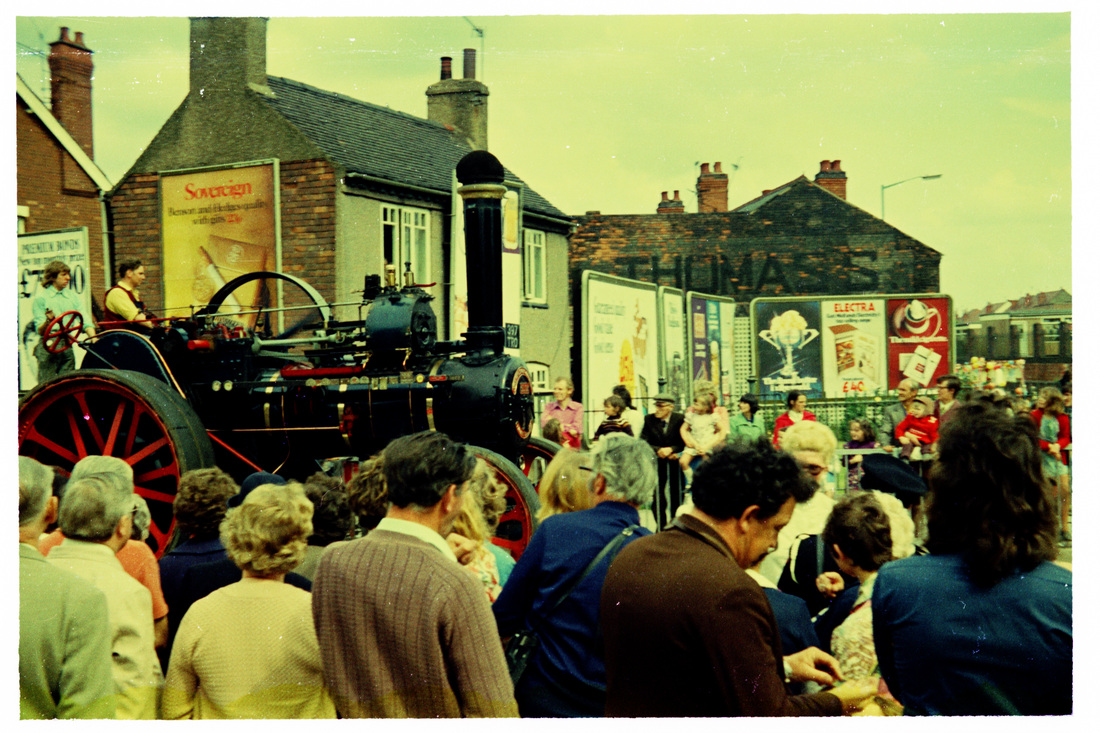
Another view of this location. Queens Road school right in the background. (E.J.Wiltshire, courtesy Colin Yorke)
Meadow Street
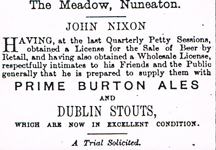
Even Meadow Street had a beer house. John Nixon set up a barrel of beer in his front parlour to entertain his neighbours.
Midland Road (Formerly Navigation Street and New Street)
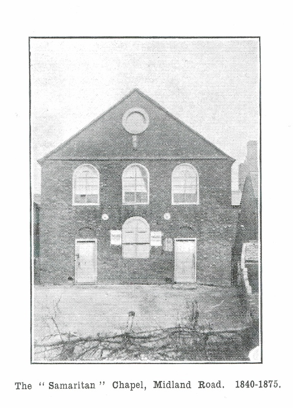
Mill Walk and Mill Lane |
and Mill Gardens |
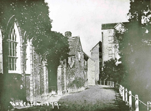
Nuneaton Flour Mill and Mill Walk in 1879. The ecclesiastical looking building on the left was the rear of Smith's Charity School whose frontage stood in the Market Place. The mill in the distance burnt down in 1885 and was replaced by the mill we see below. (Reg. Bull Collection, courtesy Ruby Atkins)

Mill Walk c. 1900. (Reg.Bull Collection, Ruby Atkins)

Mill Walk looking towards the Flour Mill and on the right is the Town Hall. (or Council as it was then) on the left is Marks & Spencer. The year is 1969. (Eileen Worthington)
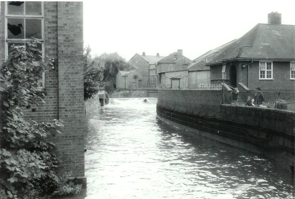
A great view of the River Anker in full spate past the Mill and the weir can be seen in the distance. Municipal toilets on the right. You can also see the old buildings associated with Nuneaton electricity works in the middle of the picture. The council once owned the electricity company but sold it about 1919. Again the year is 1969. (Eileen Worthington)
Mill House replaced Nuneaton Flour Mill and this is the view from the Mill Gardens side 17th May 1977. (Geoff Edmands)
Mill House when newly built and was built as government offices. The view from Mill Walk.
The municipal toilets are on the right.
(Geoff Edmands)
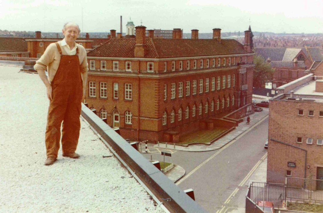
Mr. Corcoran who has taken the trouble to allow Geoff access to the roof of Mill House. We can see the Town Hall on the right and Mill Walk and to the right of Mill House the rear of Nuneaton Congragational Church. 17th May 1977. (Geoff Edmands)

The view from Mill House over the former Electric Works part of which by this time 17.5.77 was used by the council as offices. The electricity works had once belonged to the local council but was sold in the 1920's. Above the roof to the right can be seen the back of the car park and council yard and just above that the "Harcourt" pub in Princes Street. The new ring road had not been put through at this stage but part of Princes Street has already been demolished ready. The Maternity block of George Eliot Hospital can be seen on the horizon together with the George Eliot Hospital boiler chimney. (Geoff Edmands)
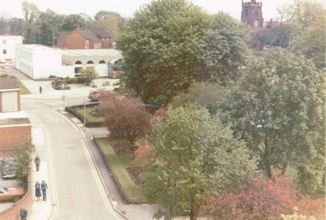
Mill Walk from Mill House looking towards Nuneaton Library. The Nuneaton parish church on the right. Nuneaton Parish Hall stands out above the library. (Geoff Edmands)
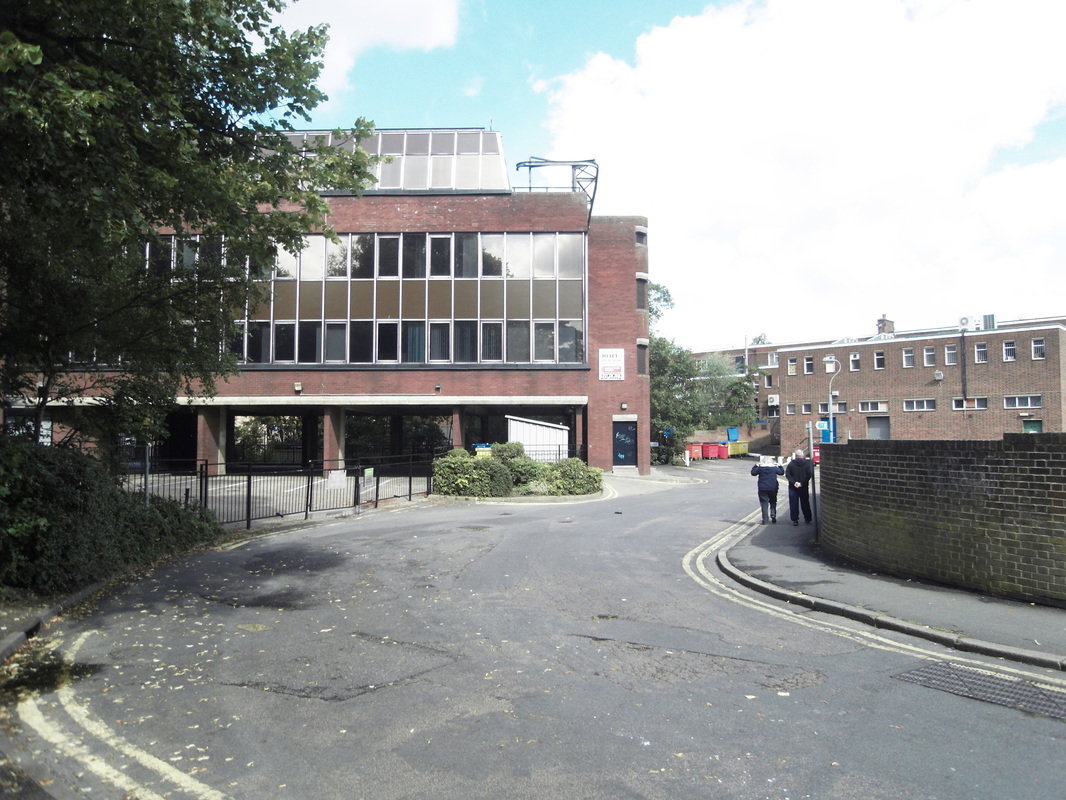
Mill House 2010, Mill Walk. (Gavin Metcalfe)
Mount Street Passage
Mount Street Passage 2010. (Gavin Metcalfe)
Newdegate Square (formerly Bye Corner)

Mr. Lester's House in Newdegate Square. This was demolished in the 1930's to make way for the extension of J.C.Smiths which is the front entrance to Debenhams today.
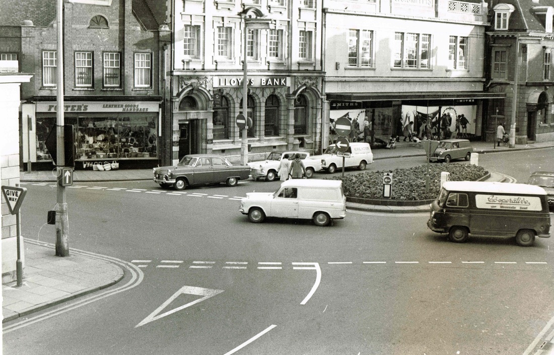
In contrast to the view above. This is a view of Newdigate Square c. 1968 with a good selection of period vehicles and J.C.Smith's frontage.
Newdegate Street
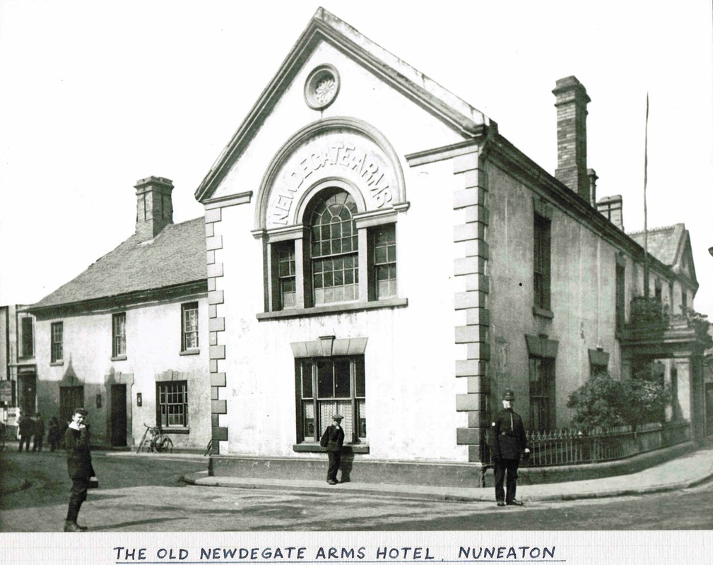
The Newdigate Arms Hotel was a hotch potch of old buildings hiding behind this smart frontage. (Reg. Bull Collection, courtesy Ruby Atkins)

Newdegate Square before 1914 with the former Midland Bank (latterly HSBC to the right) The hotel stood where George Eliot's statue is today and made this junction quite cramped as most of the entrances to the centre of Nuneaton were in the days before the motor vehicle. (Alan Cook Collection)
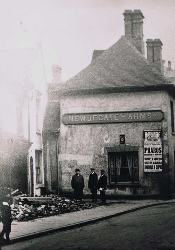
The Newdegate Arms just prior to demolition. Local worthies are inspecting demolition work in adjacent properties in Back Street which had stonework robbed out from the Abbey in their walls. The new Newdegate Arms will be built at the rear of these premises by Mr. Lilley. The local Borough council paid him to remove his hotel in order to obtain a wider road at this point. The cost of redevelopment of the Newdegate Arms site In 1914 was given as £8250 but it was badly effected by the First World War.
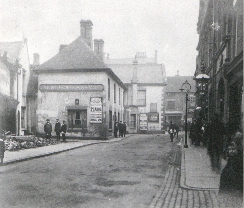
The above view is the entire photo of the enlarged view above. The cameraman is something of a novelty as this carefully posed shot is taken.
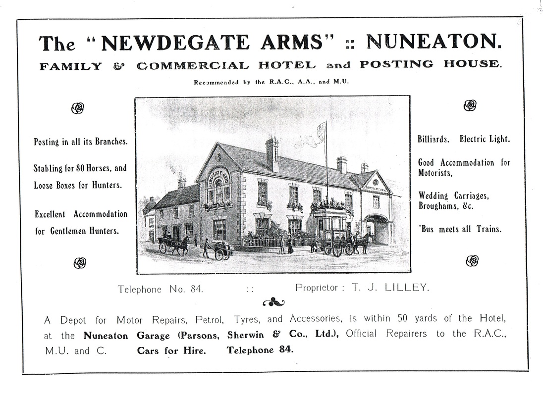
The hotel was kept for many years by Mr. T.J. (Tuddy) Lilley who died in 1921 aged 59.

The yard at the rear of the Newdegate Arms reflects building styles going back to the 15th century when the first part of the hotel was erected.
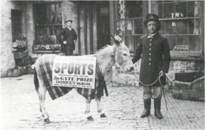
This looks to be the "Booby Prize" - a valueless donkey.
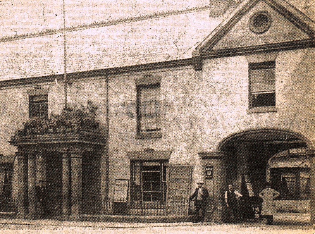
The entrance to the courtyard at the rear of the old Newdegate Arms Hotel which dated back to the 15th century. The hotel had been used for centuries as a court house and it is thought that here on 23rd August 1451 Sir Thomas Malory (1405-1471) was arraigned for theft, ambush, extortion, robbery, stealing horses, injury, a series of crimes which sent him from Nuneaton to Marshalsea prison in London. Although from a landed aristocratic family who owned estates at Newbold Revel, near Rugby and Horestone Grange (at Nuneaton where we suspect he was holed up when he was apprehended) and brought before the court at the Newdegate Arms. Sir Thomas Malory was famous, of course, for writing in prison "Mort d' Arthur".
In the 19th century the principle sports facility in Nuneaton was the Newdegate Arms Sports Ground.

John Bosworth (Jacko) the Nuneaton town crier before WW1 in his uniform given to him by Joseph Pipe, deputy captain of the Fire Brigade and landlord of the Railway Tavern which was originally used by Mr. Pipe as a costume for a play at the "Blood Hut" theatre in Newdigate Street as a character called Parson Unwin. In the background the domes of the Prince of Wales Theatre (later known as the Hippodrome) can be seen.
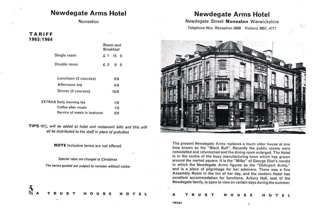
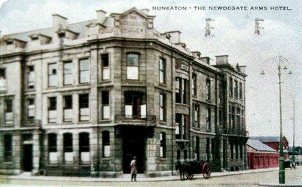
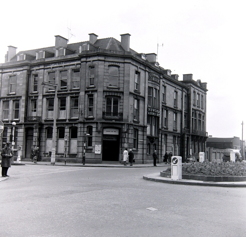
The Newdigate Arms Hotel just before demolition in the early 1960's. (Colin Yorke)
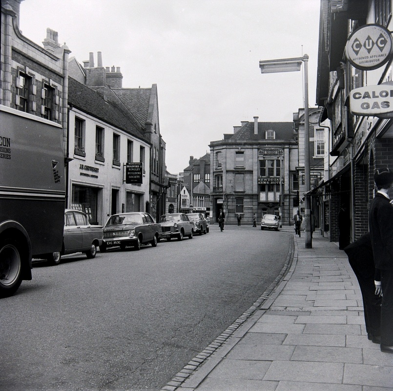
Newdegate Street probably c. 1960. The Newdegate Arms Hotel in the centre of the photo. The Calor Gas sign is outside Parsons & Sherwins shop. (Colin Yorke)
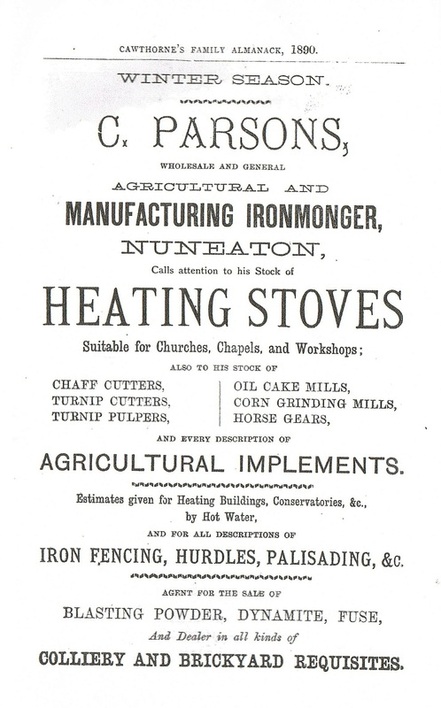
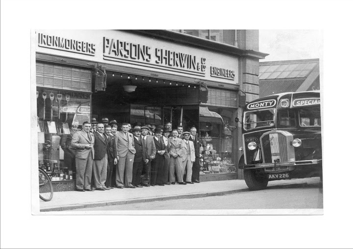
A staff outing from Parsons & Sherwins, on an old Monty's bus (see our road transport - bus section for history of this bus). But what was the occasion. (Colin Yorke)
Newtown Road
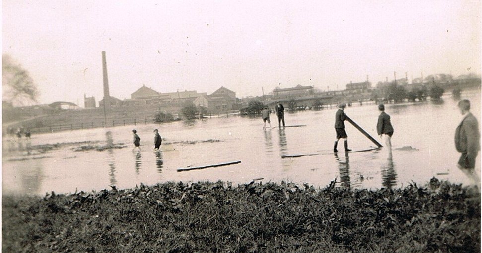
The great flood of 1932 seen from the water meadows at the rear of Biddles factory (I think). You can see two signal boxes on the Trent Valley main line. These would be Nr. 3 box and the down sidings box in Nuneaton goods yard.
Norman Avenue named for Sir Norman Jeffcoate, Emeritus professor of obstetrics and gynaecology at Liverpool University. (1907-1992) a native of Nuneaton.
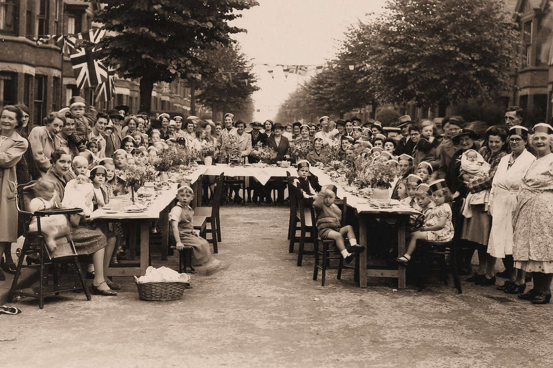
A VE day street party in Norman Avenue. 1945.
Margaret Meredith at 127 Norman Avenue, outside the front gate with Courtaulds Clock in the distance. The clock's chimes so much part of everyday life in this cluster of streets around the mill. (Wendy Boland)
Oaston Road
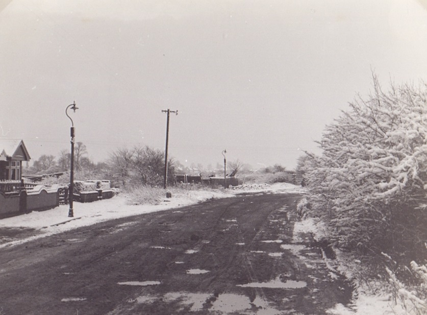
A cold and bleak Oaston Road looking over Horestone fields before any housing development. 1960. (David Gamston).
Pool Bank Street
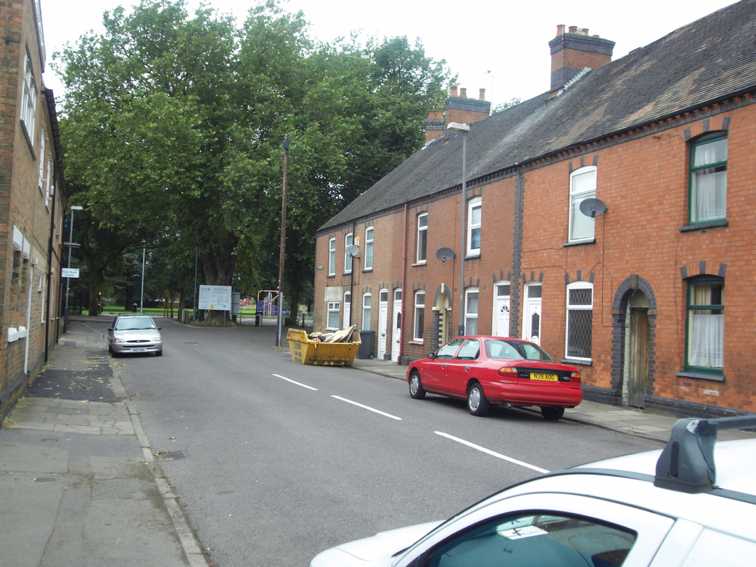
Pool Bank Street 2010. (Gavin Metcalfe)
Princes Street
Princes Street c. 1910. The smoking chimney in the distance is at Nuneaton Corporation's electricity works in Coton Road. Princes Street was quite new at this time and one of Nuneaton's best addresses. Just beyond the cyclists is a gateway which led into Slingsby's silk ribbon works. This business was one of the last silk manufacturers in the Nuneaton area having survived the great crash of the 1860's by diversifying into silk banners, medal ribbons and regalia. They continued to trade unjtil about 1948 when they were taken over by Franklins of Coventry.
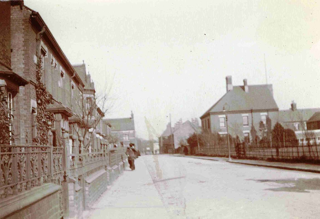
Princes Street before WW1. The building that used to be the Harcourt pub is on the right. Note the complex cast iron railings on the left. These would have been sent for scrap during WW2. (Horace Bull, Ruby Atkins Collection)
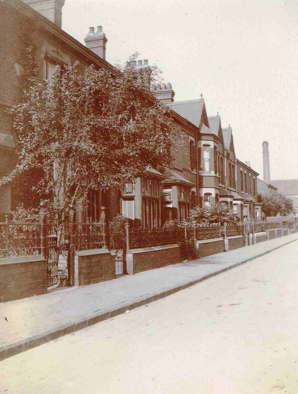
A better view of the ornate frontages of the houses in Princes Street with their elaborate cast iron railings. All cut down for the war effort in WW2 but here beautifying the front gardens of all these pleasant Edwardian villas. At the time one of Nuneaton's best addresses. (Ruby Atkins Collection)
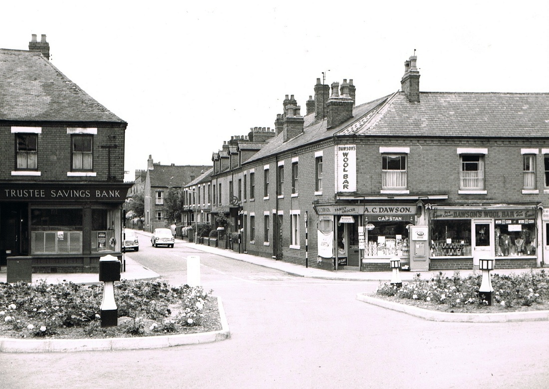
Princes Street at the Coton Road end. All this has been demolished to make way for Nuneaton Ring Road. This was a regular route for your web master who frequented this area of town playing with friends and going to Riversley Park as a kid. I recall one day a pal and I were walking back up Princes Street towards Edward Street when an old lady in a house to the right of the car with the high third floor attic window called to me and asked if my friend and I would run her an errand. She gave us instructions where to go and half a crown and we went and returned with the item she wanted. Can you imagine that today. Asking a kid to run an errand and giving him/her the money and expecting him to return. Back in the 1950's we never thought anything of running an errand for a pensioner. It was expected of us as they were the older generation who we looked up to. And she trusted us to do it knowing that deference existed and no doubt if we had run off with her 2/6d coin our Dad would find out and there would be a good belt round the ear if we did not tell him how come were suddenly flush when we existed on two bob a week pocket money. Not only that it was such a close knit community she would soon find out and we would be for the high jump. Such were the odds stacked against you you did what you were told without any thought otherwise. How society has deteriorated! (Keith Draper)
Queen's Road
Formerly Wash Lane, Gas Street, Arbury Lane, Queen Street and finally Queens Road.
Coggans bakery and cake shop in Queens Road. Coggans was established in 1933 by John Herbert Coggan who was the manager of Yoxalls another famous establishment in Nuneaton. Mr. Coggan came from Birmingham. Bakers, Pastrymen and Confectioners. John had four children one of whom Richard (Dick) was the last to run the business until it closed in Queens Road in 1987. (W.H.Pope courtesy Colin Yorke)
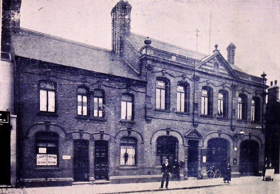
Nuneaton municipal offices, fire station and ladies lavatory which once stood in Queens Road. Most people remember it after it was turned into the library in 1933. Which served the community for 30 years as a lending library. Photo is dated approx. 1900.
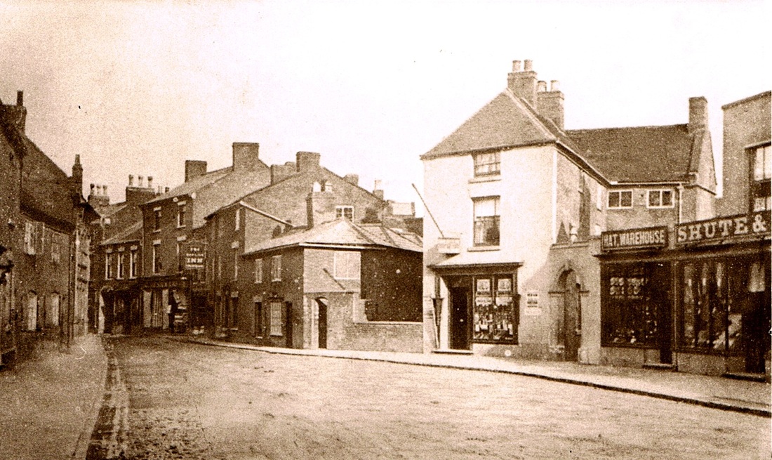
A photograph of Queens Road or Queens Street as it was then called in the 1890's. The low wall in the centre is where the Wash brook, which had been in culvert down the roadway in the foreground broke cover towards the River Anker. The old cottage like Red Lion is to its left (note the Inn sign) and Shute & Co's premises to the right. The whole of this view was altered about 1900.
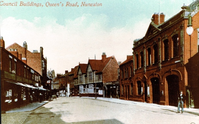
Queens Road c. 1905. The council offices were in the first floor in the buildings on the right. The fire station was below as well as the only Ladies Lavatory in the Nuneaton at the time for public use. We are more familiar with this scene as the building was converted into the local library after demolition of the Carnegie library in Coton Road in 1932/3. The site of the old library was used for the construction of the new Council House. Stratford Street on the left. Stratford Street was built as a thoroughfare in 1851. The gabled building on the right beyond the council offices was the newly erected "Red Lion" public house which replaced a much older building which had stood on the site before. The Market Place is beyond. Queens Road was originally called Wash Lane. Then this section was known as Gas Street, then in the 1880's it was renamed Queen's Street before being called Queen's Road. The Queen in question, of course, was Victoria.
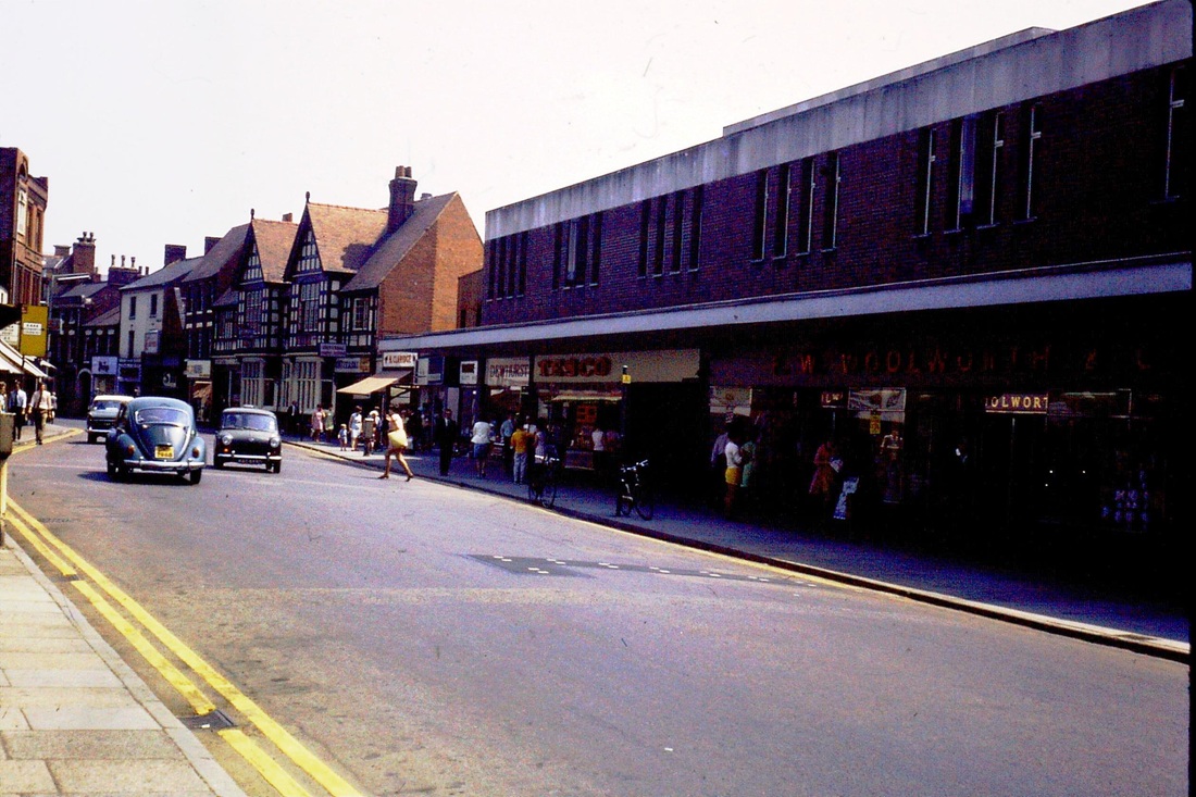
How the scene had changed by the 1960's. This photo was taken from a similar viewpoint as the above picture,
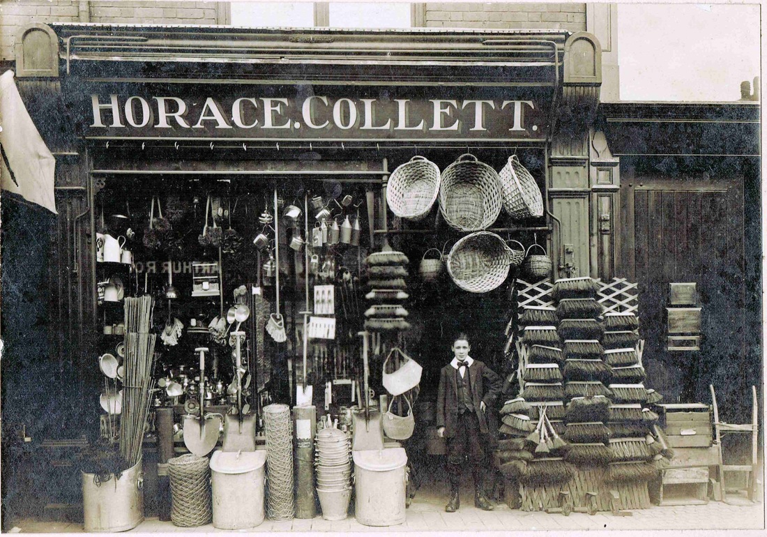
Horace Collett's Ironmongers shop. (Reg. Bull collection, courtesy Ruby Atkins)
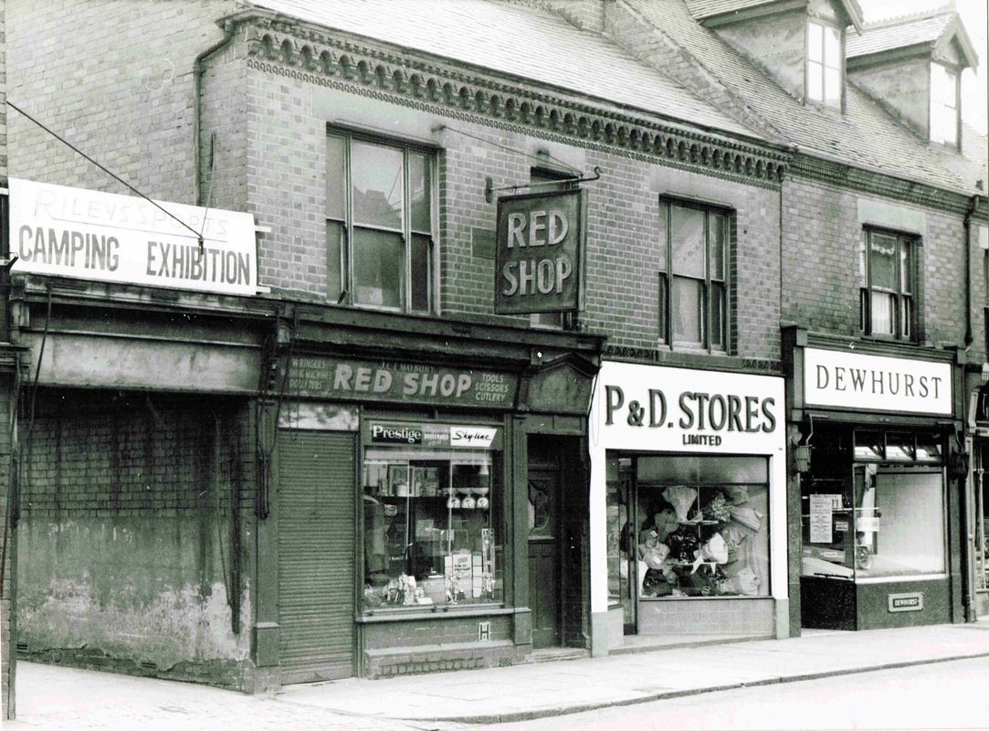
Remember the Red Shop, P&D Stores and Dewhurst's shops in Queens Road. April 1962. All swept away now.
(Reg. Bull, Ruby Atkins Collection)
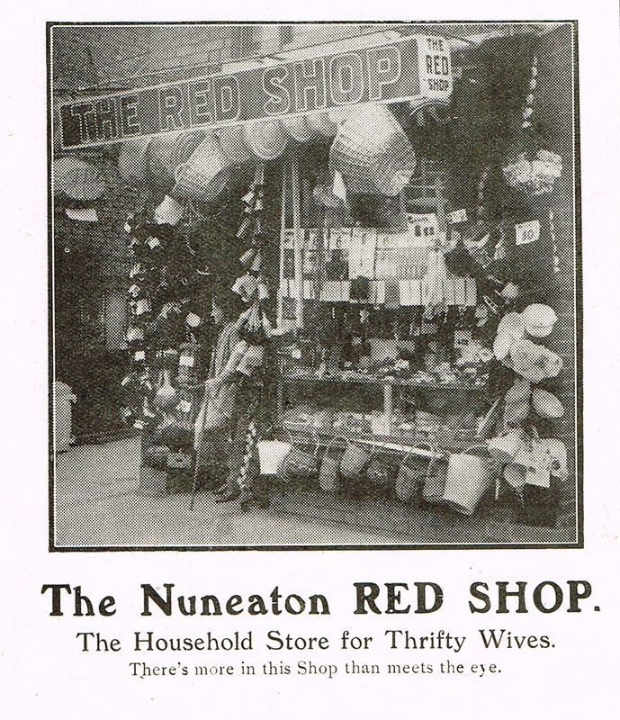
The Red Shop. There was more in this shop than meets the eye. The odour for one. Do I recall a pungent smell of carbolic soap? This was where the ladies of Nuneaton went to purchase their washing equipment, dolly tubs, wash boards, OMO, washing baskets, soap, photo taken in the mid 1920's. (Warwickshire County Graphic)
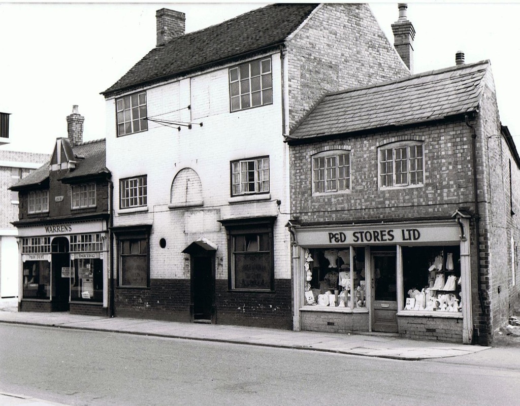
The former George & Dragon pub which was situated where the Rope Walk is today. At the rear of these premises was the original Nuneaton Ropewalk. (Reg. Bull)
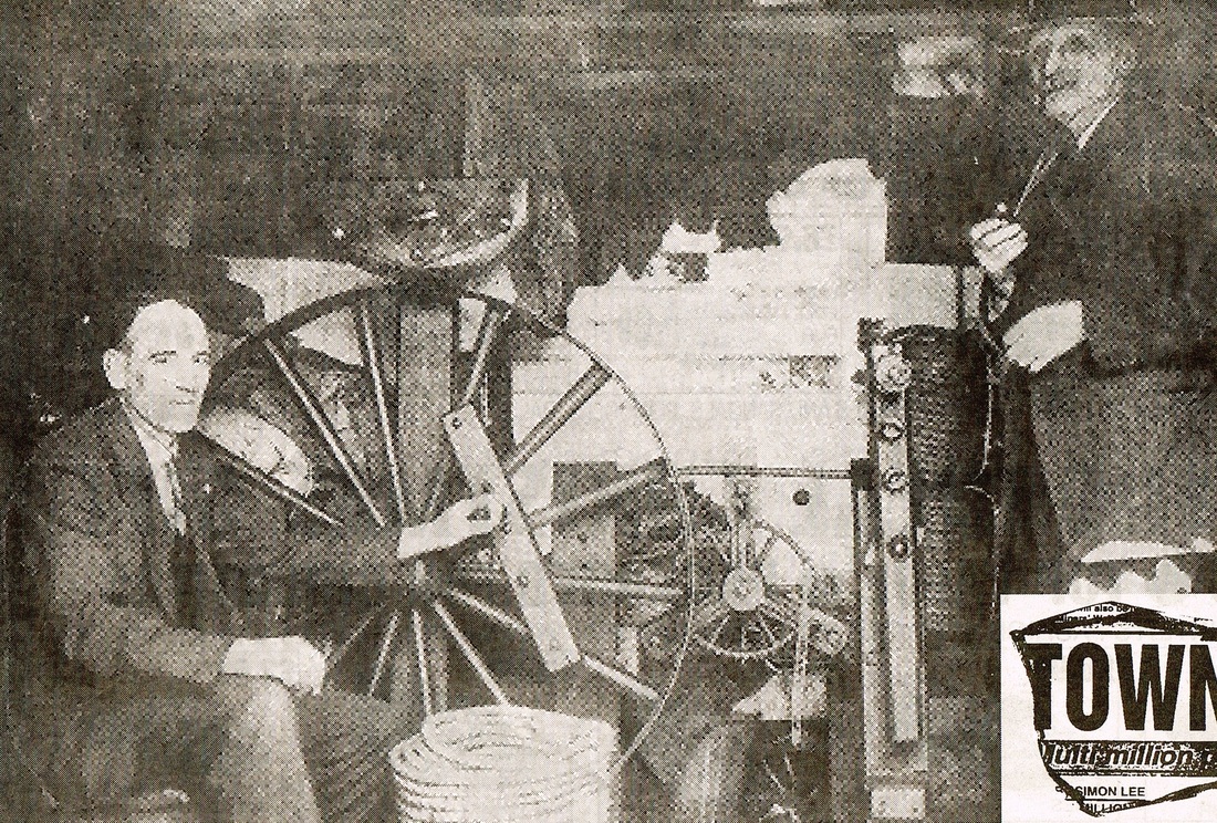
A rather poor print from a newspaper but an important picture nevertheless. It shows Mr. Charles Phillimore - ropemaker - with the gadget he used to produce string, twine and rope for all purposes. He could make thin ropes and strings with this machine or if he had to make big ropes he had to walk along his rope walk with a gadget that intertwined the strands together. Mr. Phillimore did a good trade at a time when many self respecting towns had their own ropemaker. Charles Phillimore is the old gentleman on the right.
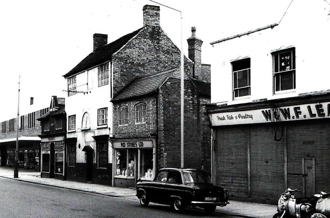

Queens Road about 1972.
(Maurice Billington)
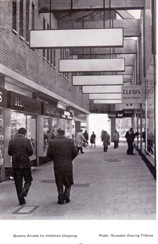
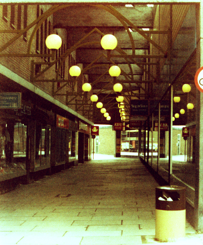
Woolworth's Arcade has been replaced by the Ropewalk. (Geoff Edmands)
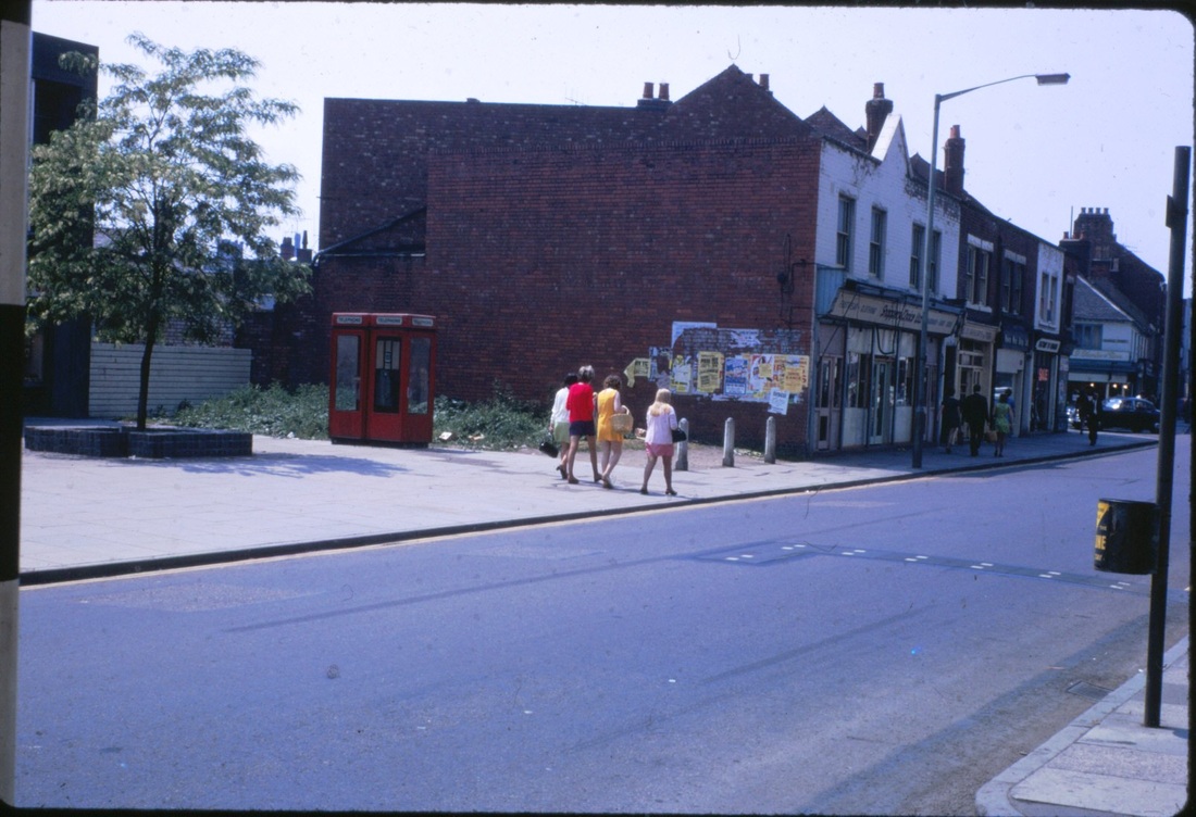
Maurice caught Queens Road in transition in this view. The new block incorporating Woolworths and the new arcade has been built, but the block of old shops on the right leading to Dugdale Street remain. They will not be there much longer. You can see in the nearest shop the iconic business - D. Di Mascios, ice cream parlour. Do you remember what a mecca this place was in the 50's and 60's. On the corner of Dugdale Street was Reg. Hadden's bookshop. Remember old Reg? What a character. The date - sometime in the 70s.
(Maurice Billington)
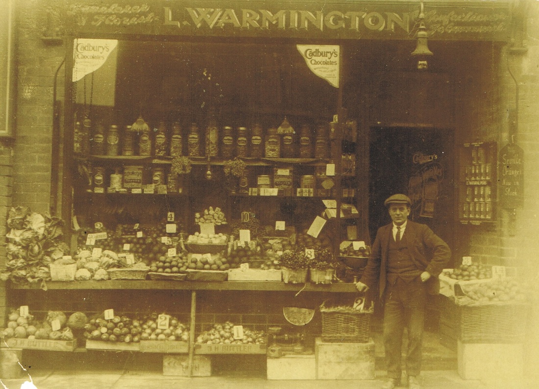
Louis Warmington's grocery shop Queens Road. 1930's probably.
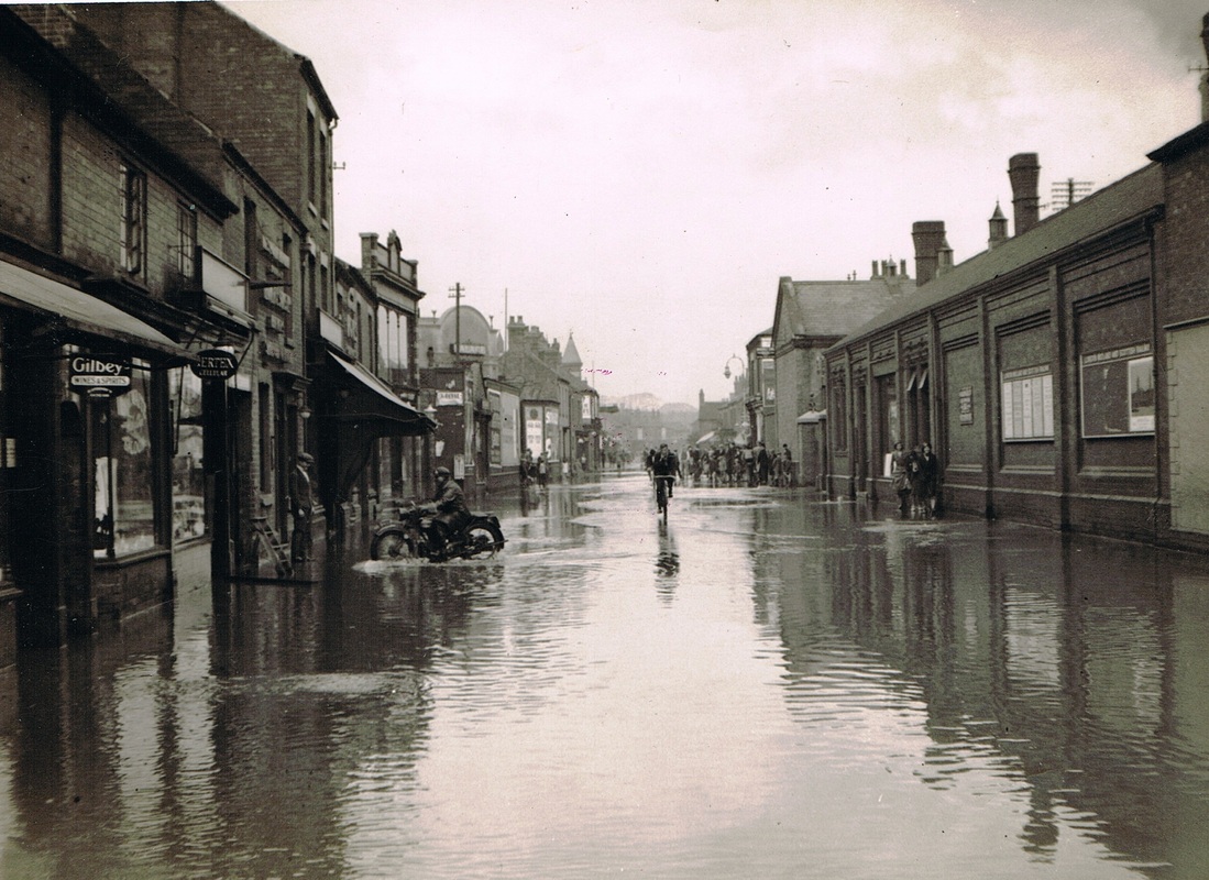
Queens Road during the great flood of 1932. Gas works on the right with the Palace cinema on the left mid way along. Maybury's famous glass fronted emporium visible. I hope he got his furniture upstairs.
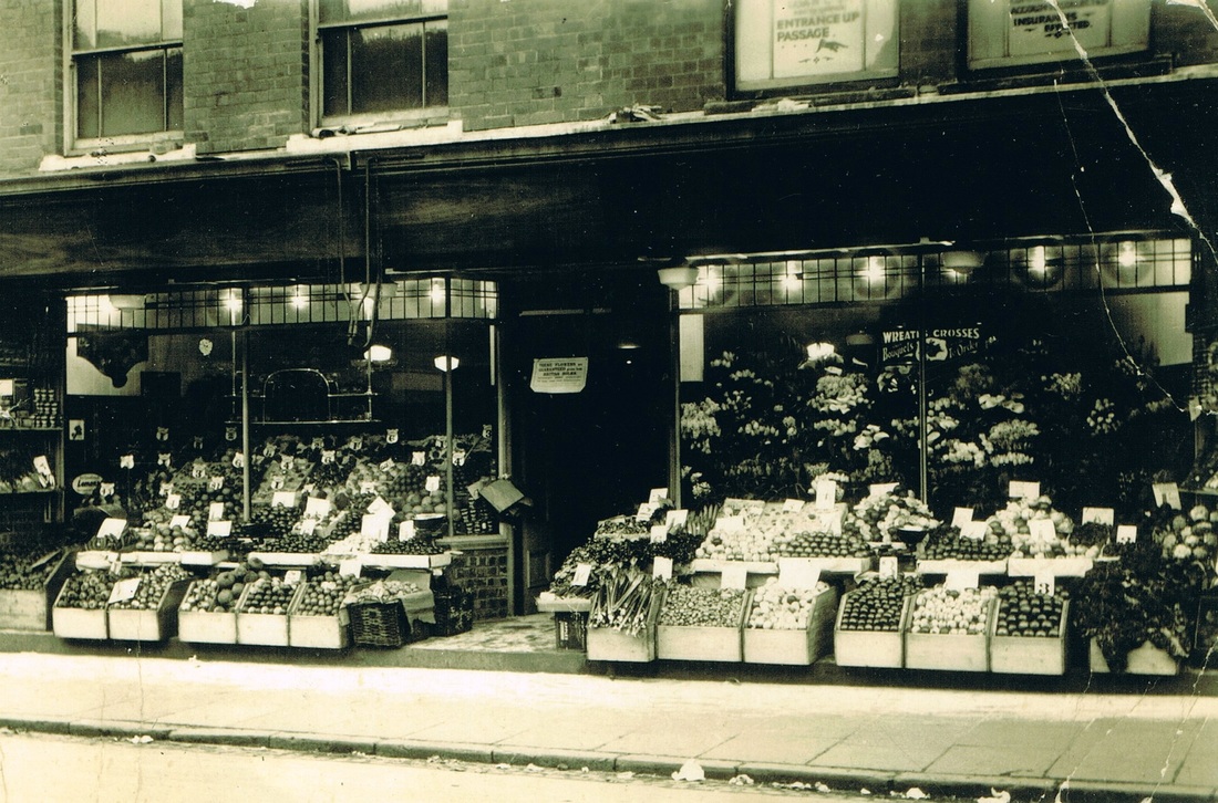
Warmington's fruiterer and grocer, Queens Road 1930's.
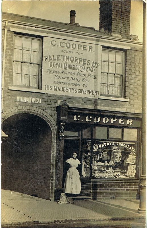
Charles Cooper's shop Queens Road.

Cooper's Bakery.
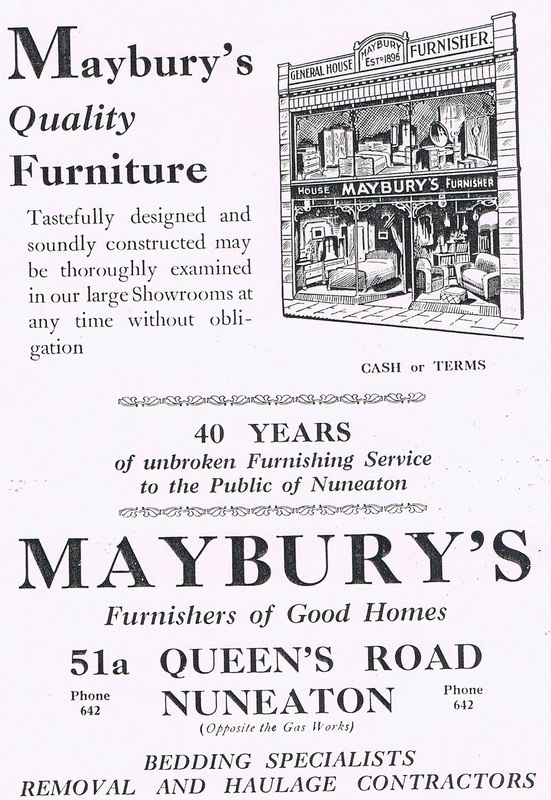
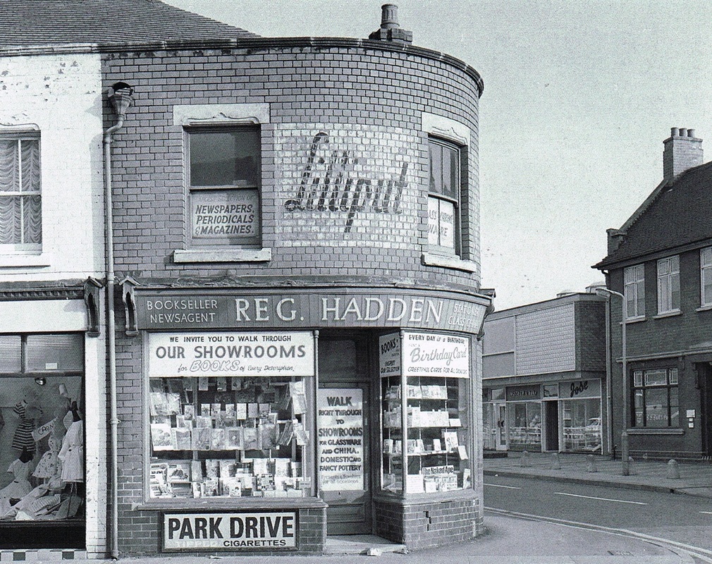
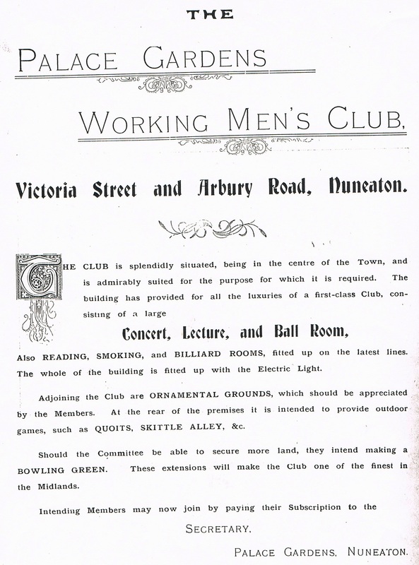
The Palace Gardens Working Men's Club was erected in the 1890's by Annie Wrighton who was the land lady at the Crystal Palace pub (hence the name - Palace"). Whereas she was very successful at the Crystal Palace with her Bohemian Smoke Room which filled up at the week-end she was less successful with her new enterprise the Palace Gardens and very soon the building was turned to other uses. The Palace Gardens was lit by fairy lights. Candles in little glass bottles. The ideal place to take your sweet heart for a carousel on a warm summer evening. The Palace cinema was erected on the site of the Palace Garden as it was figured balmy summer evenings did not figure very often in Nuneaton's weather patterns. Better put a lid on it! So they built a cinema and our local courting couples could kiss and cuddle in the warmth and comfort of a cinema seat.
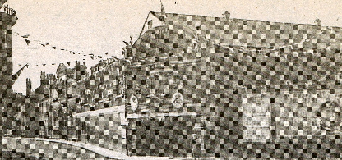
The Palace Cinema looks as though it is dressed with flags and buntings for the Coronation of King George. It appears that Shirley Temple in "Poor Little Rich Girl" is appearing soon. This occupied the site of the Palace Gardens, and the original "Palace" working men's club can be seen on the left along Victoria Street.

Photographed from Norrland Flats Queens Road with the junction of Broad Street on the right and Victoria Street in the foreground. Palace Cinema on the right. (Reg. Bull)
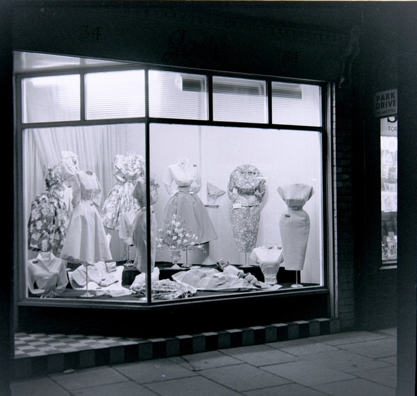
A ladies shop in Queens Road, but which one?
(W.H.Pope, courtesy Colin Yorke)
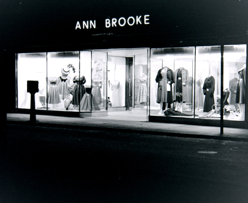
Ann Brooke looks as though she specialised in dresses and gowns for the more mature lady with a fuller figure. (W.H.Pope, courtesy Colin Yorke)
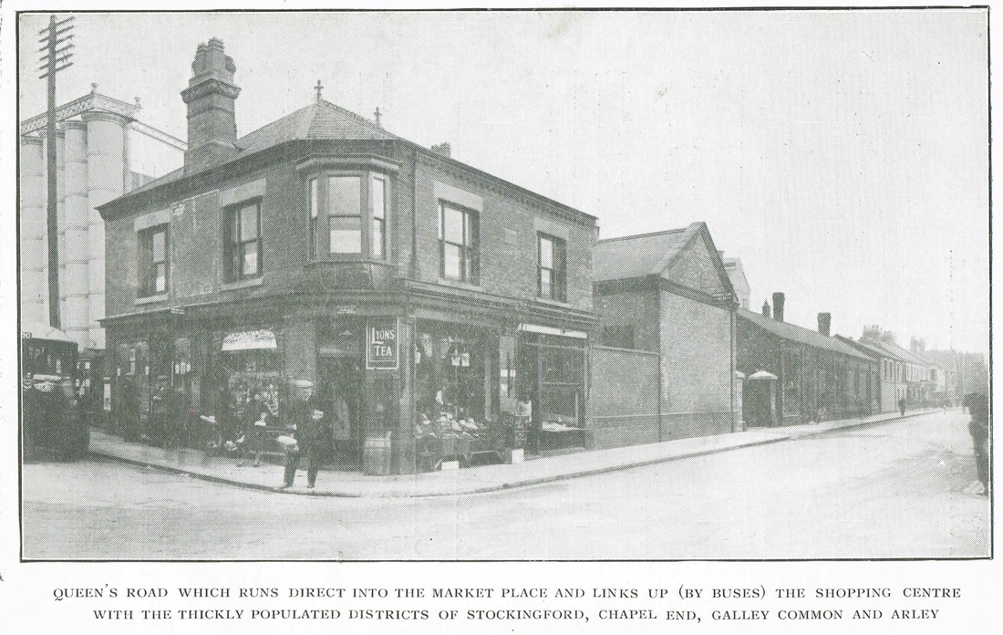
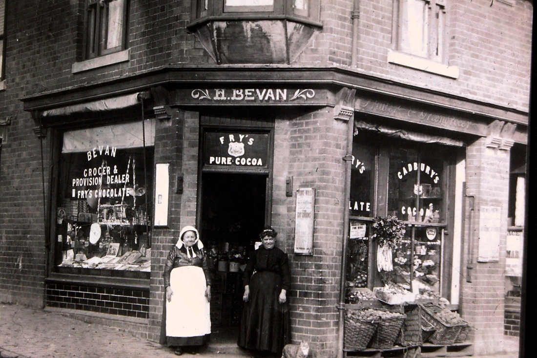
Henry Bevan's shop on the corner of Queens Road and Broad Street to the left. With the gas works behind. A photograph taken around 1910. You can see right inside as well showing the old pot flasks used to supply ginger beer and other soft drinks in the days before plastic containers. The corner shop was a great feature of daily life before the supermarket and Mrs. Bevan would have supplied a small catchment around. Presumably the gas works employees would make good use of her emporium.
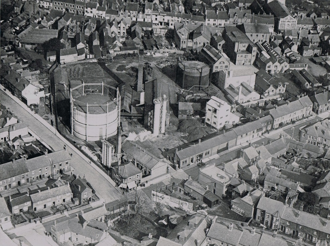
An aerial view of Nuneaton Gas Works taken in 1925. Queens Road left to right bottom of the picture. Broad Street leads off to the left heading towards the top LH corner of the picture. Victoria Street towards the bottom right. Abbey Street runs across the top of the picture. (Nuneaton Gas Works)
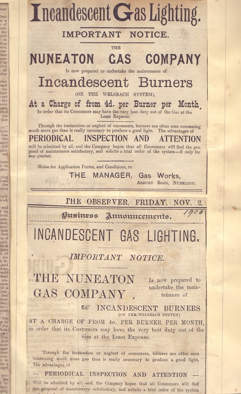
|

|

Queens Road in the 1950's. Stratford street to the left, the old library in the council offices and the fire station right. Looking towards the Market Place. (Fred Phillips Collection)
The Co-Op Hall - Nuneaton's Grand Night Out
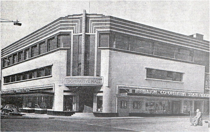
The Co-Op Hall, Nuneaton's favourite dance venue.
(Victor Welland collection)

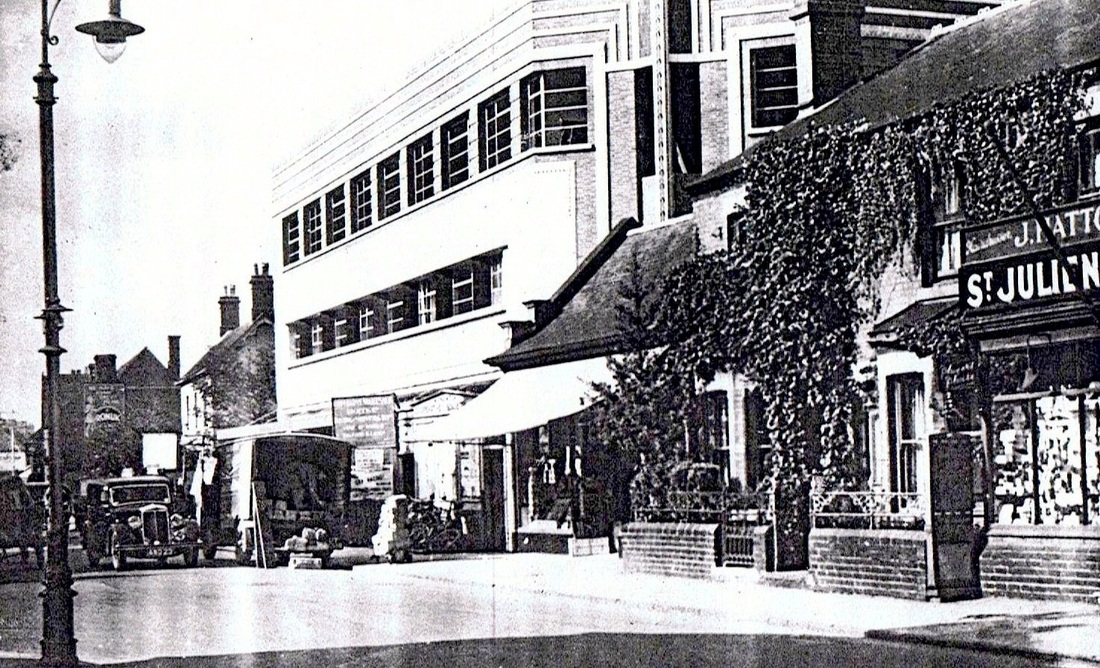
The Co-Op Hall as newly built with the old Co-Op store it replaced shown with the canvas canopy in front. This shop blocked what is now High Street from reaching Queens Road and was demolished shortly after this photo was taken c. 1937. Just a bit beyond the new Co-Op Hall can be seen old properties cleared away in the 1940's and early 50's. The houses and shops to the right were pulled down when the old Co-Op store was demolished and open ground left. (Ella Jebson)
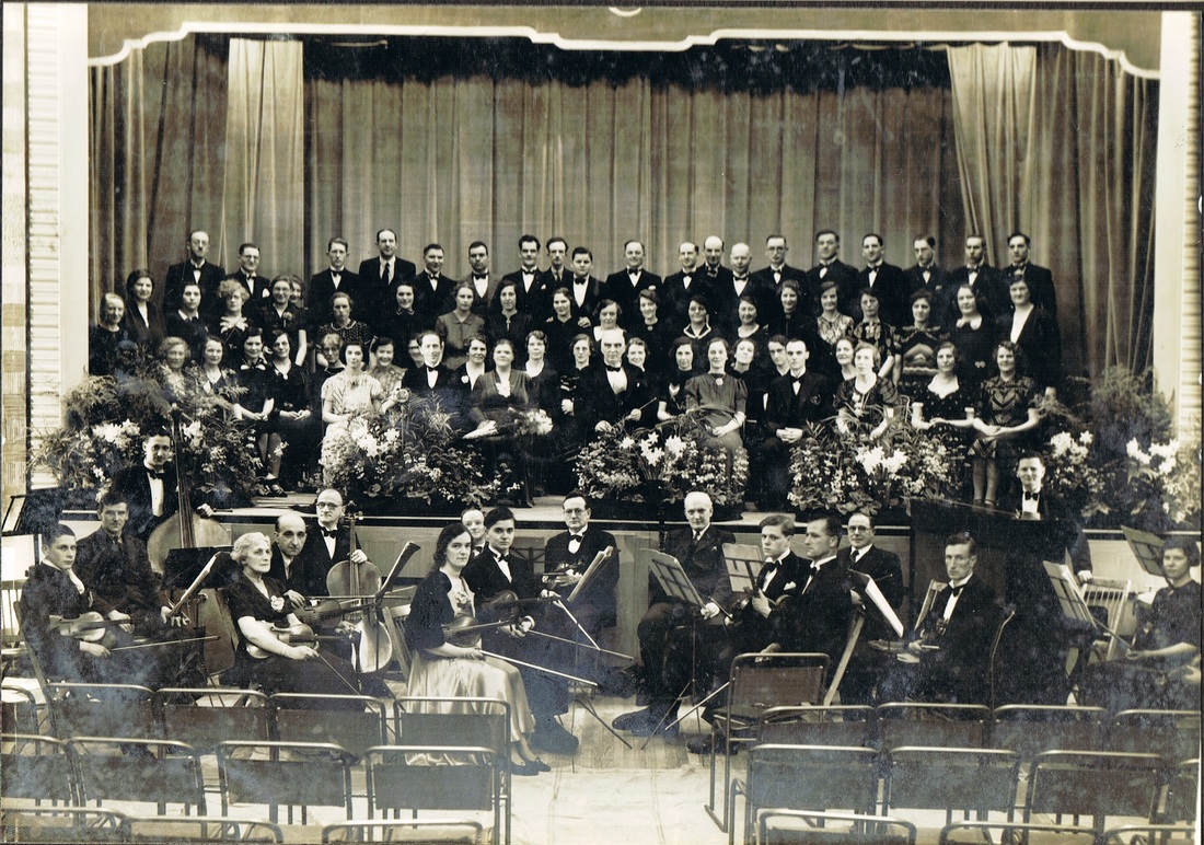
The Co-Op Hall was host to musical soirees every week in the 1937-1966 period. In this view complete with a local orchestra c. 1940's. (Jean Lapworth)
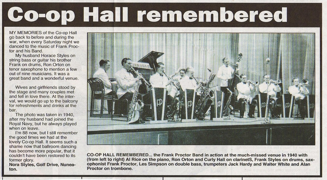
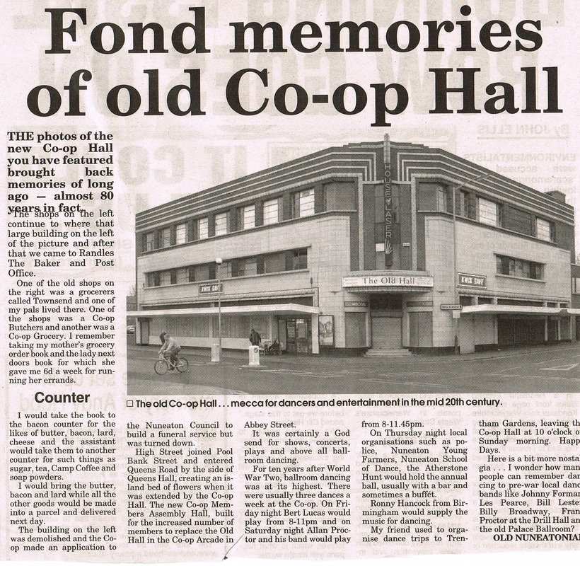
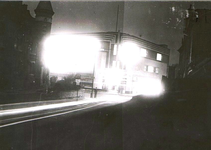
As we will always remember the Co-Op Hall. Brilliantly lit up at night just waiting for lots of boys and girls to descend on it for a great night of entertainment. We can see it here from the bottom of Edward Street with the Primitive Methodist Church (The Prims) on the left. Both of these buildings are now demolished.
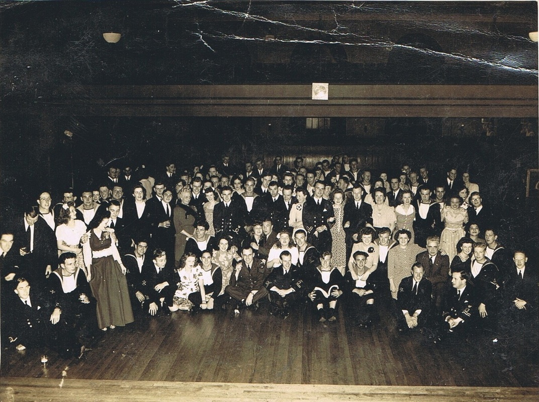
During the 40's and 50's (and this is probably the 50's) the Co-Op hall was full of young people in the services and their partners. This appears to be a Navy occasion.

Dancing at the Co-Op in the 50's.
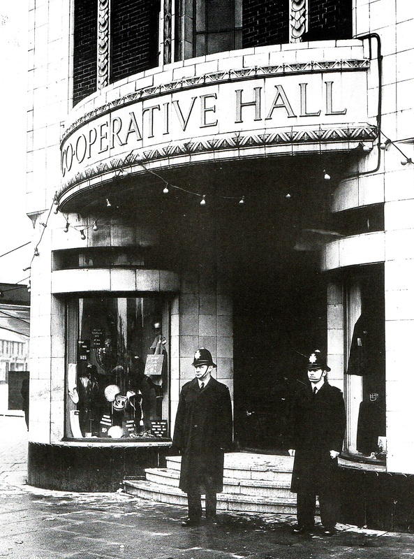
The day after the terrible disaster of the Co-Op Hall when four young people were crushed on the stairs, police were posted on the door as it was for a short time a place under investigation as to why this happened.
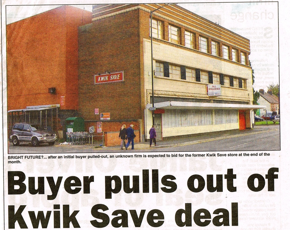
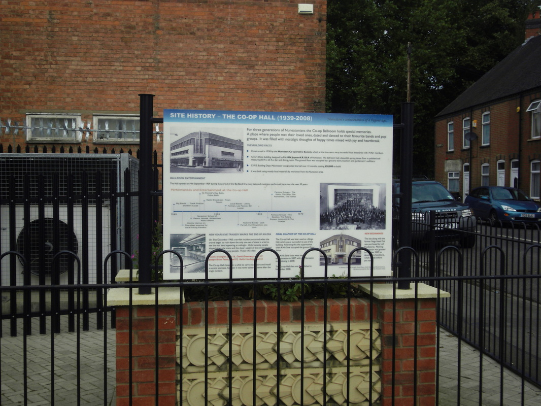
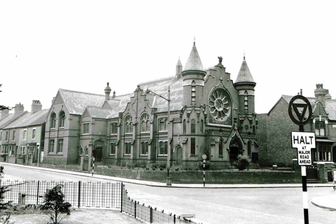
The rather ornate Primitive Methodist Chapel which stood on the corner of Edward street and Queens Road opposite the Co-Op Hall (Reg. Bull, Ruby Atkins Collection)

The Nags Head in Queens Road (Colin Yorke)

Although a poor photograph I felt it important to illustrate a part of Queens Road now almost entirely changed. Thanks to Paul Sawyer who located the picture from the Warwickshire Country Graphic and the photo was taken in 1925 when the Reliable Clothing company's premises was burnt out in a fire which, as you can see, attracted a large crowd. The roadway is unchanged but all the buildings on the right have gone to be replaced by apartments.

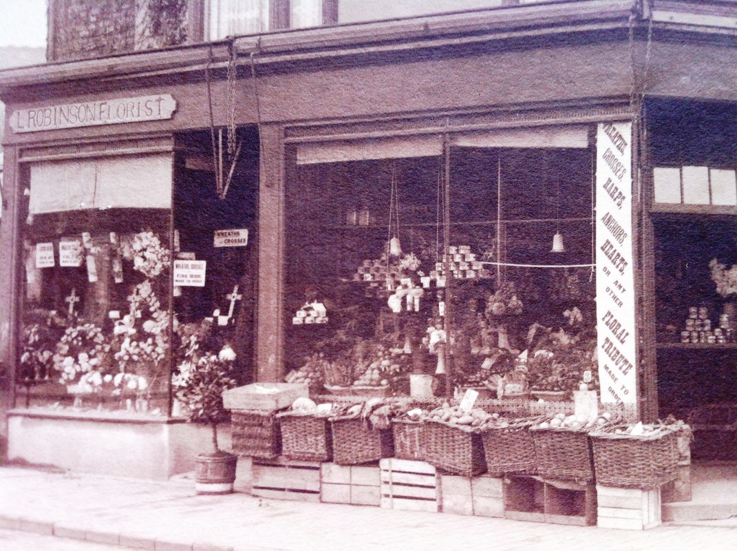
L. Robinson's Florists shop at 265 Queens Road.
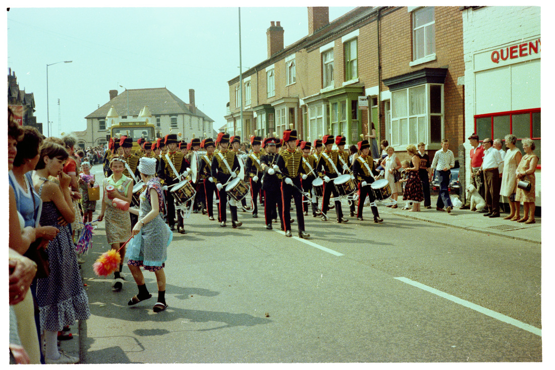
A carnival parade in Queens Road in the 1970's probably. The brightly painted garage on the right has gone today and at the time of writing the site is derelict. (Colin Yorke)
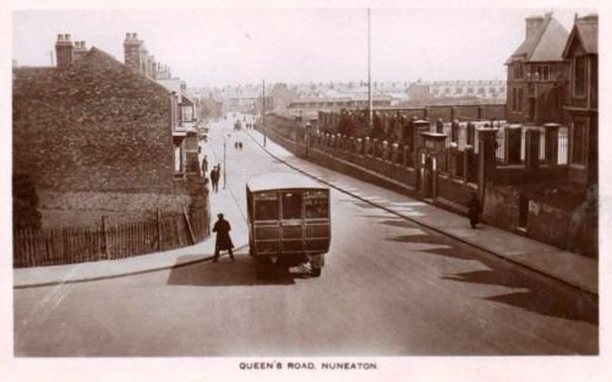
Queens Road looking towards Nuneaton town centre c. 1920. Queens Road School on the right. Could that be one of Kightley's buses which plied the Stockingford-Nuneaton route for many years, or an early Midland Red.
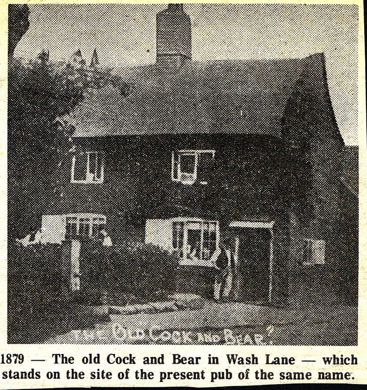
The old Cock & Bear which stood at the top of Quuens Road on the corner of Manor Court Road. The site of the pub was immediately to the rear of the present premises which is I understand being converted into a shop.
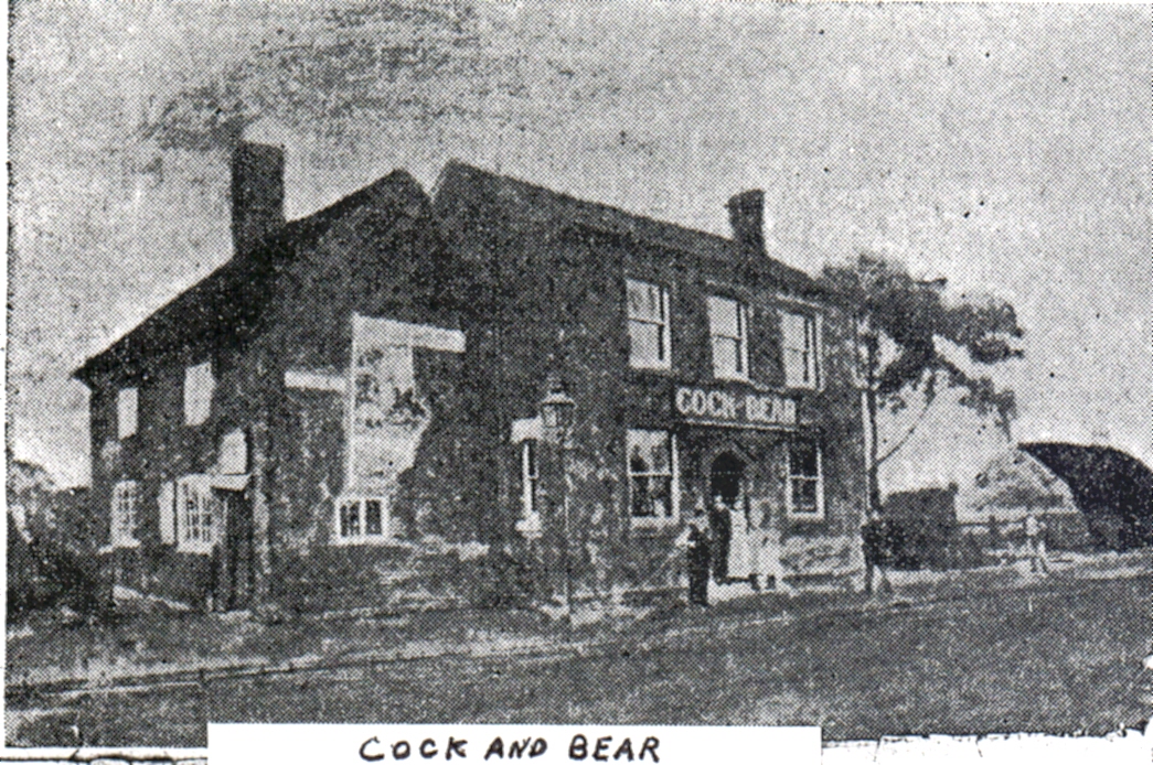
A poor but interesting visual record of the side view of the Cock & Bear pub shows that it had at some stage a brand new section built on. But all this was replaced by the modern pub of 1907. (Moreton J. Ensor Collection)
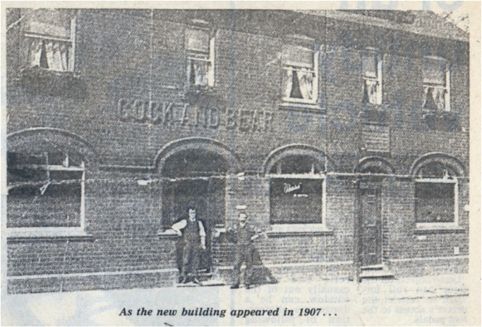
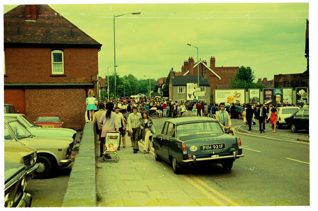
The corner of Manor Court Road from Queens Road. The Cock and Bear pub on the left. Manor Court Road in the distance. (E.J.Wiltshire-Courtesy of Colin Yorke)
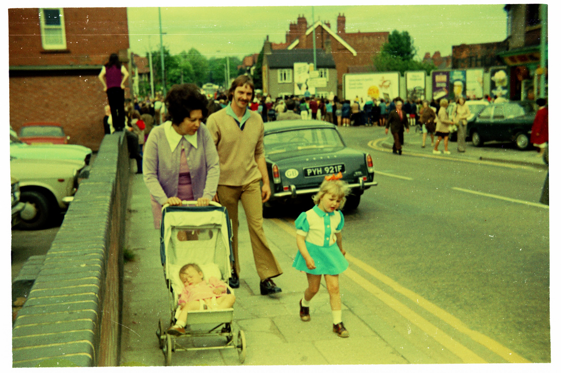
A moment caught in time climbing up to the Cock & Bear bridge. (E.J.Wiltshire - Courtesy Colin Yorke)
The Cock & Bear bridge over the Coventry Canal. Behind the hoardings is the Manor Park Football Ground, and the chimney is at the Co-Op Dairy. (E.J.Wiltshire - Courtesy Colin Yorke)
Regent Street (formerly Brick Kiln Lane)
I showed this slide once at a presentation in Nuneaton and a lady in the audience said who is that lady my grandfather - Albert Ball - is chatting up? This quiet conversation piece took place on the corner of Regent Street and Bond Street sometime in the 50's but the subject of the photo was the grim block of buildings on the corner. This is the 1840's block erected when Regent Street at this point was cut through when this area was altered radically for the building of the Trent Valley Railway in the early 1840's. Where the roadway is in this view was once an old pub "The Dun Cow" which was said, according to old wives tales, to be the most haunted pub in Nuneaton. It was swept away by the alterations of the road. This was the grim view you encountered as a traveller leaving Trent Valley station at this time. Not very enticing is it? At one time the doorway on the corner was a cafe' to entice railway travellers. The buildings here were largely unoccupied by this time preparatory to demolition, and had received some bomb damage. None were lit by electricity. It was gas up to the end. Albert Ball was the proprietor of AB Taxis. Regent Street to the left, Bond Street to the right. Today the site is occupied by Dunelm's store.

Former Weavers Cottages in a block erected in 1818 by Isaac Swinnerton. The block of buildings beyond were erected in the 1850's. Formerly Regent Street turned right before the 1850's block was built and ran across the track bed of the current Trent Valley Railway close by and the road was altered between 1845-1847 to allow the railway to be built and the right hand block was then erected in the revised roadway..
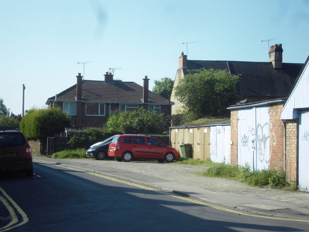
Riversley Road
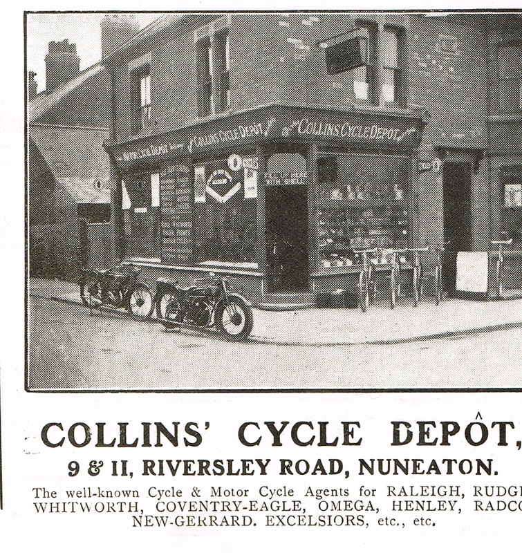
Collins Cycle Depot, 1925. (Warwickshire County Graphic)
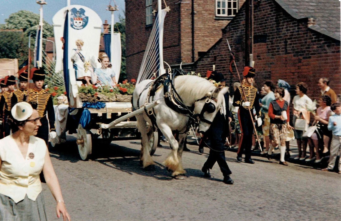
Nuneaton Carnival enters Riversley Road from Coton Road, 5th June 1966. (Geoff Edmands)
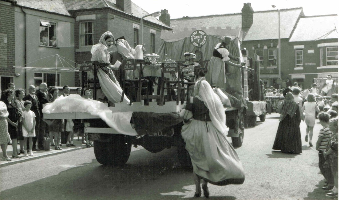
Another view in Riversley Road taken on 5th June 1966. (Geoff Edmands)
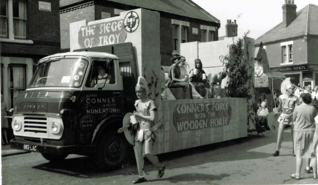
One of Alfred Connor's box factory lorries pressed into service for the carnival on 5th June 1966. (Geoff Edmands)
St.Nicholas Road

A cold and wintry St. Nicholas Road in the winter of 1960. (David Gamston)
Stratford Street


Stratford street in the 1970's.
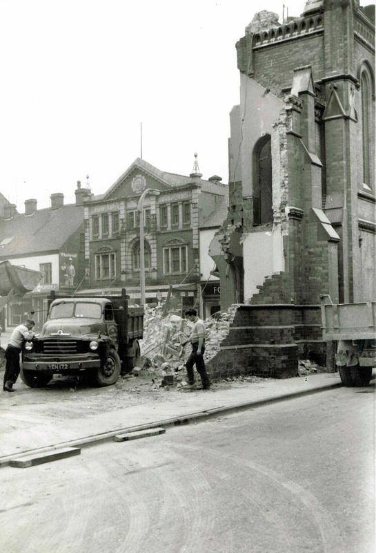
Stratford Street with demolition of the Wesleyan Methodist Church in hand. The Scala Cinema in Abbey Street can be seen in the background. 1963. (Geoff Edmands)
Tuttle Hill
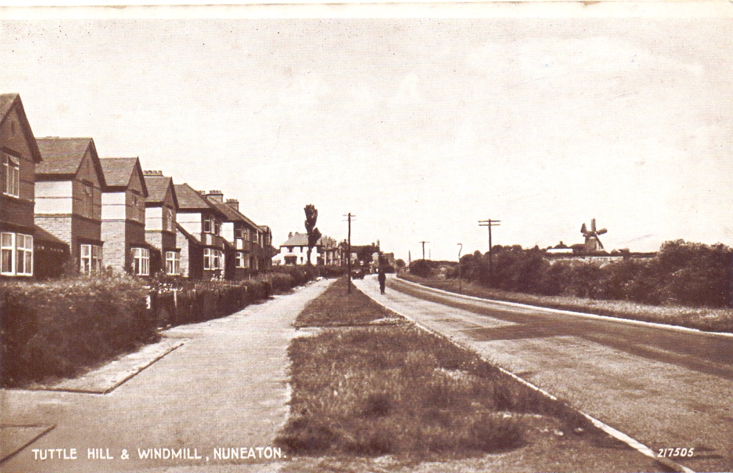
Looking towards Chapel End. (David Gamston Collection)
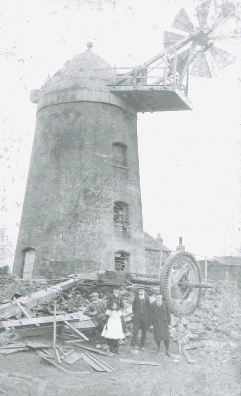
Tuttle Hill windmill after the sales blew off. 1905. Tom Burgoyne and two members of the Blezzard brothers, centre and left. The keeper at Whitehouse farm on the right, and Jean Lapworth's mother as a girl. (Jean Lapworth Collection)
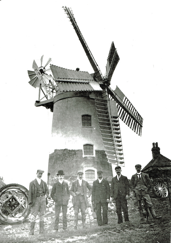
The Blezzard Brothers of Preston, windmill builders with Tom Burgoyne at Tuttle Hill Mill. (Jean Lapworth)
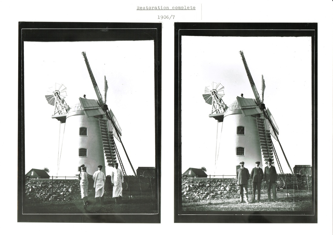
The completed mill with new sails.
(Jean Lapworth Collection)
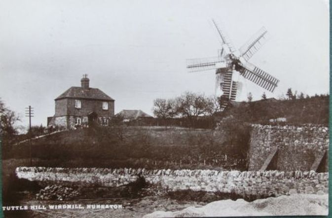
Tuttle Hill Windmill. Before WW1.
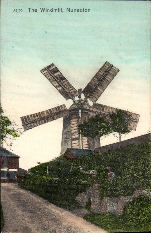
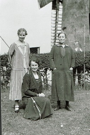
The Wright family at Tuttle Hill Windmill, Sam Wright miller in the background.
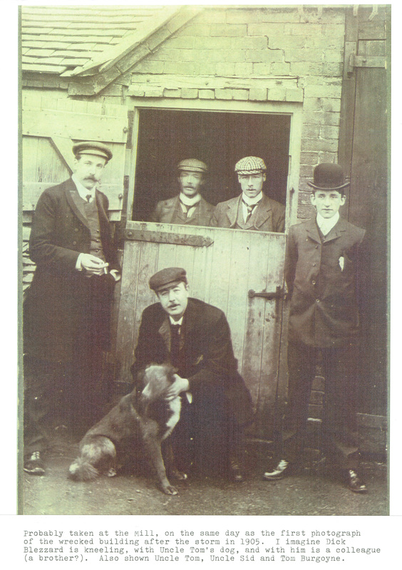
(Jean Lapworth Collection)
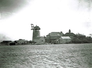
Tuttle Hill Windmill with the sales removed after the sales were damaged in a major gale in 1936. (Jean Lapworth Collection)
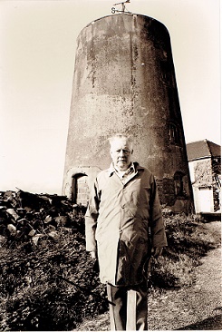
Sid Wright and the sad stump of Tuttle Hill windmill after the remains of the turret were removed and milling was carried out by electric motor.
Vicarage Street
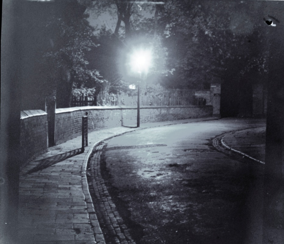
Vicarage Street used to be a narrow lane. On the left is the entrance to Vicarage Street school and beyond the Vicarage Gates. (W.H.Pope, courtesy Colin Yorke)
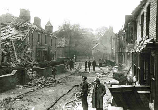
Vicarage Street suffered several direct hits during the night of May 16th/17th 1941 when there was a very serious blitz on Nuneaton. This was the result the next day. This scene today is the wide four lane road outside the Justice Centre. It has all been cleared away to gain access for the motorcar.
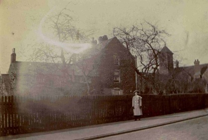
Miss Warmington outside her house in Vicarage Street. To the right Vicarage Street school. Before WW1. (Horace Bull, courtesy Ruby Atkins)
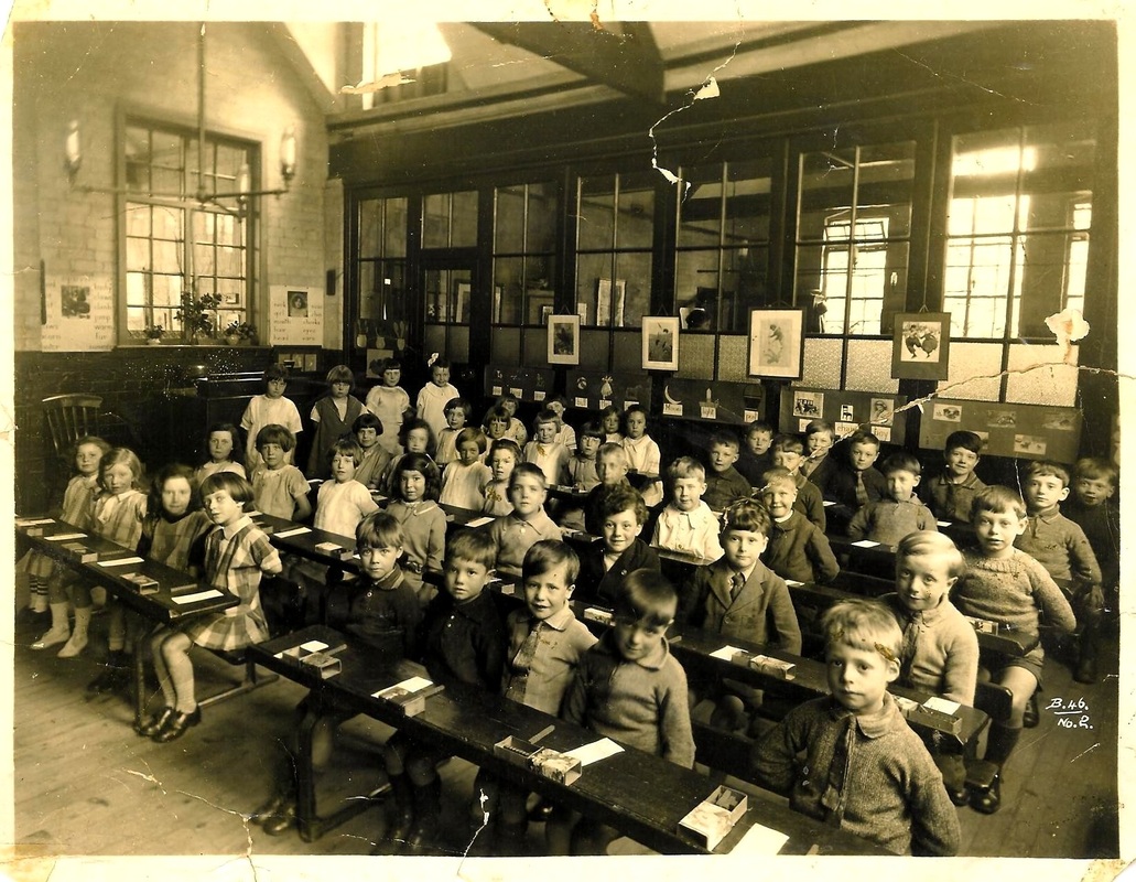
Vicarage Street School in the 1920's. about 1926/27. Second back from the right, the boy's name is Cecil Hunt born in 1921. Many thanks for Cecil Hunt's son for clarifying where this picture was taken.
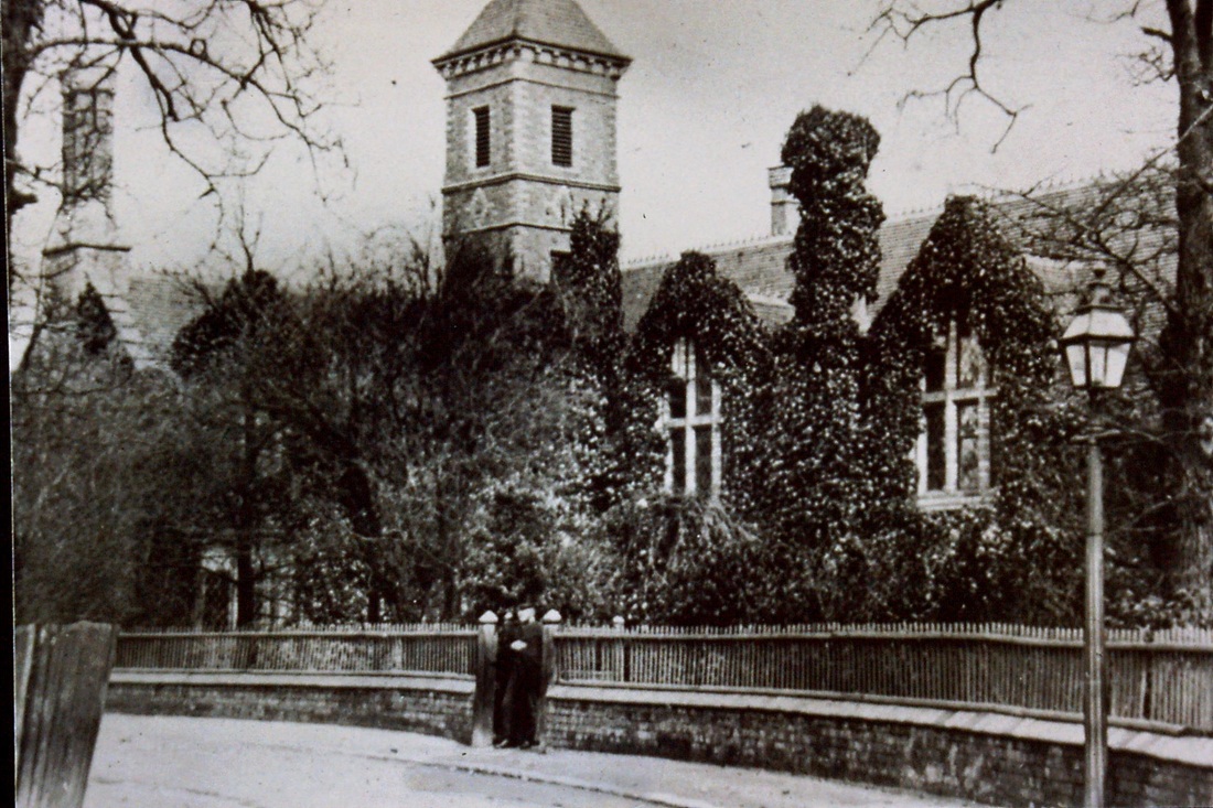
Vicarage Street school, completely dredged in ivy.
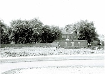
Dr. Blakeways house stood in Wheat Street and was demolished for the new police station and magistrates court in 1960. The Blakeway family had this modern house built on land anciently belonging to their family (John Estlin originally) only to see it compulsorily purchased by the local authority. Today the ground is a car park opposite the Justice Centre. (Connie Blakeway)
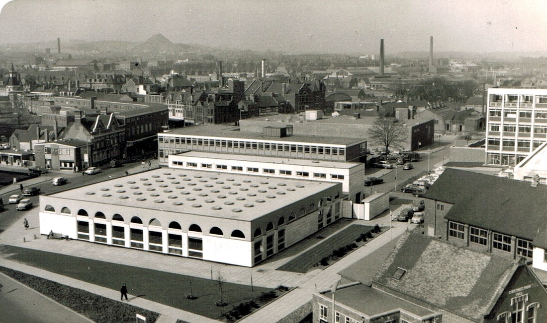
Looking over Vicarage Street from the tower of St. Nic(h)olas Parish Church. 1965. (Geoff Edmands)
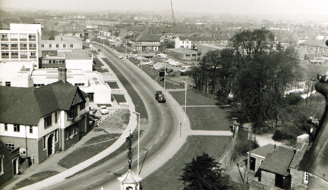
Vicarage Street Ring Road 19th March 1966. Taken from the bell tower of Nuneaton Church. Wheat Street leads off to the right in the middle distance. All the new buildings on the left have been demolished. The Justice Centre now dominates the view on the right. (Geoff Edmands)
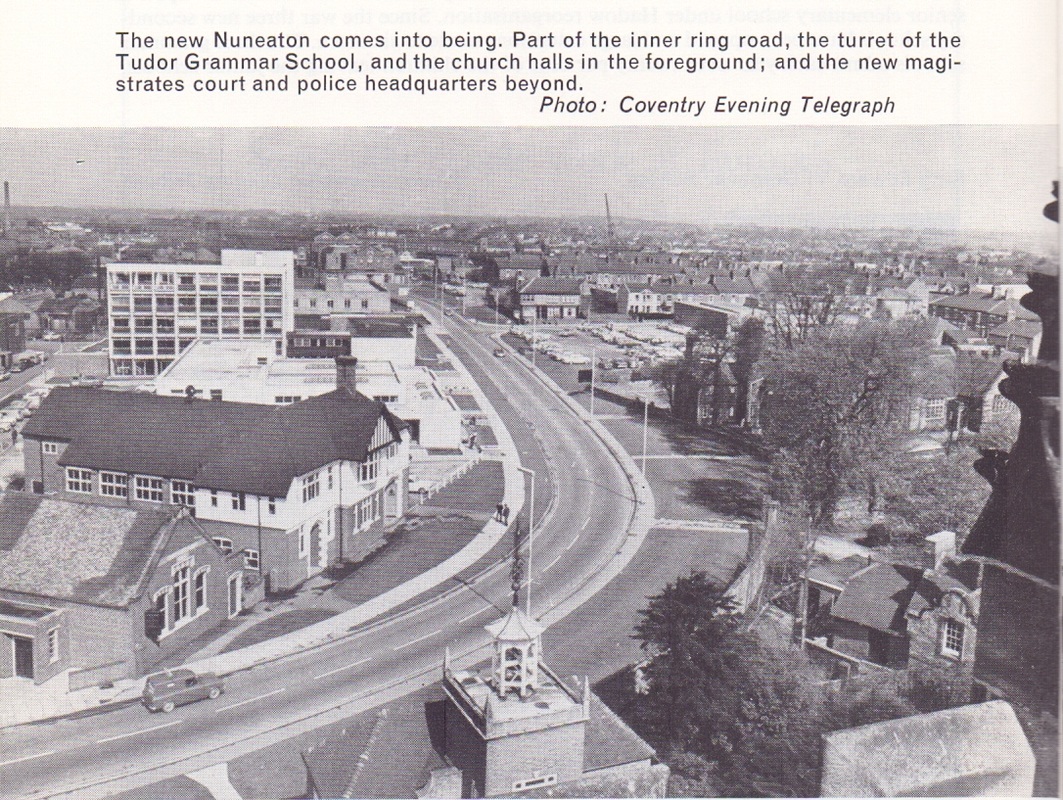
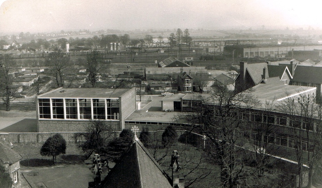
Looking towards King Edward Road. The Trent Valley Railway with the Grammar School in the foreground. (Geoff Edmands)
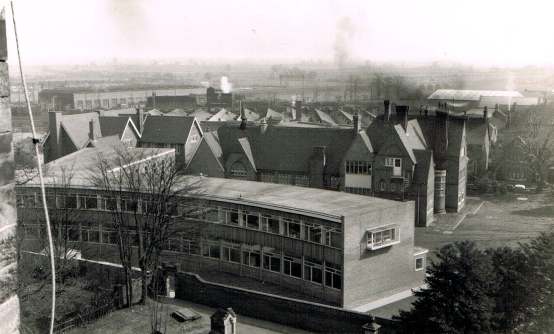
Nuneaton Grammar School. (Geoff Edmands)
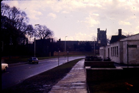
Vicarage Street in the 1970's. Former Magistrates Court on the right. Vicarage Street school stood on the left at one time.
Victoria Street
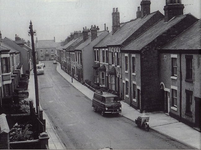
Victoria Street - most of which was built by George Wykes the local master bricklayer for members of his extended family. I am told but not had confirmed that the large house at the end was owned by George Wykes and he could see all the comings and goings in the street and keep tabs on his relatives. Victoria Street stood where Nuneaton ring road is today.
Weddington Terrace and Weddington Road
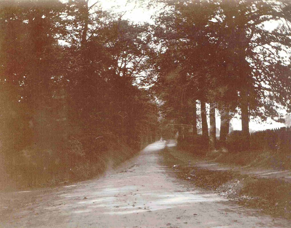
Do you remember Weddington Road when it was a narrow lane like this. I imagine no-one alive today can but this is how it used to look. (Horace Bull, Ruby Atkins Collection)
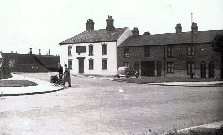
The Graziers Arms on Weddington Road. 1950's.
Wheat Street
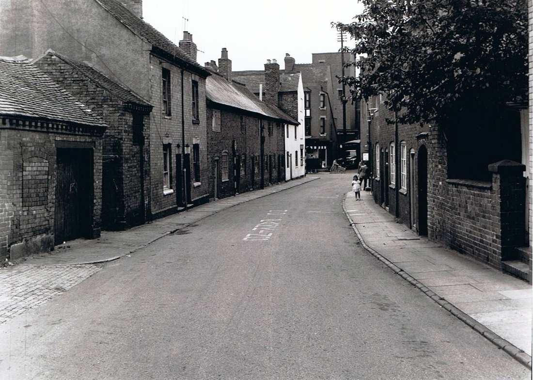
Wheat Street in the 1950's. When nearly all the properties were slums.
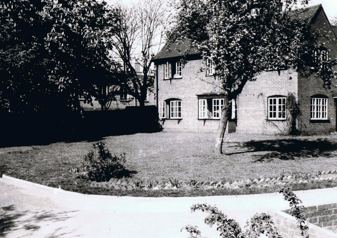
Dr. Blakeway's House, Wheat Street in the position where the Vicarage Street ring road is today. Compulsory purchased 1960 for road widening. (Connie Blakeway)
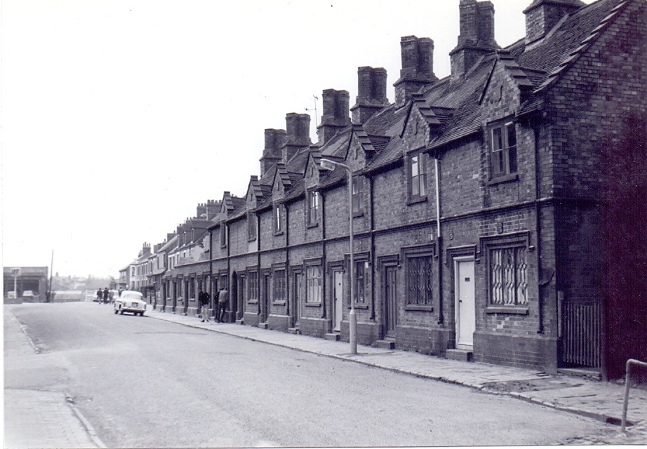
There once stood in Wheat Street a row of very distinctive cottages known as the "Twelve Apostles". I date these back to the 1840's or 1850's from the style of architecture. They stood near the entrance to the railway tunnel which takes pedestrians under the railway from Wheat Street into Oaston Road. They were demolished during April/May 1964 as you can see from Geoff Edmands photo taken on 26th April 1964 as demolition has started. They were numbered 92-114 Wheat Street. I can't help but think they were originally built as railwaymen's houses because the style of architecture is reminiscent of the first Nuneaton railway station built in 1847, although I cannot be absolutely sure of this. They were quite an attractive set of cottages and should have been preserved but hindsight is a wonderful thing, and the local authorities at the time who were busily erecting flats throughout the town deemed them simply as slums. I guess with modern bathrooms, hot and cold running water, central heating etc. they would make a contribution to the local townscape today. After they were demolished the local builders merchants - Ellis & Everard opened their builders yard on the site they left empty. (Geoff Edmands)
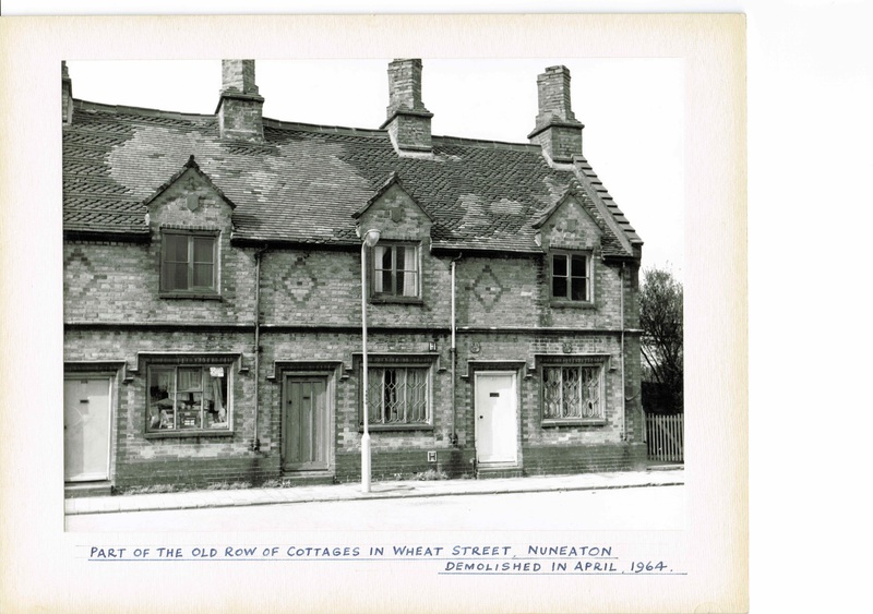
This photo comes from Reg. Bull's album. The Reg. Bull photo shows that one has been converted into a shop. Notice too that the roof has been patched up after the blitz as they were damaged by flying debris when a stick of bombs blew up some houses in Glebe Road. opposite.
________________________________________________________________________
Riversley Park, Mill Gardens & The Pingle Fields
(Riversley Park was given to the people of Nuneaton by Mr.E.F.Melly, Managing Director of Griff Collieries Ltd.)
named after the Melly family home in Liverpool - Riversley. The Pingle Fields is an ancient name - a Pingle being a water meadow, a name given to many such areas throughout the country and not unique to Nuneaton.
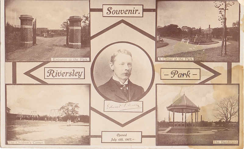
(Glenn Noon Collection)
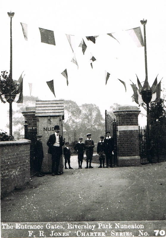
The entrance gates to Riversley Park when newly built and opened in July 1907 and recorded here in Frank Jones's Charter series. The park was opened contemporary with the status of a Borough being bestowed on Nuneaton. The gates were closed at night and the iron railings prevented ne'r do wells getting in. Note that the sentry box for the park keeper by the gates as NUDC emblazoned on it - Nuneaton Urban District Council - painted before the town became a Borough.
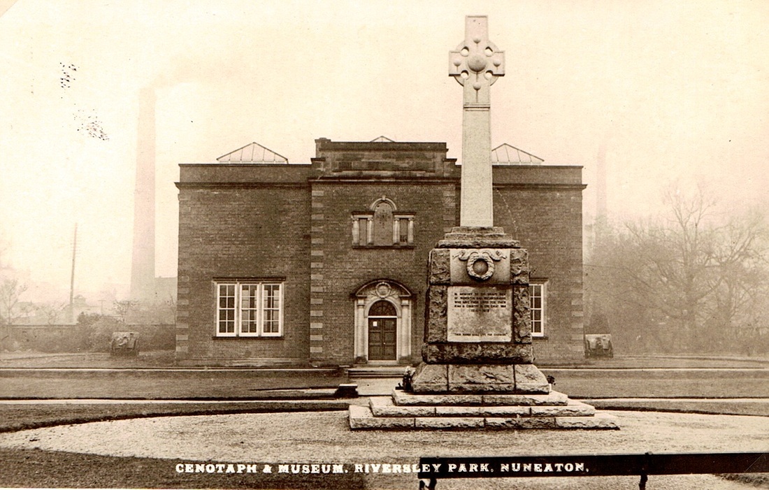
A post World War One image of Nuneaton Museum, probably in the 1920's. (NLHG Archive)
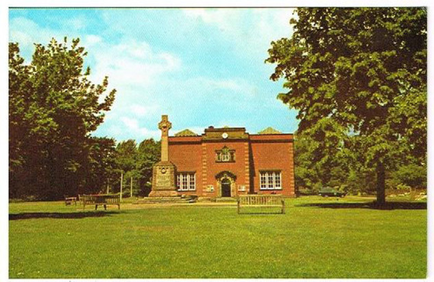
Nuneaton Museum, probably in the 1960's, from an old postcard.
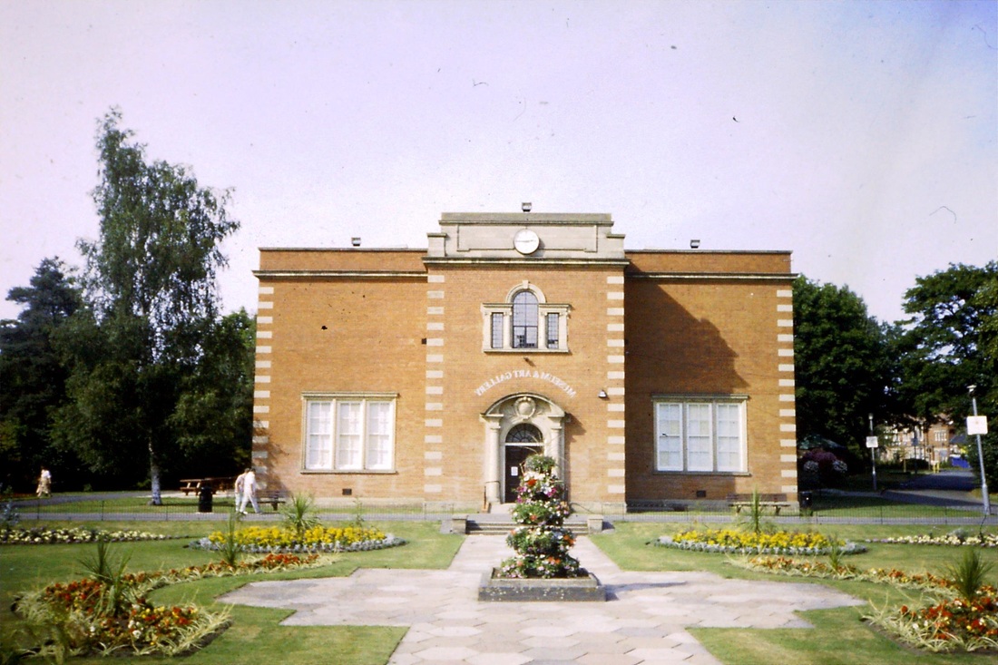
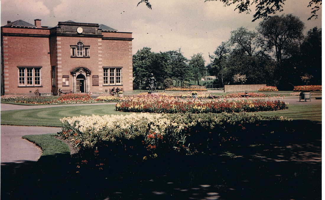
Nuneaton Museum and Art Gallery, 11th May 1958 (Geoff Edmands)
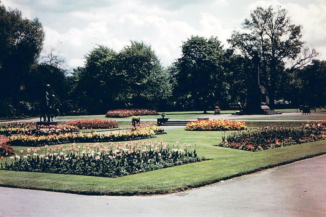
Riversley Park 11th May 1958. A beautiful floral display captured for all time by Geoff Edmands. Note the statue on the left which disappeared later. I have no information on whatever happened to it.
(Geoff Edmands)
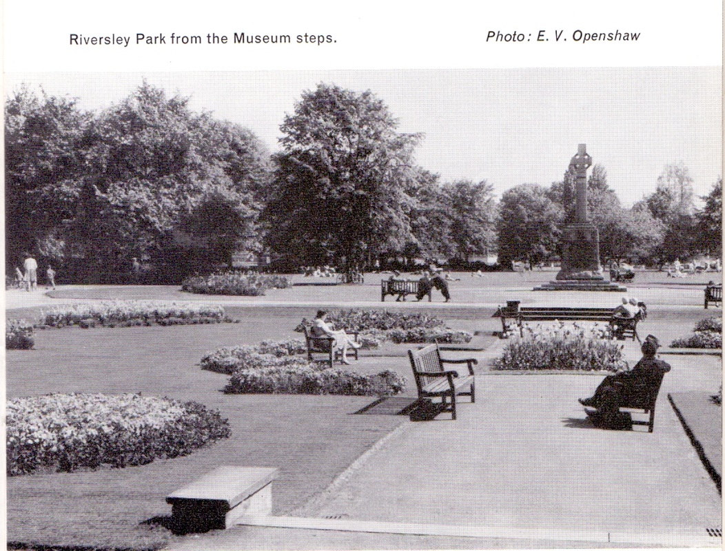
A view taken 1967/68.
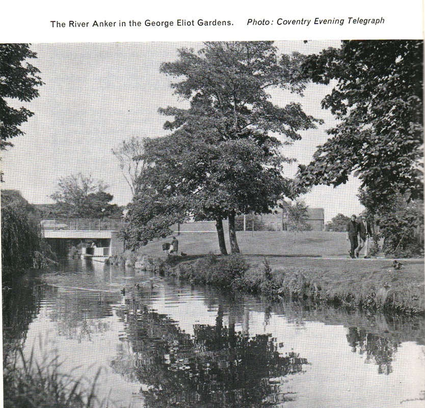
A view taken 1967/68.
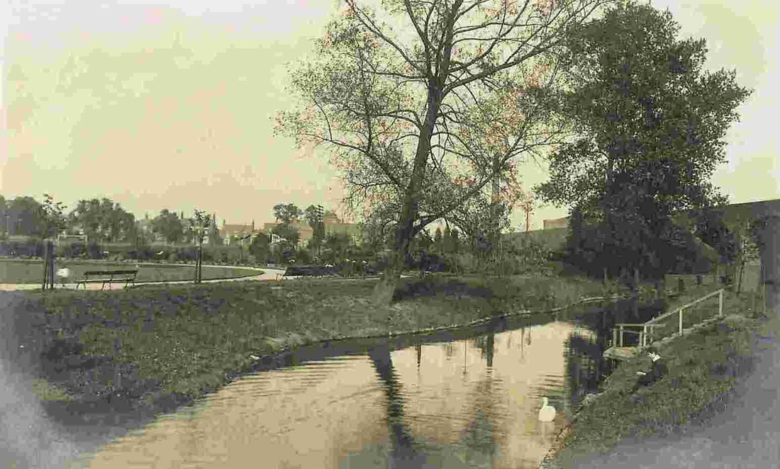
The River Anker passing peacefully through the Park. The Coventry-Nuneaton railway line embankment can be seen in the centre right of the picture. Early 1900's.(Alan Cook Collection)

Riversley Park café in the 1940's.
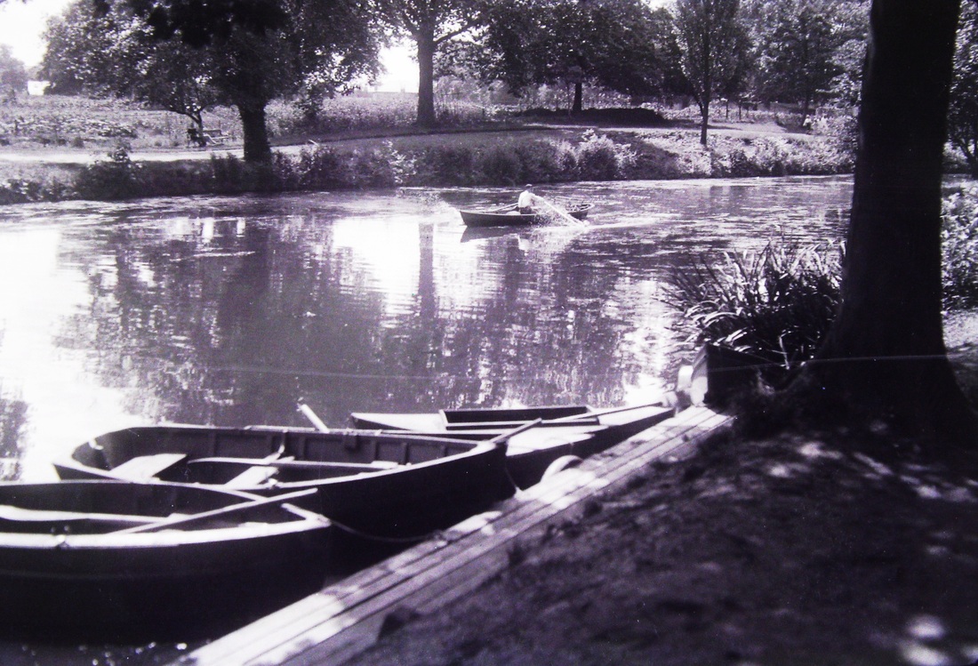
Riversley Park in the good old days when you could hire a boat and enjoy a leisurely row as far as the weir, or beyond if you were really daring! (Colin Yorke)
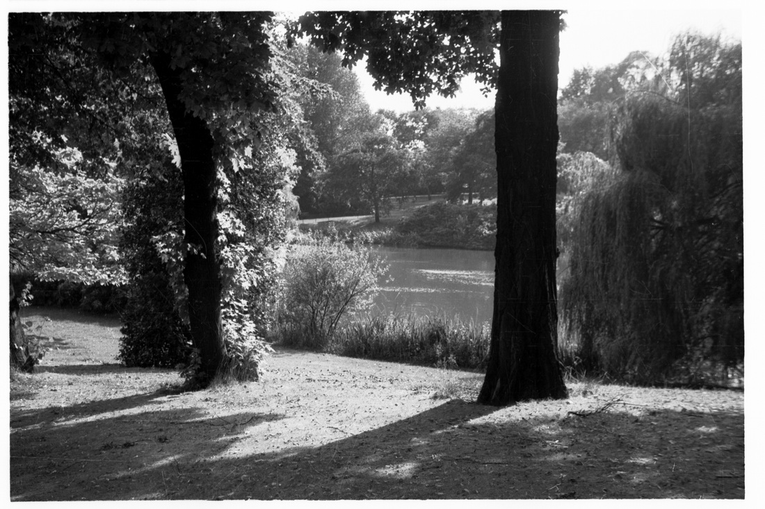
An idyllic moment in Riversley Park, in the 1950's.
(Colin Yorke)
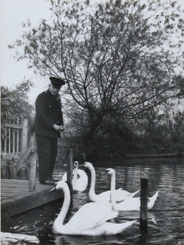
Feeding the ducks in Riversley Park. Is that the park-keeper in uniform? (Courtesy Colin Yorke)
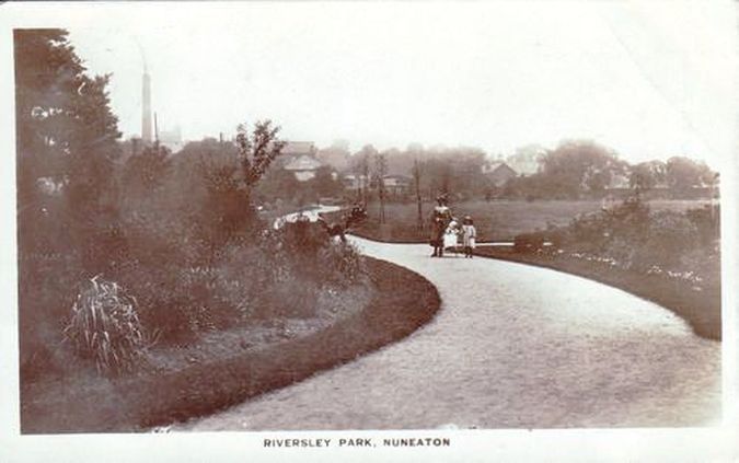
Another quiet moment in Riversley Park just after opening looking towards the town.
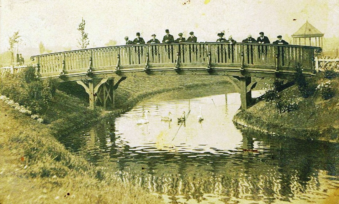
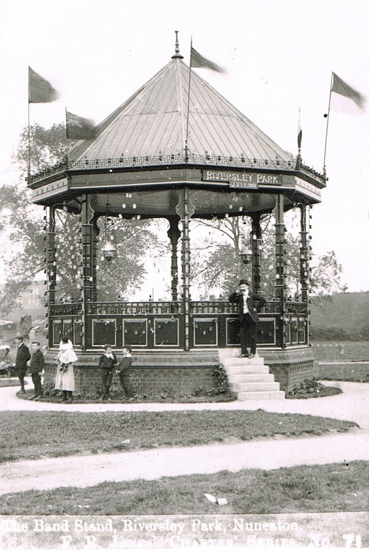
The brand new park bandstand. July 1907. Note the fairy lights draped around it. Glass bottles which had coloured candles placed in them.
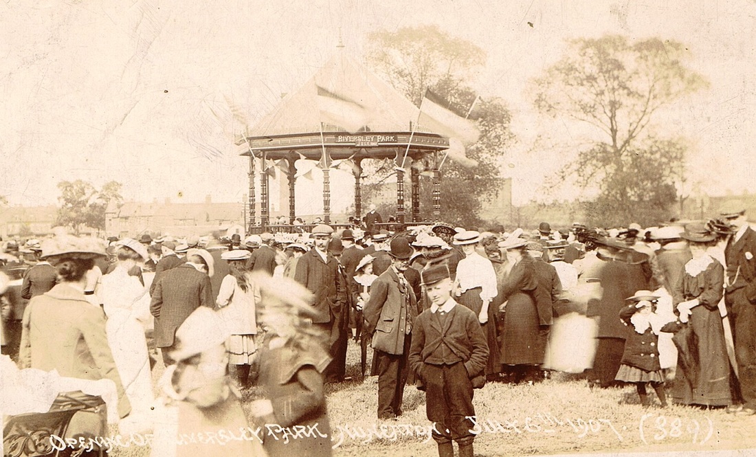
Crowds gather for the opening of the park. July 6th. 1907

The Bandstand in Riversley Park when new.
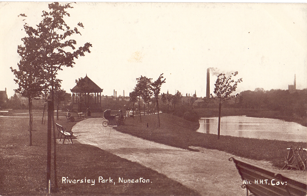
(Glenn Noon Collection)

Riversley Park in Winter c. 1951
(Reg. Bull)
Moods of the Park. (Peter Lee)
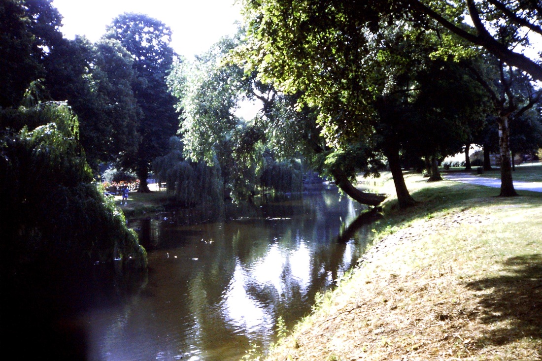
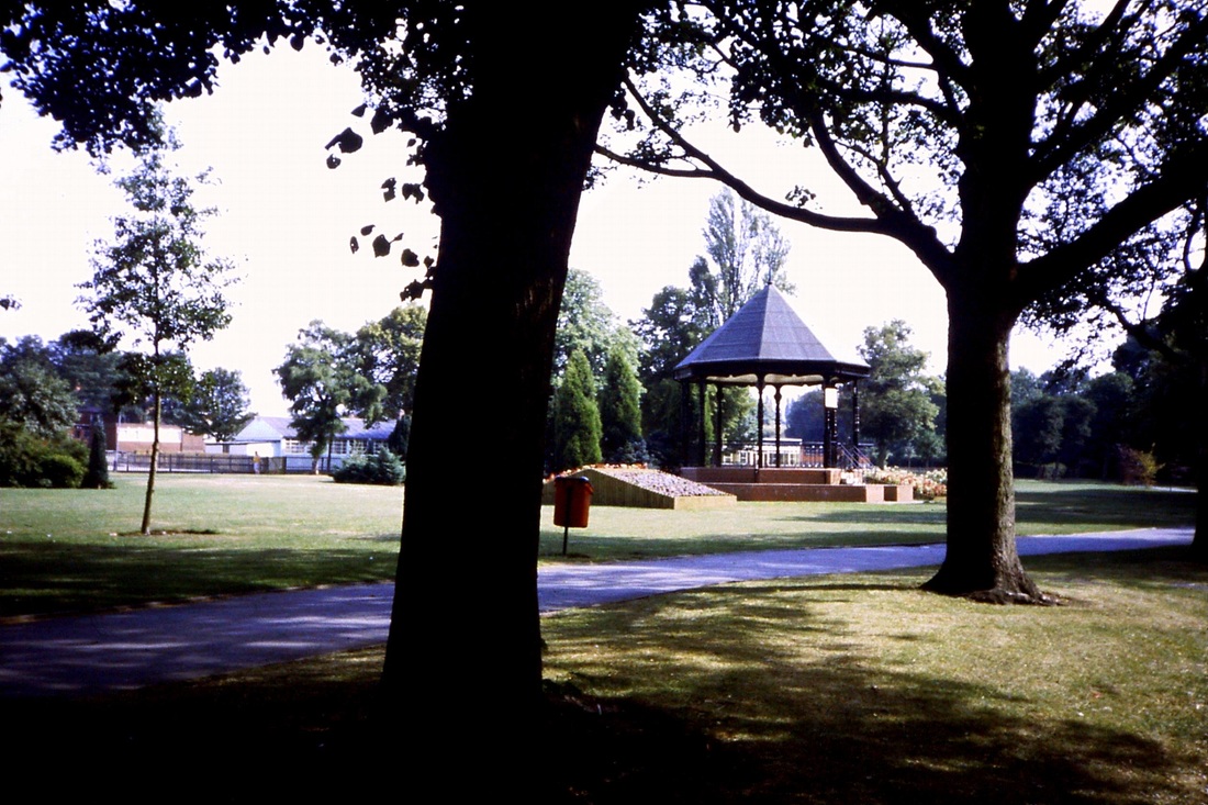
RIversley Park Bandstand in the depths of winter. (Courtesy Colin Yorke)
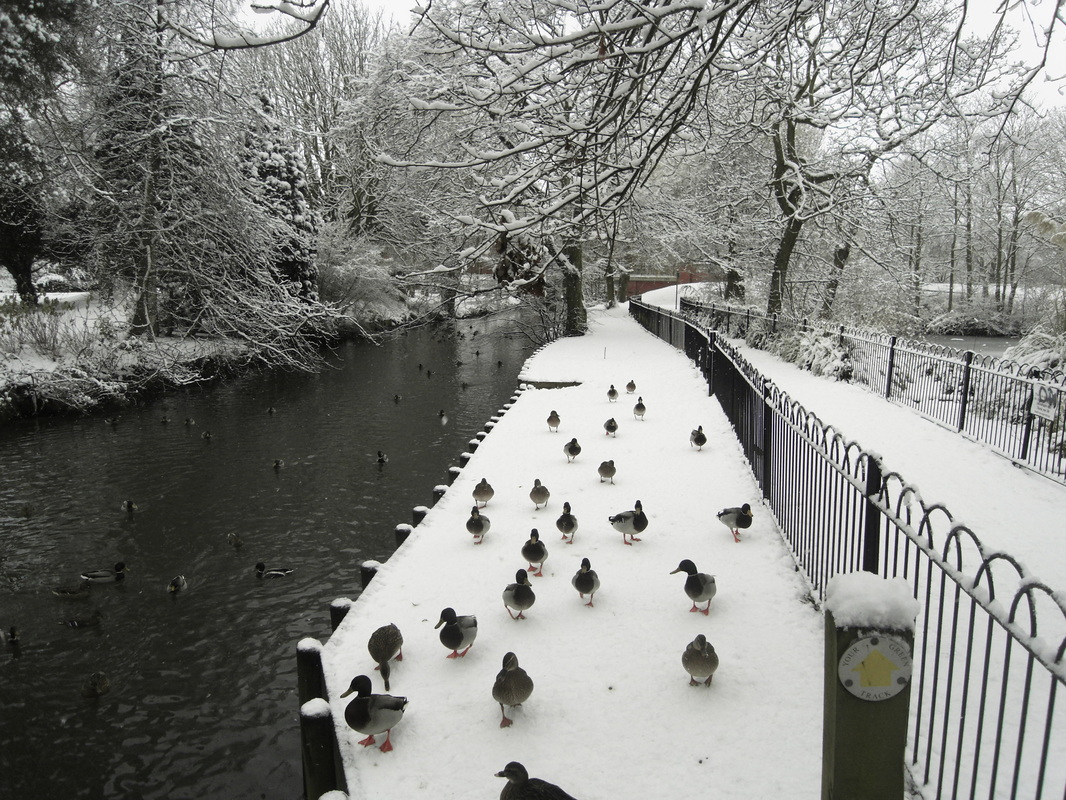
Ducks in the park in the winter of 2010. (Peter Lee)
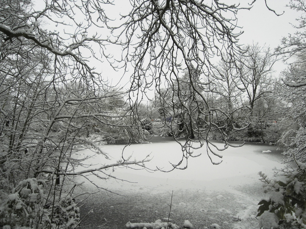
The pond near Sainsbury's frozen over in 2010. (Peter Lee)
Riversley Park near the museum 2010. (Peter Lee)
More Riversley Park 2010. (Peter Lee)
The Museum in 2010. (Peter Lee)
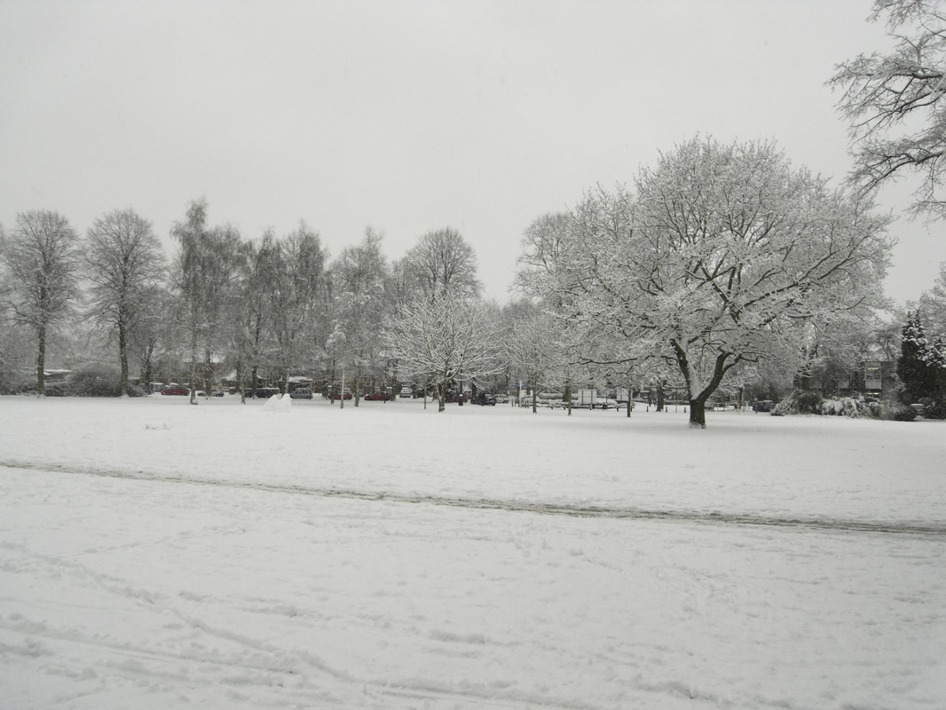
Another aspect. (Peter Lee)

The River. (Peter Lee)
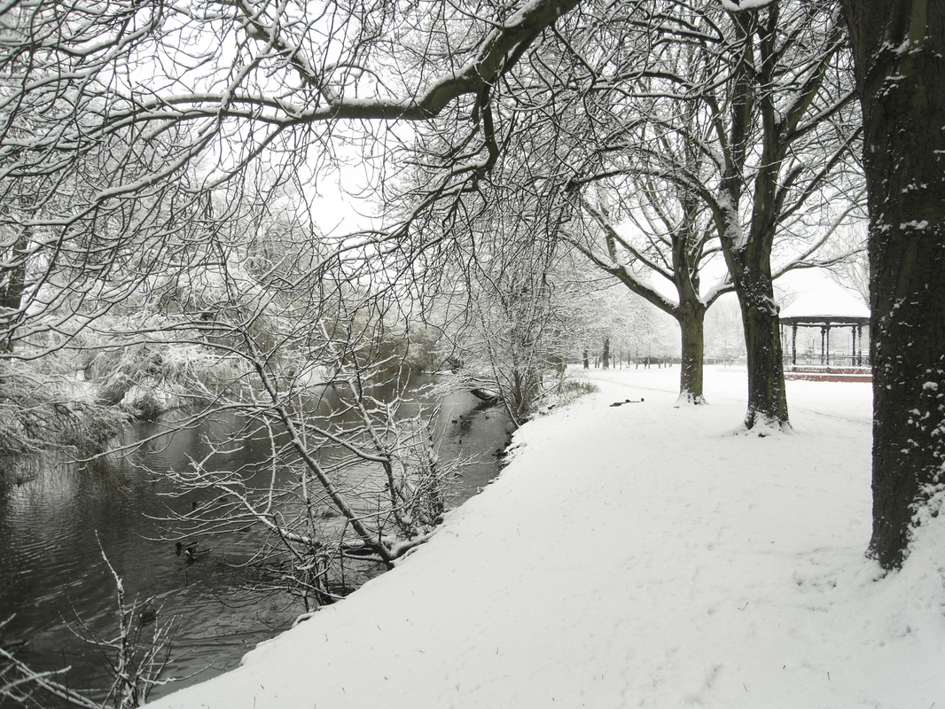
Another Aspect. (Peter Lee)

The Bandstand 2010. (Peter Lee)

The River. (Peter Lee)
The Pingle Fields
In old English a Pingle is a water meadow which is appropriate in the case of our own Pingle Fields as the Wem Brook and River Anker merge here and were notorious for flooding. This meant that the Pingles was pretty well unusable for building on and was a great feature which brought the countryside right into the heart of Nuneaton. it has been ruined in recent years by encroachment of building work due to diversion of the river at flood times due to a flood relief scheme which has diminished its wide open aspect.
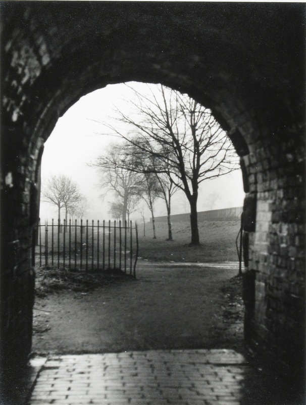
A tunnel connects Riversley Park with the Pingle Fields and runs under the railway embankment of the Nuneaton-Coventry railway line. It has had a chequered history too. During World War Two it was used as an air raid shelter. Decorative plastic blocks were inserted with old Nuneaton artefacts embedded within them, but they did not last long because local vandals dug them out, set fire to them and generally trashed them. Its probably not the best route home on a Saturday night, but during daylight hours it forms a vital connection from the park to the Pingles. (Colin Yorke)

The Pingles Swimming Pool in its heyday and quite new. (Glenn Noon Collection)

An aerial view of the Pingle Fields taken c. 1965 by Reg. Bull. The then new swimming baths in the centre. Wembrook (formerly Swinnerton School) top left. Monty's bus garage extreme right. The Harry Cleaver Rugby ground above Monty's garage. (Reg. Bull)
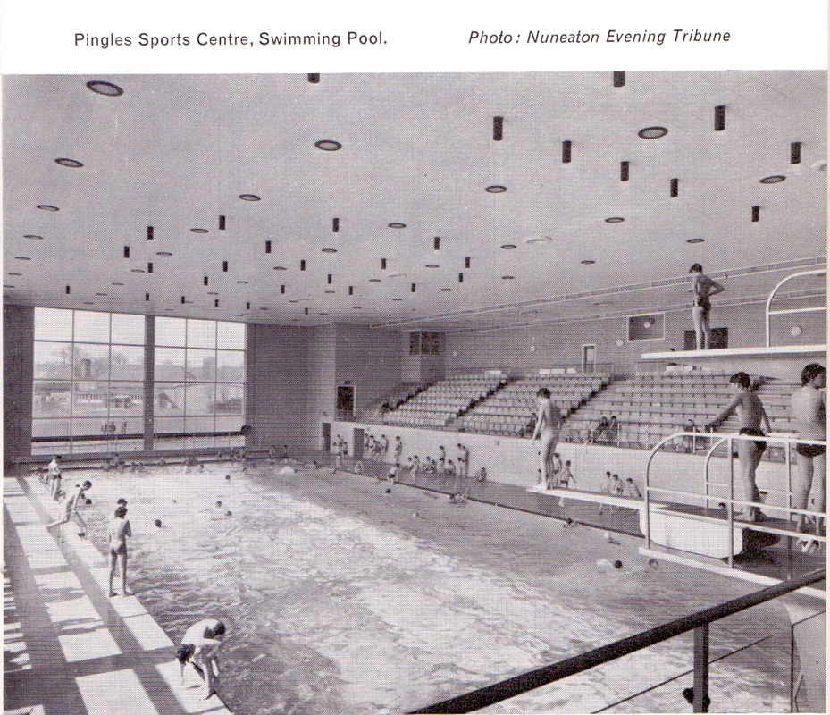
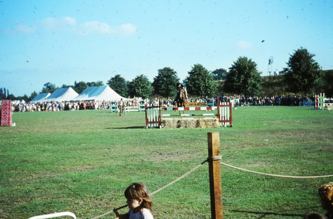
The Pingle Fields as we remember it when it was a fine open space for sports events, the carnival, fairs and circus's. (Peter Bayly)
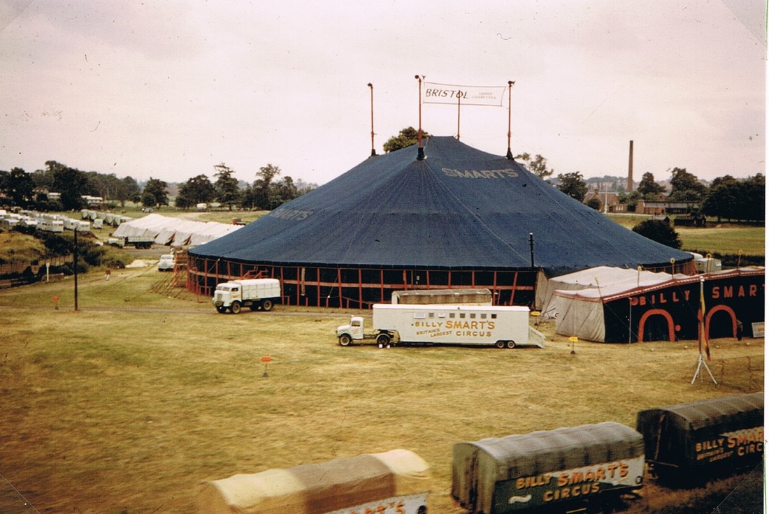
Do you remember this scene. Billy Smarts Circus on the Pingles. A view taken from a moving train on the Coventry-Nuneaton line.
From the Pingle Fields looking towards Listers Factory and the Nuneaton Rugby ground on the right. (Peter Lee)
Do you remember on fine sunny days you could let your kids paddle in the Wem Brook. Concrete steps were put in where you could sit whilst the kids played. The Wem Brook was cleaned out at this point and fully maintained so children (and adults) could play happily in the shallow water. The Polio epidemic of the 1950's put paid to all this excitement.
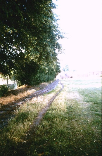
Were you aware there was a little railway in the Pingles (600mm gauge). Why was it built, when and what happened to it. Is there any of it left? Watch this space. (Peter Bayly)
Mill Gardens
The Mill Gardens derives its name from the flour mill but was laid out to incorporate former gardens at the back of Church Street which used to belong to a row of bombed out houses, and to incorporate waste land next to the mill. It is all part of a lineal feature including Riversley Park and the Pingles.

Mill Gardens today extends from the the rear of the car park at the back of the wooden shops fronting Church Street down to the river. But before the 1940's if you had stood in Mill Gardens and looked towards Church Street you would have seen the back of "Lawyer Dempster's House".

Mill Gardens from Mill House. 1977. (Geoff Edmands)
Manor Park Football Ground (The home of Nuneaton Borough F.C.)

(Colin Yorke Collection)

Nuneaton Borough Ground - Manor Park in the 1970's. (Peter Bayly)
Down Your Street. In the last decade of the 19th century new streets and suburbs marched out into the countryside away from the ancient core of the town. This is their story...........
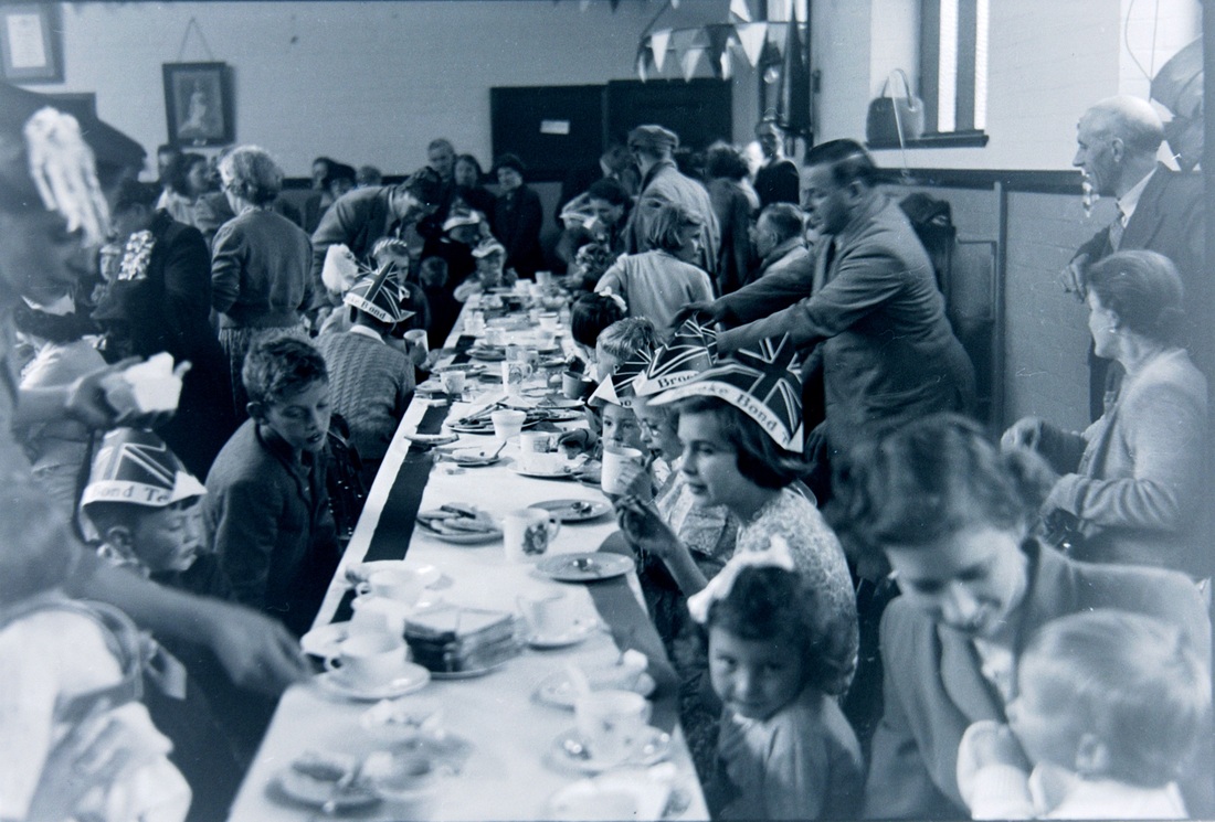
A celebration in Nuneaton, possibly the Coronation. (W.H.Pope, courtesy Colin Yorke)
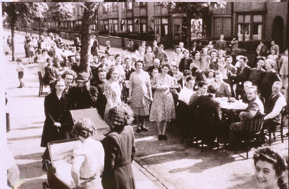
Bracebridge Street street party VE Day 1945.
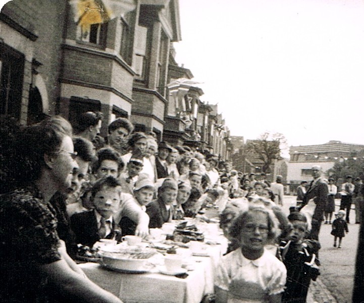
High Street VE day celebrations. 1945.
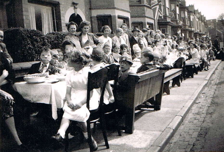
Another view of the High street celebrations.
Jitties & Courts (and alleyways, footpaths etc. an integral part of all historic towns - we showcase them here)
An entrance to a court in Abbey Street. Powells paint and decorators merchants shop is reflected in the window of Nr. 30. All these properties were demolished in the 1970's. (Alan Cook)
Bull's Head Entry - which ran from Abbey Street at the top down to Broad Street at the bottom and was a favourite cut through for us kids. It separated the Nuneaton gas works on the right from the back gardens of Broad Street, and you can just make out a gent's urinal half way along it. For me it seemed a most odd arrangement as the walls either side were high. Brown brick with a blue coping on the top and from memory there was one lamp half way along it which gave a feeble light. I would hesitate to think who would use it at night as it was a very dark escape resistant declivity, but well used during the daylight hours. At one time Nuneaton Town football club would change into their football gear at the Bull's Head pub and clatter down Bulls Head Entry to play on Daffern's field which once served as a football ground on open fields where Marlborough Road is today.
Nuneaton Recreation Ground