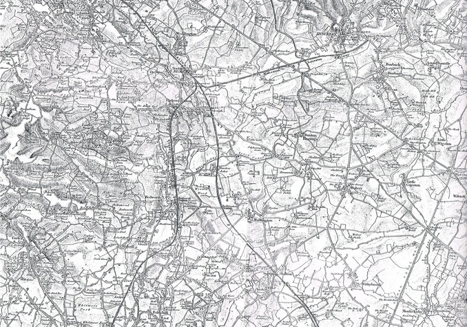
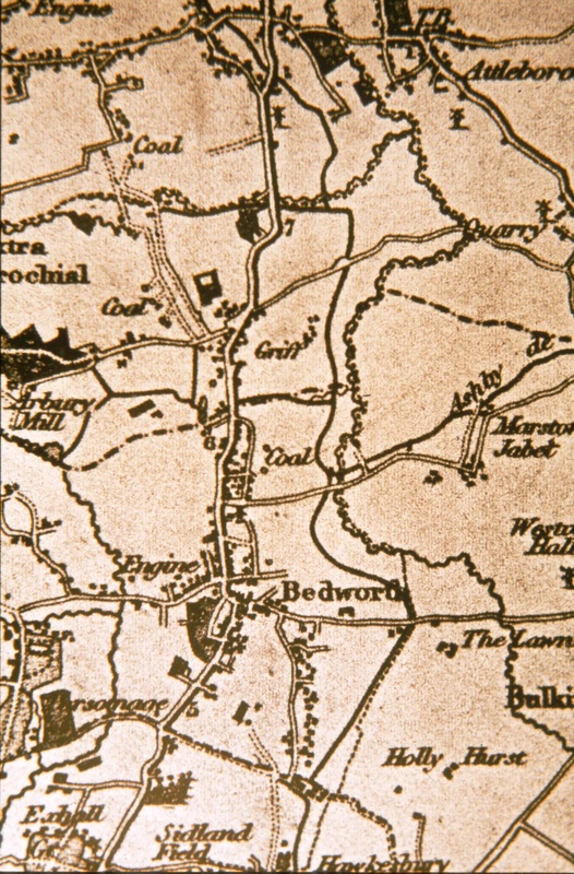
North Warwickshire c. 1862-4 (Ordnance Survey)

This caption refers to the plan above and illustrates our position as the centre of England.
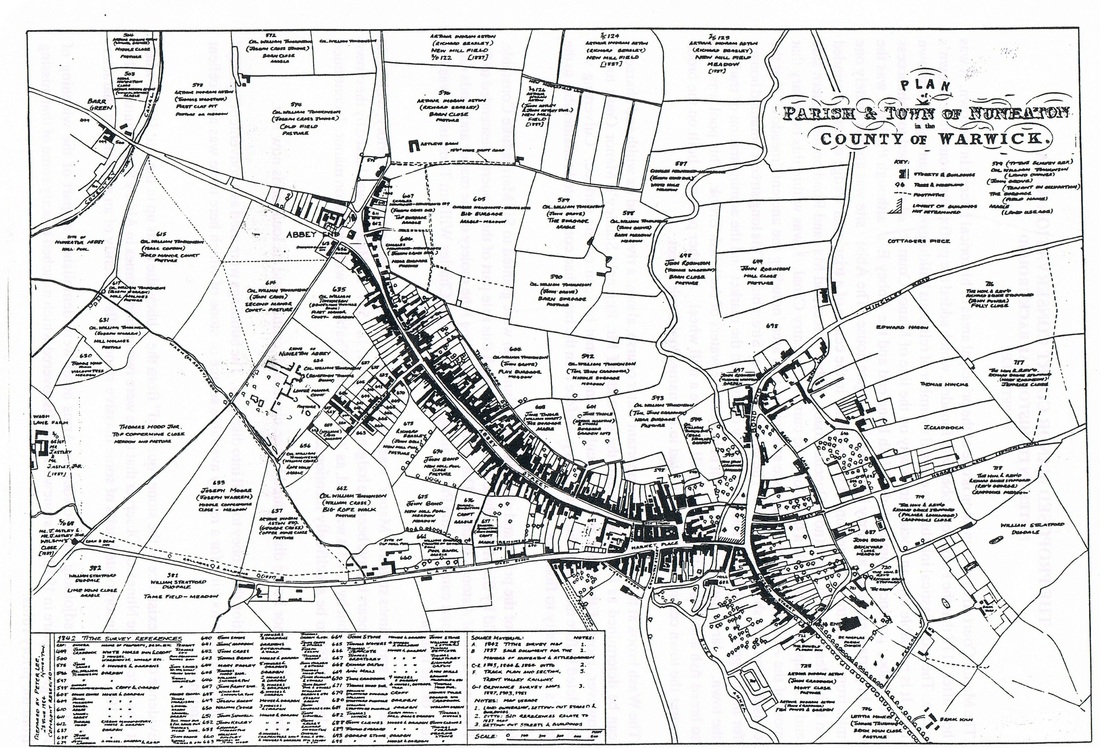
The Town of Nuneaton 1841
(Drawn by: Peter Lee)
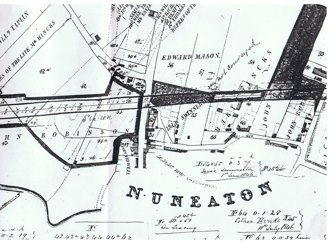
The Trent Valley Railway cuts a swathe through Nuneaton and altered the old townscape. The piece of ground on the left is where Nuneaton station is now and was sold to the TVR by John Robinson for £500. The road from top to bottom of the picture is Bond Street crossing the railway it becomes Old Hinckley Road, There was a level crossing where the railway crossed. This level crossing became a nuisance and was replaced by Leicester Road bridge about 1871. Just above the railway and going off to the left was Derby Lane, now Weddington Road. On the right hand side the railway cuts through some buildings. This was Thomas Hincks (now his widow Mary Hincks) brickyard. Thomas Hincks was also town corn miller who owned the mill in Mill Walk. The road running along the bottom off to the right is now Regent Street but was then known as Brick Kiln Lane. And the road running off the picture towards the top on the right was Wheat Street which was also built with a level crossing over the railway leading into Oaston Road (or Odd-a-Ways Lane). The roadway going off to the far right of the picture was Peacock Lane, now part of King Edward Road.
On the corner of Wheat Street and Regent Street where there are some buildings partially detailed was an open space occupied by "Lord Hop's Pit" an open clay hole filled with water long associated with "Lord Hop" the nickname of Francis Stratford who owned Horestone Grange. (From the "official" track plan and survey for the whole of the Trent Valley line dated 1845-47)
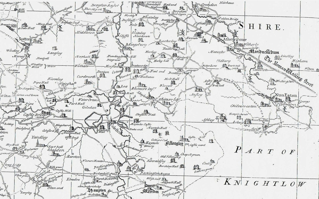
c. 1760
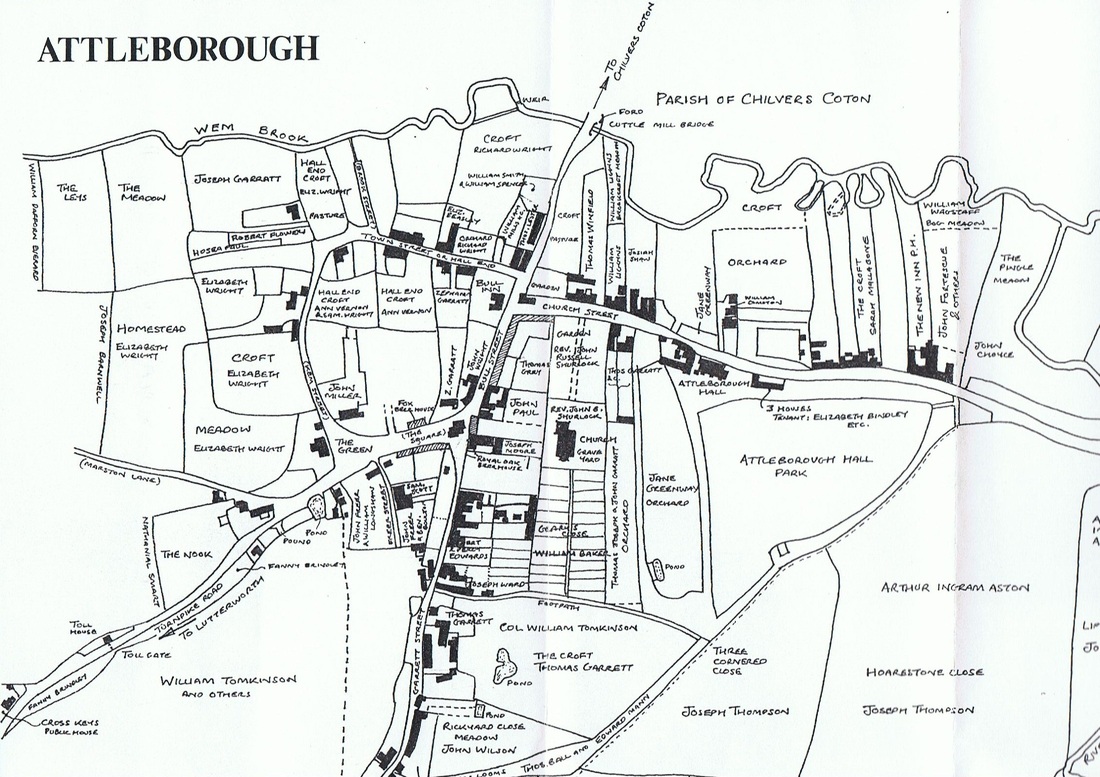
Attleborough c. 1840 (Drawn by: Peter Lee)
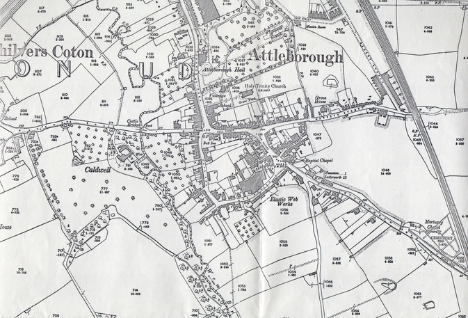
Attleborough OS Map. 1903 (Ordnance Survey)
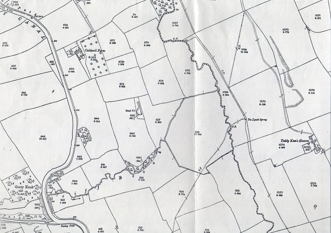
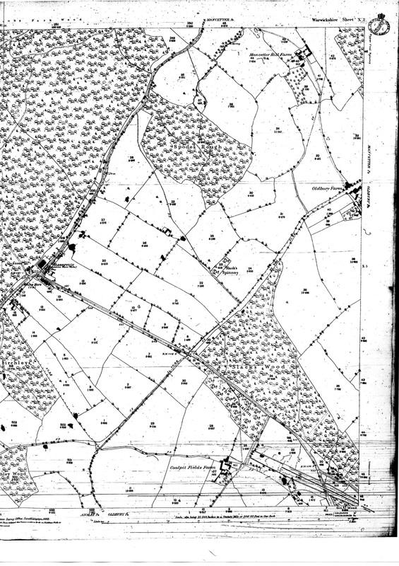
The extension southwards of the Attleborough Ordnance Survey Map 1903.
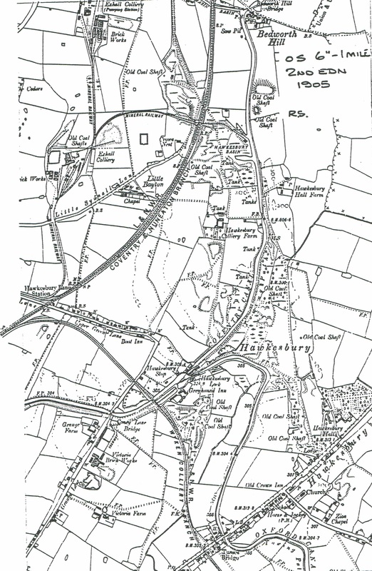
The Collieries, railways and canals south of Bedworth, featuring Exhall, Hawkesbury, Victoria and Wyken colliery sites.
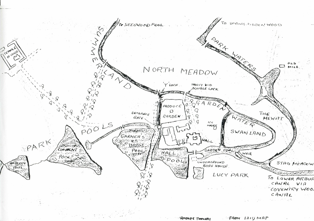
The canal and feeder pond system on the Arbury Estate.
(Jean Lapworth Collection)
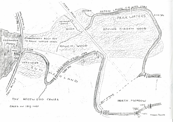
Seaswood Canal system on the Arbury Estate. (Jean Lapworth Collection)
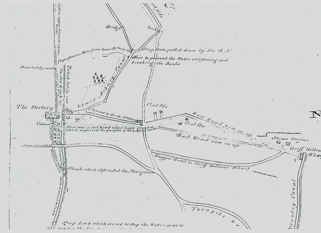
The complex of tramways and canals serving the silk factory (on left) at Collycroft. The canal is known locally as the bottom river. This would be c. 1800.

Nuneaton Town Centre 1924 (from the Ordnance Survey Map)
The Caldecote Estate
Bedworth
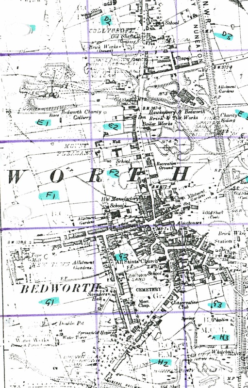
Bedworth 1887 (from the Ordnance Survey)
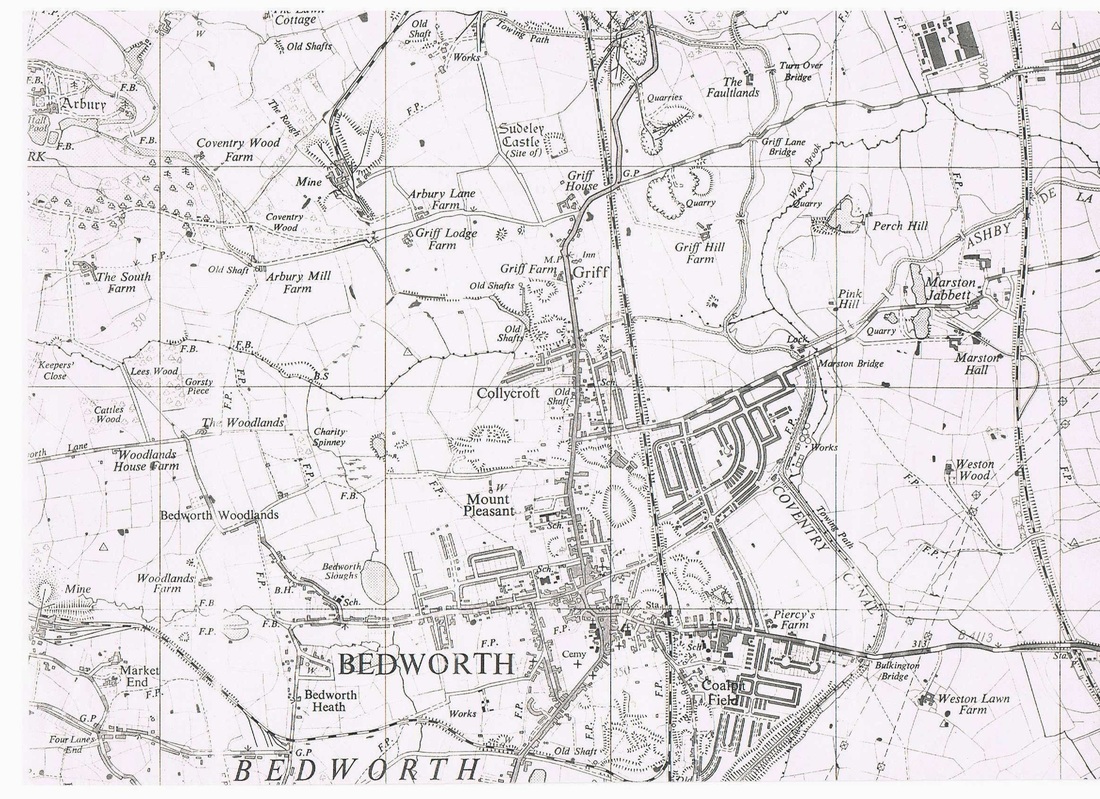
Bedworth district in the 1950's. Ordnance Survey Map.